Late-summer heat, humidity fuels southern Ontario thunderstorm risk

Another potentially stormy Wednesday is on the horizon for southern Ontario. Heat, humidity and a frontal system will create the threat of severe storms, which may bring heavy rain, localized flooding, and strong wind gusts reaching up to 80 km/h.
After the severe flooding, damaging winds, and tornadoes across parts of Ontario last Wednesday, a storm-free week would be welcome news.
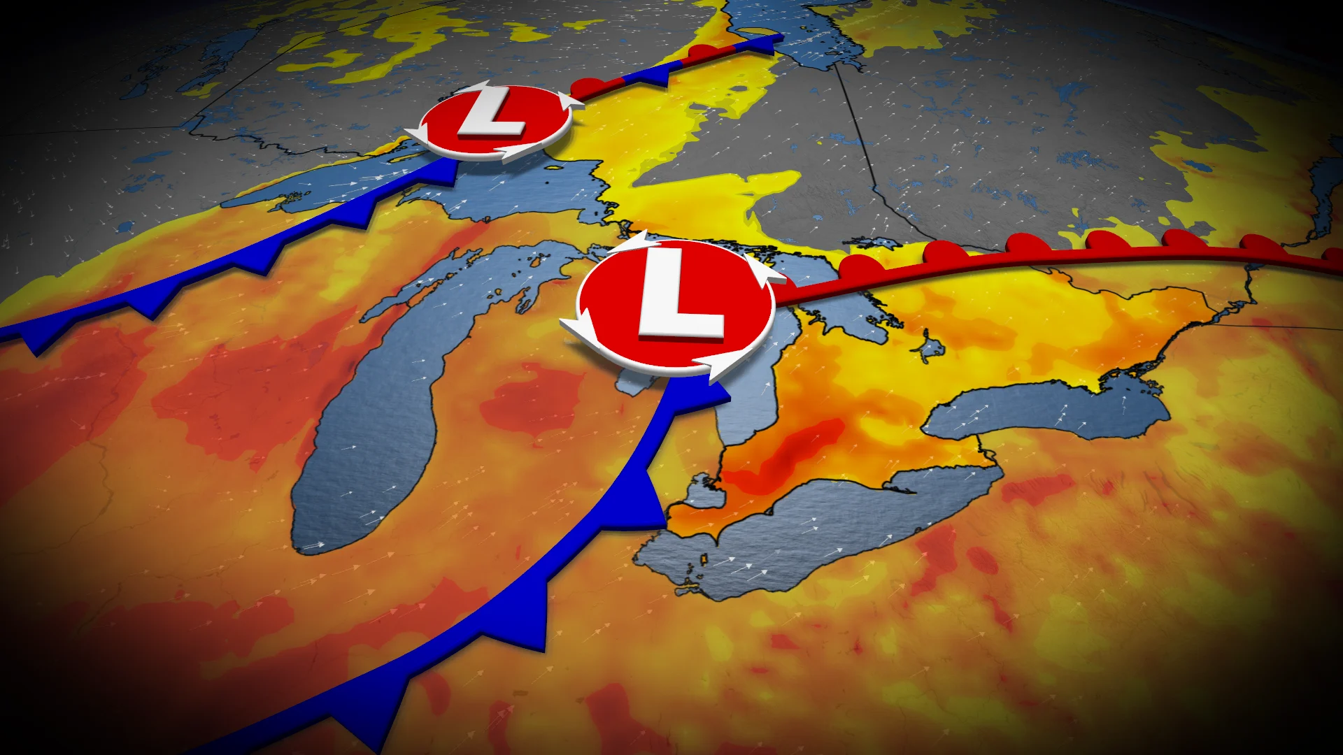
Unfortunately, that isn’t the case as an upper trough moves across the Great Lakes throughout the day on Wednesday. That means an elevated risk of thunderstorms, possibly severe, in a swath of southern Ontario, with heavy rain, gusty winds and localized flooding as the main threats.
DON'T MISS: Vaughan: Road collapses into river after Wednesday's dangerous storms
Be sure to stay alert to the changing conditions, and check for any weather warnings in your area.
Heat, humidity sneaks in for midweek storm threat in southern Ontario
As the Prairie low lifts across northwestern Ontario and moves into Hudson Bay, a more muggy southerly flow will develop across the heart of Ontario.
Temperatures will climb into the mid-20s by Tuesday and Wednesday, with Windsor and Sarnia making a challenge at 30 degrees.
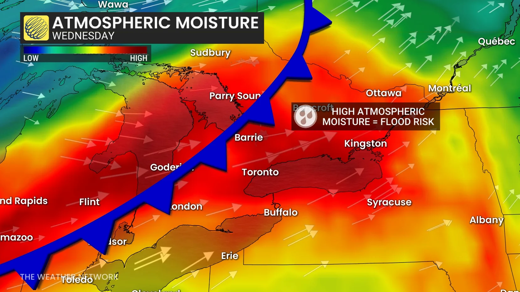
On Wednesday, moisture values reach their peak across southern Ontario, along with the available energy to develop thunderstorms ahead of the cold front.
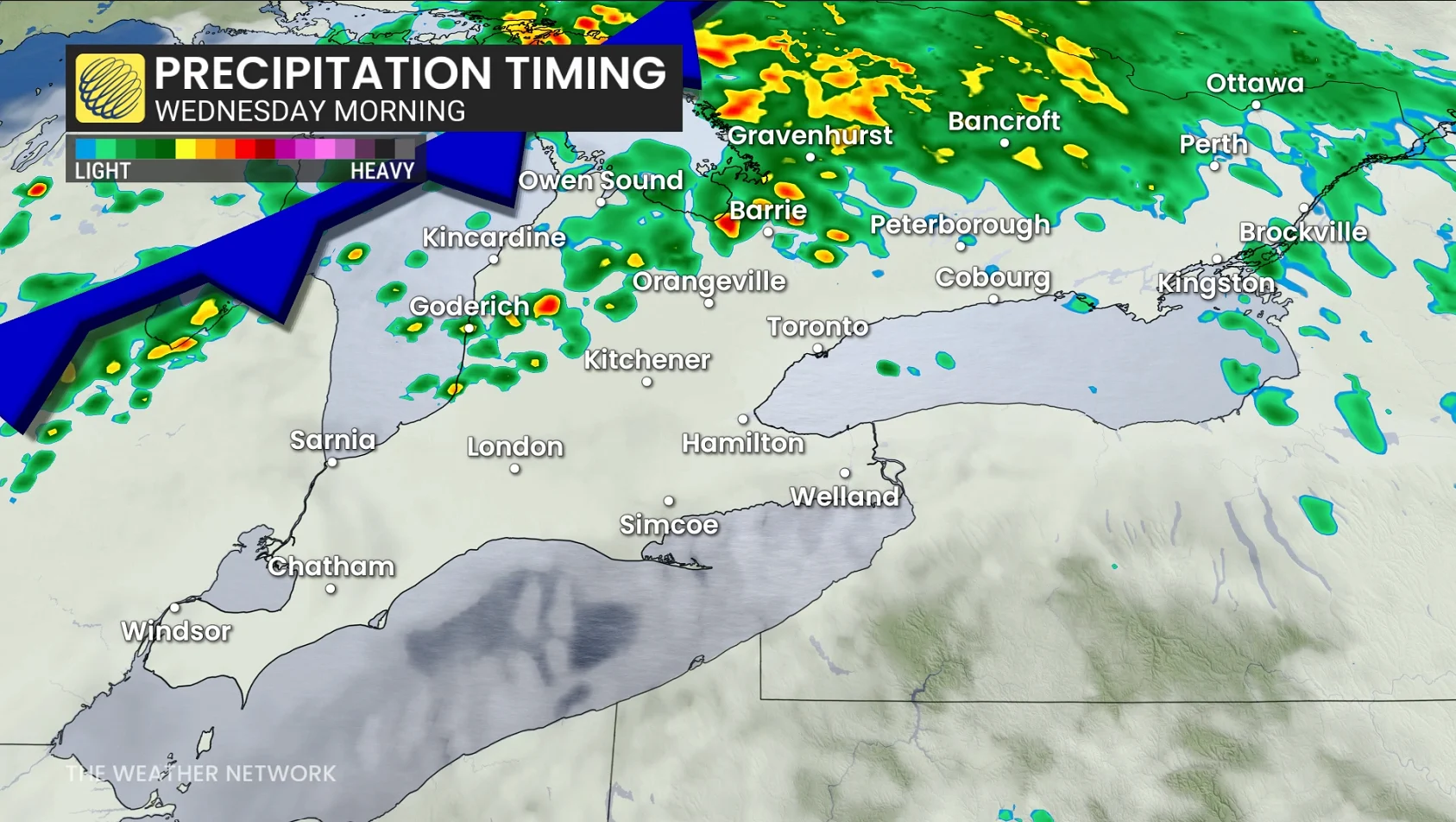
Heavy showers and thunderstorms are forecast across cottage country and Muskoka early Wednesday before the shower and thunderstorm potential increases throughout Wednesday for areas farther south.
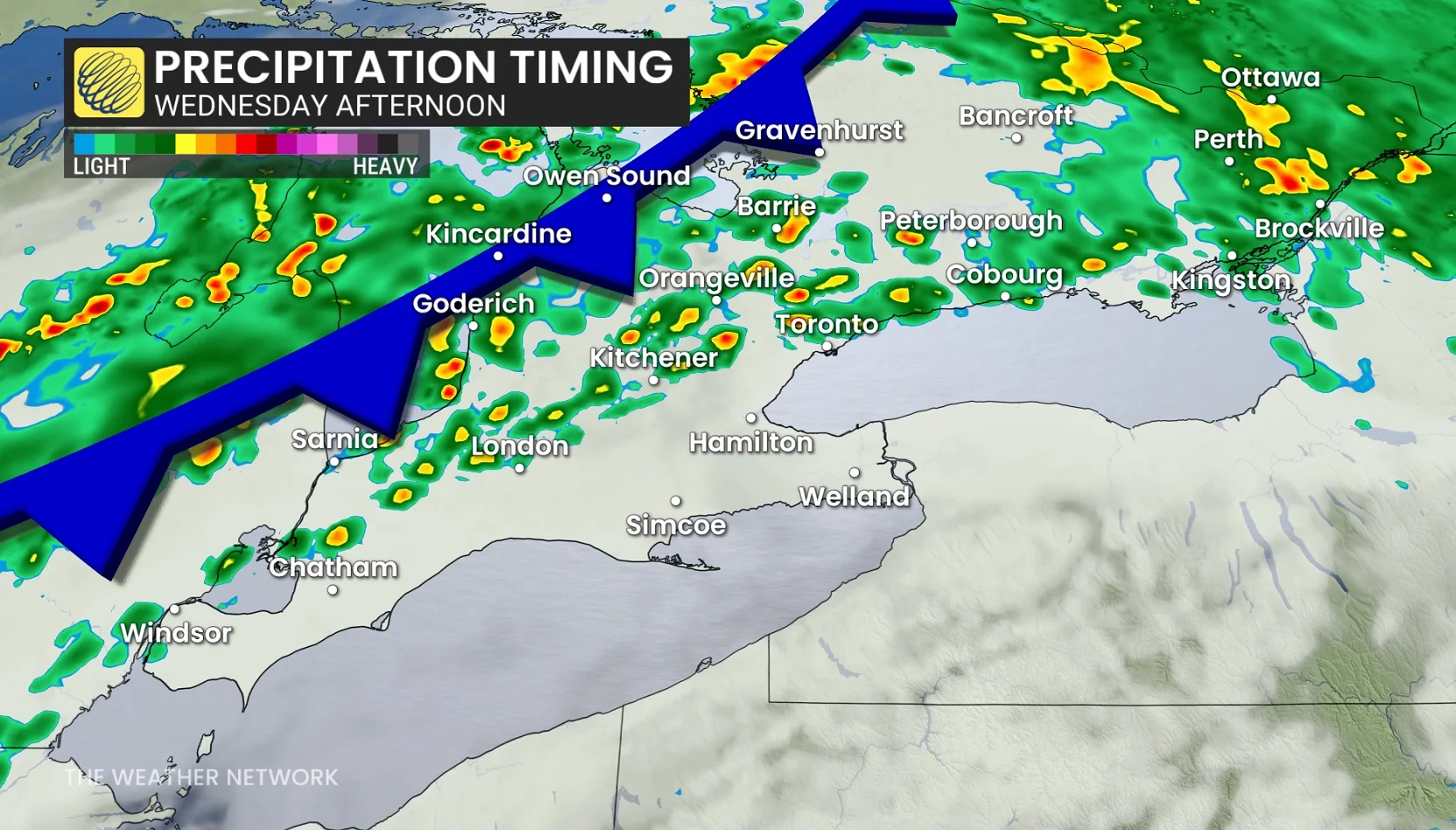
Models indicate a relatively narrow heavy band of precipitation, but model confidence in exact placement is currently low.
A cold front is projected to slide across southern Ontario Wednesday evening and overnight, ending the thunderstorm threat and zapping the humidity from the atmosphere.
Localized flooding remains the current hazard with this batch of storms as total moisture in the atmosphere is modelled to be between 40-60 mm--a red flag for flooding potential.
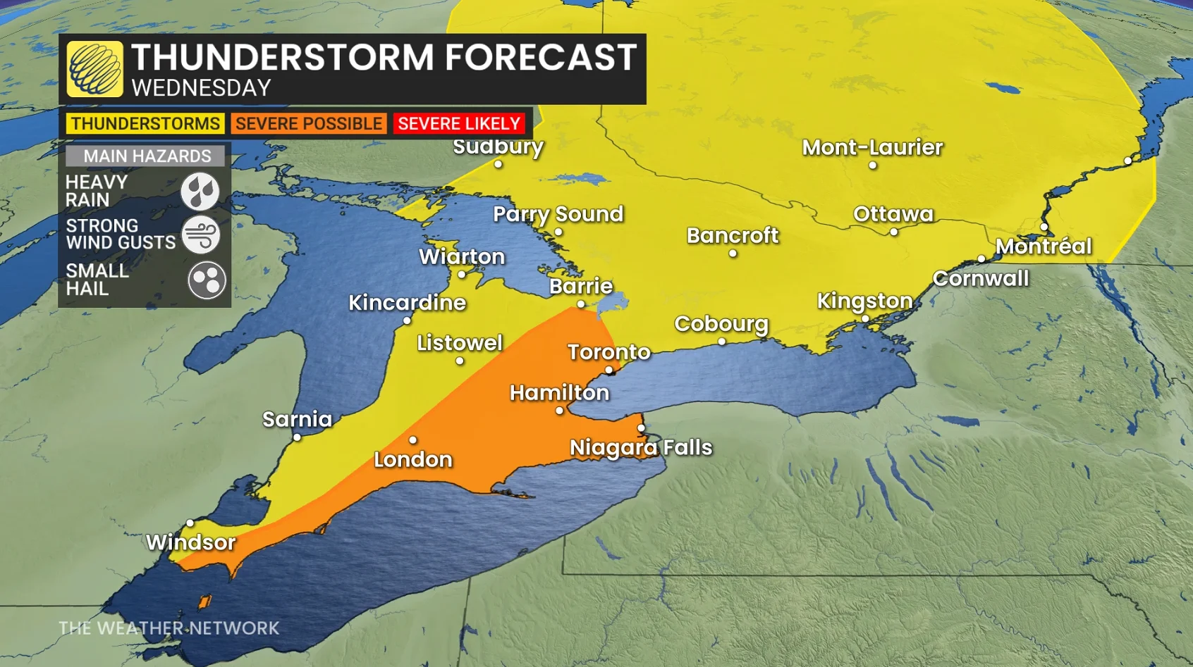
However, we’re uncertain how much instability will build in across southern Ontario on Wednesday. The higher the instability, the stronger the thunderstorm potential.
Exact rainfall amounts are a high uncertainty associated with thunderstorm activity ahead of the cold front.
Gusty winds in organized thunderstorms could reach up to or exceed 80 km/h.
Residents in the affected areas should monitor weather alerts and be prepared for potential disruptions.
Beyond Wednesday, changeable temperatures and an unsettled pattern are expected during the middle of and in late September as we will continue to be near the battleground between hot conditions south of the border and cooler conditions surging south at times.
Overall, temperatures should tip to the warm side of normal. The pattern should trend somewhat drier during late September.
Stay tuned to The Weather Network for the latest forecast updates in southern Ontario.