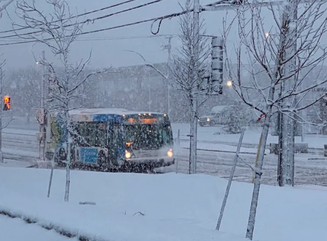
April shows its wintry side with blast of heavy snow in Quebec

Snowfall warnings and special weather statements line much of Quebec, as a messy spring storm threatens some significant snowfall totals through Tuesday. The snow spread across parts of southern Ontario on Monday afternoon and evening, quickly leading to poor road conditions and slick surfaces. Sections of eastern Ontario will continue to contend with the tricky travel through Tuesday, as the system moves its way eastwards. Drivers in both eastern Ontario and southern Quebec are being warned of suddenly reduced visibilty at times in heavy snow. More on the timing and impacts expected, below.
TUESDAY: MESSY WINTRY STORM PUSHES INTO QUEBEC, TRICKY TRAVEL AND REDUCED VISIBILITIES EXPECTED
Snow quickly began accumulating in southern Ontario by Monday evening, with 3-5 cm reported in some areas west of the Greater Toronto Area (GTA). There were also reports of thundersnow in the GTA. The snow rapidly led to slick surfaces and tricky driving.
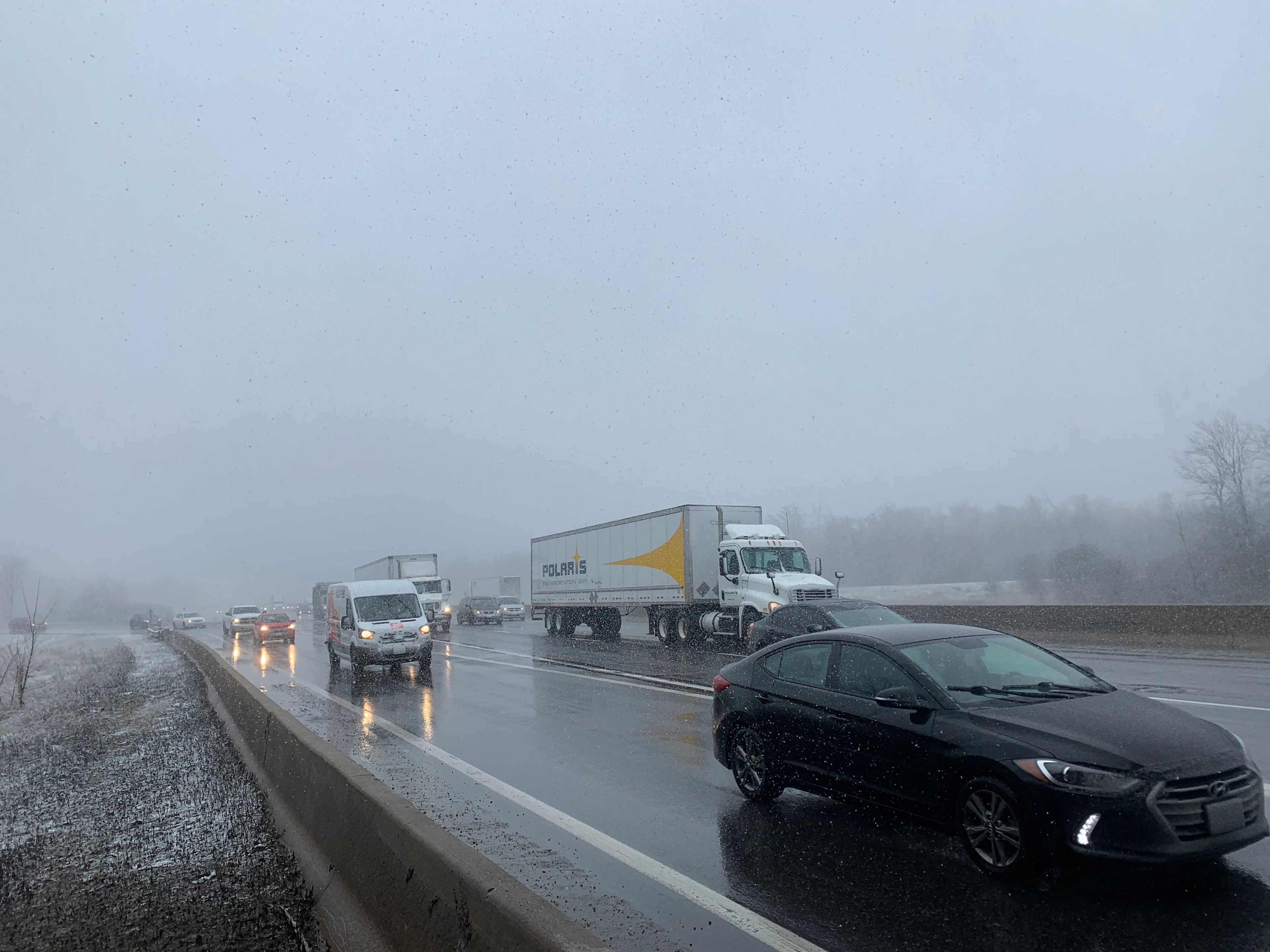
(Mark Robinson/The Weather Network)
Though conditions will improve on Tuesday, some light snow will continue through the day in Barrie and London, as well as Lake Huron and Georgian Bay regions. Lake-effect snow is expected as the system departs into Ottawa, so drivers should expect periods of lower visibility and changing conditions.
A winter weather travel advisory is in effect for sections of eastern Ontario, including the city of Ottawa where 5-10 cm of snow is expected. Significantly reduced visbilities are likely at times with snowfall rates up to 3 cm per hour.
"Be prepared to adjust your driving with changing road conditions," warns Environment and Climate Change Canada in the travel advisory. "Take extra care when walking or driving in affected areas. Visibility may be suddenly reduced at times in heavy snow."
Sporadic showers may be prevalent in parts of cottage country and eastern areas in the afternoon, before diminishing in the evening. As well, blustery winds will persist Tuesday, bringing periods of low visibility and changing conditions.
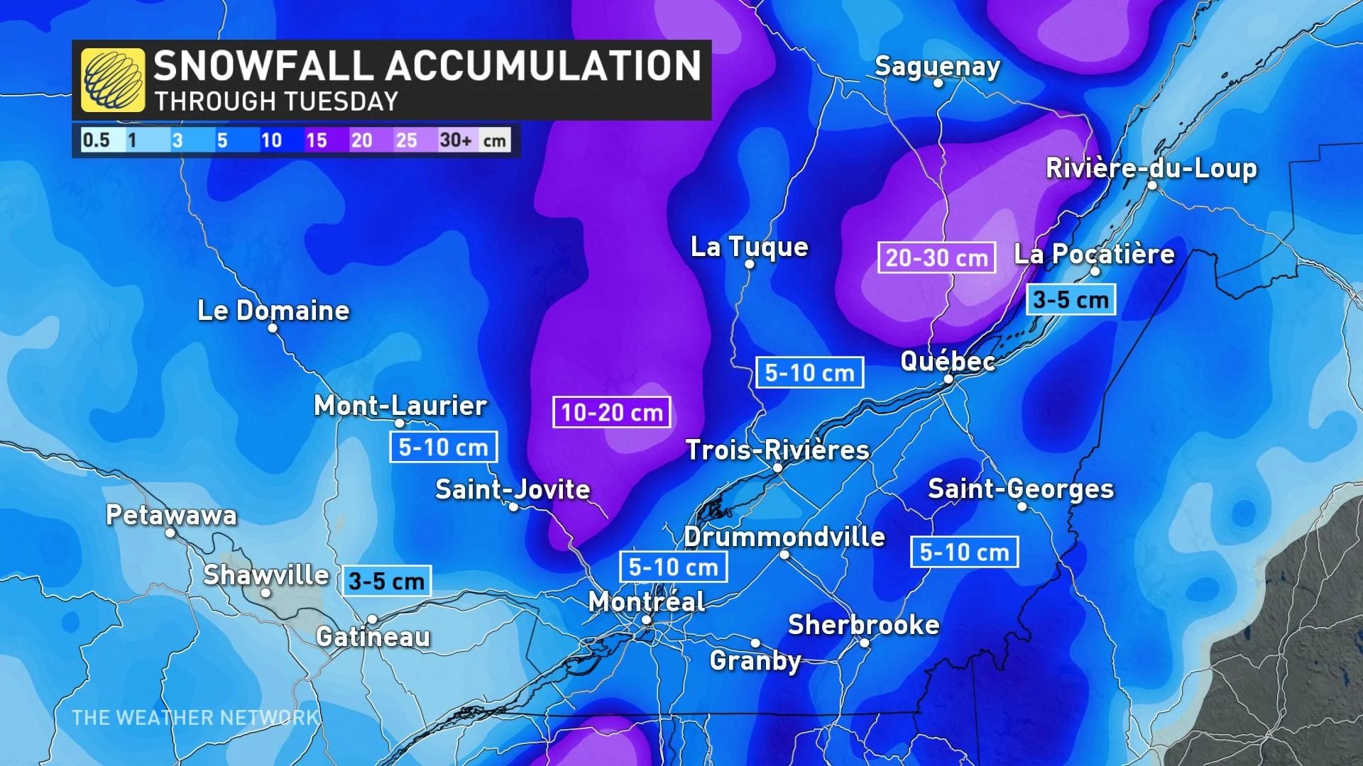
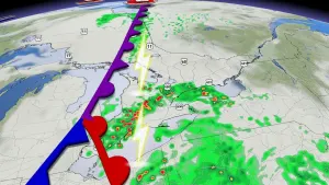
A stronger, secondary low that developed Monday tapped into deeper moisture, resulting in more significant impacts to parts of Quebec through Tuesday. As temperatures will be near the freezing mark, snow is expected to be wet and heavy.
Before 9 a.m., Montreal had already picked up 10 cm of snow, with the higher terrain outside of the St. Lawrence Valley seeing 10-30 cm through Tuesday. Special weather statements and snowfall warnings in effect.
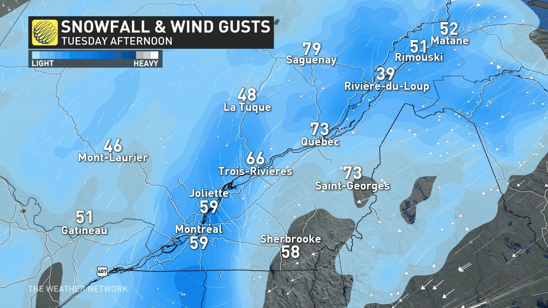
Winds will be brisk on Tuesday and Wednesday with gusts potentially reaching up to 80 km/h. The combination of heavy snow and strong winds could result in power outages, and periods of hazardous driving conditions.
There may even be some ice pellets for the extreme sections of eastern Quebec in the afternoon Tuesday. Precipitation will begin to wind down in the province from west to east through the evening and overnight.
WATCH: POWER OUTAGES A CONCERN AS HEAVY WET SNOW HITS SOUTHERN QUEBEC
Beyond the system, a few hours of rain is expected in southern Ontario late Wednesday night and Thursday morning, and during the day Thursday for eastern Ontario and southern Quebec. Becoming sunny, windy, and much warmer for southern Ontario Thursday afternoon, but the clearing will not reach Ottawa and Montreal until after dark.
A very tricky temperature forecast for Sunday as early summer-like warmth surges north into southwestern Ontario, with mid-20s possible, while chilly weather holds on across southern Quebec. Wind direction will be the key to whether the GTA sees temperatures in the lower 20s versus the lower teens.
A brief warm-up and unsettled weather is anticipated across the region for the start of next week in the warm sector of a storm tracking north of the region, but then a much colder pattern will return for the final days of April. A cool pattern is expected to dominate through early May.
Thumbnail image courtesy: Valley Weather/Twitter
Stay tuned to The Weather Network for the latest forecast updates across Central Canada.