
Last-minute snow guarantees a white Christmas across southern Quebec
Heavy snow on Tuesday could lead to hazardous holiday travel disruptions
Forecasters are monitoring the progress of an Alberta clipper sliding into the Great Lakes from the west. This system will tap into enough moisture to produce widespread snowfall throughout southern Quebec as it tracks northeast.
Any doubt of having a white Christmas will be erased by Tuesday morning with the clipper moving along the Ontario-Quebec border.
RELATED: Intensifying snow threatens Monday commute, holiday travels in Ontario

DON'T MISS: Which of these Christmas weather extremes would you rather endure?
Due to the cold temperatures, lighter, fluffier snow is expected to accumulate, with amounts of 10-20 cm forecast along the provincial border. 10-15 cm is forecast near Montreal, with amounts closer to 5 cm for Quebec City.
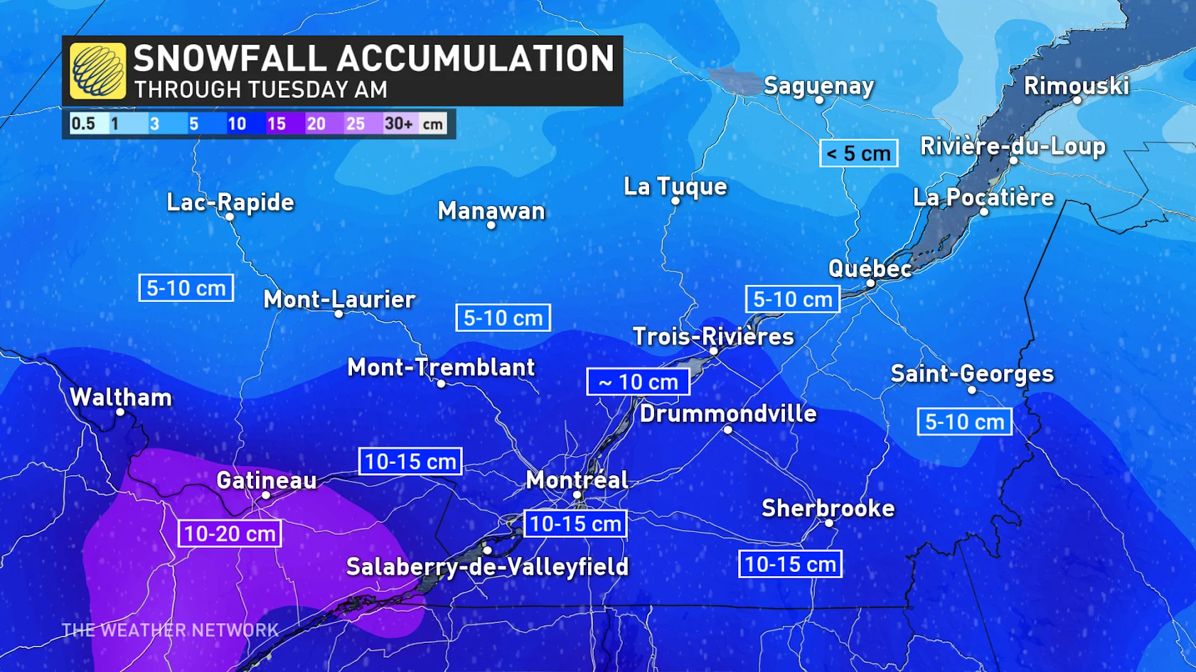
The clipper is expected to track south of the province, leading to an all-snow event just in time for the holidays. It will be a guaranteed white Christmas for all, including Gatineau, Montreal, and Quebec City!
As the system continues to move east into the Maritimes through Tuesday, we could see some snowfall lingering in the Eastern Townships on Tuesday evening.
An area of high-pressure will immediately move into the province behind the clipper on Tuesday, bringing pleasant conditions across the province in time for Christmas Day.
Stay with The Weather Network for more forecast information and updates on your weather across Quebec.