Large hail, tornado risk: Prairies face possible repeat of severe weather

A rejuvenated threat for severe weather will be found on the Prairies on Saturday, with some areas facing a risk of a tornado alongside the potential for large hail and strong wind gusts
Friday night featured a marathon of severe thunderstorm and tornado warnings for parts of the Prairies, with approximately eight hours of active alerts.
The storm-plagued Prairies will once again see a renewed potential for severe weather on Saturday. All modes of severe weather will be possible, including one or two tornadoes.
DON’T MISS: El Niño is rapidly strengthening with global implications
Stay aware of severe weather watches and warnings in your area, especially if you have outdoor plans. Advanced warnings are proven lifesavers.
Severe weather is likely on Saturday
A risk for severe thunderstorms continues into Saturday as a boundary and surface low linger over the region.
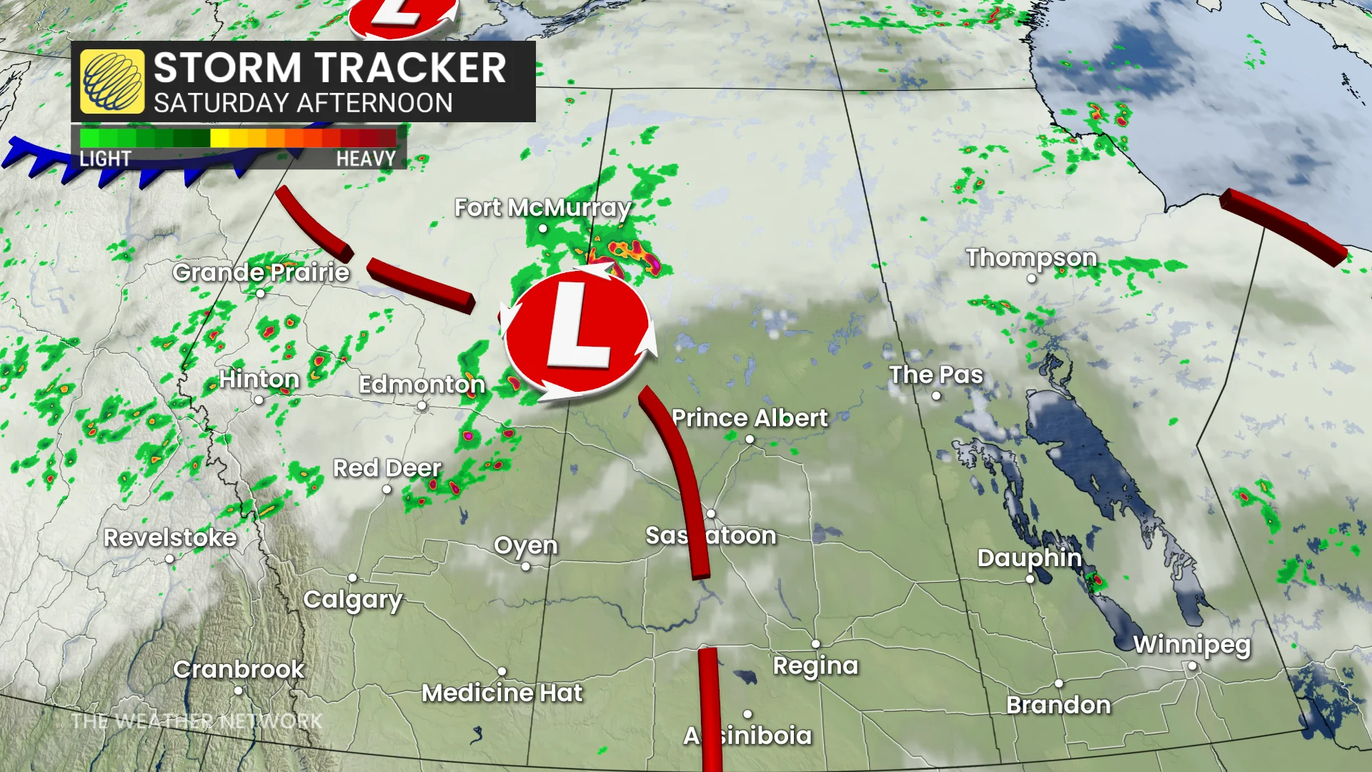
Dynamics will grow increasingly favourable for hazardous weather through the day, with plenty of instability, moisture, and wind shear available for storms to fire off and quickly turn severe.
Saturday’s storm potential will cover a wide swath of Alberta and Saskatchewan. All modes of severe weather are possible, including large hail, strong wind gusts, and tornadoes.
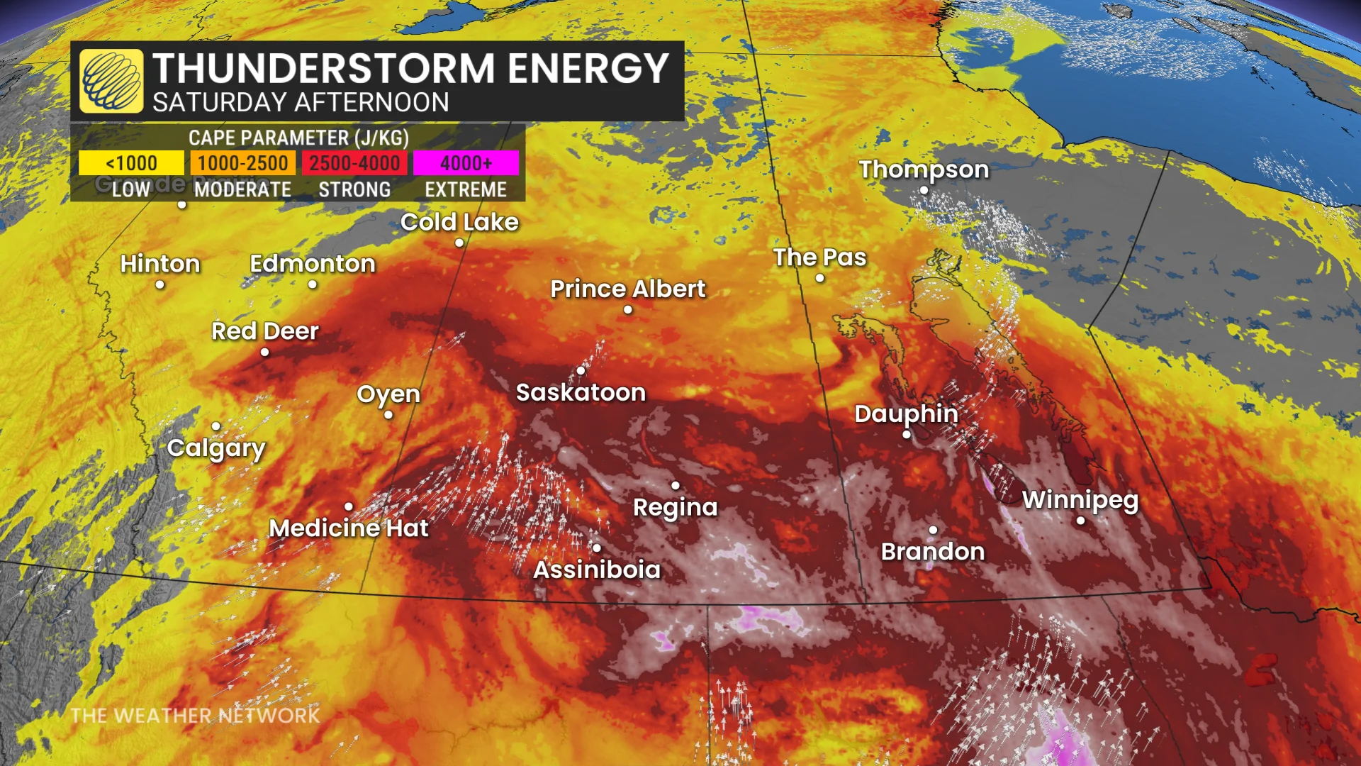
Increased shear lifts north, increasing the severe potential and chance for rotating storms from north of Lloydminster, extending west and east from the provincial border.
Isolated supercells are expected in central Alberta and parts of Saskatchewan by the afternoon, but a cluster of storms will move through in the evening.
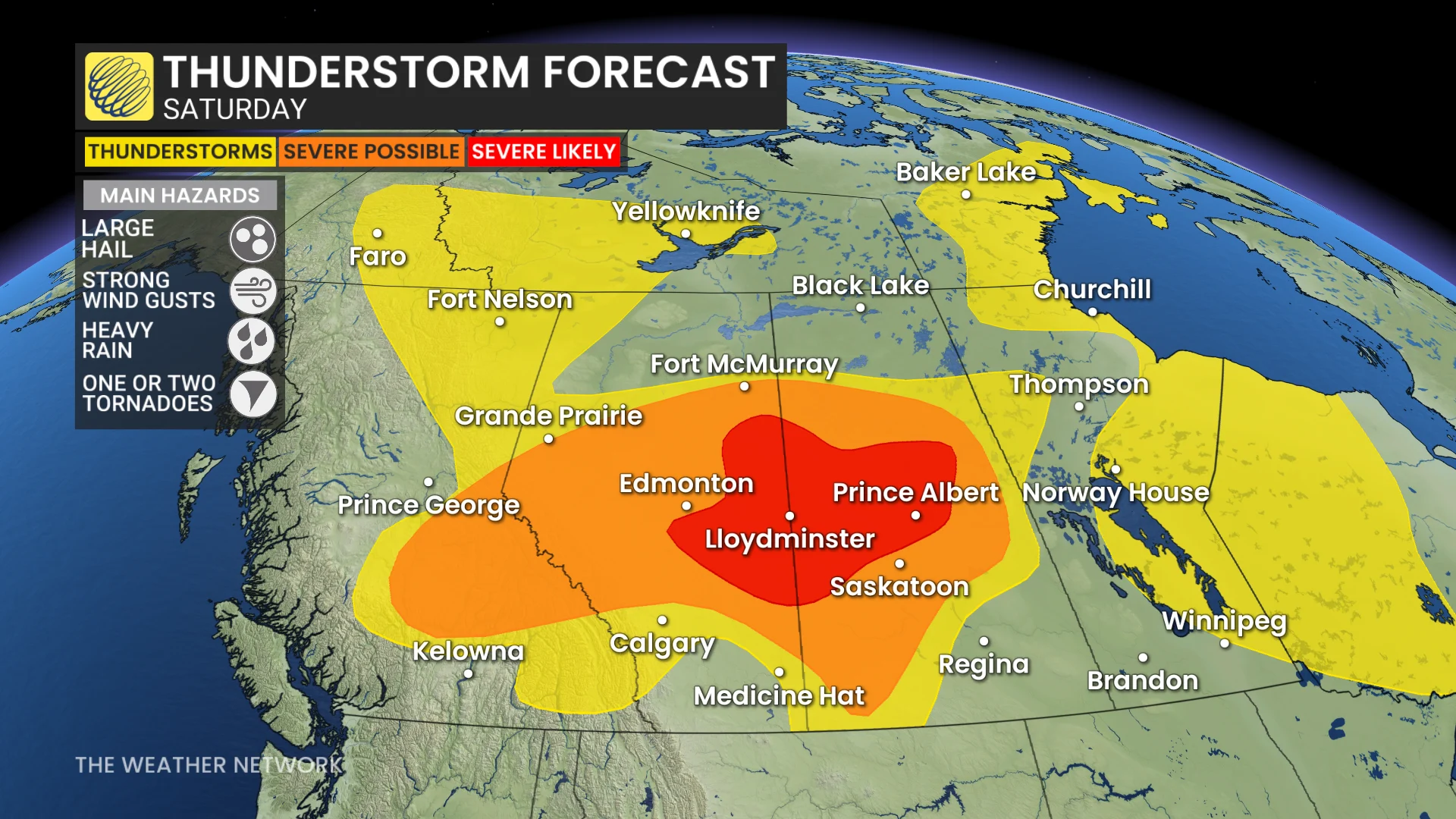
The main threats include large hail (4 centimetres in size or greater) and strong wind gusts near 100 km/h.
An isolated tornado cannot be ruled out, based on the environment on Friday. The greater risk will be found in Saskatchewan with higher amount thunderstorm energy and a trigger.
The threat for tornadoes is greatest east-southeast of Edmonton and northwest of Saskatoon, around Lloydminster and Prince Albert and other areas north.
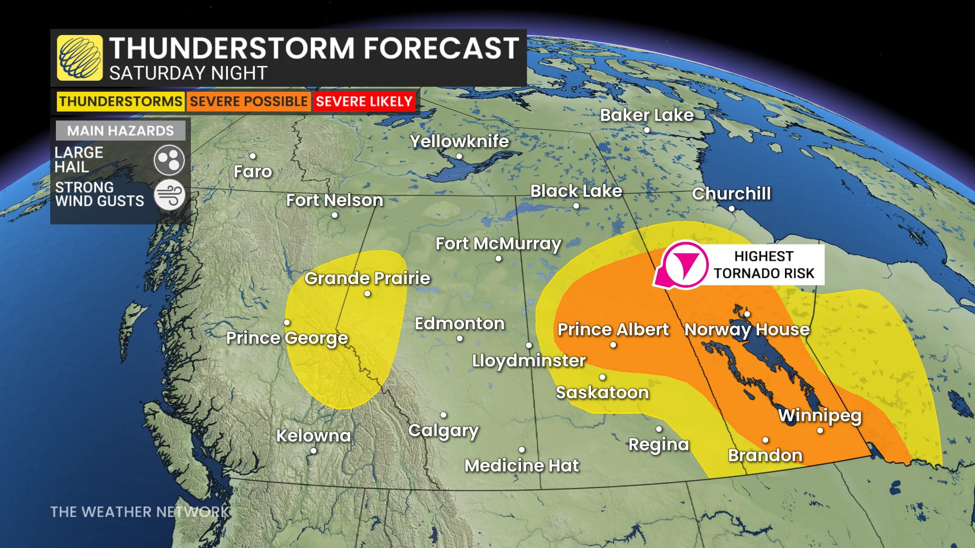
Models show storms developing starting in the afternoon (1 p.m. local time and onwards), and tracking northeast to central Manitoba--persisting into the overnight hours with the threat of severe storms lingering.
However, the southern portion of the Prairies looks to have a strong cap that may inhibit storms from developing.
A heat dome building over the United States will begin to influence conditions over the southern Prairies this weekend. Temperatures will climb into the mid-30s with humidex values into the 40s on Saturday and Sunday.
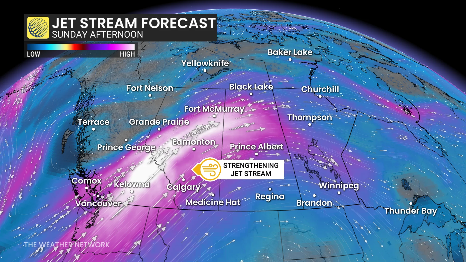
This stateside ridge will shunt the active storm track up towards northern regions of Alberta, Saskatchewan, and into the Northwest Territories.
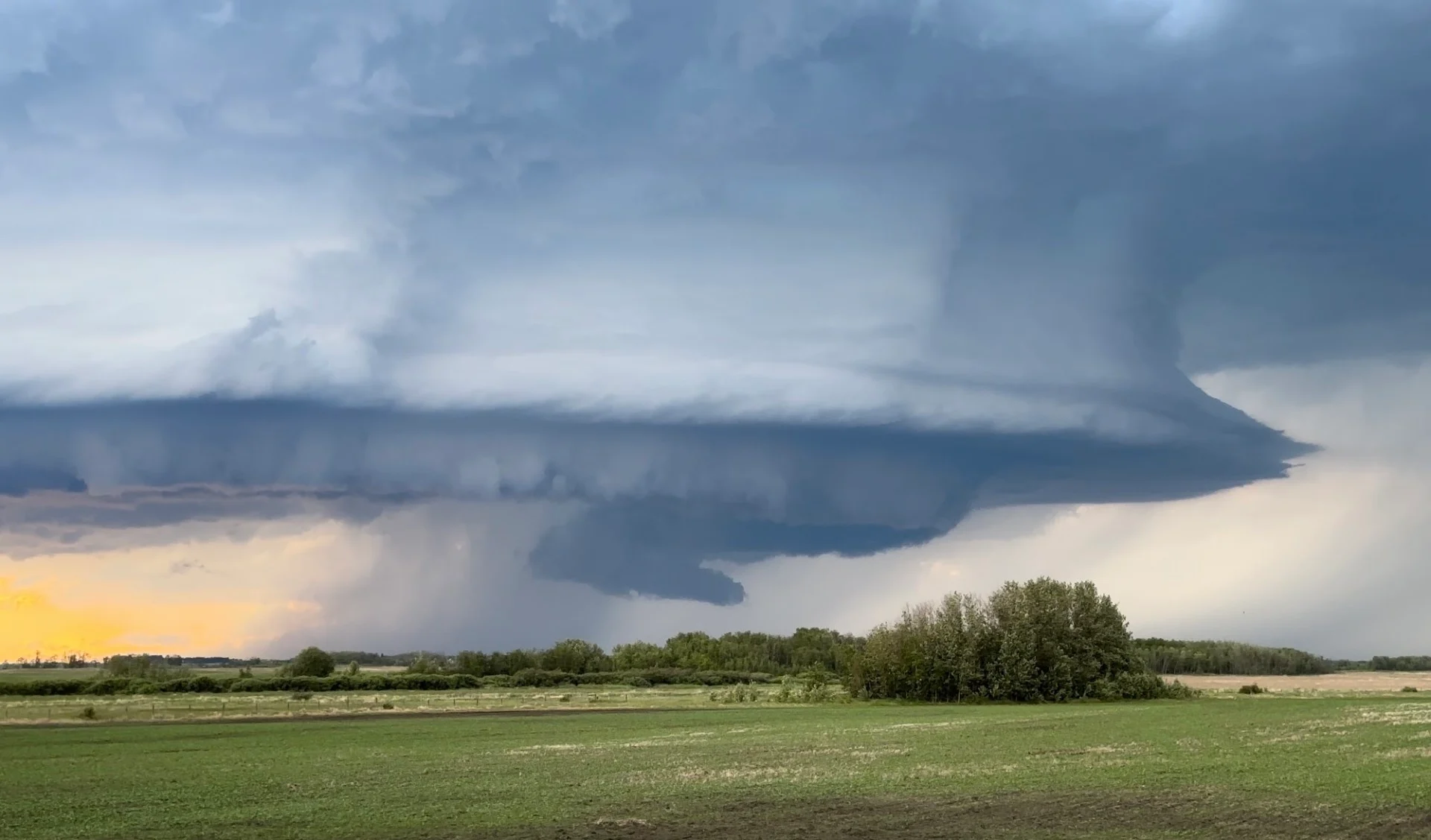
Thumbnail courtesy of Loreen, taken near Spalding, Sask.
Stay with The Weather Network for all the latest on conditions across the Prairies.