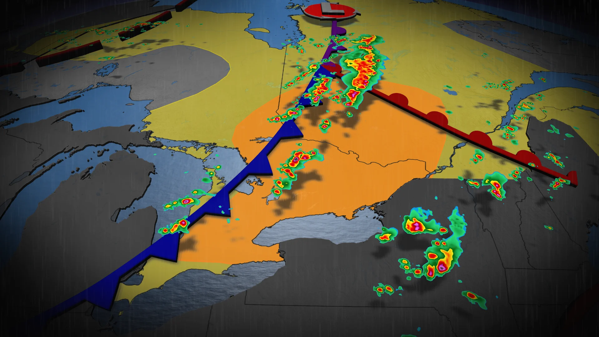
Severe storms bring flood, hail threat to start weekend

A turbulent Saturday is possible as severe thunderstorms are likely across parts of Ontario and Quebec. The main hazards include strong wind gusts, heavy rain and large hail, as well as a potential for localized flooding
With muggy conditions sticking around, severe weather will possible throughout parts of southern Ontario and Quebec on Saturday, including a risk for localized flooding, strong wind gusts, and large hail.
Flooding will be a major concern for areas such Bancroft, London and the Niagara region. The latter has already seen ample amounts of rain and flooding in the past two weeks.
DON’T MISS: Precise, targeted severe weather warnings coming to Canada
Stay alert for rapidly changing conditions, and pay attention to any potential watches or warnings in your area.
Saturday storm risk grows in Ontario and Quebec
A cold front pushing into the region on Saturday will provide the trigger needed to spark scattered thunderstorms.
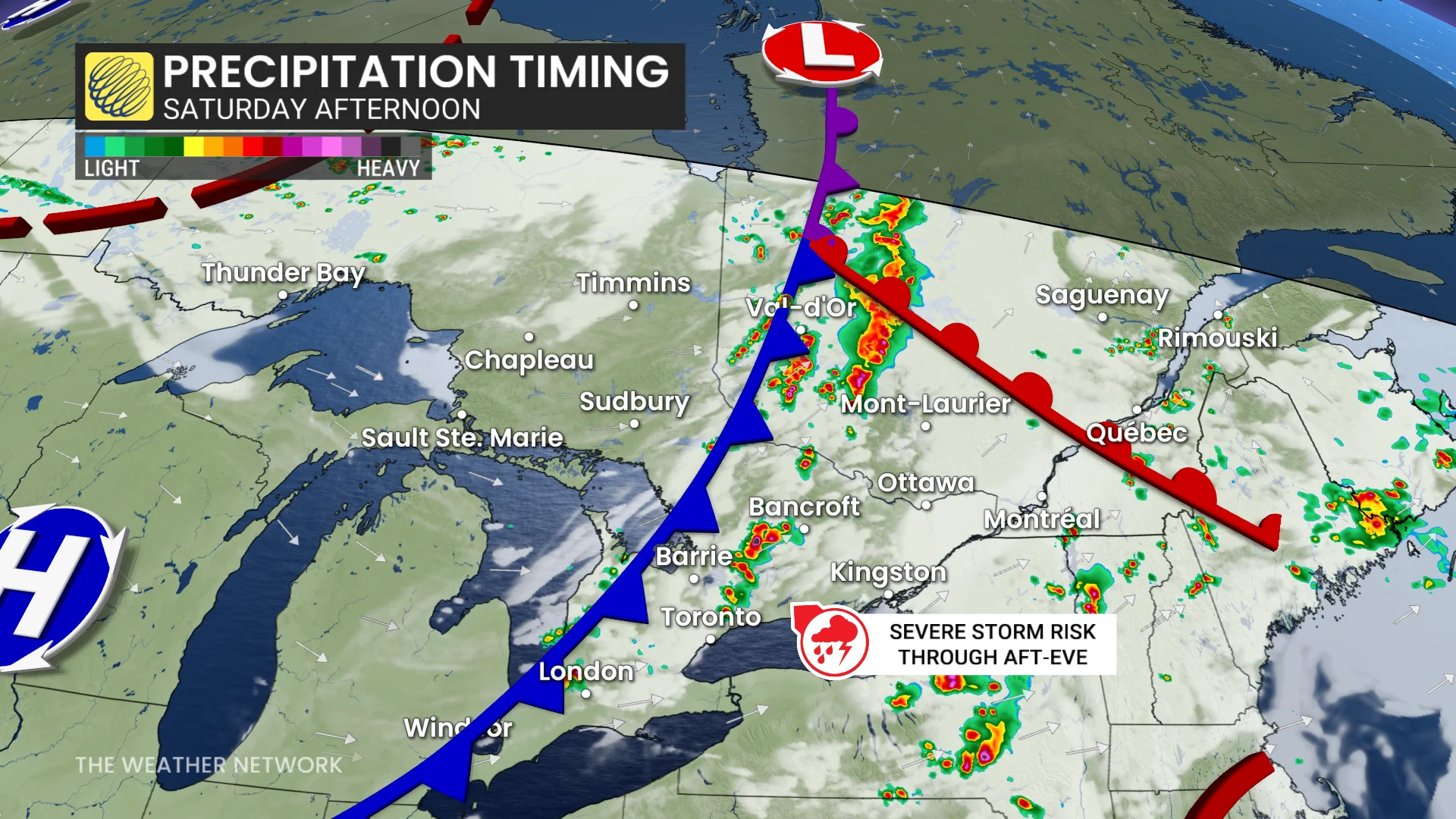
The activity began Saturday morning, with precipitation infiltrating the Niagara and Simcoe regions. It will reach the Greater Toronto Area as the day progresses, with a severe storm risk encompassing the region and eastern Ontario in the afternoon.
Peak afternoon heating and instability will likely fuel the strongest storms along the cold front. Discrete thunderstorms will bubble up across northeastern and eastern Ontario, as well as into western Quebec.
RELATED: How to flood-proof your home, basements
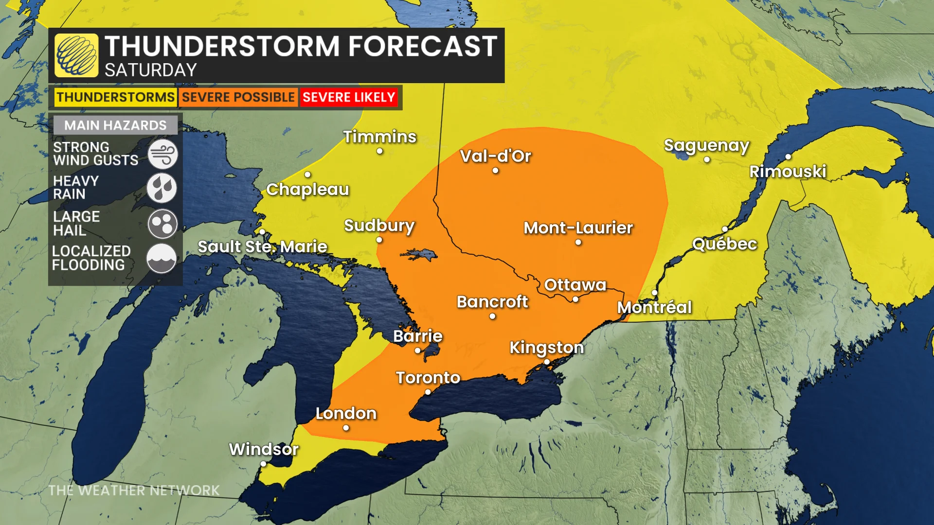
We’ll see these storms organize into a line during the early afternoon. Potent wind gusts, heavy rainfall, and large hail (2 cm to 3 cm in size) are possible in the strongest storms. Isolated rotation cannot be ruled out given environmental conditions in northeastern Ontario and southwestern Quebec.
The risk will shift into southern Ontario by Saturday evening as thunderstorms triggered by lake breezes become organized as the cold front advances into the area.
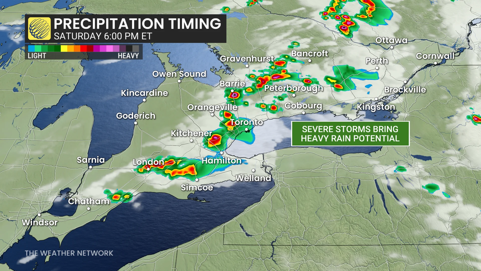
Ample atmospheric moisture will provide a rich reservoir for these storms to tap into and produce very heavy rainfall. Localized flooding is expected. Strong wind gusts are also possible.
There’s some uncertainty in the forecast given that the cold front will also carry some upper-level smoke into the region from fires out west. The smoke may suppress the severity of any of Saturday’s storms.
Stay with The Weather Network for all the latest on conditions across the region.