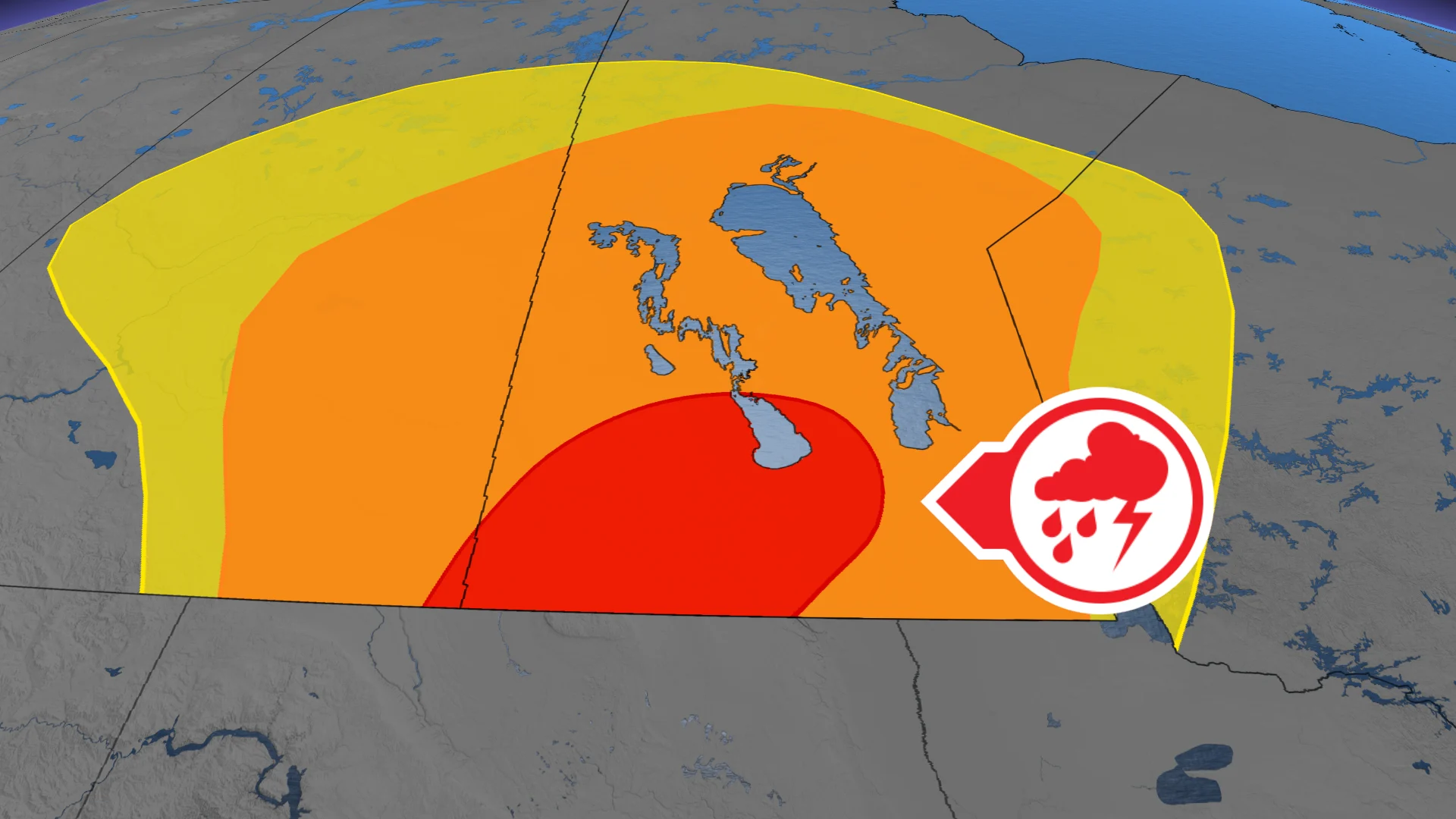
Large hail and tornado threat with severe storms over Sask., Manitoba
Severe thunderstorms with risks of large hail, isolated tornadoes, and strong wind gusts are expected to develop in southern Manitoba on Tuesday afternoon, affecting areas like Brandon between 3–6 p.m. and reaching Winnipeg by evening
The eastern Prairies brace for an unstable atmosphere on Tuesday as persistent southerly winds bring heat and moisture into the region, intensifying storm potential. Thunderstorms are set to develop Tuesday afternoon and evening, with risks of large hail and an isolated tornado threat over parts of southern Manitoba.
DON'T MISS: TORNADO SAFETY 101, safety reminders and tips if there's a tornado warning
Be sure to stay alert to the changing conditions and stay updated on any weather warnings in your area.
Severe thunderstorms, large hail, and tornado risk for southern Manitoba Tuesday
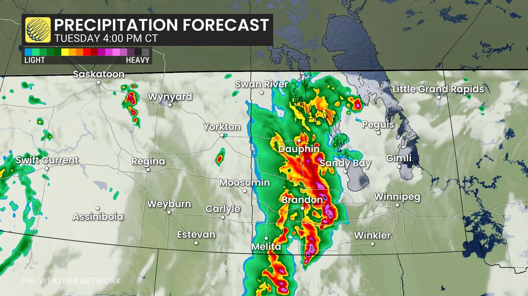
Severe thunderstorms are expected Tuesday as a shortwave trough moves across southern Manitoba and North Dakota, creating conditions for supercell development.
Wind shear and steep lapse rates will support these storms, with large hail—potentially toonie-sized or larger—as the primary threat. Forecasters suggest one or two tornadoes are also possible, along with strong outflow wind gusts.
RELATED: Stuck in your car during a tornado? Here’s what you should do
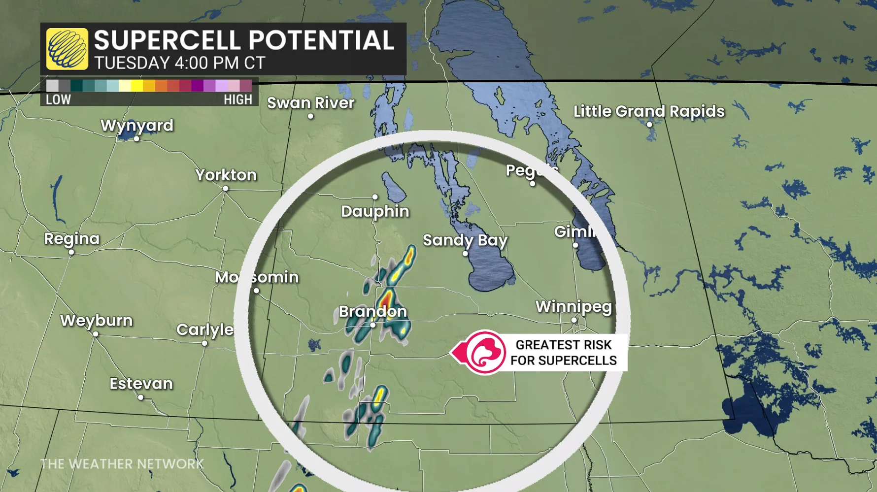
Thunderstorms are forecast to initiate in the U.S. before moving into southwestern Manitoba during the afternoon. Isolated storms will evolve into widespread clusters by early evening, tracking northeast from southwestern Manitoba toward the Interlake and eastern regions.
Brandon faces the greatest storm risk from 3–6 p.m. local time, with thunderstorms expected to reach Winnipeg after dinner and into the evening hours.
SEE ALSO: Tornado WATCH OR WARNING? What you need to know about staying safe
Conditions will stabilize after the system passes, marking the end of the current extreme heat. Stay weather-aware and monitor alerts for updates.