Large hail and strong winds: Severe storm threat hits Alberta
Potential for damaging hail and wind over central Alberta Friday
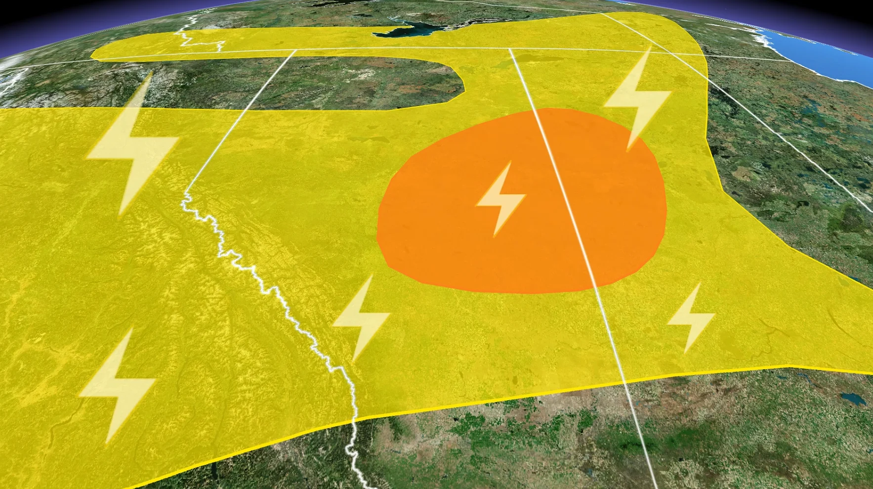
A multi-day thunderstorm risk persists in Alberta, with severe storms possible near Edmonton Friday.
Stay alert for watches and warnings throughout the day.
DON’T MISS: The pros and cons of an El Niño summer across Canada
Storms are expected to initiate west of Edmonton around midday and will track eastward through the afternoon and early evening.

The thunderstorm risk will reach Edmonton by mid-afternoon, continuing east towards Cold Lake and Lloydminster. Large hail and strong winds are the primary severe weather hazards.
Some areas may see an environment favourable for localized storm rotation later in the afternoon, and into the early evening.

Commuters should prepare for potential traffic slowdowns around Red Deer, Edmonton, and roadways along and east of the QE2. Do not stop beneath bridges or overpasses during a hailstorm, as this creates a very dangerous traffic jam.
Further south, strong downsloping winds are expected by Friday evening, with gusts ranging between 40–60+ km/h.
Weekend Outlook
An unsettled trough over western Canada will maintain isolated thunderstorm risks through the weekend. Periods of sun, cloud, showers, and isolated thunderstorms are in the forecast for both Saturday and Sunday.

Looking ahead, scattered thunderstorms are likely to remain a feature for much of the coming week. Stay updated with the latest forecasts and alerts for your region.
Stay with The Weather Network for all the latest on conditions across Alberta.