Southern Ontario gets a taste of cold winter temperatures, lake-effect snow
A taste of winter is setting up through the end of the week for southern Ontario, with a blast of both snow and cold
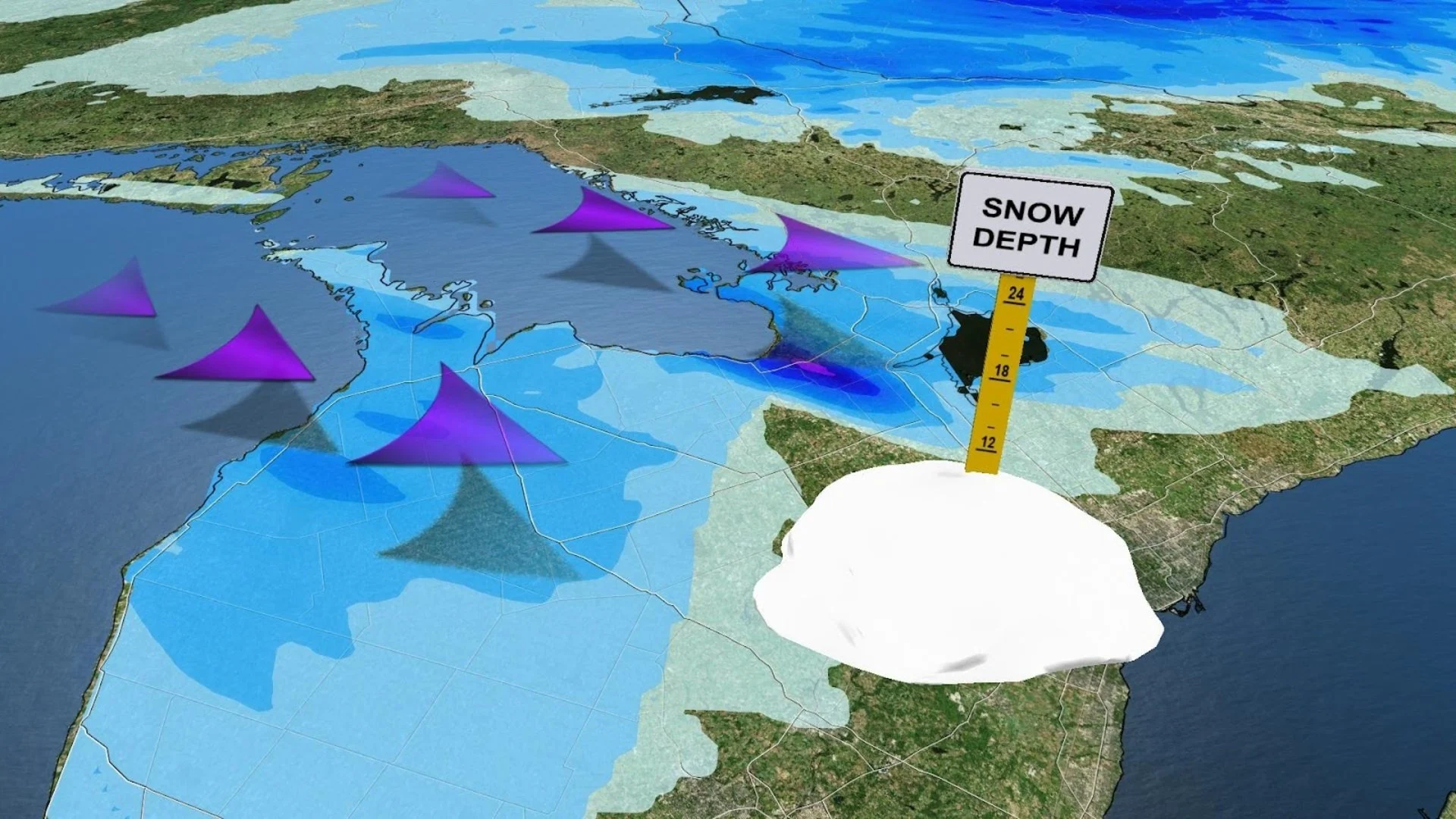
Bundle up! The coldest weather of the season is about to hit southern Ontario to end the week. Daytime highs will struggle to crack the freezing mark as we head into this final weekend of November, with blustery bands of lake-effect snow possible east and southeast of Lake Huron and Georgian Bay into Saturday.
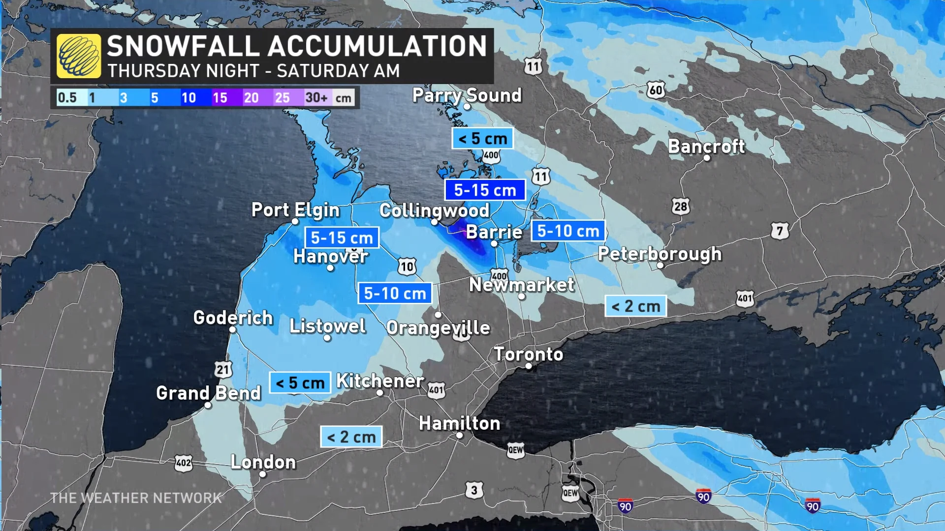
As much as 15 cm of snow is expected in the heaviest snow bands off of the lakes, making for difficult travel and reduced visibility. Drivers are urged to plan ahead, and to adjust to the changing and deteriorating conditions.
MUST SEE: Why the Great Lakes produce some of the world’s heaviest snow
While conditions remain cool through the first days of December, another milder pattern is set to return, and likely stick around into the mid-month mark.
Thursday overnight through Saturday morning
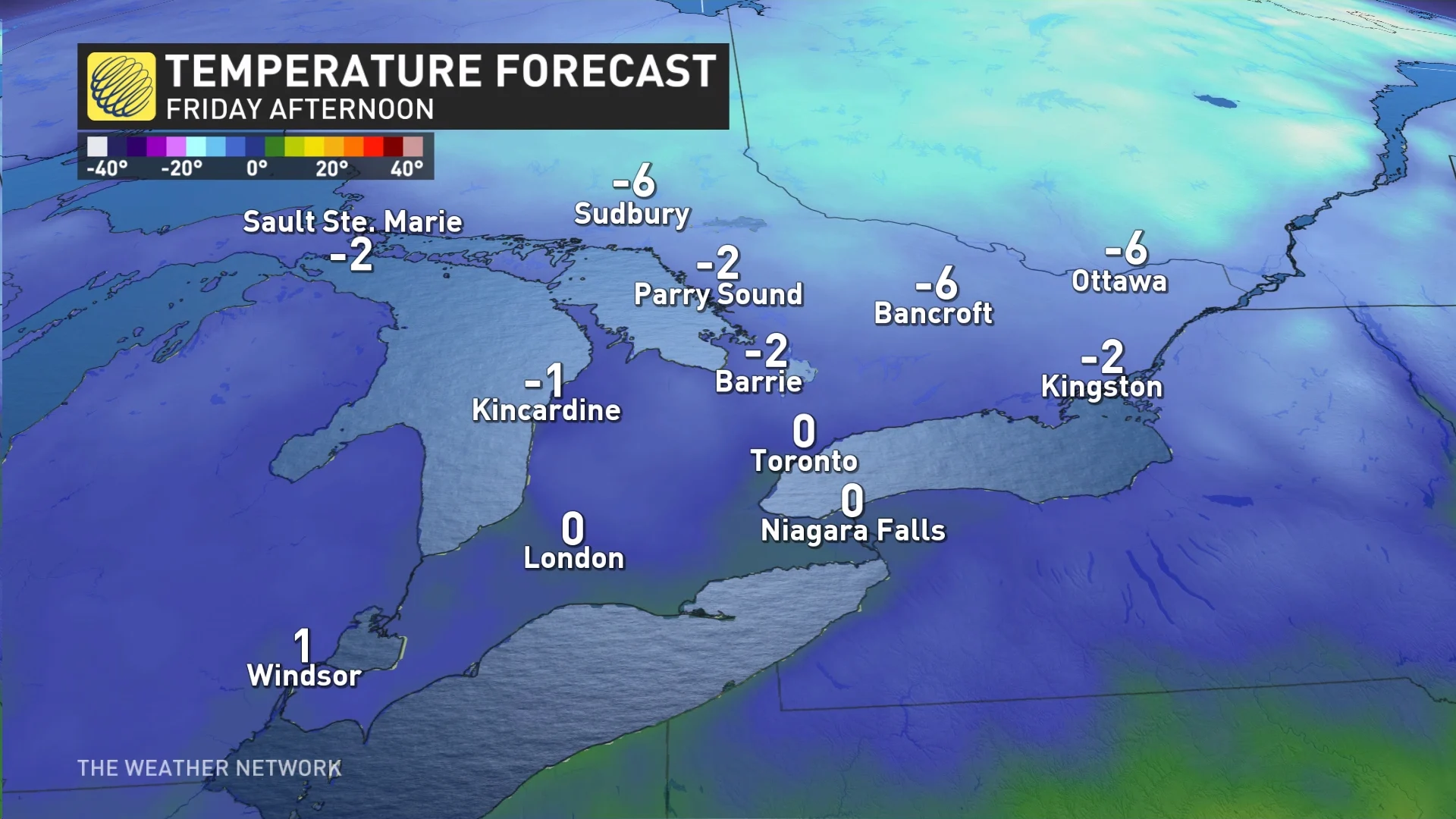
As a cold front passes through southern Ontario Thursday evening, much colder air will usher into the region, bringing the coldest daytime high temperatures of the season so far on Friday.
Daytime high temperatures will range from a chilly 1°C to -8°C in southern Ontario.
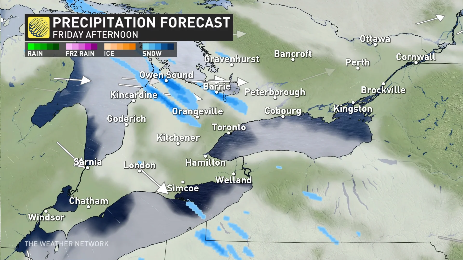
With this cold air, lake-effect snow squalls are expected to develop in between the cold front off of Lake Huron and Georgian Bay.
Northwesterly winds will push snow bands inland to the southeast. These bands are expected to continue through Friday, before ending early Saturday morning when the winds shift.
Up to 15 cm of snow is expected in the heaviest snow bands off of the lakes. The heaviest snow can impact locations such as Wasaga Beach, Barrie, Port Elgin and the Saugeen Shores.
Breezy winds can reduce visibility especially on Highway 21 and 26, where the worst conditions will be. Some bands may briefly make their way to Highway 400 south of Barrie, as well.
Lake-effect snow is quite common in November, however, this year there hasn't been a major lake effect set-up.
It was around this time last year, November 17-20, 2022, when a potent lake-effect event dropped 125 cm in Wiarton, Ont., and a whopping 206 cm in Hamburg, NY.
WATCH: Why November can be a monster for snow near Canada's big lakes
Be sure to check back for the latest weather updates across Ontario.