Hurricane Isaias downgraded to tropical storm, still a risk for Florida

Isaias, the second hurricane of the 2020 Atlantic season, continues to inch toward Florida. Downgraded to a tropical storm, but the risk for Florida persists.
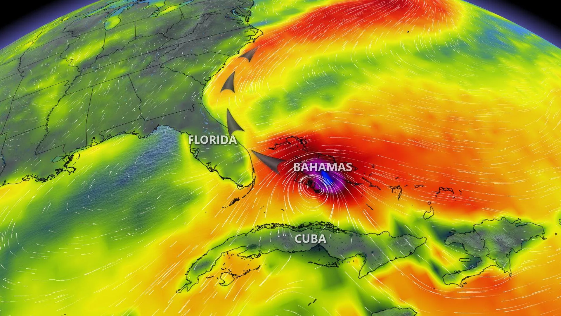
Hurricane Isaias has been downgraded from a hurricane to a tropical storm. Right now the storm is just north of The Bahamas and heading towards Florida. As it continues, it is losing its wind speed. The current wind speed, as of Saturday night, is 115 km/h.
As far as where Isaias is heading, it looks like it will continue to hug the Eastern Seaboard.
The Caribbean has already experienced strong wind gusts, torrential rains and high tides reaching up to three meters.
The storm is already responsible for at least two deaths in the Dominican Republic, along with damage to homes there and in Puerto Rico.
The storm has already slowed down since Saturday morning, when, according to the [U.S. National Hurricane Center (NHC)](https://www.nhc.noaa.gov/text/refresh/MIATCPAT4+shtml/010851.shtml?, maximum sustained winds were around 140 km/h.
Its speed is expected to decrease some decrease in the next day or so and a slight track shift to the north-northwest is anticipated by late Sunday.

Hurricane and tropical storm watches and warnings are in effect in Florida and the Bahamas. As of Saturday night, this is was the storm looks like:

"Heavy rainfall from Isaias could result in potentially life-threatening flash and urban flooding, especially in low-lying and poorly drained areas. Minor river flooding is possible across portions of the Carolinas and into Virginia," the NHC says.
Philip Klotzbach, a meteorologist at Colorado State University, tweeted that 2020 is now tied with 2005 for the most Atlantic named storm formations on record (since 1851) during the month of July.