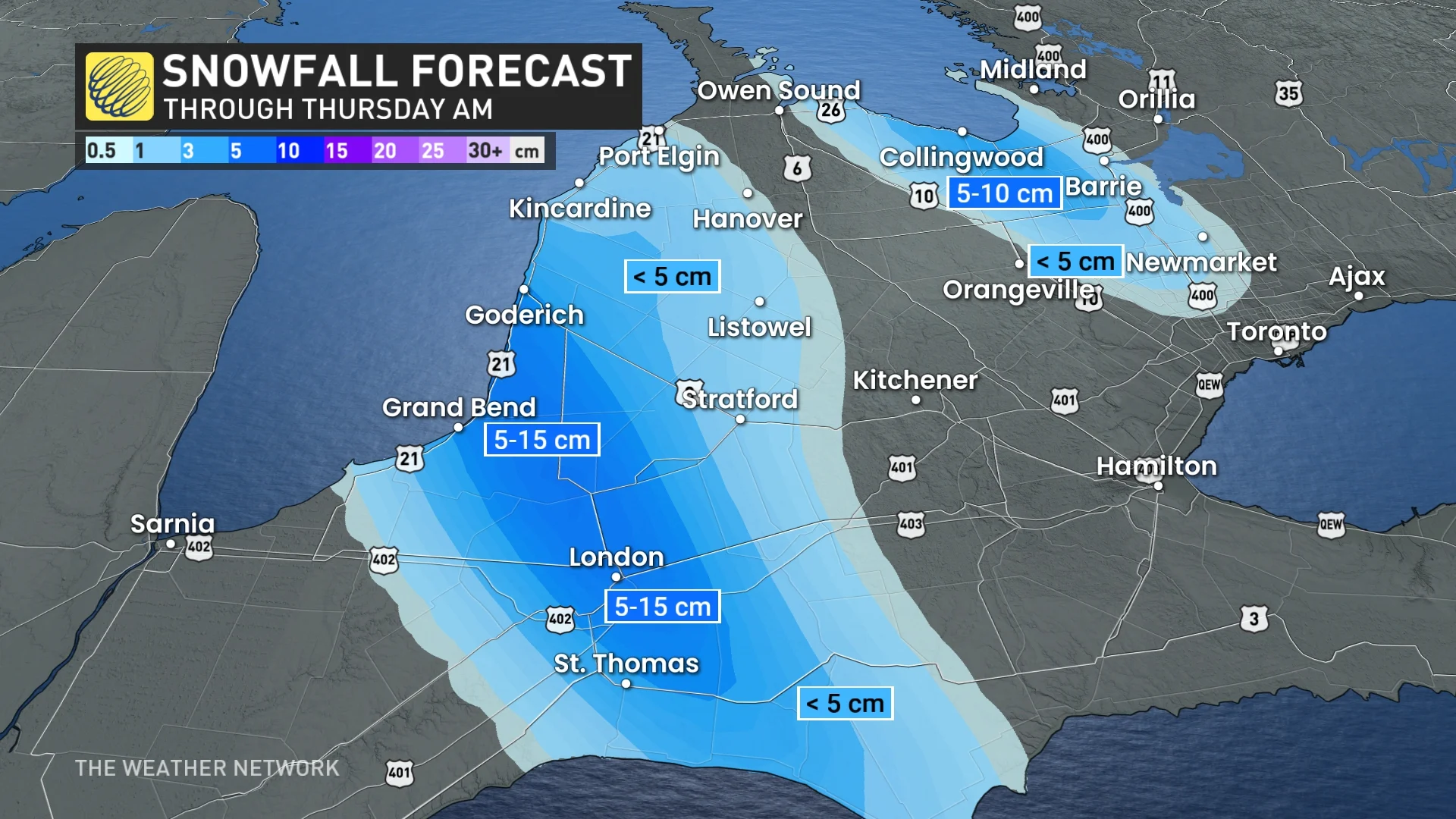
Inundated: Another 10-20 cm of snow possible for Ontario cities
Prepare for quickly changing and deteriorating travel conditions, as snow squalls continue off Lake Huron and Georgian Bay Wednesday
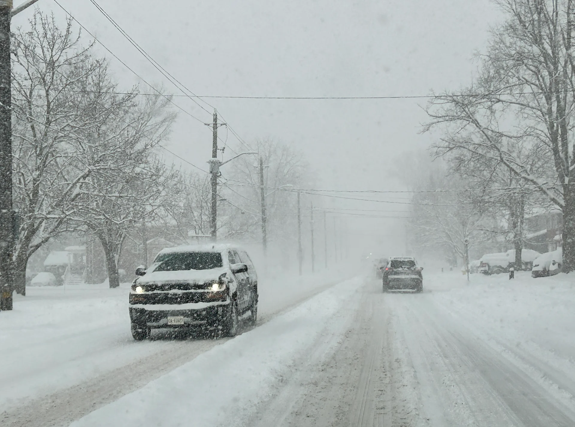
Closures are racking up across parts of southern Ontario, as another round of powerful snow squalls hit the traditional snowbelt regions off Lake Huron and Georgian Bay. Snow squall warnings remain in effect.
"Travel is expected to be hazardous due to reduced visibility in some locations. Rapidly accumulating snow could make travel difficult over some locations. Road closures are possible," warned Environment and Climate Change Canada (ECCC) in the snow squall warning issued for the London area. Warnings also continue for Barrie and Collingwood, and other locales around southern Georgian Bay and Lake Huron.
RELATED: Why snow squalls are one of the hardest events to forecast
An additional 5-15+ cm could fall throughout the day on Wednesday, adding to the already hefty totals that have accumulated since the start of the week. In the London area, 25 cm had already fallen by early Wednesday.
If snow squalls become stationary over one area, locally heavier amounts are possible.
Northwesterly winds gusting between 20-40 km/h will continue though Wednesday evening. Squalls will end by Thursday morning, as the winds ease and shift direction ahead of the next incoming system for Friday evening into Saturday.
RELATED: Snowy start and end to the weekend; plan travel accordingly in southern Ontario
Bands of lake-effect snow persist into next week
After a very cold week, temperatures will rebound to near seasonal for Friday and the weekend.

Widespread light snow will develop across the region late Friday and into Friday night, as moisture from the storm tracking across the southern U.S. will stream north and interact with the dynamics associated with the low pressure system tracking across northern Ontario.
DON'T MISS: Ontario cold snap likely to be Toronto's longest in at least three years
Saturday will be partly sunny with bands of lake-effect snow hitting areas southeast of Lake Huron and Georgian Bay. Bands of lake-effect snow will also develop late Monday, and continue through Tuesday and into Wednesday for the same areas.

While no major storms are in sight, as we get deeper into the second half of the month, the pattern is expected to become more active as it will be more conducive to Colorado and Texas Lows, which can tap into moisture from the Gulf of Mexico.
SEE ALSO: January is Canada’s snowiest month. Here’s what you can expect
Colder than seasonal temperatures are expected to dominate during the third week of January.