
Sizzling heat set to fizzle in B.C. with a cooler pattern looming
Heat will persist on Wednesday in B.C., alongside a thunderstorm risk, before a pattern change will bring cool and rainy weather, gradually, on Thursday
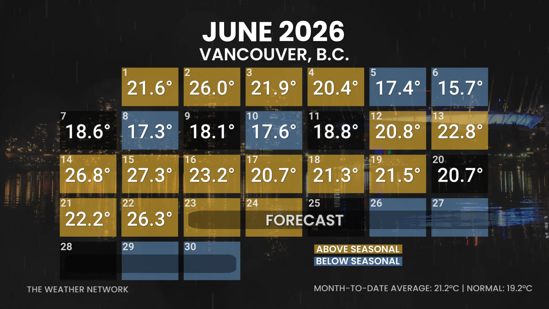
It's been an above-seasonal June across British Columbia this year, being two degrees warmer on average than usual. In fact, the last time we saw below-seasonal temperatures in the province was back on June 10 in Vancouver. However, this was quickly followed by the hottest day of the year so far on June 15, when temperatures reached 27.3°C.
SEE ALSO: Canada's wildfire season off to a dramatically slower start so far
The summer heat has been building across B.C. to start the week, with temperatures peaking on Tuesday thanks to a ridge of high pressure pushing dry heat into southern and central parts of the province.
Temperatures reached a stifling 30°C on Monday in West Vancouver, as well as 32°C in Abbotsford, and 34°C in Lytton.
There will be a chance of thunderstorms on Wednesday across central Vancouver Island and throughout the Interior. Primary threats localized flooding with slow-moving storms and 1-1.5 cm hail in the Interior.
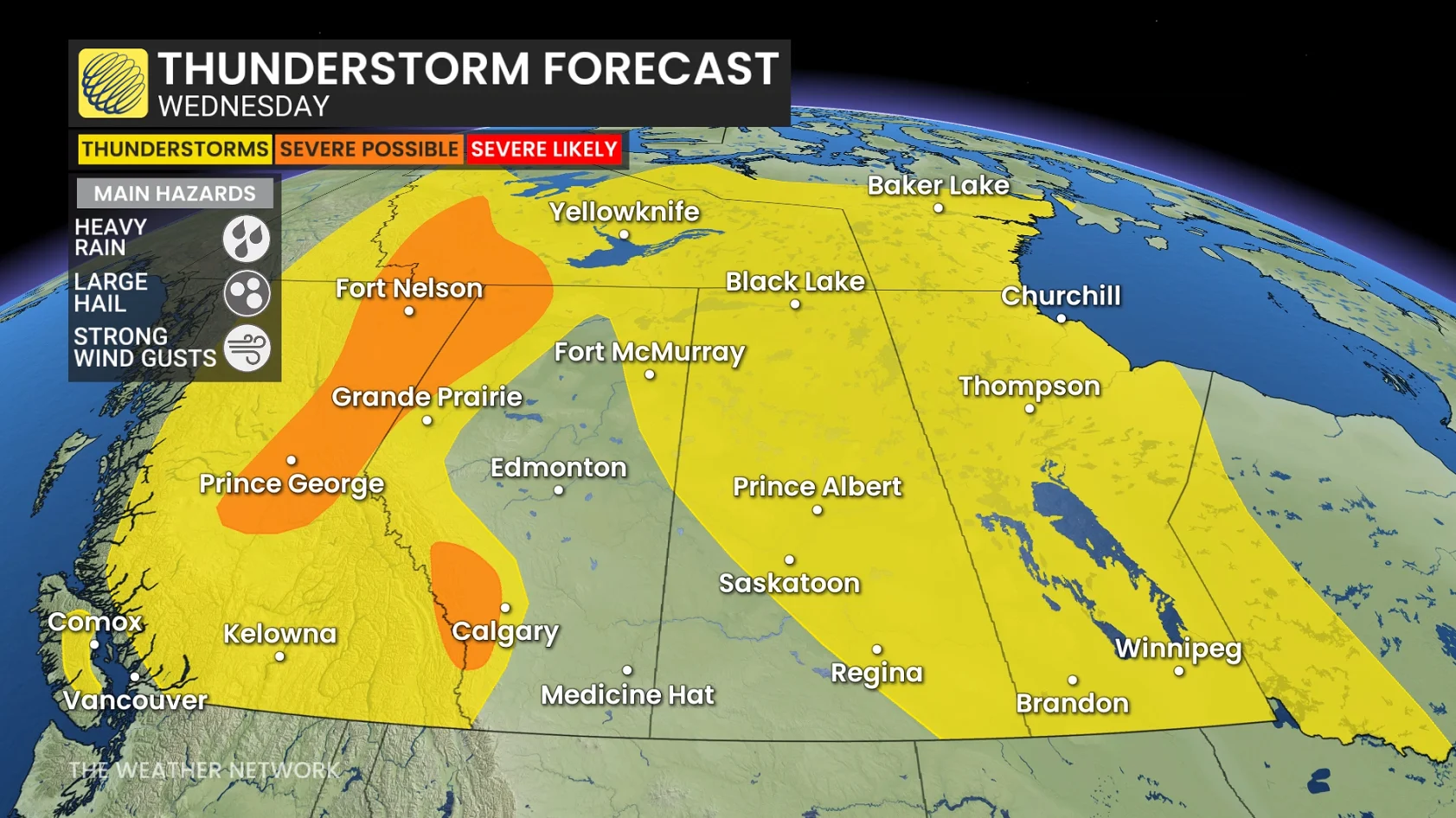
More storm energy could turn storms briefly severe in these regions: Cariboo, Prince George, Mcgregor, Williston, B.C. Peace River, Fort Nelson, Muncho Lake and Stuart-Nechak.
Heat safety tips
Intense heat can be dangerous for everyone, but especially for children, elderly people, unhoused people, or those with respiratory disease. Check up on friends and family to make sure they have access to a cool space and drinking water.
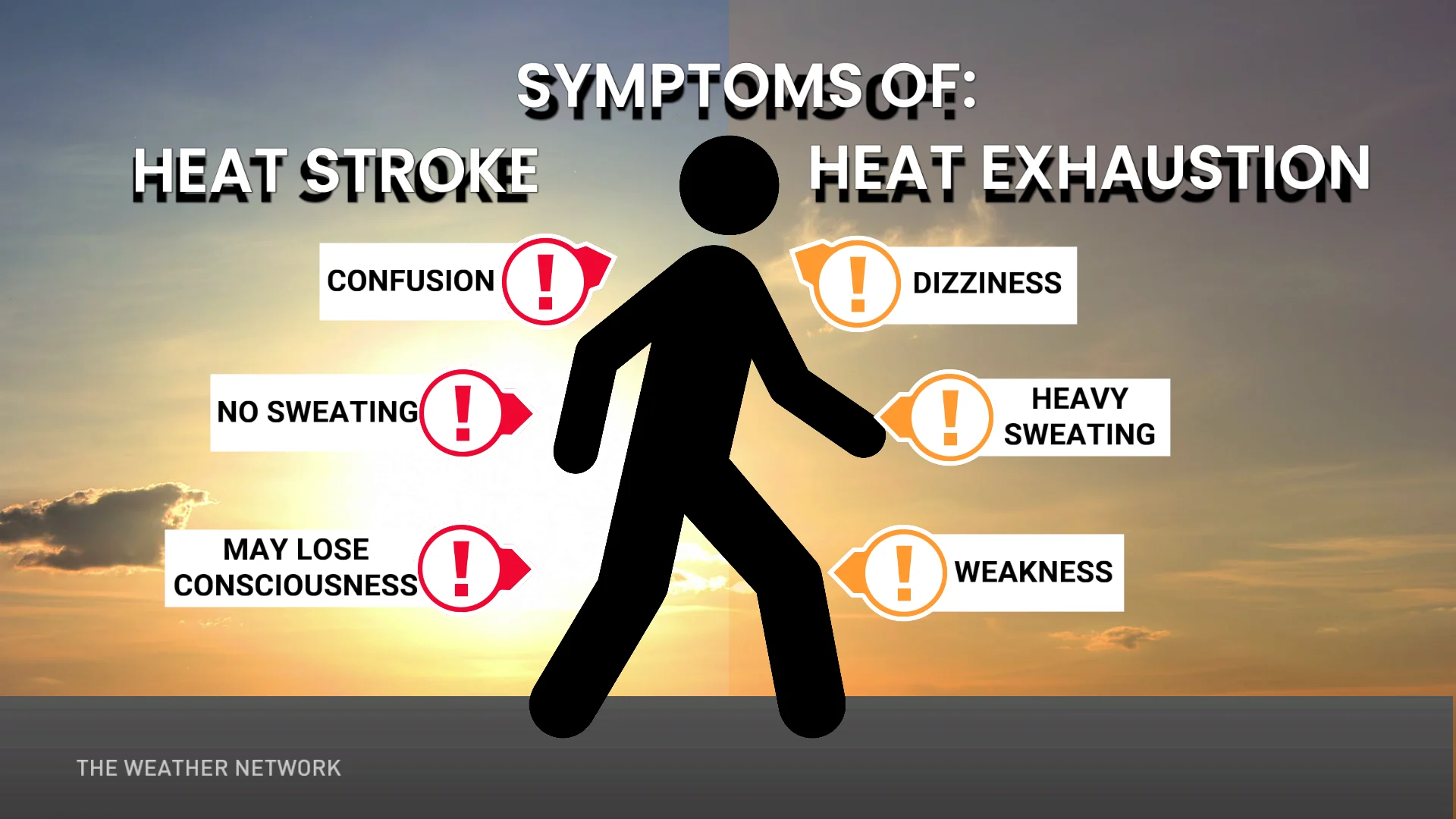
If you can, try to limit your time outdoors and in the sun, as well as make sure to drink plenty of fluids.
Also, remember to never leave children of animals alone in a vehicle, as the interior temperatures can and will quickly soar to dangerous levels.
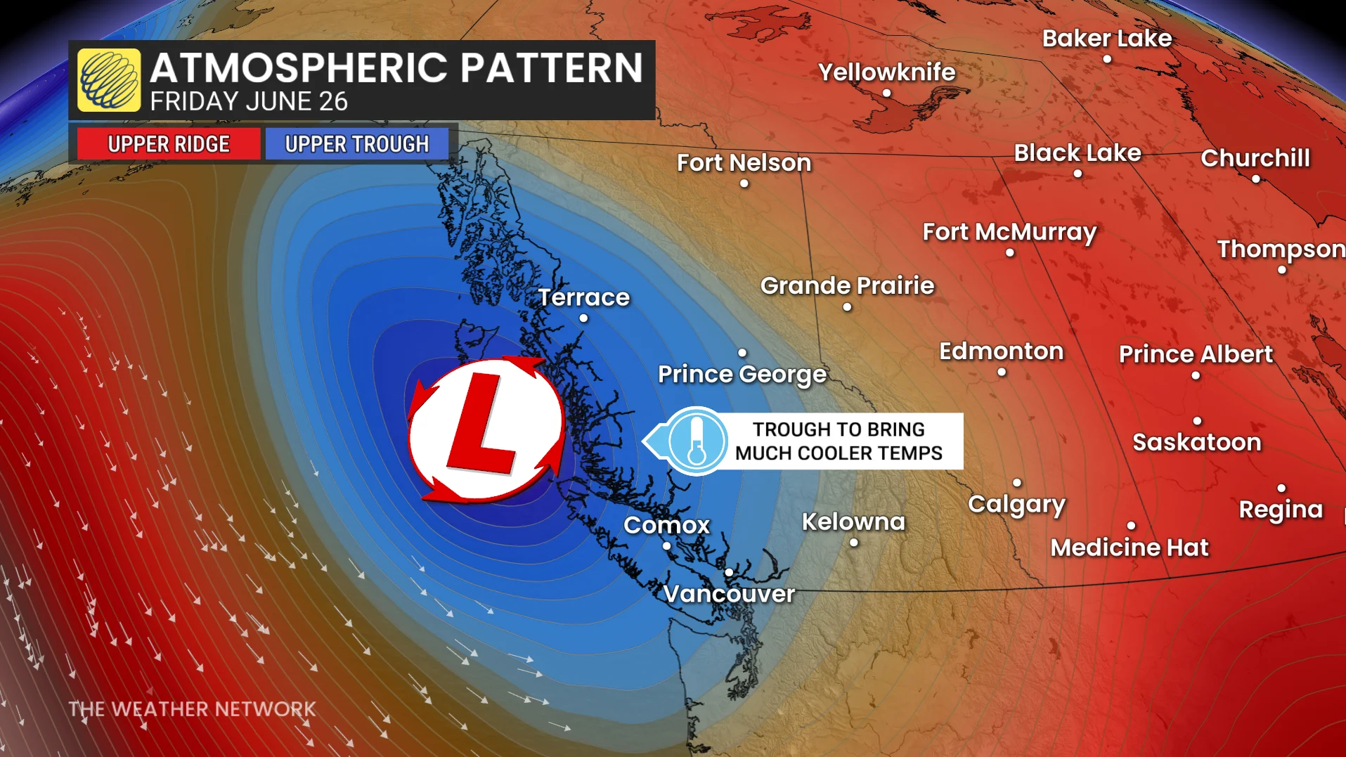
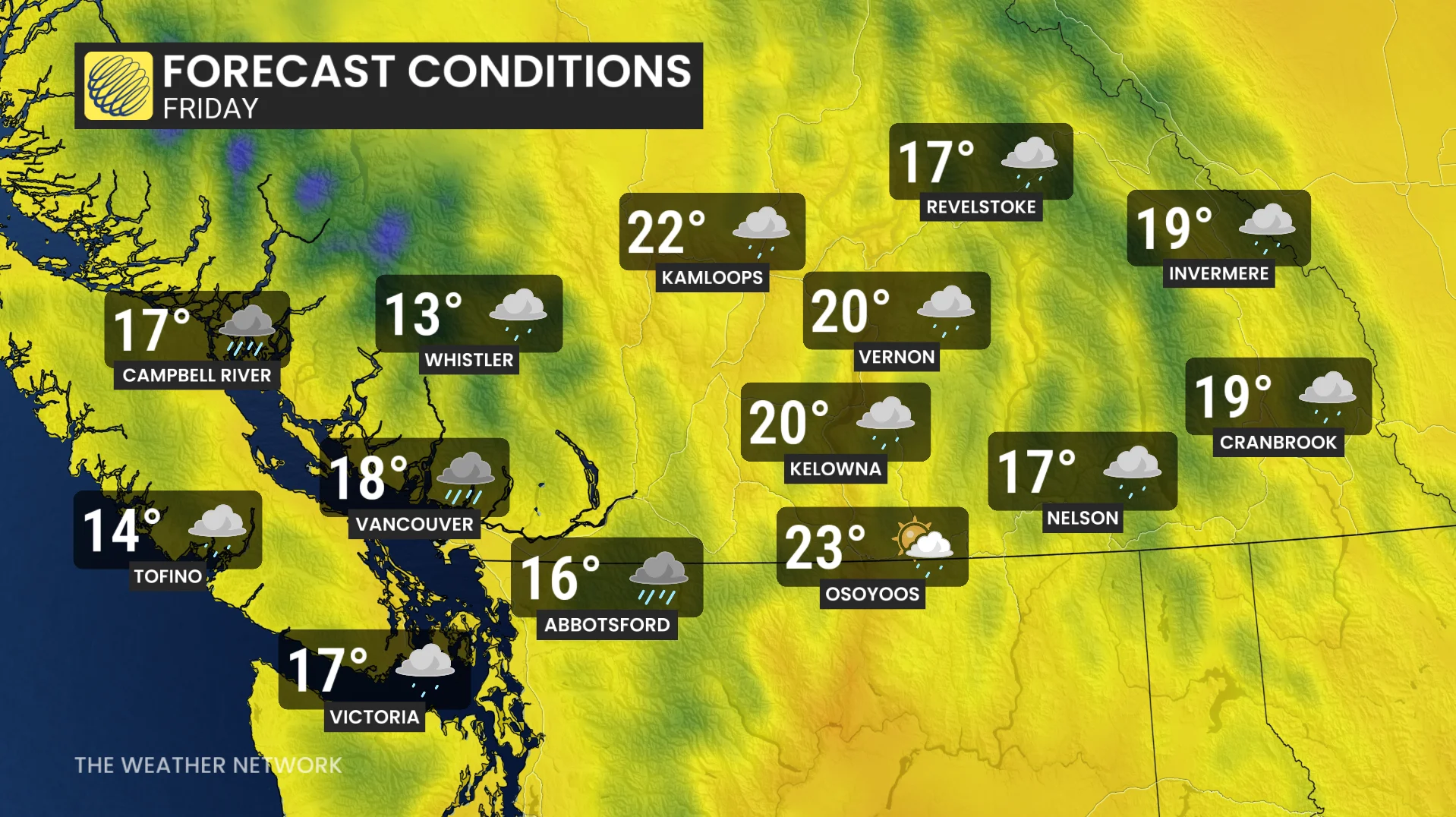
Chilly pattern change on the horizon
A pattern change by the end of the week is expected to bring a complete 180 to the forecast across the province.
DON'T MISS: A month's worth of rain swamps central Alberta
Folks should see cool and rainy weather gradually move into the province on Thursday, with daytime highs plunging back into the teens by the weekend.
The return of cool and rainy weather is great news for B.C.'s wildfire risk.
WATCH: Five heat safety tips to keep in mind
Stay with The Weather Network for more information and updates on your forecast across B.C.