Canada's East faces soaking rains and risk of extended period of ice
The storm parade continues across Eastern Canada, with days of rain and some icy precipitation threatening parts of the region. Brace for localized flooding and power outages
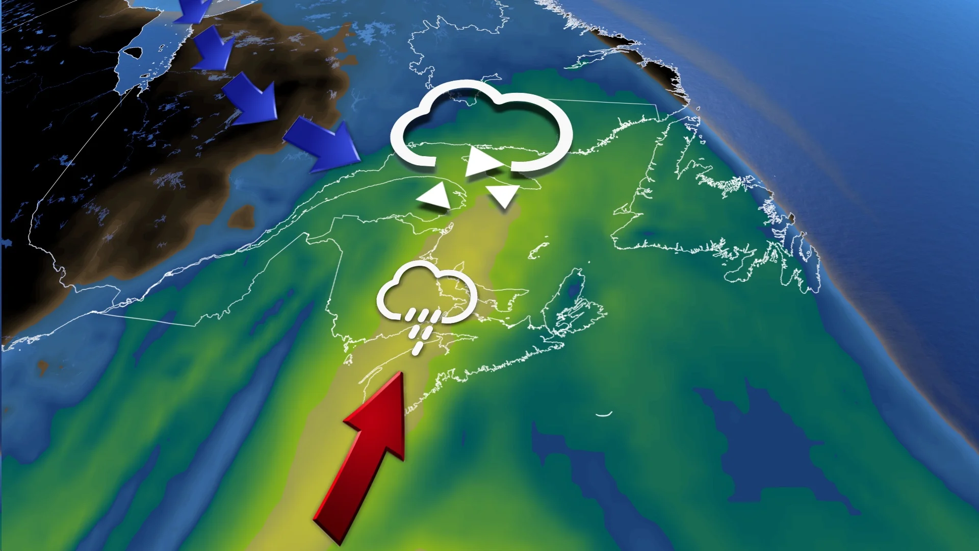
An active weather pattern remains locked over much of Eastern Canada this week, with an extended period of rain set to spread over the Maritimes, while more icy impacts track into Quebec and northern New Brunswick. Travel conditions will likely be jeopardized, with a heightened threat for localized power outages, as well.
RELATED: Storm washes out roads, leaves thousands in New Brunswick without power
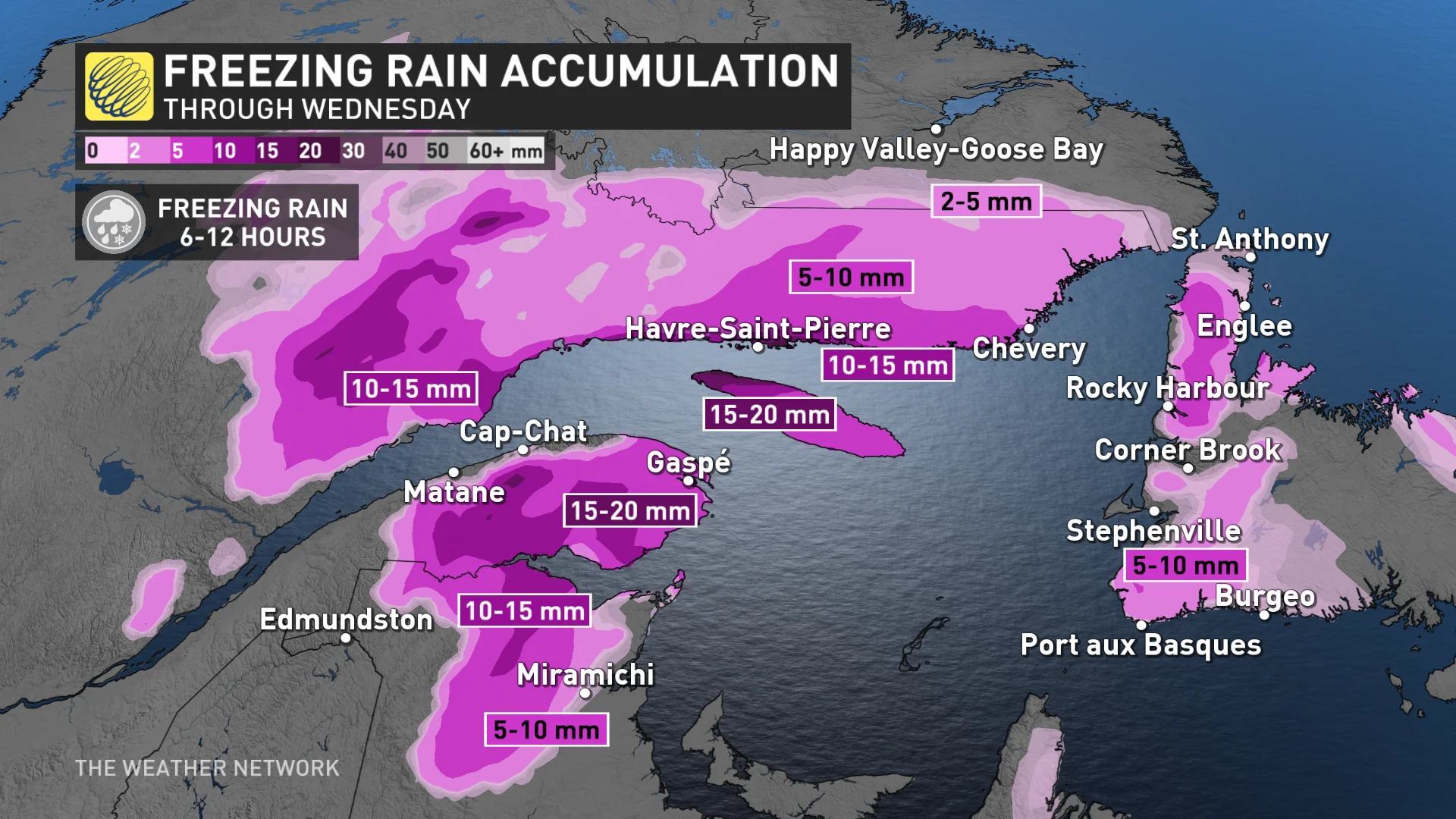
The system will move into the region late Tuesday, pushing east and intensifying throughout the day on Wednesday. Precipitation rates will pick up over northern sections of New Brunswick, with 10-20 mm of ice accretion possible in just a 6- to 12-hour timeframe.
Expect rounds of rain to last well into the Easter weekend, with cool and blustery conditions settling in behind the storm system.
Wednesday: Rain and freezing rain moves in
Rain showers will begin early Wednesday across the southern Maritimes, with icy precipitation picking up across northern New Brunswick and Quebec's North Shore as temperatures remain cooler.
Precipitation rates will intensify throughout the day in the north.
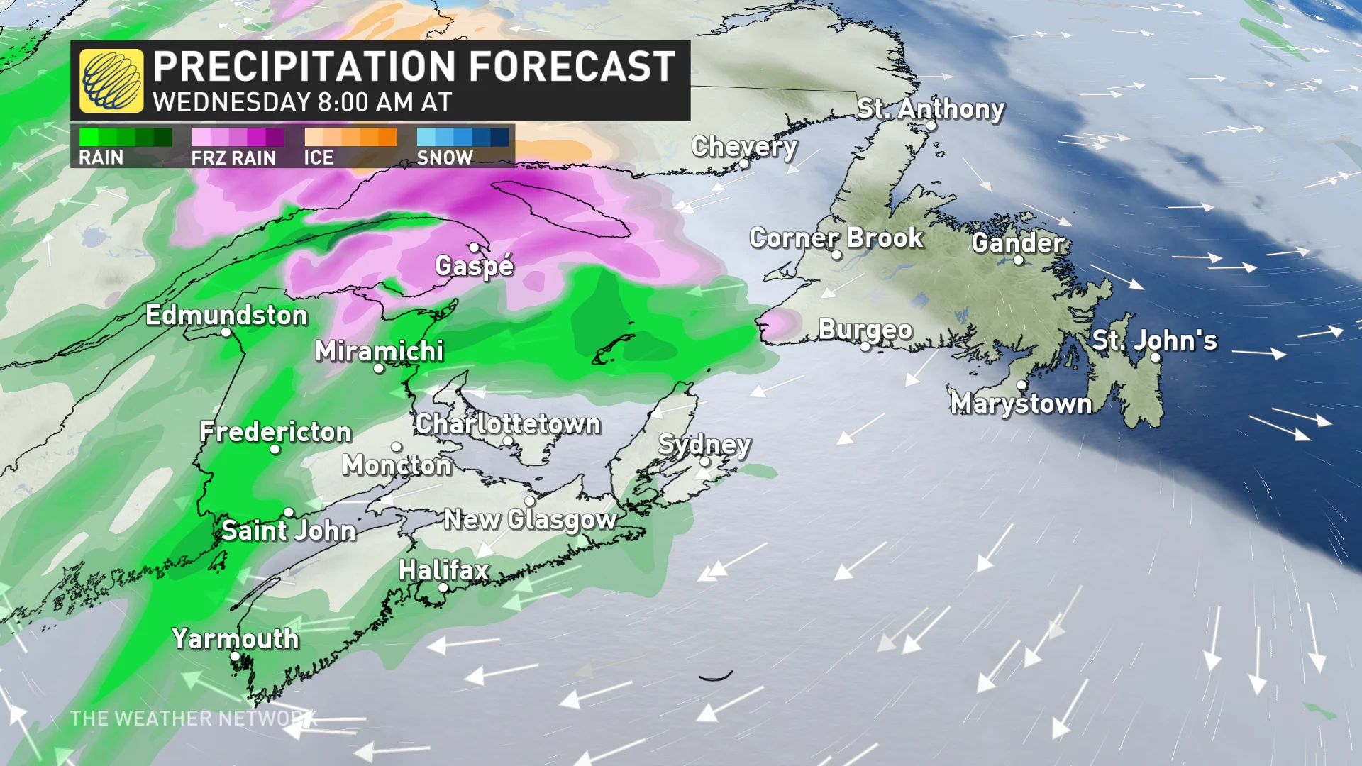
The exact location and freezing rain totals are somewhat uncertain at this time, and will depend on the storm track, as well as the fluctuating temperatures. The freezing rain threat creeps into parts of western Newfoundland for a few hours on Wednesday, as well.
Between 10-20 mm of ice accretion is possible for the hardest hit spots, which could bring slippery road conditions and localized power outages.
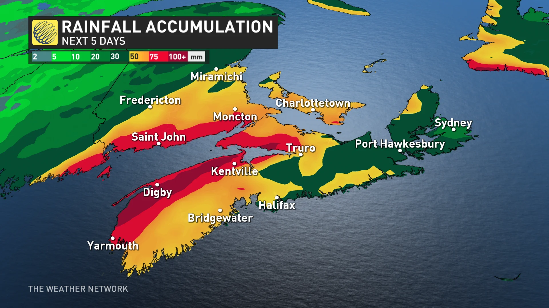
The icy precipitation will eventually be replaced by straight rain, with bands of locally heavy rain expected across the Maritimes for the next several days. That's as a developing low pressure system tracks up the U.S. East Coast, bringing in a relentless stream of moisture. The widespread soaking rain and blustery conditions will persist well into the Easter weekend.
The greater threat for localized flooding, and ponding and pooling on roadways, will be across Nova Scotia and southern New Brunswick, especially with unstable soils from recent rains and high moisture.
A band of significant snow is expected to develop on the back side of the storm, possibly impacting eastern Quebec and parts of the Maritimes, though the track of the system and its exact impacts are still uncertain.
Conditions will remain blustery and cool, with yet another system eyeing the region for the middle of next week.
Be sure to check back for the latest updates across Eastern Canada this week.