
IN PHOTOS: Funnel clouds, flash flooding, more storms ahead

Wednesday was a rough one for many in southern Ontario, and there's potential for another round Thursday.
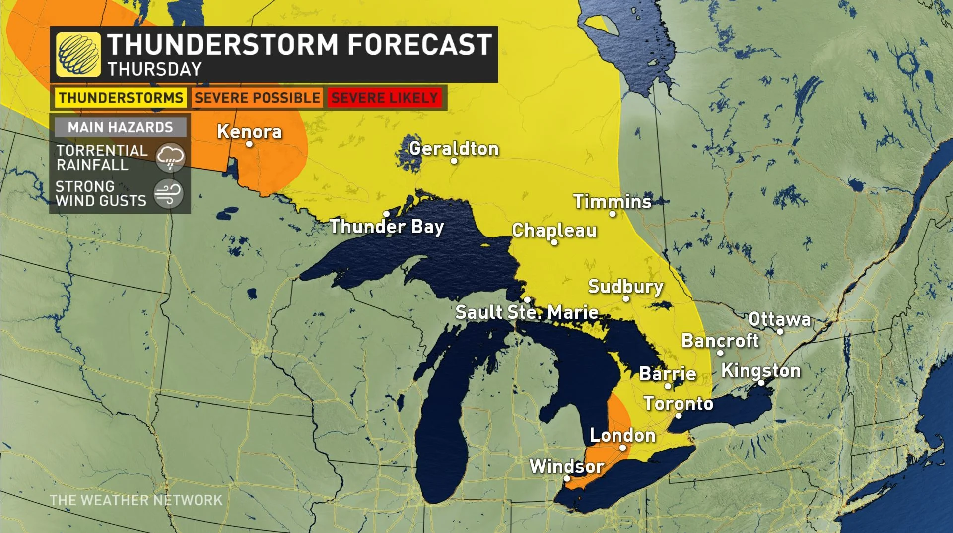
Wednesday's storms were punishing for parts of southern Ontario, marked by torrential downpours as they pushed through the southwest and GTA in the morning (making for Toronto's rainiest July day in six years), and also sparked some funnel clouds elsewhere. You can see the best shots of those storms gathered below, but first take a look at where to expect Thursday's round of storms.
WEATHER HIGHLIGHTS
Chance for another round of thunderstorms reaching the shores of Lake Huron late Thursday evening.
Forecasters keeping an eye on potential for very strong winds
Extreme heat keeps building in for the rest of the week into the weekend
Stay up-to-date on the ALERTS in your area
WATCH BELOW: THE NEXT ROUND OF POTENTIALLY DAMAGING STORMS
There is once again a slight chance of thunderstorms for Thursday, largely non-severe, across most of Ontario, with the more eastern parts of the province likeliest to escape. This is associated with the warm front which will open the door for another push of humidity.
But forecasters are eyeing areas on or inland of Lake Huron, which should see storms and showers begin moving in in the afternoon. Those areas have the greatest chance of a few isolated severe storms late evening and overnight, with the main threats being not only torrential rainfall, but also strong, potentially damaging winds.
There will still be plenty of humidity helping fuel these storms, while also making still-rising temperatures -- with heat records in danger of being broken as the week comes to a close -- feel even hotter, with humidex values above 40 for many locations.
As for what Wednesday's storms wreaked on southern Ontario, here's a selection of how they played out on social media.


