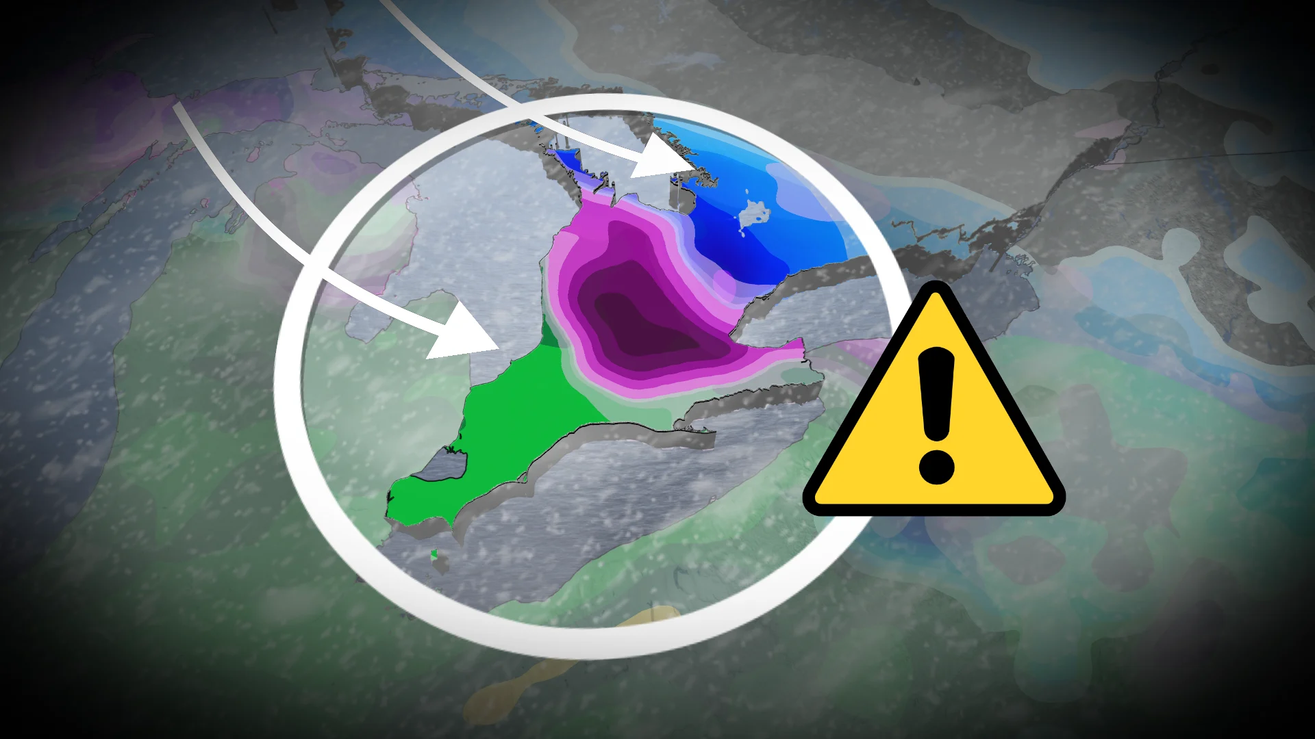
Parts of southern Ontario face hours of freezing rain, ice, and heavy snow
A potent and messy winter storm will bring major travel impacts to southern Ontario on Wednesday, with a swath of freezing rain, rain and heavy snow. As a result, there will be a potential for power outages, tree damage, flight delays and/or cancellations, and local school closures.
A swath of messy, wintry weather, including significant snow (10-20+ cm) for some, is headed to southern Ontario on Wednesday.
DON'T MISS: More than $2M in parking tickets issued in Toronto following historic snowstorm
Meanwhile, prolonged freezing rain (10-12+ hours possible) is expected south of the snow and rain is likely to the south of the warm front--with a messy, wintry mix in the middle for some areas. Travel will be heavily impacted as road conditions will be slippery and poor.

Be sure to keep storm drains clear to prevent localized flooding, as well as prepare for travel and power disruptions throughout Wednesday.
Don't write off the winter season just yet
Rain and warm temperatures will be seen in extreme southwestern Ontario on Wednesday morning, lasting through the day.
That means an elevated risk for snowmelt and ponding from 10-20+mm of rain, leading to a localized flooding threat.

SEE ALSO: Toronto's record winter highlights snow removal challenges in North America
Freezing rain will begin Wednesday morning in the London, Guelph, Hamilton and Niagara regions, extending north into some of the snowbelt regions near Lake Huron.
Freezing rain will likely last the entire day, as long as 10-12+ hours, intensifying in the afternoon.
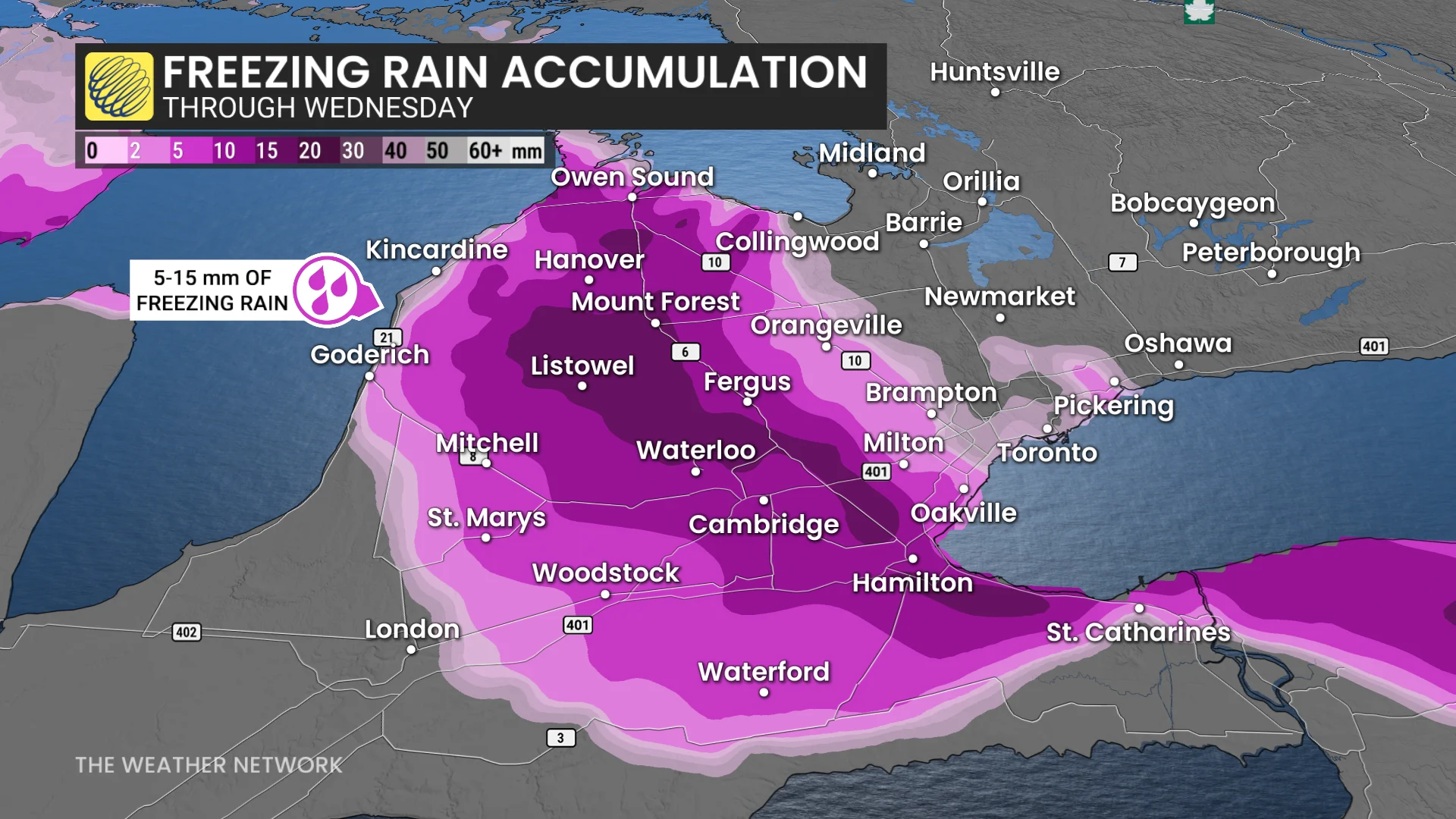
Accompanied by 40-60 km/h wind gusts, 5-15+mm of icing is possible for the highest-risk of areas, including Orangeville, Fergus, Guelph, Cambridge, Brampton, Hamilton and Niagara.
Freezing rain impacts likely on Wednesday afternoon and onwards as ice builds up on trees, sidewalks, possibly signs and power lines. Power outages and significant travel interruptions are expected.

There is high confidence the transition zone from freezing rain to snow will be over the Greater Toronto Area (GTA).
Toronto may begin as snow late morning, with a period of ice pellets possible before going back to snow in the evening. Snowfall forecast is 5-10 cm, with higher totals north and east of downtown where colder air is expected.
The heaviest snowfall rates anticipated by the afternoon and evening.

Finally, an all-snow event is expected extending from Barrie to Newmarket, Oshawa, Peterborough and areas east. Heaviest amounts expected off Georgian bay where 15-2 0cm is forecast. 10-15+cm possible along the Lake Ontario shores.
The Wednesday afternoon and evening commute is still highly impacted across southern Ontario. Precipitation begins to ease across the southwest as we progress through Wednesday evening and overnight before the system dissipates.