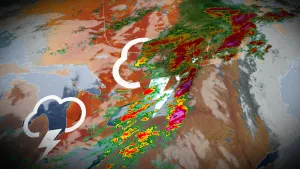
Hurricane forecasters tracking 7 disturbances, including 4 named storms

Forecasters are closely watching the potential for the remnants of Sally to bring heavy rain to Atlantic Canada. There is also the potential for this part of Canada to see impacts from Hurricane Teddy next week.
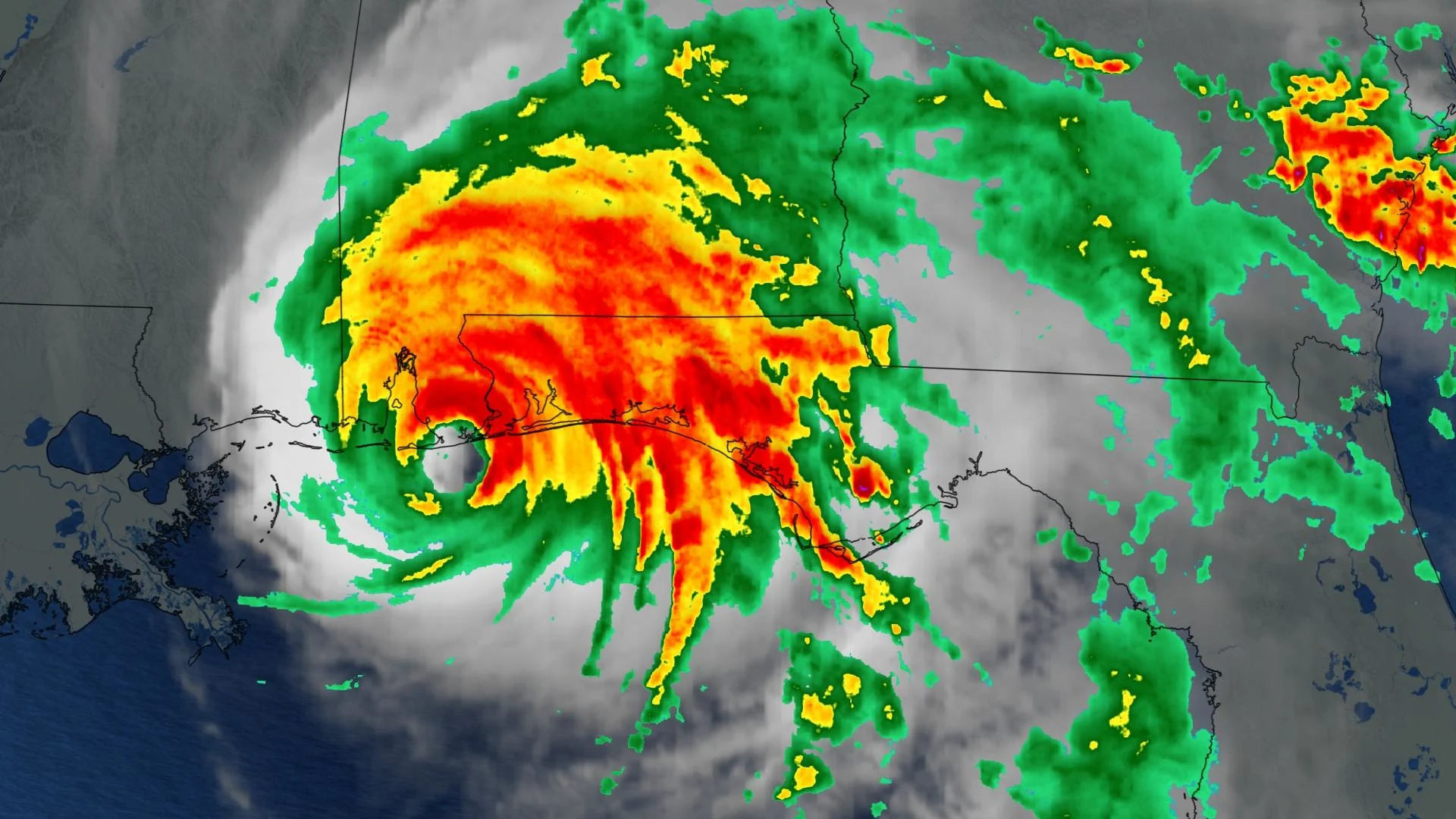
Sally made landfall near the Gulf shores of Alabama as a Category 2 hurricane early Wednesday morning. This powerful storm has left nearly one million people dealing with damaging floods and power outages.
"On the forecast track, the center of Sally will move across southeastern Alabama tonight, over central Georgia on Thursday, and move over South Carolina Thursday night," says the National Hurricane Center (NHC).
TEDDY INTENSIFIES, VICKY WILL SOON WEAKEN
The tropical activity includes three other named storms: Teddy, Vicky and Paulette.
Hurricane Teddy is 1,145 km east-northeast of the Lesser Antilles. Its maximum sustained winds have increased to near 155 km/h, with even higher gusts. Strengthening is forecast for the next several days and Teddy could reach major hurricane strength.
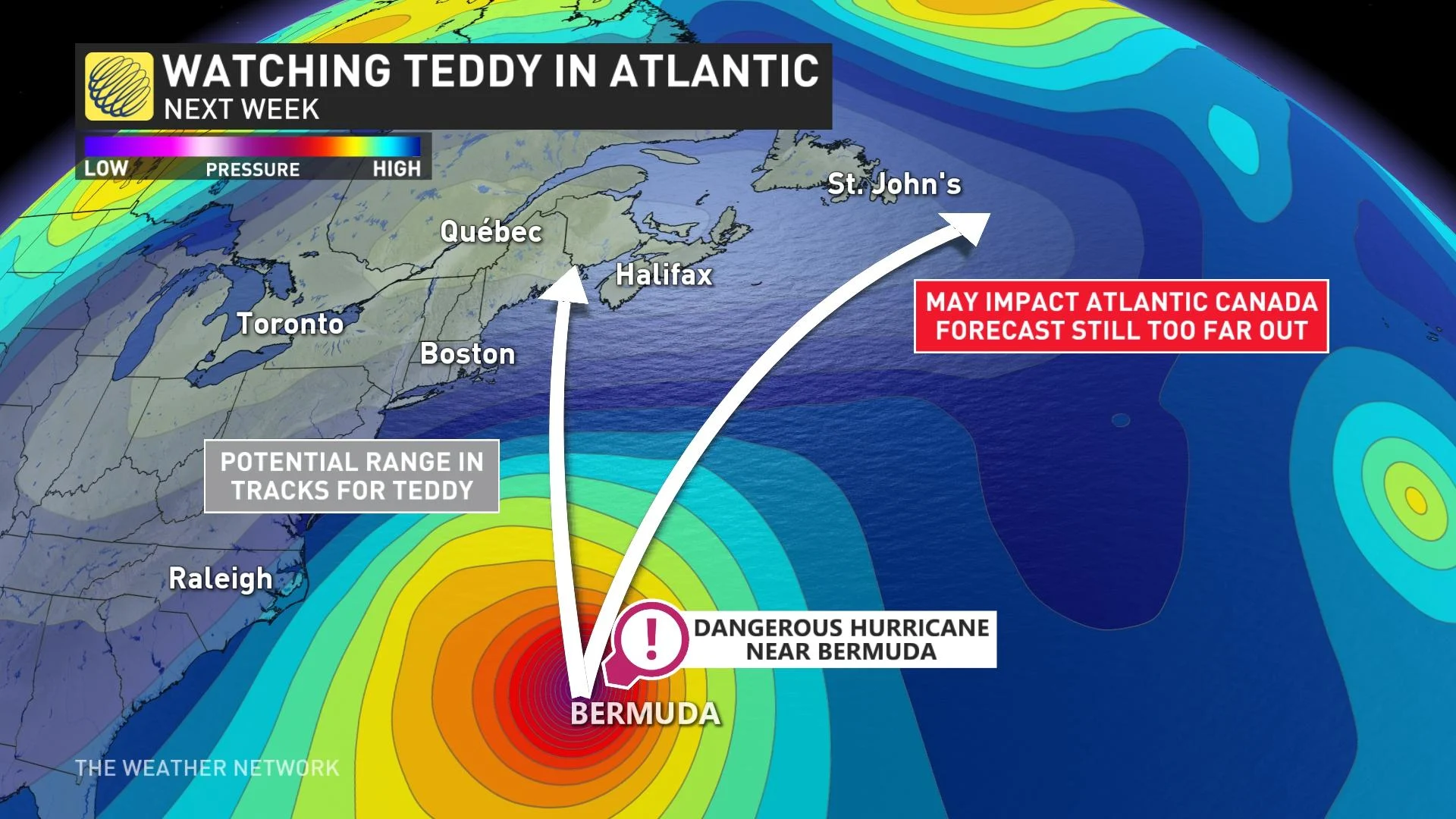
"Teddy is moving toward the northwest near 13 mph (20 km/h), and this general motion is forecast to continue for the next few days," the NHC says.
All eyes will be on Hurricane Teddy as it approaches Bermuda early next week and its potential track beyond the island, as it may have impacts to Atlantic Canada next week.
Tropical Storm Vicki is currently situated 1,375 km west-northwest of the Cabo Verde Islands. It has maximum sustained winds near 65 km/h, with higher gusts.
Weakening is forecast due to strong upper-level winds during the next few days and Vicky is likely to degenerate into a remnant low by Friday or Saturday.
Post-tropical cyclone Paulette was located 725 km east-southeast of Cape Race, Newfoundland with maximum sustained winds of 140 km/h on Wednesday night.
“The post-tropical cyclone is moving toward the east-northeast near 35 mph (56 km/h), and this general motion is expected through Thursday. Afterward, the cyclone is forecast to slow down and turn toward the southeast and south late Thursday and Friday,” the NHC says.
OTHER ATLANTIC ACTIVITY
Elsewhere in the Atlantic, forecasters are keeping a close eye on three other disturbances that may develop within the next five days.
There are disturbances in southwestern Gulf of Mexico, south-southeast of the Cabo Verde Islands and in the far northeastern Atlantic that have chances of further development.
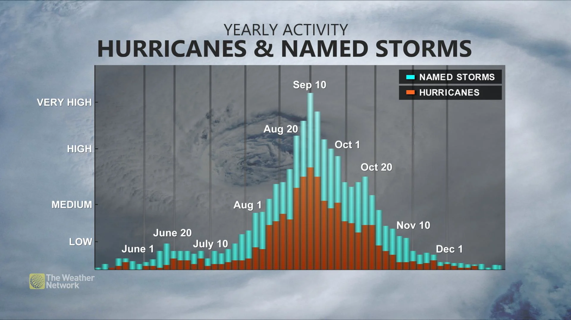
WHY DOES ACTIVITY PICK UP IN SEPTEMBER?
We typically see more frequent tropical systems, with greater lifespans and greater intensity, in September due to a few factors.
By this time of year, we have encountered peak summer heating, and the oceans are typically warmer than early months in the season. Warmer waters fuel tropical systems, allowing excessive rising motion over the water, resulting in strong thunderstorms that can become organized into tropical systems.
Another factor that comes into play is that we typically have less wind shear in the pattern this time of year. The Jet Stream is weaker in the summer months and wind shear fades through June and July, becoming almost non-existent in August and September. This is not a good thing, as wind shear can help weaken tropical systems.
When forecasters warn of an "above average" season, they are talking purely in terms of expected named storms, and none of these predictions typically make any claims to the expected severity of the storms. Indeed, so far the 2020 season has only produced one major hurricane -- that is, Category 3 or higher -- in the form of Hurricane Laura, which reached Category 4 prior to impacting the U.S. Gulf Coast with extreme winds and major storm surge last month.