Hurricane Polo remnants to end southern Ontario's record dry streak

Tropical moisture from Hurricane Polo in the Pacific is expected to end southern Ontario's 14-day dry spell
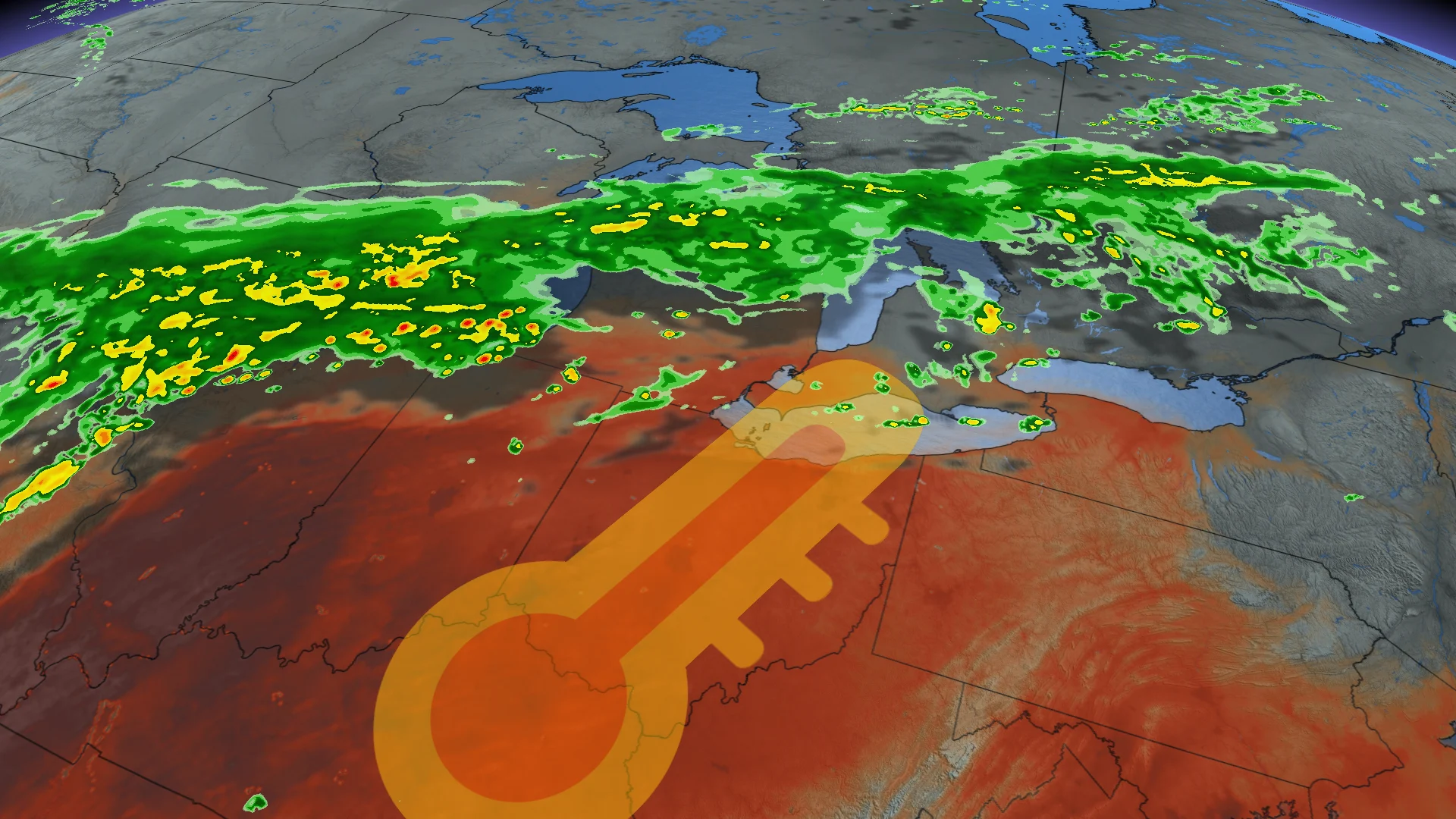
The remnants of Hurricane Polo, which made landfall as a Category 2 hurricane on the Baja California Peninsula Monday night, are set to bring significant rainfall to parts of southern Ontario. This moisture will travel 3,000 km to reach the Great Lakes region.
DON'T MISS: Polo cements status as Pacific’s second-most intense hurricane
The storm's tropical moisture is merging with a low-pressure system and pulling additional moisture from the Gulf of Mexico.
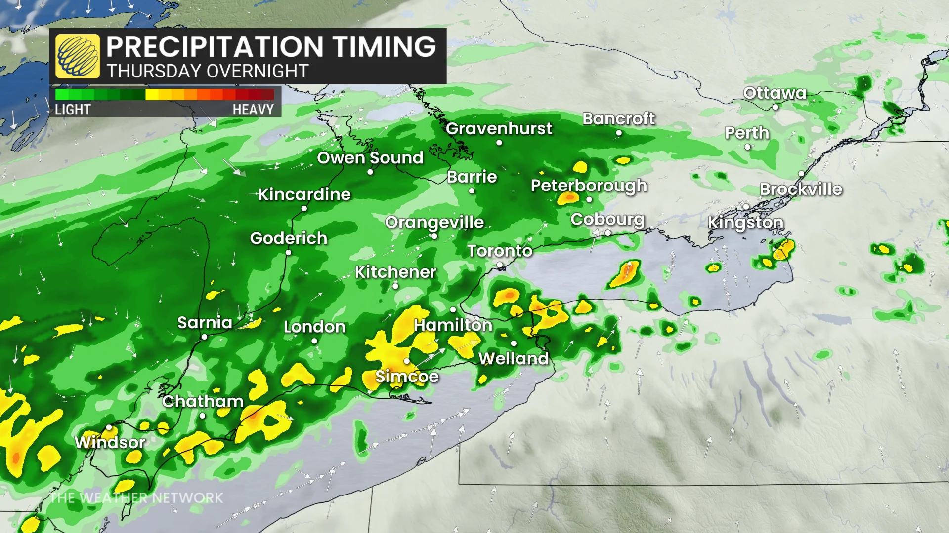
Rainfall in southern Ontario is expected to begin Thursday morning and continue into Friday, with the most intense precipitation expected Friday morning along the 401 corridor. This weather system could provide some relief to the region, which has experienced one of the longest dry stretches of 2026.
Flood watches also remain in effect across parts of the U.S. desert states where Polo’s moisture threatens heavy rainfall and flooding. Up to a month's worth of rain is expected in some areas, with 50-100 mm possible due to training thunderstorms driven by tropical moisture.
Polo influence: Humidex values soar for the final days of September
Tropical air from Polo will also surge into Ontario, making the final days of September feel more like summer across southern and eastern sections of the province.
SEE ALSO: El Niño could delay persistent frost and hard freezes across Canada
Communities including London, Toronto, Ottawa, and Montreal are forecast to experience muggy conditions, with humidex values reaching the high 20s on both Wednesday and Thursday afternoons. Parts of extreme southwestern Ontario, including Windsor, may even see the humidex rise up to 30.
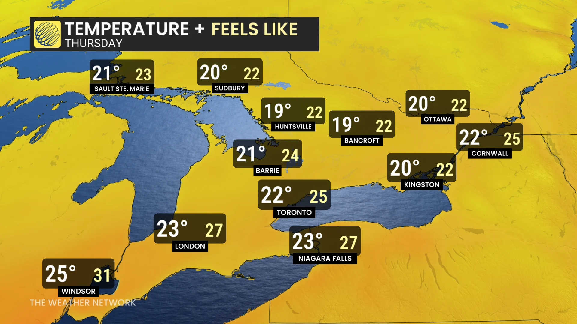
The warm and humid conditions are driven by high, atmospheric moisture moving from the Pacific, through the U.S., and into the Great Lakes region.
For those enjoying the warmth, the spell will be brief. Cooler air is likely to return to Ontario by early October.
Be sure to check back later this week for the full release of the October outlook.