Two tropical storms, Marco and Laura, set to slam U.S. Gulf Coast

Marco and Laura are both set to make landfall this week, with roughly 48 hours in between them.
Once a hurricane, Tropical Storm Marco is still set to pack a punch as it approaches Louisiana and the U.S. Gulf Coast for a Tuesday landfall. Hot on its heels, Tropical Storm Laura is set to strengthen to hurricane strength ahead of its own hit on the coast, roughly 48 hours after Marco -- and its abundant moisture may have an impact on Canada's weather by the weekend.
HURRICANE MARCO
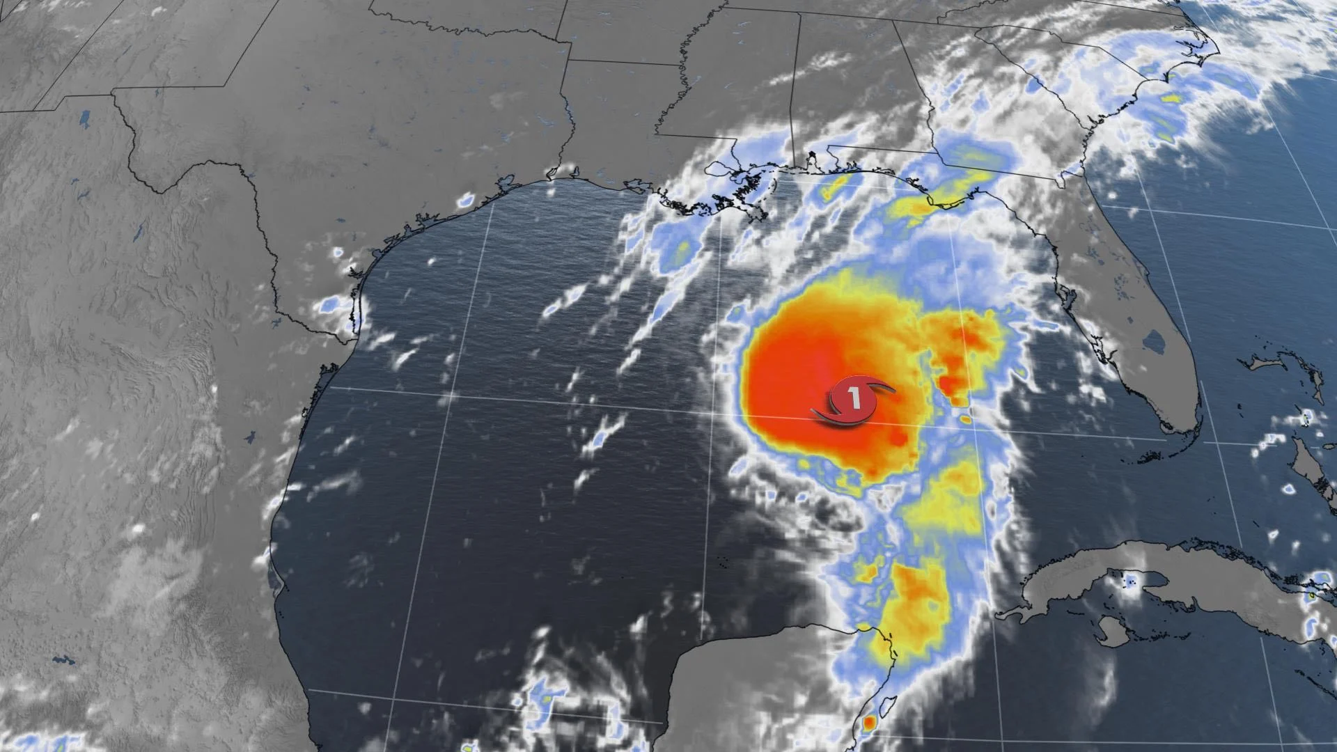
Though briefly a hurricane at its peak over the weekend, Marco is once again a tropical storm as it begins its final approach to the U.S. Gulf Coast.
As of Monday morning, was around 135 km from the mouth of the Mississippi river, with maximum sustained winds of 80 km/h.

Tropical storm and storm surge warnings are in effect for much of the Louisiana and Mississippi coasts, and the storm is already bringing rainfall to those areas ahead of its expected arrival sometime Tuesday morning, with a motion more or less parallel to the coast before a rapid loss of strength.
The storm is expected to bring 75-125 mm worth of rain over the course of its impact, with locally higher amounts up to 250 mm possible as well.
TROPICAL STORM LAURA
Though Marco is already weakening, Laura's strongest days are still ahead of it, even as it brought torrential rains to Puerto Rico, the Bahamas, and Hispaniola over the weekend.
The storms' track is still set to take it roughly parallel to Cuba Monday, before exiting to the open Gulf. There, warm waters look likely to fuel a fair bit of strengthening, such that Laura may reach Category 2 strength before making landfall either in Texas of Louisiana sometime Thursday morning.

"From late Wednesday into Friday, Laura is expected to produce rainfall of 5 to 10 inches (125-250 mm), with isolated maximum amounts of 15 inches (380 mm) across portions of the west-central U.S. Gulf Coast near the Texas and Louisiana border north into portions of the lower Mississippi Valley," the U.S. National Hurricane Center says. "This rainfall could cause widespread flash and urban flooding, small streams to overflow their banks, and the possibility of some minor river flooding across this region."
It should be noted that the storm will impact the same region affected by Marco two days prior, worsening the risk of flooding given how waterlogged the region will be.
Beyond, Laura's remnants look set to track up through the Mississippi Valley, and its moisture may help fuel showers even as far as the Great Lakes, including Ontario.
Check back as we continue to monitor these storms.