East Coast will be spared Franklin's full wrath, but won't escape its moisture

Hurricane Franklin will grow into a formidable storm this week as it passes far south of Atlantic Canada. The storm may still influence heavy rain in the region
Visit The Weather Network's hurricane hub to keep up with the latest on tropical developments in Canada and around the world
Although a few days ago it appeared there was a non-zero risk to Atlantic Canada from Franklin, it’s looking increasingly likely there will just be minimal impacts.
However, despite its likely turn toward the east, residents may think they’ve been hit by a tropical system anyway by the end of the week.
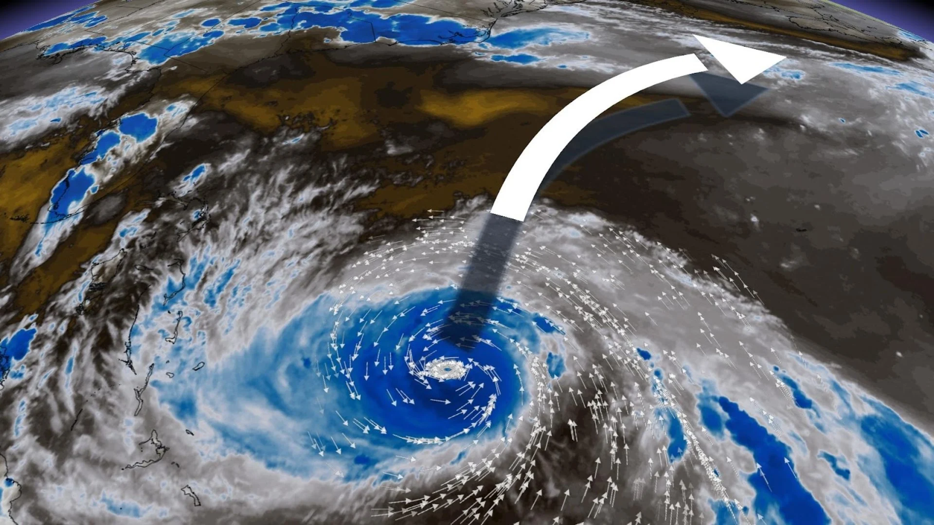
Franklin and the Gulf of Mexico will stream a hefty plume of tropical moisture over the Atlantic provinces on Thursday and Friday, likely fuelling yet another round of heavy rain in the region.
DON’T MISS: The best way to prepare for a hurricane is well ahead of a potential disaster

The U.S. National Hurricane Center (NHC) upgraded Franklin to a full-fledged hurricane on Saturday afternoon, noting the storm’s improved appearance as it rolls north and encounters lower wind shear along its path. Low wind shear allows storms to concentrate around the centre of the storm, allowing it to gather strength as it organizes.
This hurricane is forecast to become the first major hurricane, category three or higher, for the 2023 Atlantic hurricane season. Remember, it’s still early in the Atlantic hurricane season. At this time last year, there were only three named storms and zero hurricanes developed by the end of August.
Thankfully, Hurricane Franklin looks to peak well away from land by early this week. The NHC’s forecast calls for Franklin to peak as a major hurricane as it passes west of Bermuda, threatening only disruptions to shipping lanes and a risk for strong rip currents and rough surf along the U.S. East Coast.
STAY SAFE: What you need in your hurricane preparedness kit
For several days now, Franklin’s eventual path looked uncertain due to a complicated tango of upper-level winds around the storm. A small nudge one way or another would have a significant effect on the storm’s track.
WATCH: Glimpse inside Franklin as plane takes rough ride through storm
Hurricane Franklin has started its trek north towards Atlantic Canada, slowly, and will remain near Bermuda by Tuesday.
Models and forecasters are now more confident that the upper-level winds steering Franklin will guide the storm out to sea, curving east well before the storm has a chance to threaten Nova Scotia or Newfoundland.
Although the forecast track is well to the south of Atlantic Canada, a sub-tropical flow of moisture will setup across Atlantic Canada this week, continuing the record wet summer. It’s possible some parts of Nova Scotia will have accumulated close to a metre of rainfall since June 1st, as Bedford Range has recorded 807 mm and counting.
The moisture will lift north from the Gulf of Mexico and the southeast U.S., arriving late-Tuesday and lingering through Wednesday.
Here’s a rough outlook for rainfall projections through Thursday morning for Atlantic Canada.

Wednesday is forecast to be quite the washout at times, with the heightened risk of localized flooding across the Atlantic provinces, even as Hurricane Franklin churns about one-thousand kilometres to the south.

We could see hefty rainfall totals across many areas that simply don’t need any more rainfall this summer. Halifax has seen close to 200 per cent of its normal rainfall since June.
Stay tuned to The Weather Network for the latest updates on Franklin.