Tricky severe storm set-up to close out the week in Ontario

A brief surge of summer heat and humidity returns to southern Ontario for Friday, with a tricky storm set-up threatening some severe conditions through the afternoon and evening.
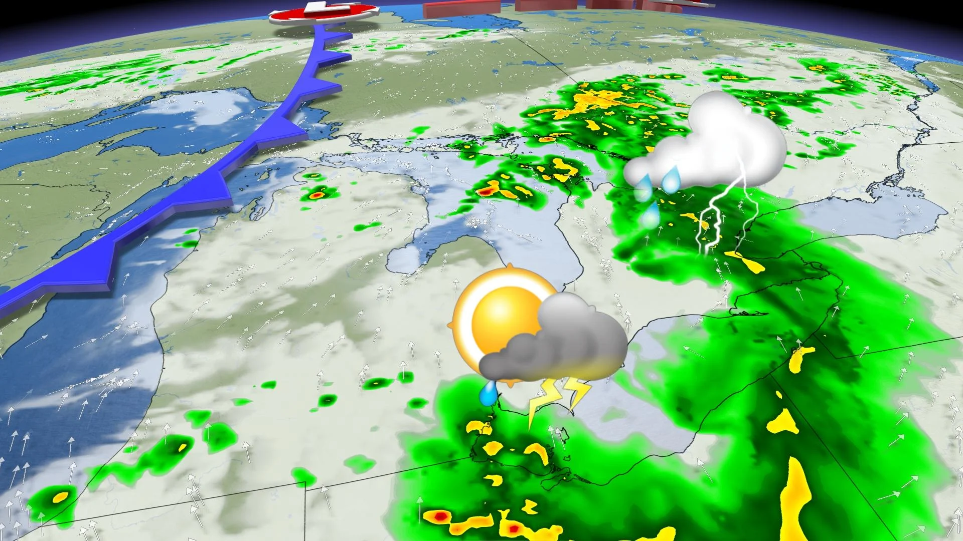
The refreshing air that’s blanketed much of southern Ontario this week will briefly retreat on Friday as summer-like humidity builds in ahead of an approaching cold front. Thunderstorms are possible across the province during the day as this cold front pushes into the humid air. Lingering rain in the morning could put a damper on the instability later in the day. Depending on the timing of the cold front and how quickly that morning rain clears out, some of the thunderstorms in the afternoon could turn severe with large hail, damaging winds, and torrential downpours possible. Drier and more comfortable air will flow in behind the cold front, leading to a beautiful Father’s Day and first “official” day of summer on Sunday. More on the timing of Friday’s system and the lack of extreme heat to close out the month, below.
FRIDAY: A BRIEF BOUT OF SUMMER-LIKE HUMIDITY, THREAT FOR SEVERE STORMS ACROSS THE SOUTH
An incoming weather system will bring a storm threat into Friday, though the forecast will be a tricky one with a complex timeline of events that will ultimately determine the exact storm risk.
Winds will shift on Friday ahead of a cold front approaching from the west, allowing humidity to build back over southern Ontario. A complex of storms developing over the northern Mississippi Valley overnight Thursday will track through the Great Lakes region into Friday morning.
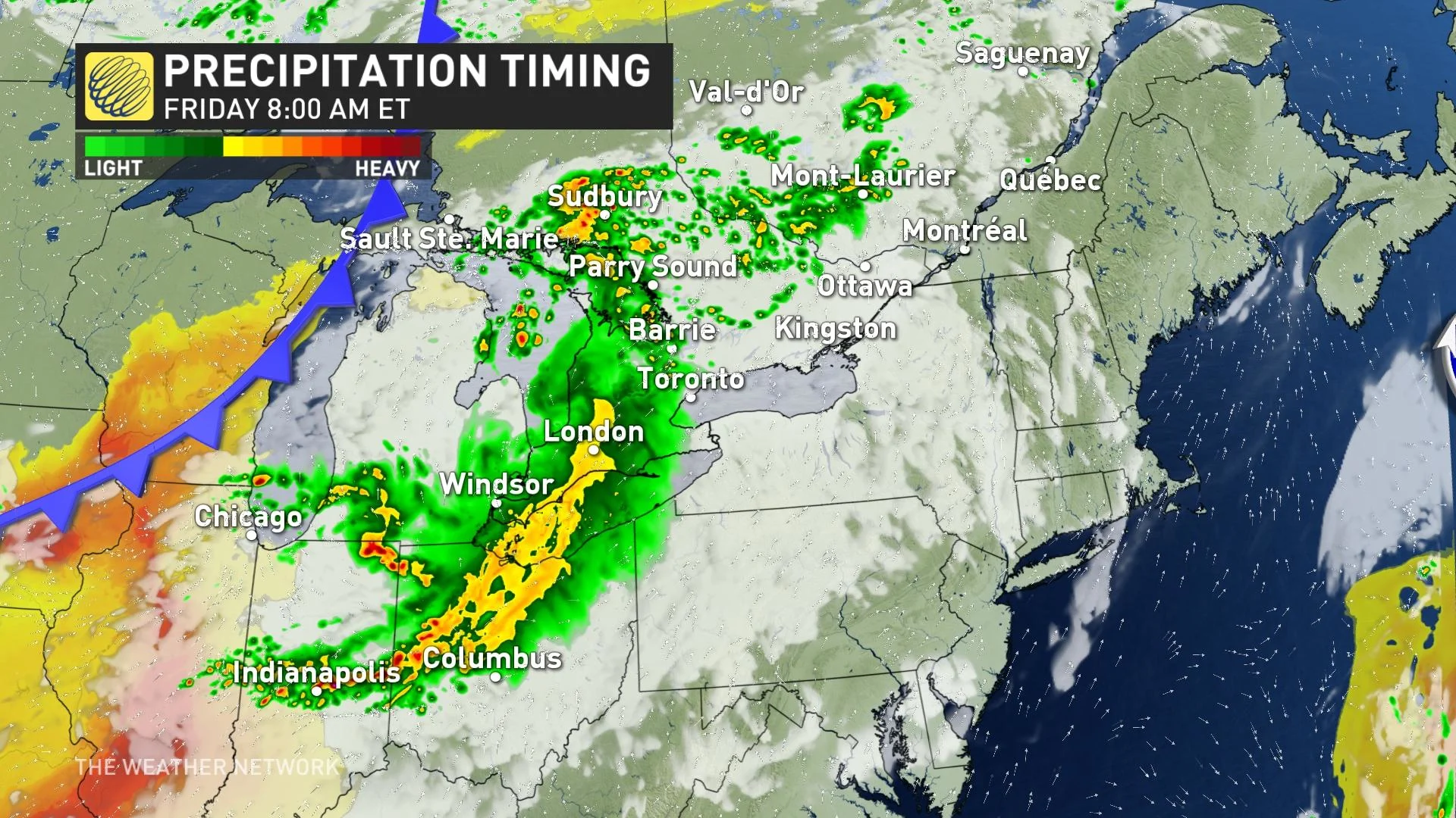
"Though these nocturnal storms should be losing steam by the time they reach Ontario, they will have the potential to bring a shield of rain with embedded heavy downpours, gusty winds, and a few rumbles of thunder to southern Ontario early Friday," says Michael Carter, a meteorologist at The Weather Network.
The timing of this storm complex, and how quickly it clears the region, will be the key to what storm threats develop later in the day for southern Ontario. If the early storm complex clears quickly, it could allow the environment to destabilize through the afternoon under the strong June sun.
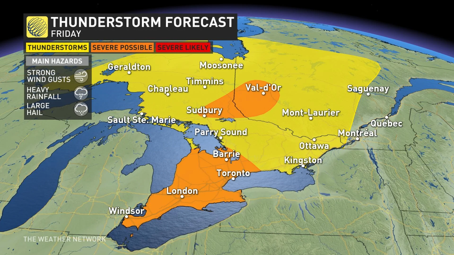
"This would lead to the possibility of a round of severe storms developing across southern Ontario late in the afternoon and early evening, with the threat for large hail, damaging winds, and torrential downpours," Carter adds.
But if the morning storms are slower to clear, we could be left with cloud cover and sinking air, which would help stabilize the atmosphere, and shift the higher end severe storm threat south of Lake Erie. This scenario would likely produce a weaker band of showers and thunderstorms triggered by the front as it passes through in the evening hours. It will be something to keep an eye on as the day progresses.

The cold front will extend northward all the way to James Bay, providing a focus for showers and thunderstorms for parts of northeastern Ontario and northern Quebec as well.
WEEKEND: TEMPERATURES CLIMBING, GORGEOUS FATHER'S DAY
Rain showers could linger into Saturday morning, though it looks like abundant sunshine will dominate most of the afternoon and evening as temperatures climb well into the upper 20s.
Even more gorgeous summer weather will span the region for Father's Day and the summer solstice, the official start to the season on Sunday.
It’s worth enjoying the weekend weather while it lasts however, as a potent low-pressure system could develop and approach the Great Lakes by early next week.
A shot of rather chilly weather is expected behind the system as well, with well below seasonal temperatures lasting for a couple of days before warming up again late week and weekend.
But at this point it doesn’t look like we will see another extended heat wave shape up before the month of June comes to a close.
Stay tuned to The Weather Network for the latest updates.


