Howling winds whipping across southern Ontario precedes sharp cooldown

A frontal system nearing southern Ontario will generate some intense wind gusts Friday, possibly sparking localized power outages and damage to tree branches. Temperatures will then dip below seasonal heading into next week.
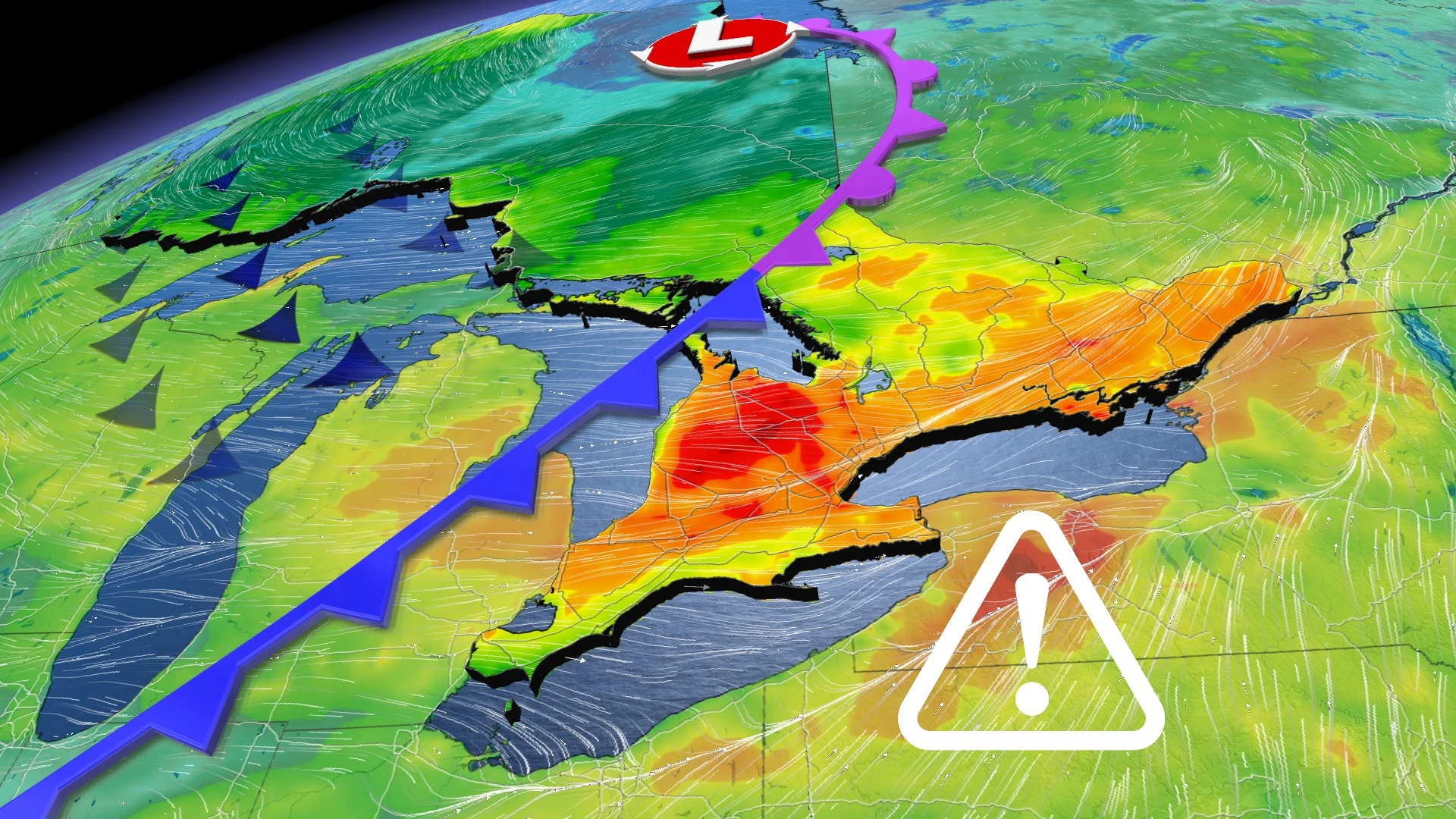
Batten down the hatches, southern Ontario. It's going to be a blustery Friday, with intense 60-80+ km/h wind gusts racing across the region. The potential is there for localized power outages and tree branch damage through the afternoon and evening. Once the system passes, a marked cooldown will follow along with some wintry weather at times through the weekend and on Monday, as well, with another front passage. More on what you can expect Friday and beyond, below.
FRIDAY: GRIP THE STEERING WHEEL AS GUSTY WINDS PUSH IN
Similar conditions are anticipated for Friday, though with much cooler temperatures, with winds picking up in a hurry as another front pushes across the region. Widespread special weather statements are in place.
Strong winds aloft will easily mix down to the surface, allowing Friday's wind gusts to push 60-80 km/h across much of southern Ontario. They will begin to ramp up in the late morning and early afternoon, with the strongest winds possible across the escarpment and near Lake Ontario and Lake Huron. Some areas near Lake Huron and southwestern Ontario may see winds exceeding 80 km/h.

Use extra caution while driving and driving near high-profile vehicles, and remain mindful of any small debris that could get tossed around by the lively gusts. Also be prepared for possible localized power outages and possible damage to tree branches.
Light precipitation will form as the front passes through the eastern Great Lakes Friday. It looks like much of the precipitation will remain south of the lakes, but some passing showers are likely in the afternoon and evening in the south and eastern sections, respectively.
However, in behind it, some light mixing and flurries are possible as we head through Saturday morning along the Erie shores and parts of cottage country. We're even watching the potential for a little accumulating snow near the Niagara region on Saturday. Parts of eastern areas and cottage could see some light snow redevelop in the evening, lingering into early Sunday morning.

Winds will calm down Friday overnight into the pre-dawn hours Saturday, which will also see temperatures drop well below seasonal as colder air filters in. Saturday’s highs will come in 5-10 degrees below seasonal for the date.
A system is expected to track into the Great Lakes Monday evening with widespread wet snow, though mixed with rain in the south. The exact track and impacts are still uncertain, but a coating of wet snow is possible for parts of southern Ontario with more significant snow expected for Quebec.

Another system is expected Wednesday night and into Thursday.
A blocking pattern and a recurving typhoon will help to reinforce the chilly pattern across the region through next week and weekend, with a couple of systems likely to impact southern Ontario next week with rain and possibly wet snow.
Stay tuned to The Weather Network for the latest forecast updates on southern Ontario.