Hours of freezing rain prompt warnings in eastern Newfoundland, outages likely
Freezing rain warnings are in effect across eastern Newfoundland, with the threat for up to 10 hours of icy conditions through Friday
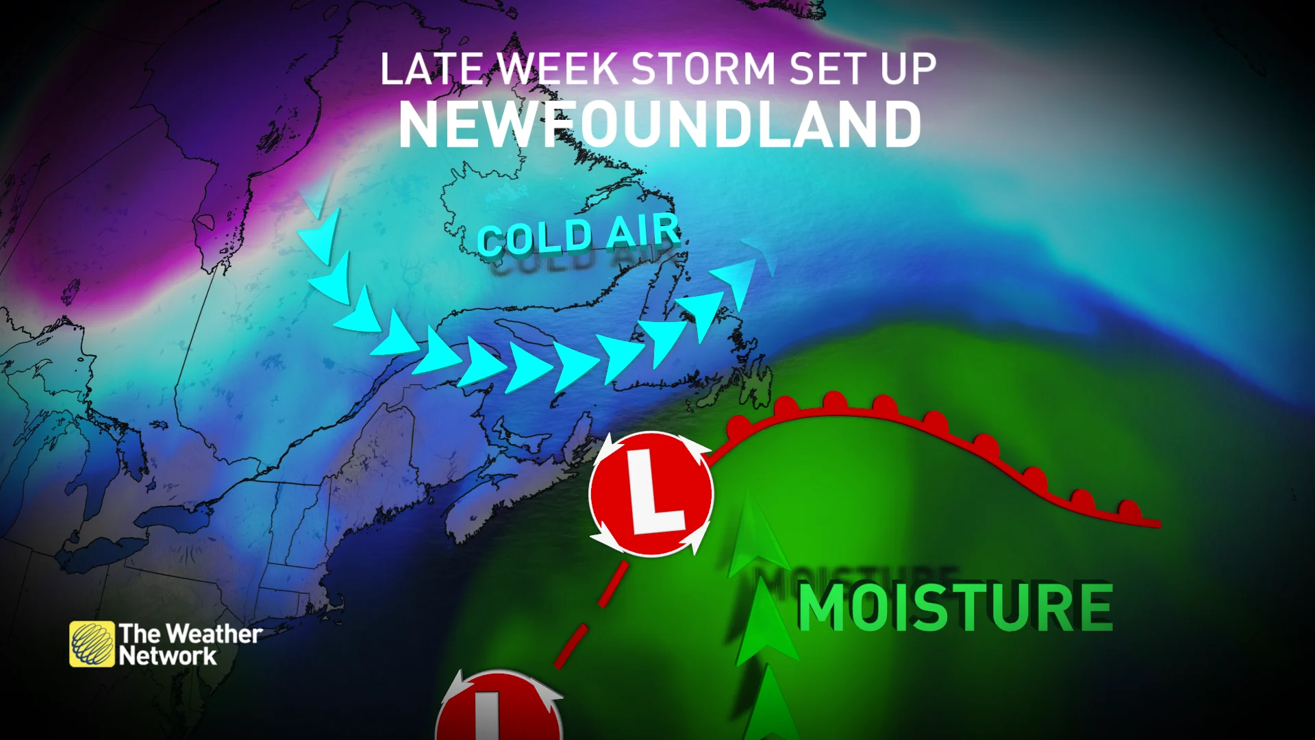
This week will end on a messy note across Newfoundland, as the province is a dealt a one-two punch of rain, snow and ice. Both waves will bring all three precipitation types to the island, with the key differences being exact location and intensity.
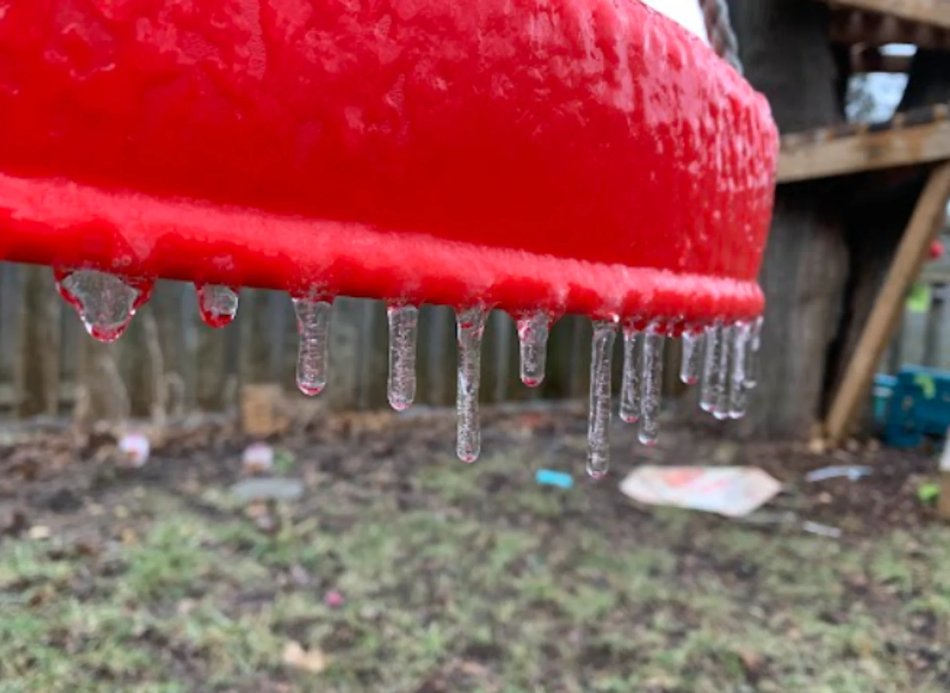
In the first round, cold air in place collides with the storm's warm moisture through Thursday afternoon, bringing the risk for an extended period of freezing rain and ice accretion to eastern sections of the island. Some areas may receive up to 10 hours of icing, which could result in dangerous travel conditions and localized power outages.
SEE ALSO: Snow little time: N.L. residents dig out from snow after compounding snowfall
The second and milder round takes aim through the weekend, with periods of heavy rain expected. Significant snowmelt and runoff are possible, so residents are urged to clear ice and other debris from drains and gutters before it rains.
Thursday into Friday: Dangerous icy impacts
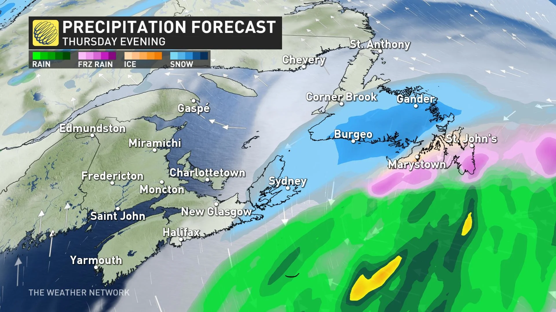
Freezing rain will be the biggest threat with this first round, as it begins in the southwest Avalon Thursday afternoon, spreading into St. John's and the Burin Peninsula, through the evening and overnight. For the Avalon, only a few centimetres of snow is expected to accumulate before changing to freezing rain and ice pellets by the evening.
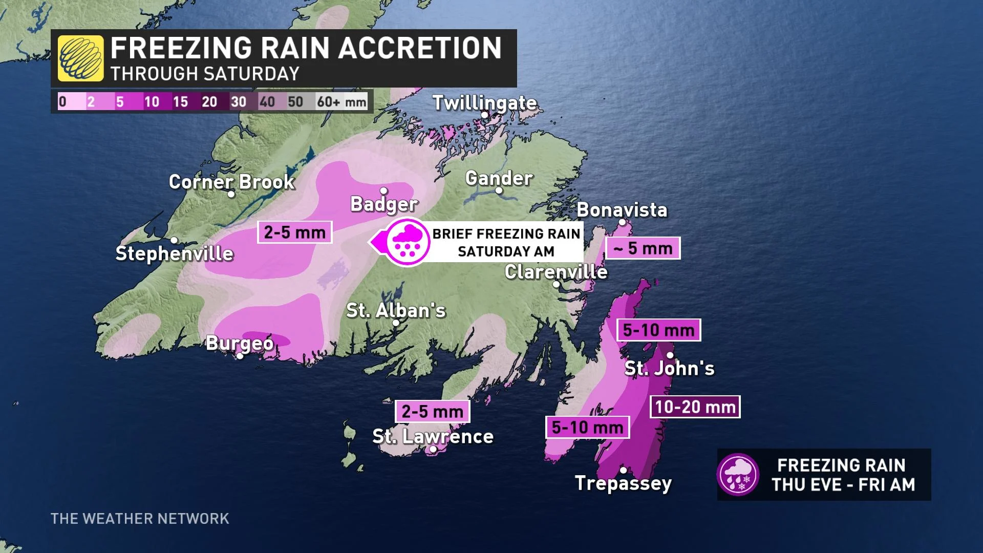
Southeastern regions may experience 8-10 hours of ice accretion through the event, with difficult travel and localized power outages possible. While the icy precipitation is expected to end by Friday morning, roads will likely still be slick and dangerous through the rush hour commute. Drivers are urged to plan ahead, and to brace for some slower travel.
"Surfaces, such as roads, streets, sidewalks and parking lots, will become icy, slippery and dangerous. There could be utility outages. Use caution when walking or driving in affected areas," says Environment and Climate Change Canada (ECCC) in the warning.
By Friday morning, the storm progresses swiftly through the island, forcing warmer air further inland.
All precipitation types will inch northwest across the island. Snowfall is expected for the west, rainfall takes over the Avalon and Burin region, while a sliver of freezing rain continues in eastern sections, south of Gander.
Colder air holds on in central Newfoundland during this time, with 5-15 cm of snowfall expected in the hardest hit areas through Friday.
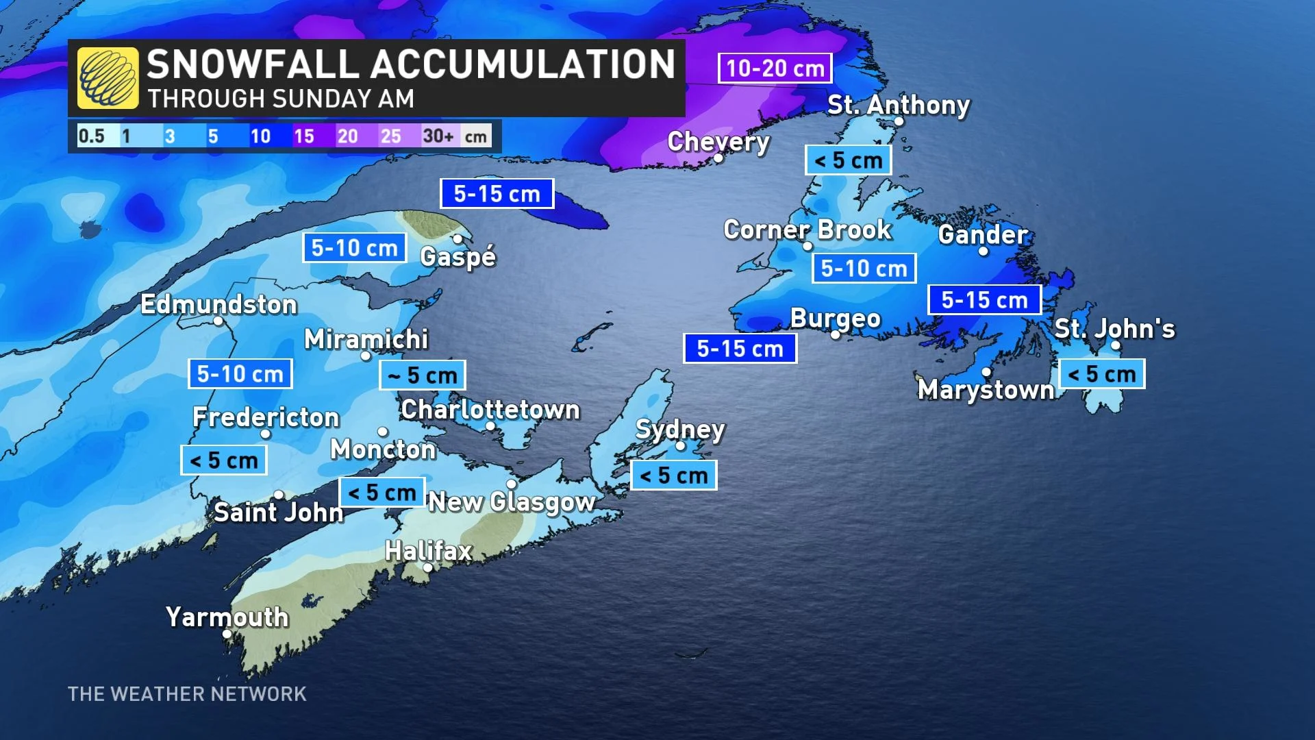
The precipitation is expected to then change to rain as temperatures increase through Friday, though with a second warm and rainy system pushing in for Saturday, as well.
Saturday into Sunday: Heavy rain takes aim
In this second wave, the low slides farther west across the St. Lawrence, and this means, warmer conditions, and a shift westward in the precipitation and intensity.
It begins overnight Friday across the southwest as snow. There will be a brief period of freezing rain and ice pellets before changing over to rain through the morning Saturday. The rain could be heavy at times, especially across the Burgeo area.
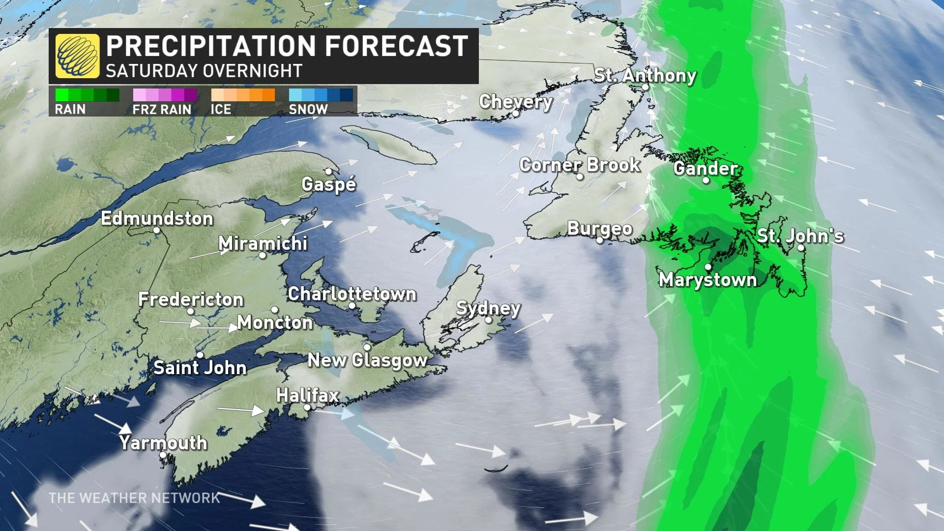
As the precipitation spreads eastward, it stays as rain Saturday evening on the Burin and Avalon Peninsulas. Significant snowmelt and runoff are possible with the weekend rain, as well as the threat for some localized flooding.
By Sunday, all of the precipitation will have ended, though with unsettled weather expected to return later next week and weekend. With very mild temperatures in place, primarily rain is expected.
Be sure to check back for the latest updates across Newfoundland.