Highly impactful winter storm bears down on Quebec, 30+ cm snow possible
The first major storm of the year is veering into Quebec Tuesday afternoon, expected to bring an array of hazards
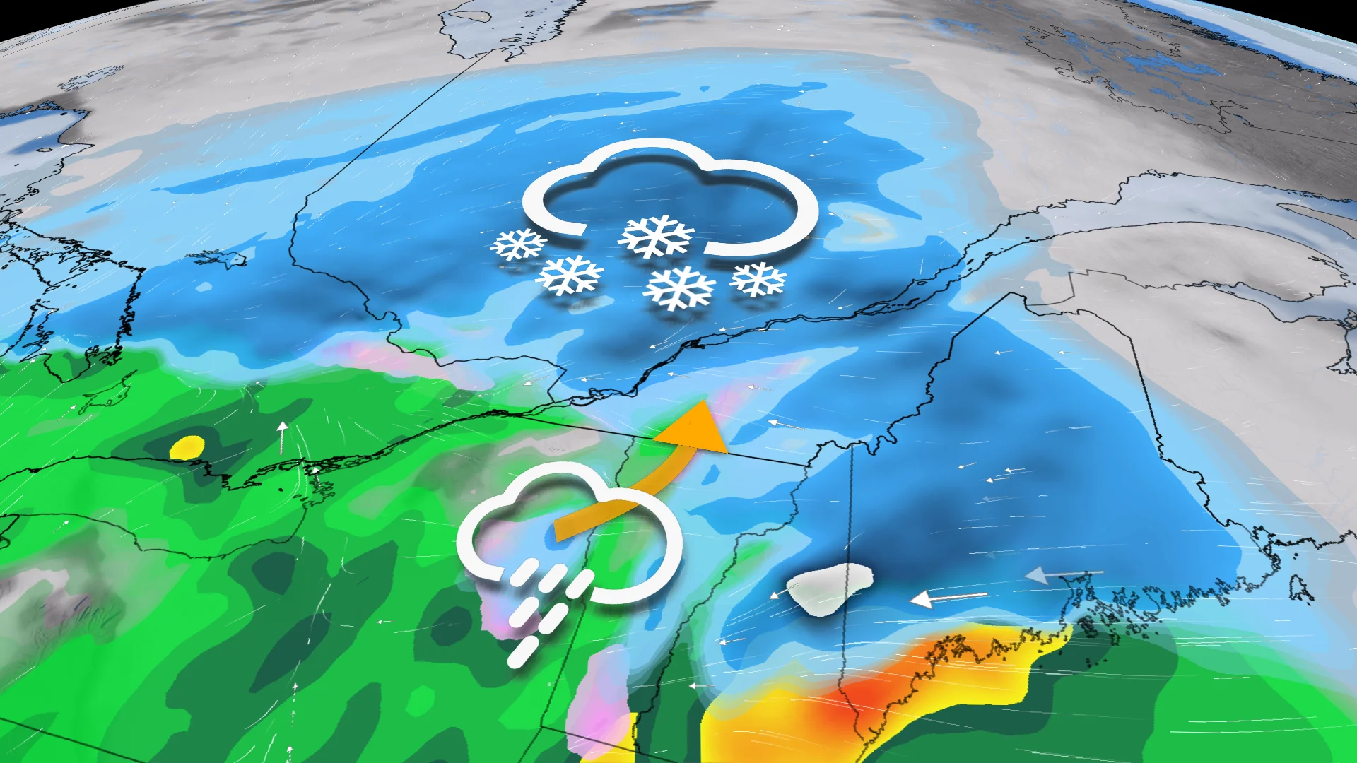
A major storm is taking aim at Quebec through mid-week, with a swath of heavy snow, rain, strong winds and ice all on the table. This will be the biggest storm of the year for the province so far.
Travel conditions will deteriorate in a hurry, and drivers are being urged to consider postponing non-essential travel until things improve later Wednesday.
Going somewhere? Check out the current highway conditions before heading out!
The sprawling low-pressure system will draw on cold air from Canada, warm and humid air from the Gulf of Mexico, and a tremendous amount of energy swinging over the Rockies to produce an array of hazardous weather across the continent.

WATCH: Everything you need to know about messy Quebec storm
Swath of heavy snow before a change over to rain
A swath of heavy snow is expected across western and southern Quebec to start on Tuesday afternoon and evening. This heavy snow will continue through the overnight hours, dropping up to 30-40 cm across the Laurentians by Wednesday afternoon.

During the pre-dawn hours on Wednesday, there is the chance for 5-10 mm of rain to push into the Gatineau and Montreal regions as warmer winds push in. That's after picking up between 15-25 cm of snow, however, with 15 cm in the south and up to 25 cm in the northern areas.
Freezing rain and ice pellets are also possible during this transition, making for slick and icy travel conditions during the Wednesday morning commute.

Quebec city is expected to see 20-30 cm of snow, and remain snow, through the entire event.
Across the Eastern Townships, 5-10 cm of snow is expected before warmer temperatures allow for 5-10 mm of rain. The combination of snow and rain will make for a sloppy mess.

Gusty winds will also accompany the wintry mix across central and eastern parts of the province, with the threat for dangerous whiteout conditions and power outages on the line, as well.
Environment and Climate Change Canada (ECCC) issued winter storm warnings Tuesday morning across much of the province as the event approaches.
As the system moves east, the precipitation will end from west to east through Wednesday afternoon and evening.
Looking ahead to the weekend, another potent system is forecast to once again bring widespread, heavy snow across the province, so stay tuned as we begin to monitor this next system.
Stay with The Weather Network for the latest on this major storm in Quebec.