Marginal, overnight severe storm risk in Alberta precedes new Thursday threat

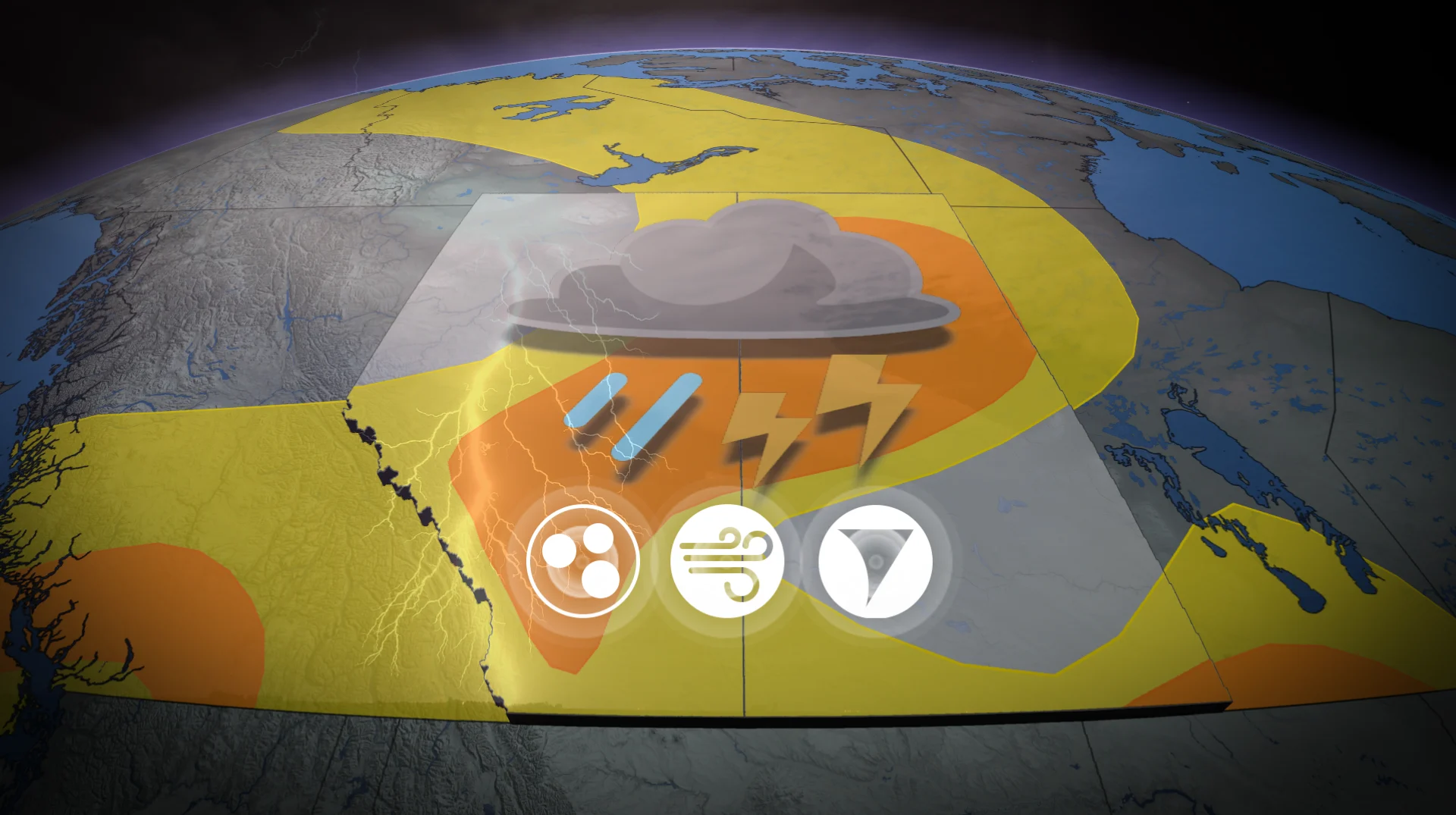
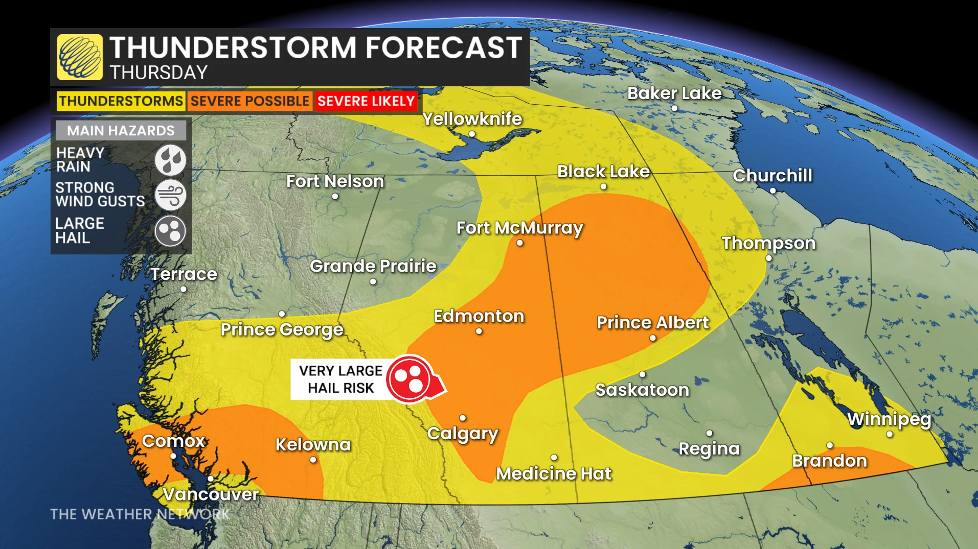
The Prairies will see yet another severe storm risk bubble up on Thursday, expanding outside of Alberta to also include parts of Saskatchewan and Manitoba. A tornado or two will be possible for parts of the region
Residents across Alberta should monitor alerts, and be prepared for a lingering, marginal severe storm threat through Wednesday overnight.
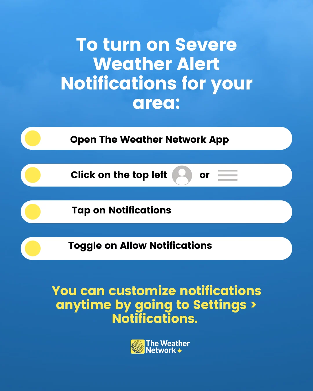
People should keep their phone notifications on and have a plan ready in case threatening weather approaches.
DON'T MISS: Tornado warning safety: Here’s what you should do
The multi-day severe weather event will then continue on the Prairies on Thursday.
Thursday’s risk will pop up in Alberta again, and expand into central and northern Saskatchewan, as well as southern Manitoba. Large hail, damaging wind gusts and heavy rain are the main threats, but a tornado or two can’t be ruled out in southern and central Alberta.
Thursday: Severe thunderstorm potential rises again, with a tornado risk
The thunderstorm potential increases on Thursday with high CAPE available.
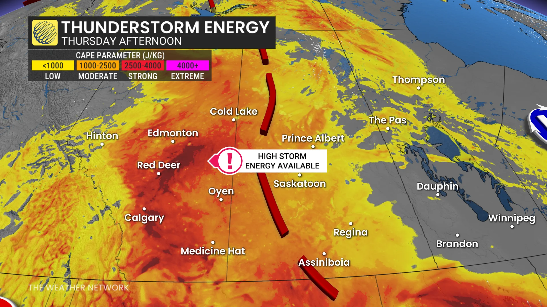
A low-pressure system will be centred in northern Alberta-Saskatchewan while the surface trough lingers and aligns down the Rockies.
Severe thunderstorms are expected from the foothills into northern Saskatchewan, mostly in the afternoon and evening on Thursday.
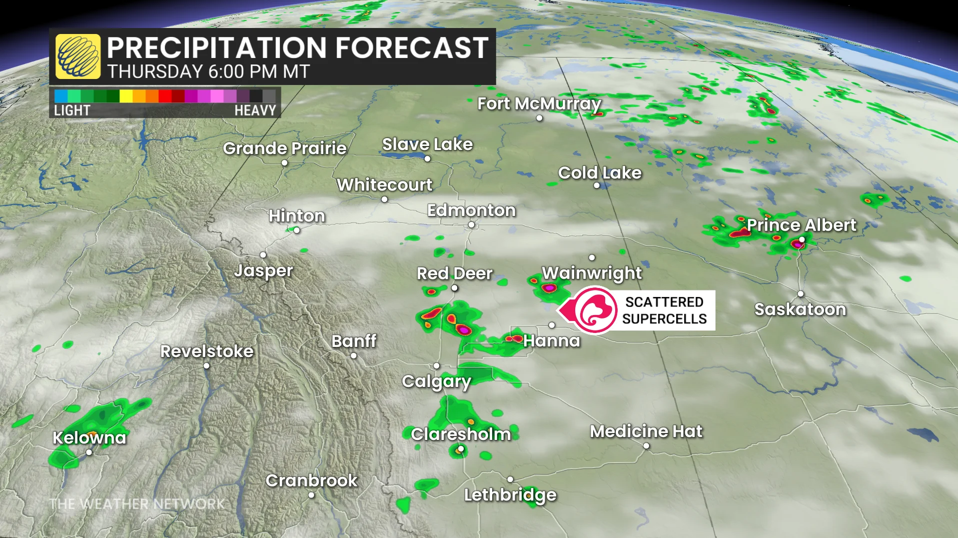
The storms should be scattered in nature, leaving uncertainty on where they will develop.
High CAPE, wind shear and strong lapse rates provide the following threats:
Strong wind gusts possibly exceeding 100 km/h in the strongest storms
Large hail possibly reaching golf ball-size
Funnel clouds (northern Alberta and Saskatchewan)
One or two tornadoes (south and central Alberta)
Residents are encouraged to monitor alerts and have safety plans in place for changing weather conditions.