
High pressure lends a helping hand to Atlantic Canada to block Ian

A trough and surface high pressure works in our favour to provide continued dry weather for cleanup efforts in Atlantic Canada this weekend
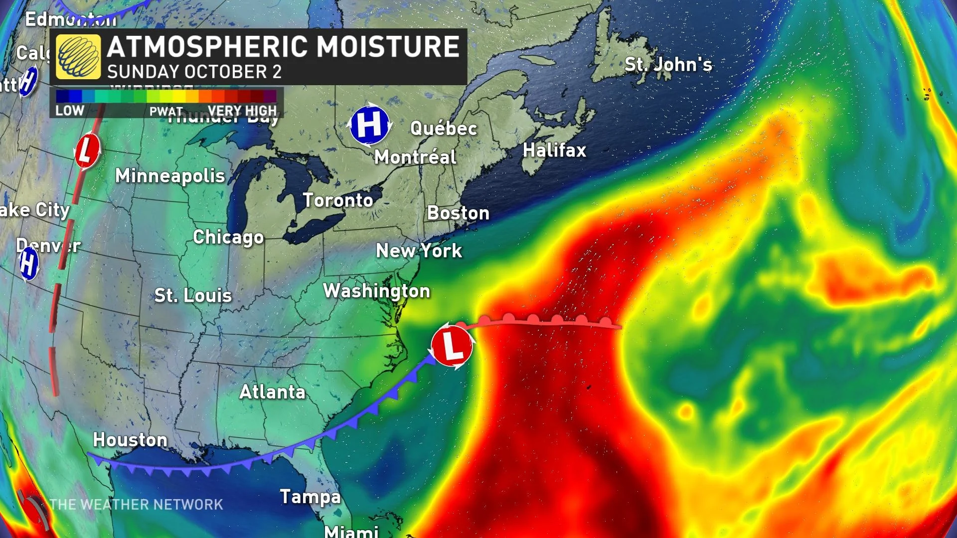
Satellite imagery this weekend shows what's left of Hurricane Ian is a typical mid-latitude system – characterized by classic weather fronts.
Remember last week when the upper trough captured Hurricane Fiona? That trough manoeuvre proved to be catastrophic.
SEE ALSO: Canada's October outlook: Slow slide or freefall into colder weather?
Now, a trough and surface high pressure works in our favour to provide continued dry weather for cleanup efforts. The chilly trough on Sunday pushes some remnant moisture offshore, guaranteeing very little impact to Atlantic Canada.
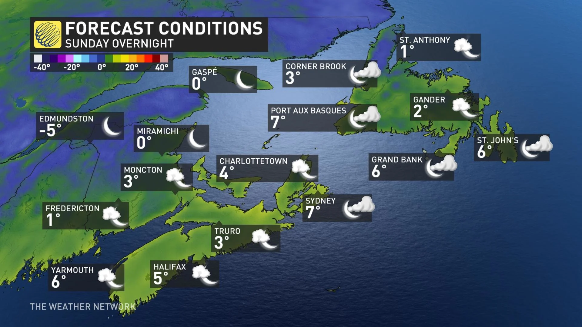
It will come at a bit of a price, including chilly temperatures. If you've peered at your forecast, overnight temperatures Sunday show a freeze occurring across inland sections of New Brunswick, with even some patchy frost possible across inland Nova Scotia.
The surface low will remain off Cape Cod and New England through the early week before spinning northeast. As the system encounters the region of high pressure, it will naturally weaken and disintegrate, giving an isolated shower threat later in the week.
Stay tuned to The Weather Network for the latest forecast updates for Atlantic Canada.