Energy-primed low may drop ample snow totals in areas of Manitoba, NW Ont.
Snowfall warnings and special weather statements span a good portion of southern Manitoba and northwestern Ontario as a large Colorado low moves in, threatening up to 20 cm of snow for some areas
Parts of the eastern Prairies and northern Ontario will be in for a snowy ride through the majority of the rest of the week.
A Colorado low, made with energy from the atmospheric river that brought flooding and intense winds to coastal California, is expected to bring a fair amount of snow in parts of southern Manitoba and northwestern Ontario into Friday.
FORECAST: All of Ontario experiencing an extreme February thaw this week
Although it is not a major system, there is still a chance of 10-20 cm in the hardest-hit areas with this system. There is the potential Brandon, Man., could see its largest, one-day snowfall of the season. Snowfall warnings and special weather statements cover parts of both provinces.

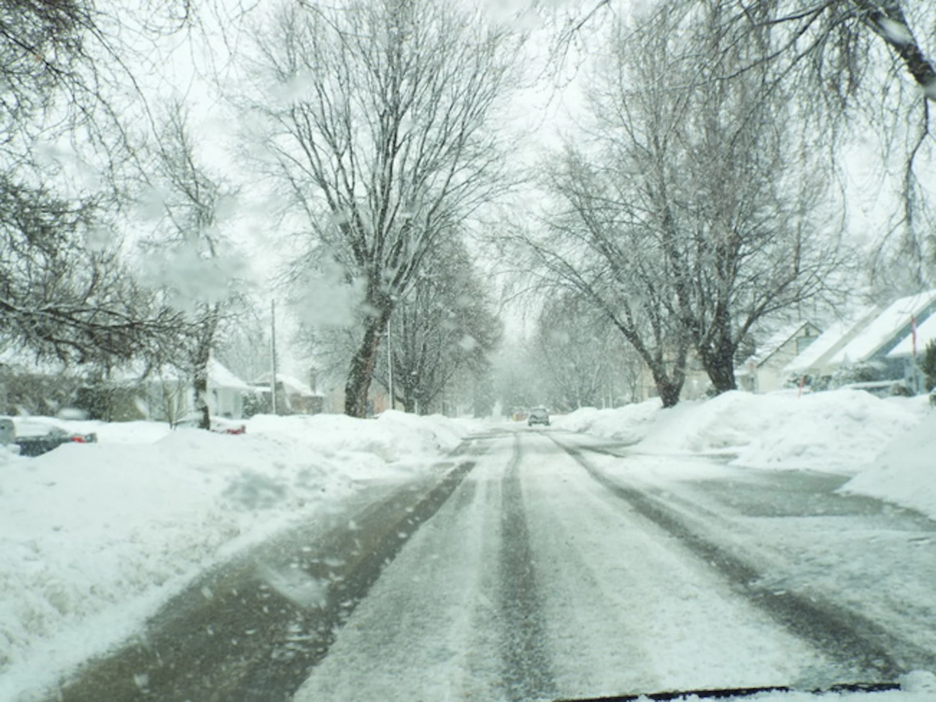
Rapidly accumulating snow could make travel difficult over some locations. Visibility may be suddenly reduced at times in heavy snow. Drivers should be prepared to adjust their driving with changing road conditions.
Thursday into Friday
Temperatures won't be exceptionally cold, but they’ll be cold enough to bring snow to Saskatchewan, Manitoba, and northwestern Ontario into Friday. Some milder temperatures could bring rain into southeastern Manitoba and parts of northwestern Ontario. The rain should stay along and south of the Trans-Canada Highway.

PHOTOS: Record-setting snowstorm drops 100+ cm of snow on Nova Scotia
On Wednesday, periods of snowfall developed across parts of Saskatchewan and Manitoba, and this slow-moving Colorado low isn’t going anywhere fast through Thursday.
It’s not all snow, and in the big warm sector of the low ushering in milder temperatures, there is some rainfall forecast into southeastern Manitoba and parts of northwestern Ontario.
Snow continues across southern Saskatchewan and western Manitoba Wednesday overnight. Temperatures for southeastern Manitoba and northwestern Ontario will hover at or just above the freezing mark, bringing rain into the region through Thursday afternoon before transitioning to snow from west to east.

Snow continues to move east, with most of the heaviest snow done by Thursday evening. However, some lingering flurries are expected for northwestern Ontario on Friday. There’s a risk of blowing snow with brisk, northwesterly winds gusting up to 60 km/h behind the departure of the Colorado low, beginning later Thursday and lingering into Friday.
MUST SEE: What’s the recipe for a severe drought in Western Canada?
As of now, the heaviest snowfall totals look to be north of Kenora and Dryden in extreme northwestern Ontario, with the purple shades below representing pockets of 10-20 cm of snowfall across Saskatchewan, Manitoba and northwestern Ontario. Winnipeg, Man., will start with rain and transition to snow through the day on Thursday.

While the snow could make for difficult travel conditions and slower commute times, it will surely be welcomed across areas facing a moderate drought situation, and in need of the precipitation.
Be sure to check back for the latest weather updates across the Prairies and northern Ontario.