Snow brings treacherous travel across the GTA, collisions reported

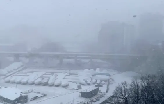
Heavy snowfall brought dangerous whiteout conditions to the GTA and some other areas in southern Ontario Tuesday.
Strong winds and local blowing snow made for some dangerous and messy travel conditions Tuesday. The easterly flow over the still relatively warm waters of Lake Ontario are likely to boost snowfall amounts in some areas by the time the snow moves out. The good news is that the heaviest snow has ended, with just flurries possibly lingering into the overnight. In a winter that's barely had any snow to give to the region, this all-day storm will be the most system snow that's piled up since Christmas. It'll also stick around for some time, with the cooling temperatures settling in for late week. More on the timing and impact of this Texas low, below.
WEATHER HIGHLIGHTS:
Heavy snow causes collisions amid whiteout conditions Tuesday
Most of GTA to see near 10 cm of snow Tuesday, locally higher amounts possible in western areas
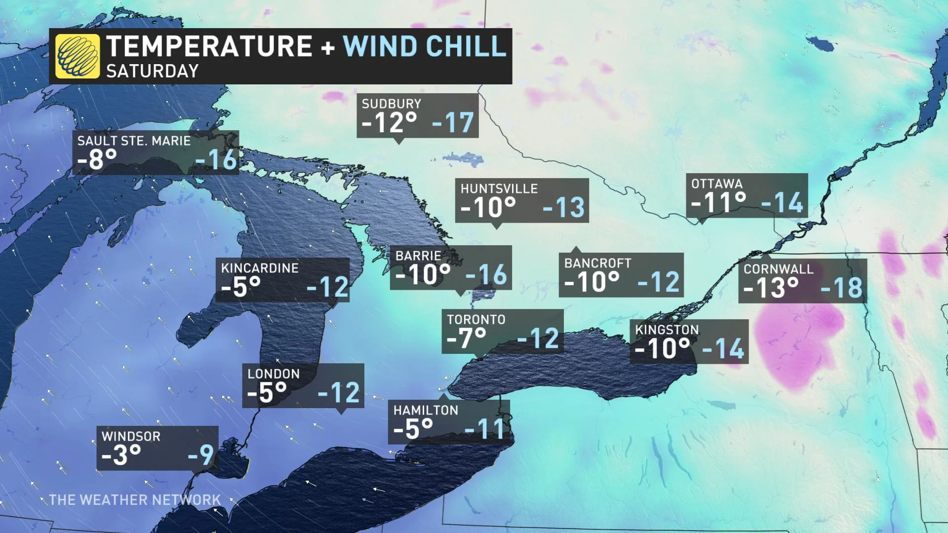
Coldest temperatures of the season for many so far expected late week
TUESDAY: DANGEROUS, WHITEOUT CONDITIONS THREATEN GTA
The heaviest snow associated with this large stateside system has diminished, with just flurries possibly lingering into the overnight period. But the snow reportedly caused multiple collisions on the road as conditions deterioriated due to whiteouts and poor visibility.
SEE ALSO: Deadly tornado rips through Alabama
When all is said and done, snowfall accumulations are expected to be near 10 cm across most of the GTA. Locally higher amounts are possible with lake enhancement between Hamilton, Milton and Toronto due to the east wind off Lake Ontario. Elsewhere across the Golden Horseshoe, including the Niagara region, snow totals will be between 5-10 cm.
Lesser amounts are expected north and east of the Greater Toronto Area.

Weather travel advisories have dropped for most of the GTA but continue for eastern areas including Ottawa, as well as Dufferin and Niagara regions, among others.
"Rapidly accumulating snow may make travel difficult. Visibility may be suddenly reduced at times in heavy snow and local blowing snow," warns Environment Canada in the advisory.
ROADS DETERIORATE QUICKLY
There were reports of multiple crashes on Highway 401 through Milton and Puslinch ahead of the lunch hour, with a jackknifed tractor trailer on Highway 6 southbound, blocking two left lanes and backing up traffic there. Several smaller accidents have also been reported in and around the city of Toronto.
In a video the Ontario Provincial Police (OPP) posted to Twitter Tuesday, Norfolk County Const. Ed Sanchuk urged people to drive according to the road and weather conditions because the roads are slick.
He also urged motorists to have their "entire headlighting system on... so you are seen to other members of the motoring public." As well, Sanchuk wants people to slow down on the slippery roads, avoid tailgating and ensure the gas tank and windshield washer fluid reservoir are full.
"As you can see, the snow is falling, the roads are snow-covered and we're just asking everyone to please reduce their speed. As you can see it's 80 km/h zone here," said Sanchuk. "You do not have to be doing 80 km/h to travel (during) this weather. Slow your vehicle down to get to where you are going safely."
He added, "We're just asking everyone to please get home safe with their families and please reduce your speed. You are not going to be able to stop on a dime out here."
While most school students continued their learning online amid the pandemic restrictions, both Halton and Peel boards cancelled buses for the day early Tuesday for the few students still attending specialized programs and in-person learning. The Peel District School Board also closed all school buildings and offices to students and teaching staff, with virtual learning continuing at home.
MUST SEE: Has online learning melted away your shot at a 'snow day?'

Some areas may end up seeing more snow than others because of lake enhancement, as an east wind with gusts up to 60 km/h, provided an extra boost.
WATCH ICY WAVES CRASH ALONG LAKE ONTARIO BOARDWALK
LOOK AHEAD: COLDER TEMPERATURES AND MORE MESSY STORMS
Beyond Tuesday's snow, southern Ontario will see fair weather and rather cold temperatures for mid and late-week. In fact, the coldest temperatures of the season so far for many areas are expected for Friday and into Saturday along with a brisk northwest wind. That means Tuesday's snow will have a chance to stick around into next week.
Forecasters are also keeping a close eye on a messy system that could track into southern Ontario Sunday and into early next week. Because we're still far out, it is too early to have confidence in the exact storm track and impacts, but this has the potential to bring significant snow and possibly ice to the region.
"There is a lot of uncertainty regarding the storm track and how far north and east the snow will reach into southern Ontario," says Weather Network meteorologist Dr. Doug Gillham. "Hamilton and Niagara have the best chance of seeing significant snow and we will have to closely watch the GTA."
A more southerly track is also possible, which would result in minimal impacts on this side of the border, Gillham adds.
Temperatures will begin an upwards climb again next week, even trending back above seasonal by the end of the week.
Be sure to check back for updates as we continue to monitor the timing and impacts of the Texas low.
Thumbnail image courtesy: James Stamos, taken in Toronto, Ont.


