Lingering storm risk hangs on over B.C. with rain and powerful winds
Widespread rain continues for the B.C. coast into Tuesday, with just enough instability to bring an isolated storm risk. Ferry-goers may be in for a rough ride through the Strait of Georgia, as winds will be gusty
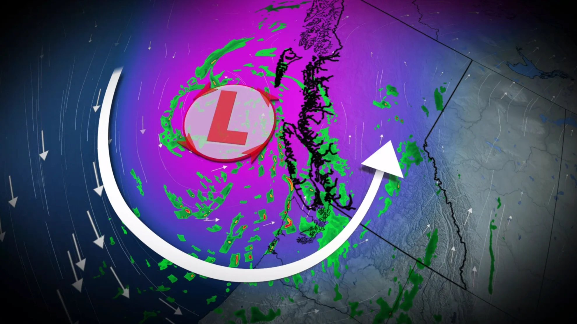
A potent system that has reached the B.C. coast will ramp up in intensity on Tuesday, bringing heavy downpours and gusty winds to the region before departing mid-week.
Rainfall totals of up to 100 mm can be expected and strong wind gusts could potentially cause delays Tuesday and Wednesday.
Visit our Complete Guide to Fall 2023 for an in-depth look at the Fall Forecast, tips to plan for it and much more!

Tuesday
Areas: Coastal B.C.
Timing: A short ease in precipitation to start Tuesday, but a stronger low quickly fills in precipitation along the coast and Interior. The rainfall and gusty weather will continue well into Wednesday, improving by Wednesday overnight.
Weather: Steady rain and gusty southeasterly winds are on tap throughout Wednesday as the low-pressure system stalls across northern Vancouver Island, bringing similar or slightly more rainfall accumulations to Monday’s system. We’ll even have to watch the threat for a couple lightning strikes near Vancouver Island on Tuesday, associated with colder air funelling in aloft.

RELATED: Why the aroma affiliated with a rainfall is so appealing
Two-day rainfall totals are likely to approach 100 mm for Tofino, and 20-40 mm across Metro Vancouver. Winds are more of a concern on Tuesday and Wednesday morning in terms of ferry delays and isolated power outages, as sustained winds approach 40-50 km/h in the straits.

Maximum wind gusts will fluctuate, but peak at around 80 km/h in the northern Strait of Georgia, and 70 km/h across the southern Gulf Islands and exposed sections of Greater Victoria.

Wednesday
Weather: Rain showers continue into the day Wednesday, then tapering off overnight with cloud cover clearing, as well. Low to continue trekking across the province, making its way to the Rocky Mountains. High-pressure system settles in for Friday, bringing sunny conditions and warmer temperatures.
Temperatures likely to dip to or below-seasonal values early to mid-week before the second ridge builds in late week or by the weekend from the north.
SEE ALSO: B.C. doubled its old wildfire record. Experts say we can take action now
A weak coastal ridge will usher in fair and seasonably warm weather into the region on Thursday and Friday before the threat of showers re-emerge next weekend.
Stay tuned to The Weather Network for more forecast updates in British Columbia.