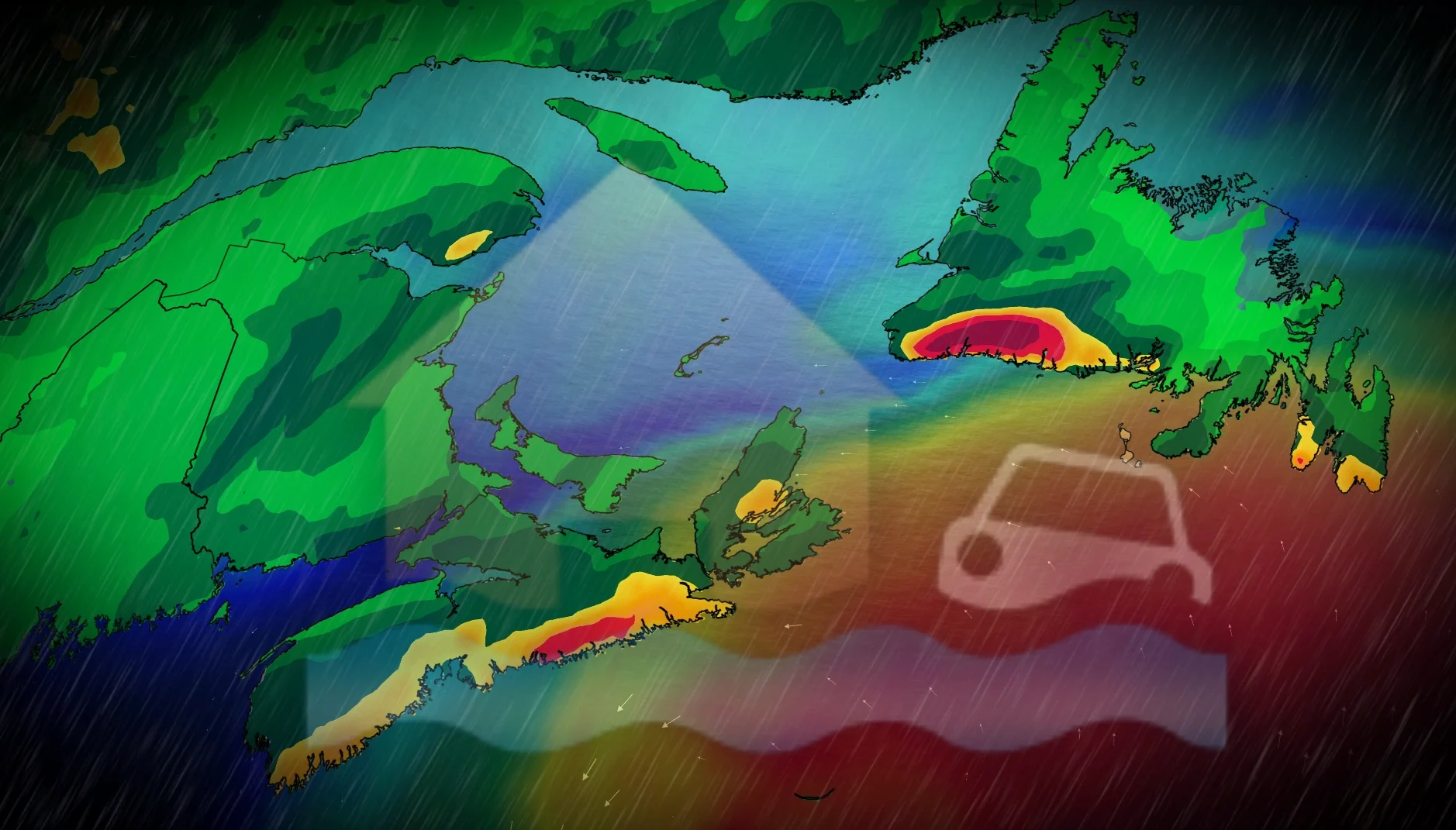
Heavy rainfall, severe thunderstorms to impact Atlantic Canada through Saturday

Heavy rainfall and severe thunderstorms target Atlantic Canada with a multi-day storm event forecast through Saturday
A prolonged period of heavy rain and thunderstorms is underway across Atlantic Canada, driven by a low-pressure system pulling significant moisture from the Gulf of Mexico. Rainfall began early Wednesday in the Maritimes and is expected to last through Saturday for coastal Nova Scotia and parts of Newfoundland.
Be sure to monitor the changing weather conditions, and stay up-to-date on any alerts or warnings in your area.
The setup:
A strong, high-pressure system over the Atlantic Ocean is blocking the eastward progression of the low, resulting in consecutive rounds of rain.
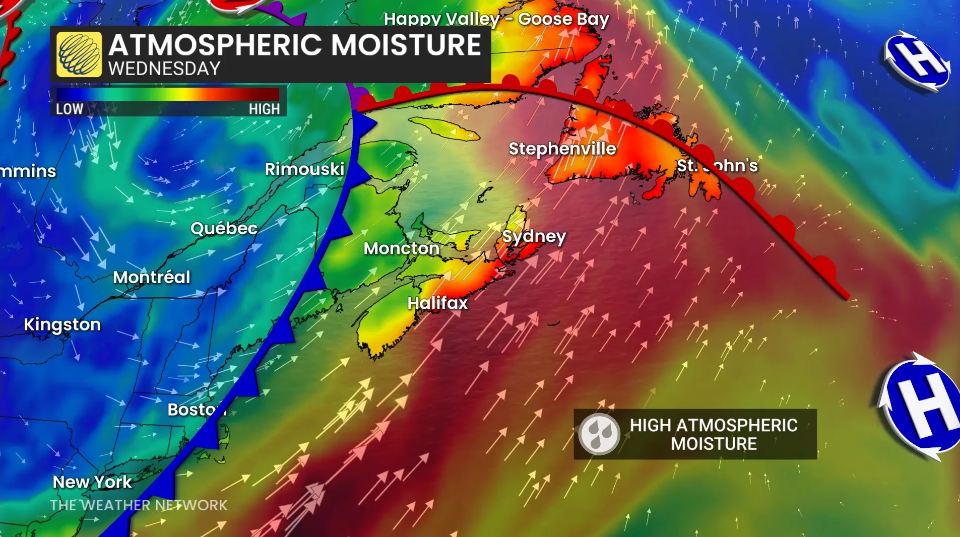
Showers will persist near Nova Scotia’s coastlines and Newfoundland as the low remains stationary.
Rain will taper off in New Brunswick mid-day Wednesday, but could intensify again in central and northern Nova Scotia Thursday, extending into Newfoundland’s Burgeo region. Accumulations may reach 50-70 mm along Nova Scotia’s coastline by Friday, with locally higher amounts near thunderstorms.
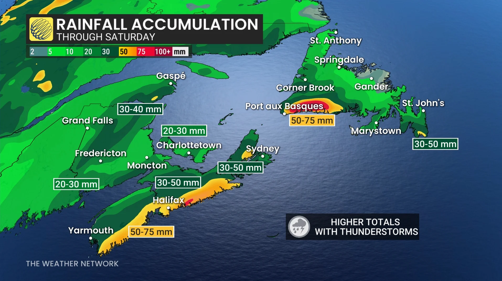
The Bay of Fundy coastlines in New Brunswick could see 30-50 mm.
DON'T MISS: How do thunderstorms form and grow into immense weather powerhouses?
Winds and tides:
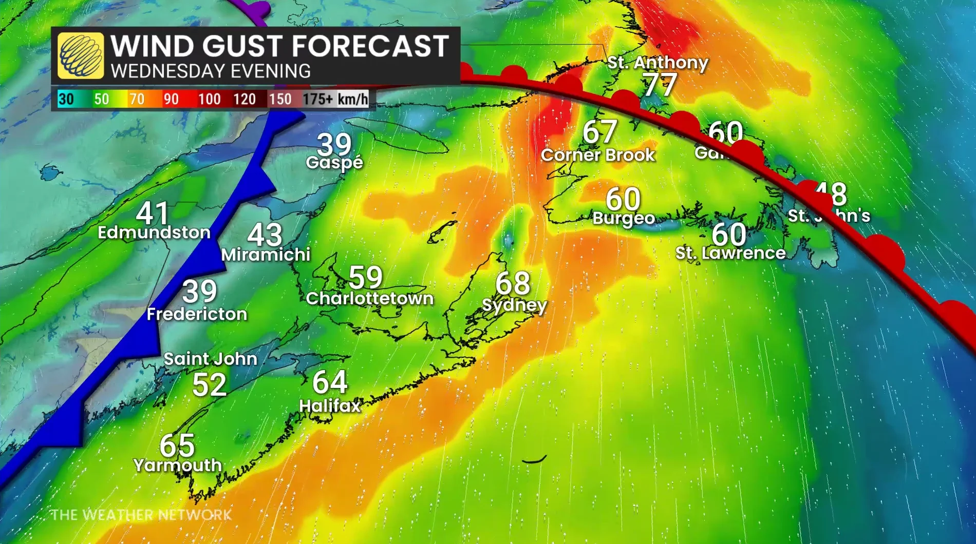
Strong winds of 60-85 km/h are forecast through Wednesday and Thursday, particularly along the cold front. Residents along the shorelines should also prepare for higher tides due to gusty conditions.
WATCH: Traffic lights out as storm sweeps through Halifax
Thunderstorm risk:
On Wednesday, a severe thunderstorm risk covers northern New Brunswick where the cold front could trigger storms by evening. Hazards may include heavy rainfall, localized flooding, small hail, and damaging wind gusts.
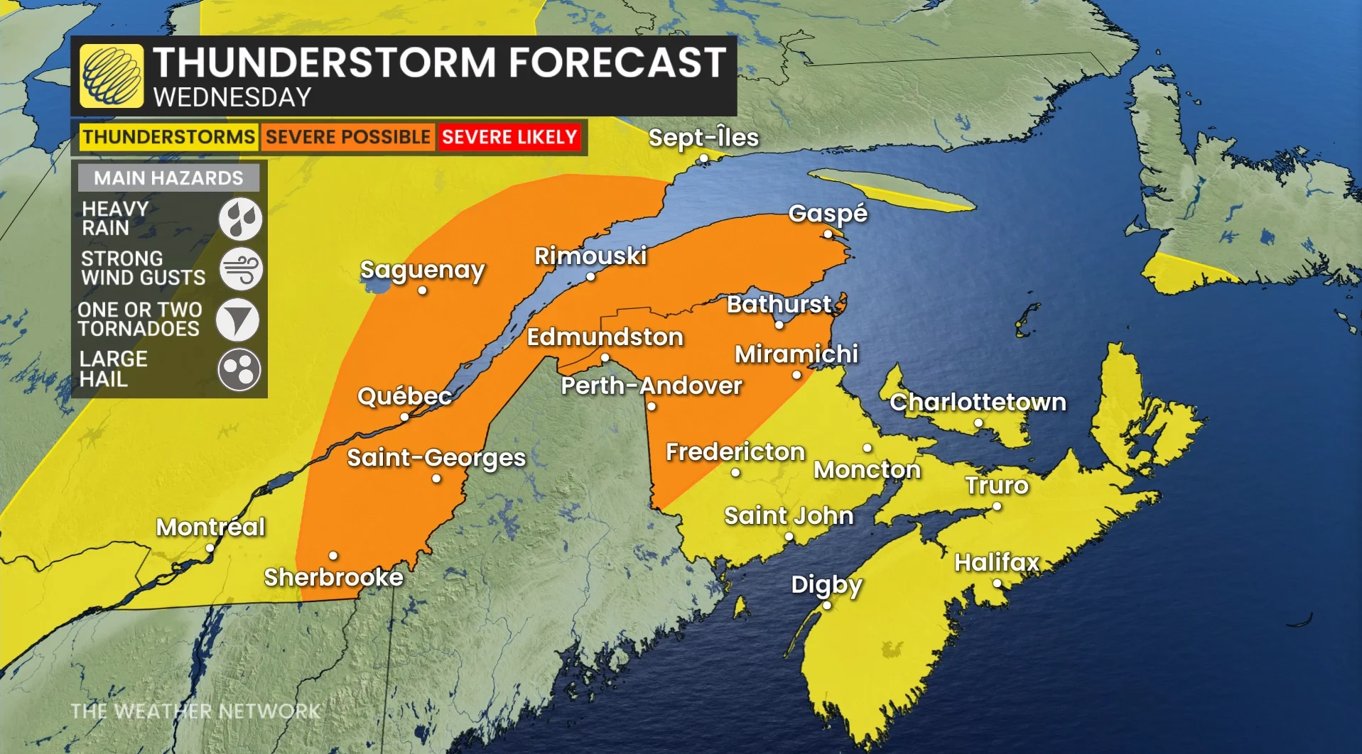
There is a slight chance of rotating storms as the line of storms moves in from Maine.
RELATED: Understanding floods: Preventative measures to minimize your risk
Impacts:
Residents should prepare for potential power outages, pooling water in low-lying areas, and localized flooding. Stay updated for further warnings through the week.