
St. Patrick's Day storm whips the East Coast, strong winds, rain continue
No luck from Mother Nature on Tuesday in Atlantic Canada as significant wind gusts, heavy rain, and possible thunderstorms may cause power outages and travel delays on Tuesday, putting St. Patrick's Day plans in jeopardy
Atlantic Canada won't get any help or luck from Mother Nature on Tuesday, with a rain- and wind-filled day on tap for St. Patrick's Day.
Heavy rain, strong winds, and embedded thunderstorms are creating wet and windy conditions for many in Atlantic Canada this St. Patrick’s Day. Be sure to plan ahead before heading out for any festivities. If you decide to go out, don’t forget to bring an umbrella!
DON'T MISS: Did the groundhogs get it right? Grading this year’s furry forecasters
Also, brace for potential power outages due to the winds. Keep mobile devices charged. Secure loose objects around your property that could be blown away.
Strong system moves into the Maritimes, risk of thunderstorms on Tuesday
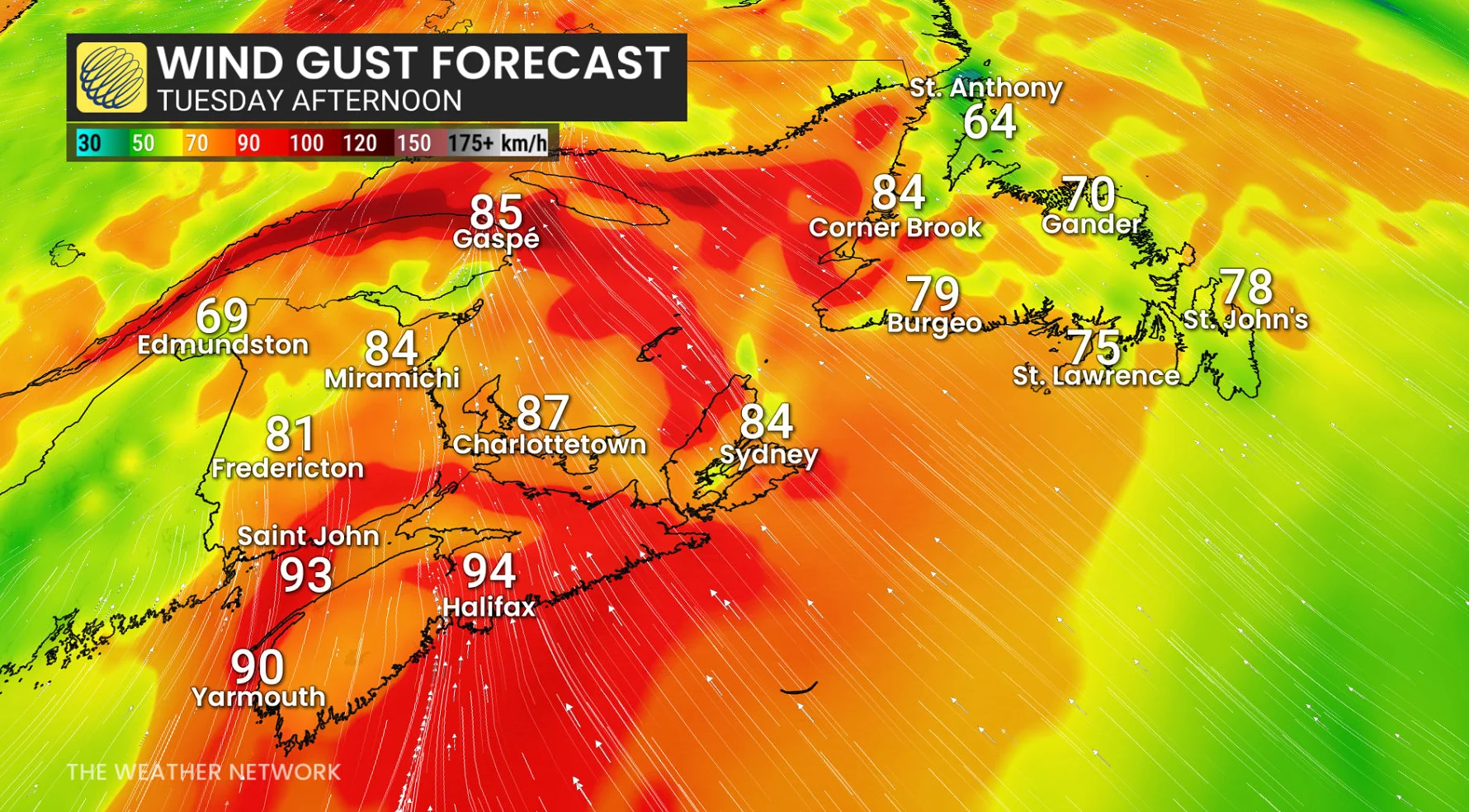
The system's cold front will cross the Maritimes Tuesday morning into the afternoon, bringing a second round of non-severe thunderstorms and widespread wind gusts of 80-90+ km/h across the region during the day.
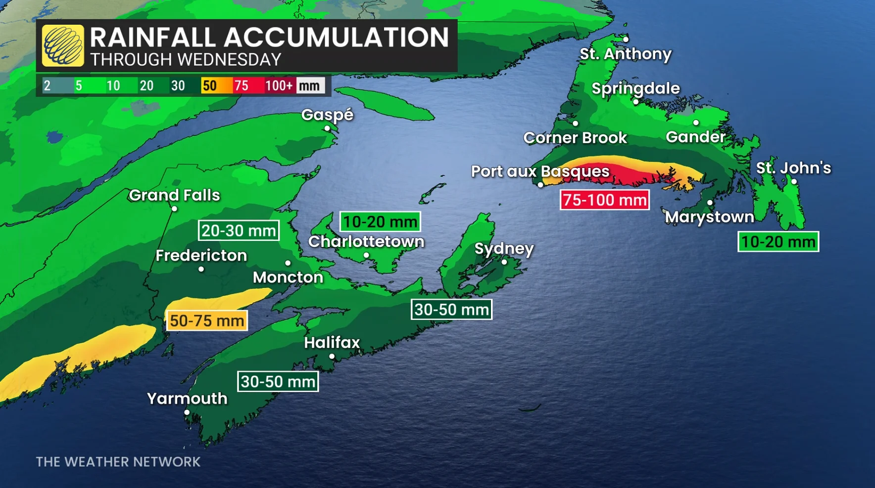
Rainfall totals generally hitting 30-50 mm, so watch for some local pooling and ponding.
Strong winds were reported in Halifax on Tuesday morning, and the risk of power outages persists as potential wind gusts threaten to bring down tree branches onto power lines.

Tree branches down closing part of North St. in Halifax, N.S. Tuesday morning. (Nathan Coleman/The Weather Network)
Residents are reminded to keep a safe distance from fallen power lines, as they may still be live and pose a serious risk of electrocution.
Meanwhile, there will be a chance for some embedded thunderstorms and locally heavy rain across southern New Brunswick and western Nova Scotia throughout the day.
RELATED: Thundersnow is a rare and electrifying experience
Strong winds will spread across Newfoundland through the day Tuesday, and continue into Wednesday morning.
As for temperatures, a significant cooldown will follow Tuesday evening into Wednesday, bringing notably chillier conditions.

Expect a chillier Wednesday across the Maritimes with temperatures 10-20 degrees colder.
Prepare for strong winds and shifting temperatures as the system moves through the region.