
Heavy rain, snow, winds with weekend storm that races into Atlantic Canada
Plan ahead: A strong late fall storm is expected to impact Atlantic Canada this upcoming weekend
Extremely mild November temperatures will end this week across Atlantic Canada, with widespread double-digit daytime highs, and even potentially record breaking warmth reaching the region.
But enjoy it while you can. Another blustery, weekend soaker is en route to the East Coast, with some areas in line to get 50-100+ mm of rainfall, alongside wind gusts of 80+km/h. Heavy snow is expected to the northwest of the storm track, including for parts of northern and western New Brunswick, eastern Quebec and Labrador.

MUST SEE: Brace for chill: Arctic air oozing into Canada for next week
Low pressure will develop over the Atlantic, and to the east of Florida, on Thursday and then rapidly intensify as it races north. This storm will track into the Maritimes late Saturday and Saturday night, and then into eastern Quebec and Labrador during the day on Sunday.
Brace for potential weekend outages as late fall storm races north
A combination of a cold front, southern U.S. low-pressure system and subtropical moisture will all combine over Canada’s East.
The result is a strong system that may make for a washout of a day on Saturday for the Maritimes. Any outdoor plans will likely need to be postponed.
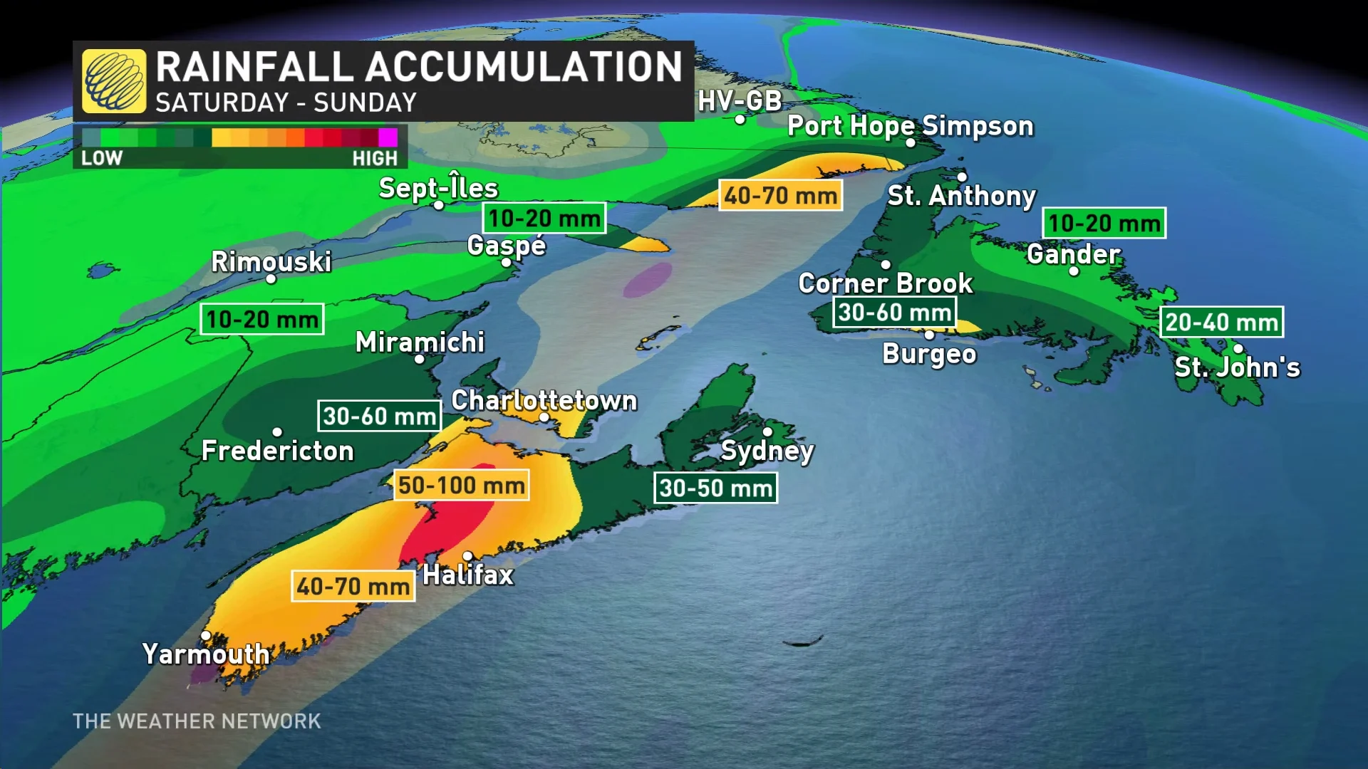
Locally heavy rainfall in the range of 50-100+mm is forecast for Nova Scotia, P.E.I. and parts of New Brunswick is forecast, resulting from extra moisture streaming northwards from the tropics.
Heavy snow is expected to the northwest of the storm track, including parts of northern and western New Brunswick.
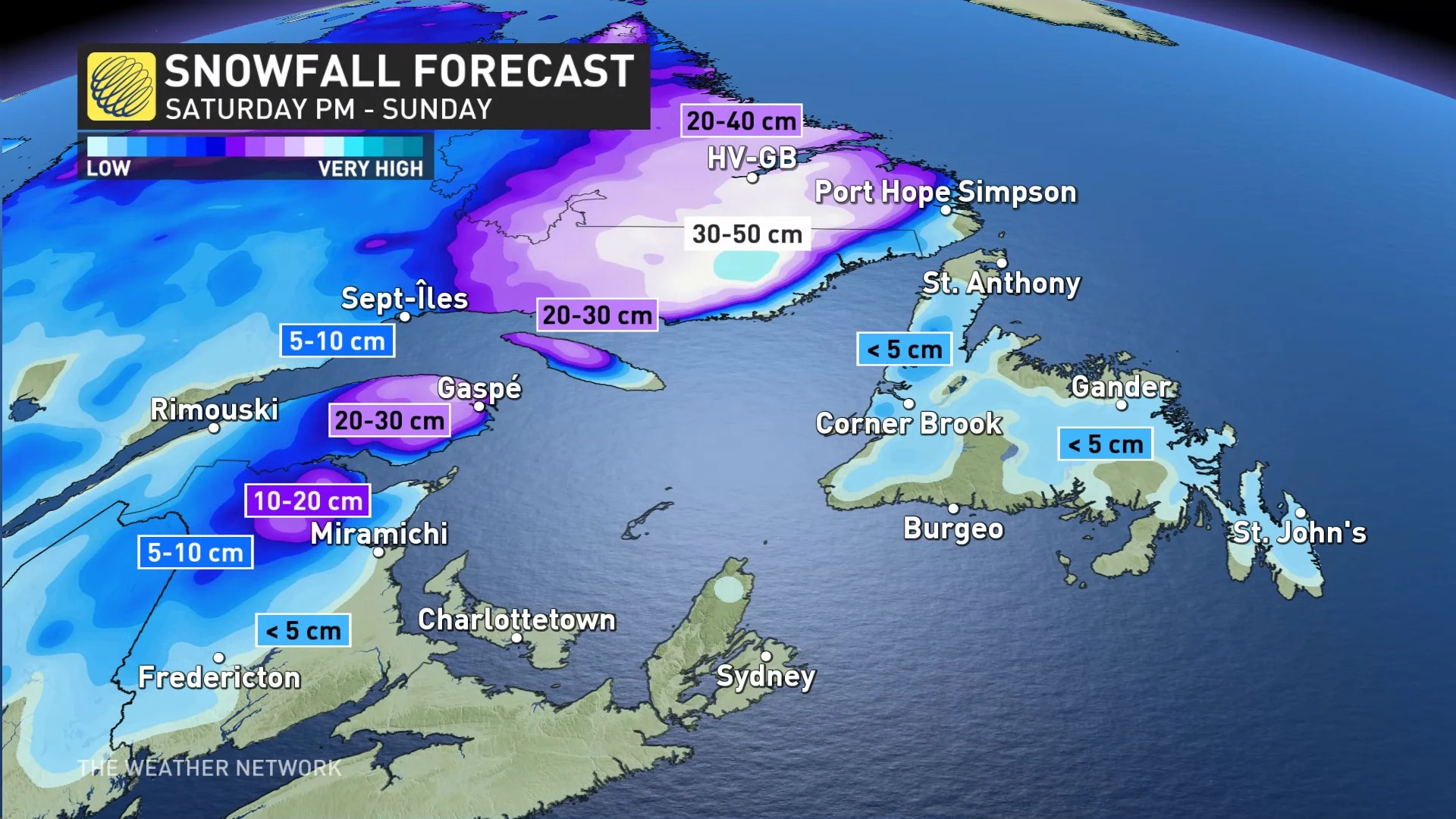
The exact track of the storm continues to waver, however, which could make all the difference in what kind of precipitation you can expect. A southward shift may put in the heavier snowfall to north and central New Brunswick, while a northward shift may mean all rainfall.
WATCH: Halifax, watching the potential for a nor'easter building this weekend
Questions arise about the system. How strong will it be? How quickly will it intensify? As it approaches Canada, it is expected to deepen and strengthen as multiple energy sources come together.
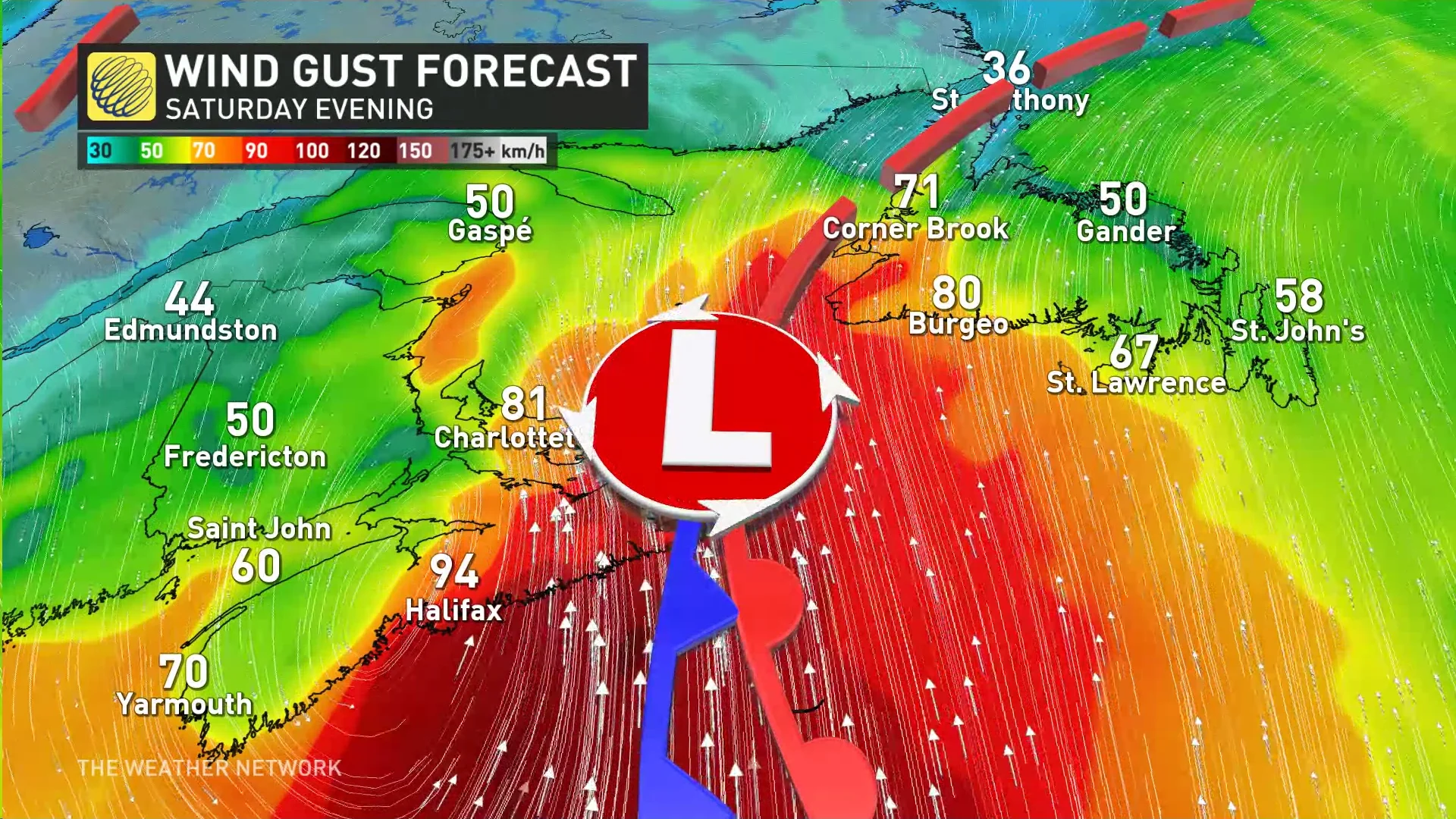
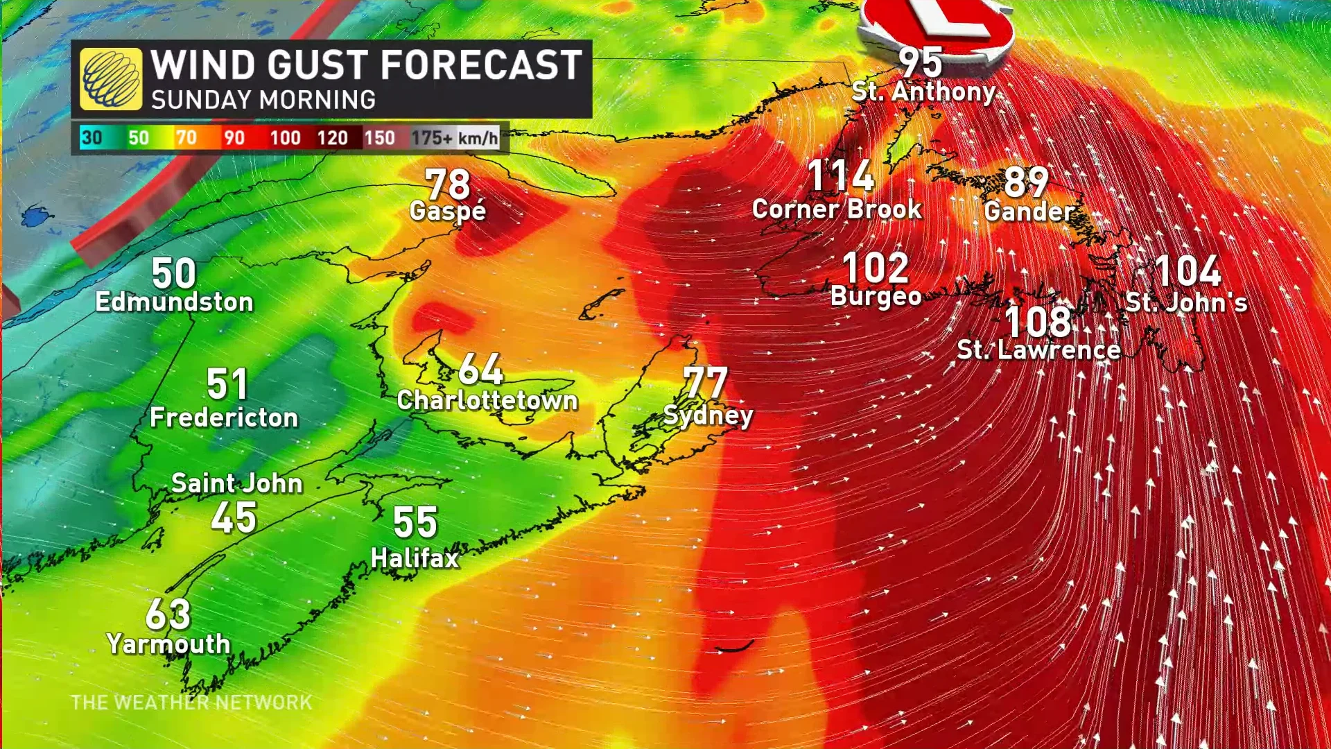
The process will generate intense wind gusts, potentially reaching 80+ km/h on Saturday.
Higher values may be probable, however, and could lead to power outages across the eastern Maritimes and Newfoundland through the weekend.
Blustery and much colder weather will spread into the region behind the storm.
Looking ahead, forecasters say another system is possible during the second half of next week. Colder than normal temperatures are expected to dominate during the final week of November.
Stay tuned to The Weather Network for the latest forecast updates in Atlantic Canada.