Windy, rainy, snowy system peaks over Atlantic Canada into Saturday
Folks across the Maritimes and Newfoundland have to get through one more foul day before conditions finally clear up throughout the region
We’ve endured multiple slogs of heavy rains across Atlantic Canada in recent days, and the region’s latest bout of drenching rain will is nearly finished.
Much of the rain that’s fallen since Wednesday came as two plumes of tropical moisture collided with a boundary parked over the East Coast.
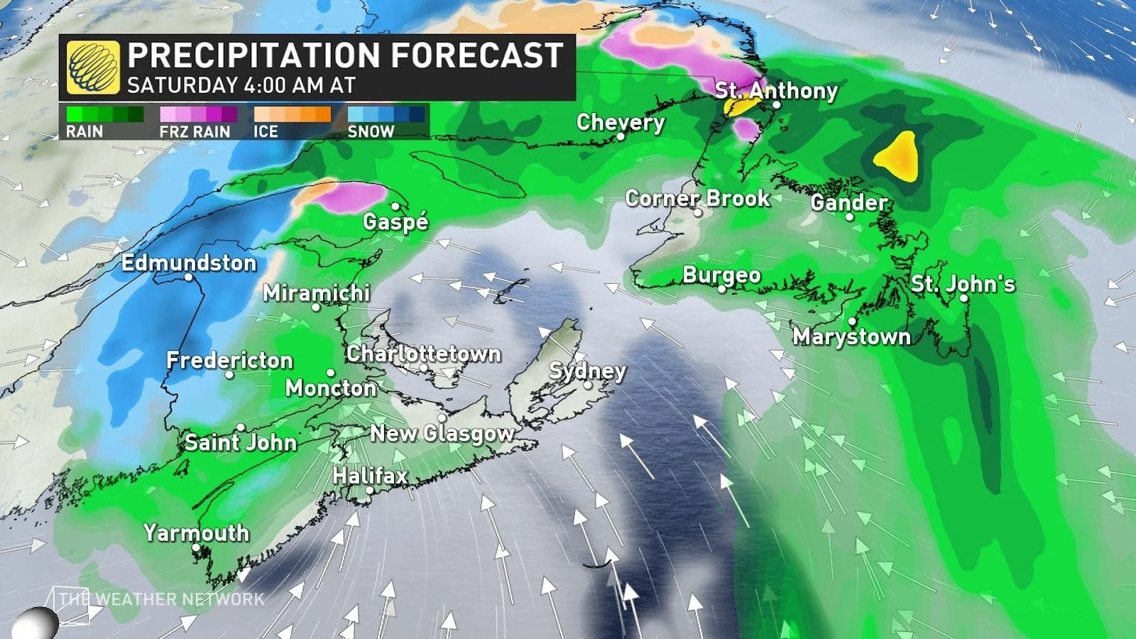
A low-pressure system moving into the Maritimes from the south will fuel this event’s last hurrah as heavy rain, periods of heavy snow, and gusty winds continue into Saturday morning.
DON'T MISS: Canada faces a fickle April as winter wanes and summer teases
Through Saturday: Rain and snow for a little while longers
Rain will persist into the first half of Saturday across much of the Maritimes and Newfoundland, where widespread rainfall warnings remain in effect.
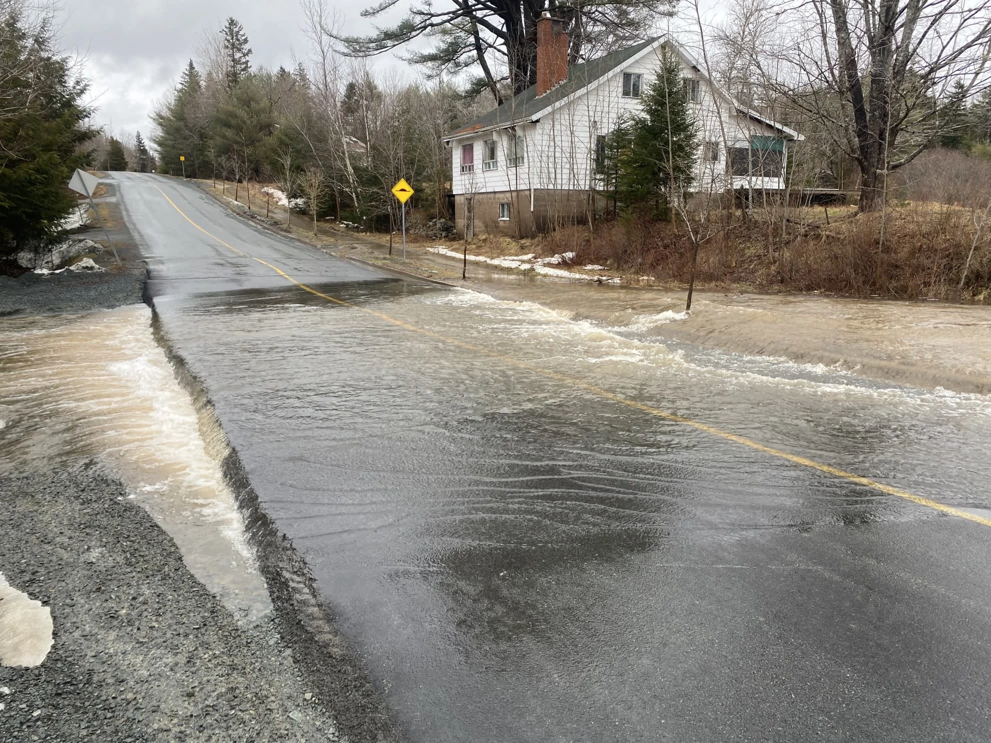
Some communities will see as much as 75-120 mm of rain in the gauges by the time precipitation finally lets up on Saturday. Soils are already soaked by recent rains, and additional heavy rainfall could lead to a threat for localized flooding.
Portions of the Maritimes that experience excessive rainfall are at a heightened risk for flooding over the next few days—especially given the storm we saw last weekend.
An important area to watch will be around the lower Saint John River. Due to ice jams and their unpredictable nature, it's hard to tell what the river levels will be like between Perth-Andover and Woodstock with this rainfall event.
River levels are forecast to reach a critical threshold around New Brunswick's Nashwaak and Durham Bridge in the coming days, so be sure to regularly check for public alerts and advisories if you are in this area.
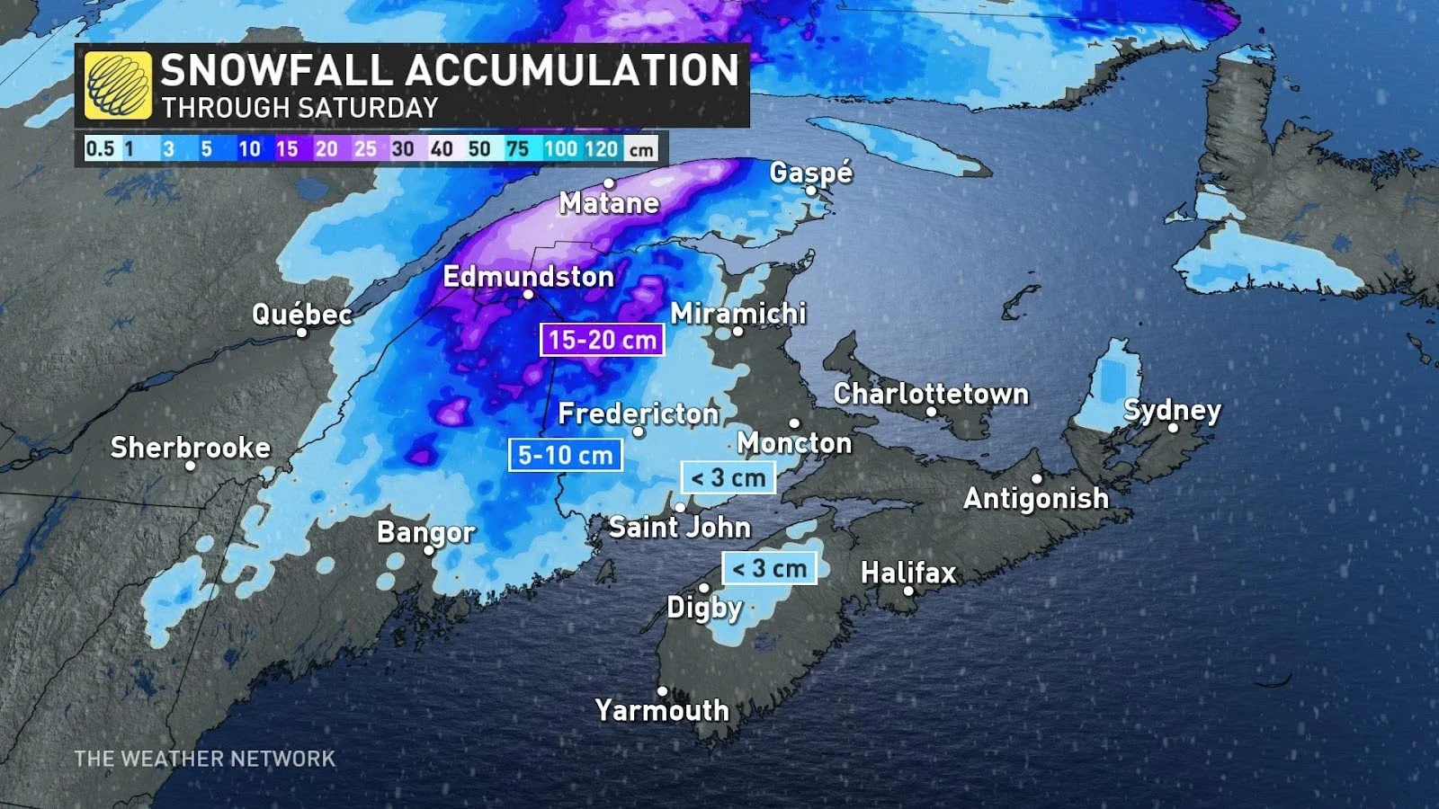
Cold air wrapping around this approaching low-pressure system will force rain to change over to snow for portions of western and northern New Brunswick.
Snowfall totals of 15-20 cm are on tap for communities near the international border through Saturday morning, including Edmundston, with totals up to 30 cm in spots at higher elevations.
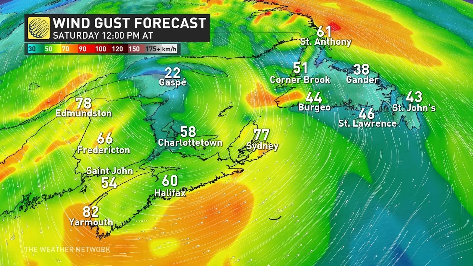
Winds will continue to increase as the centre of low pressure pushes into the Maritimes overnight Friday and into early Saturday. Gusts could climb as high as 60-90 km/h by early Saturday morning. The combination of gusty winds and rain-soaked soils could result in scattered power outages across the region.
Conditions will remain blustery and cool behind this system, with yet another messy system eyeing the region for the middle of next week. Some wintry weather is possible again with this next system.
WATCH: River watch is underway in New Brunswick as warmer weather approaches
Be sure to check back for the latest updates across Eastern Canada this week.


