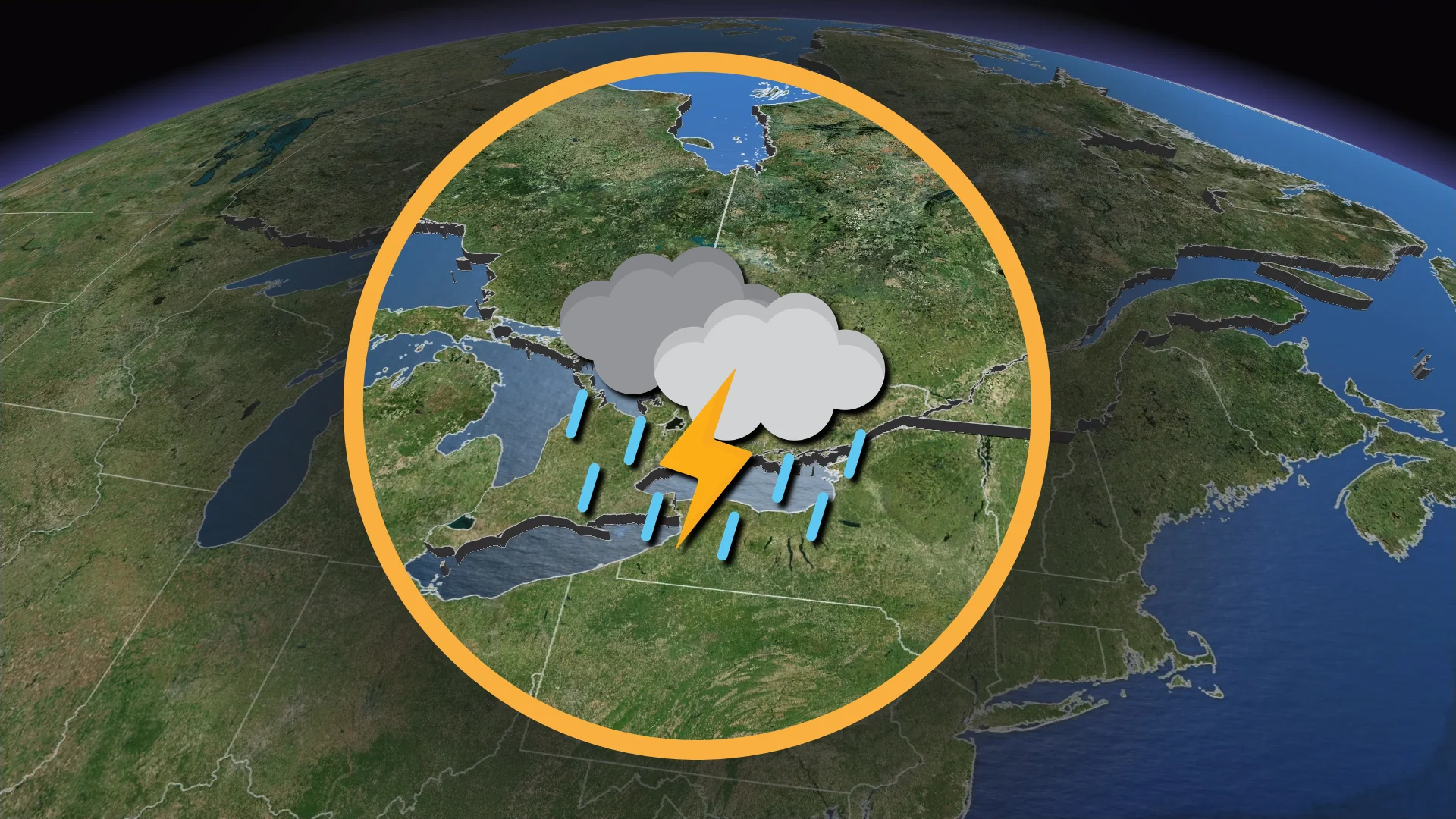
Heat wave fuels renewed severe storm risk in Ontario, Quebec
A significant spell of heat and humidity will fuel additional rounds of severe thunderstorms overnight Wednesday and into the day Thursday
A stormy couple of days across Ontario and Quebec will continue into Thursday as a heat wave fuels additional rounds of severe weather across the region.
Expect some severe thunderstorms during the overnight hours Wednesday, with a renewed risk building with the heat of the day again Thursday.
Pay close attention to watches and warnings in your area. Have a plan in place to act quickly if dangerous thunderstorms threaten your location. Avoid sleeping in rooms where falling trees or tree limbs could pose a hazard.
DON’T MISS: Canada’s July outlook holds a major flip-flop across the country
Wednesday night risk in cottage country, eastern Ontario
High levels of thunderstorm energy will hold steady through Wednesday night across northeastern and eastern sections of Ontario.
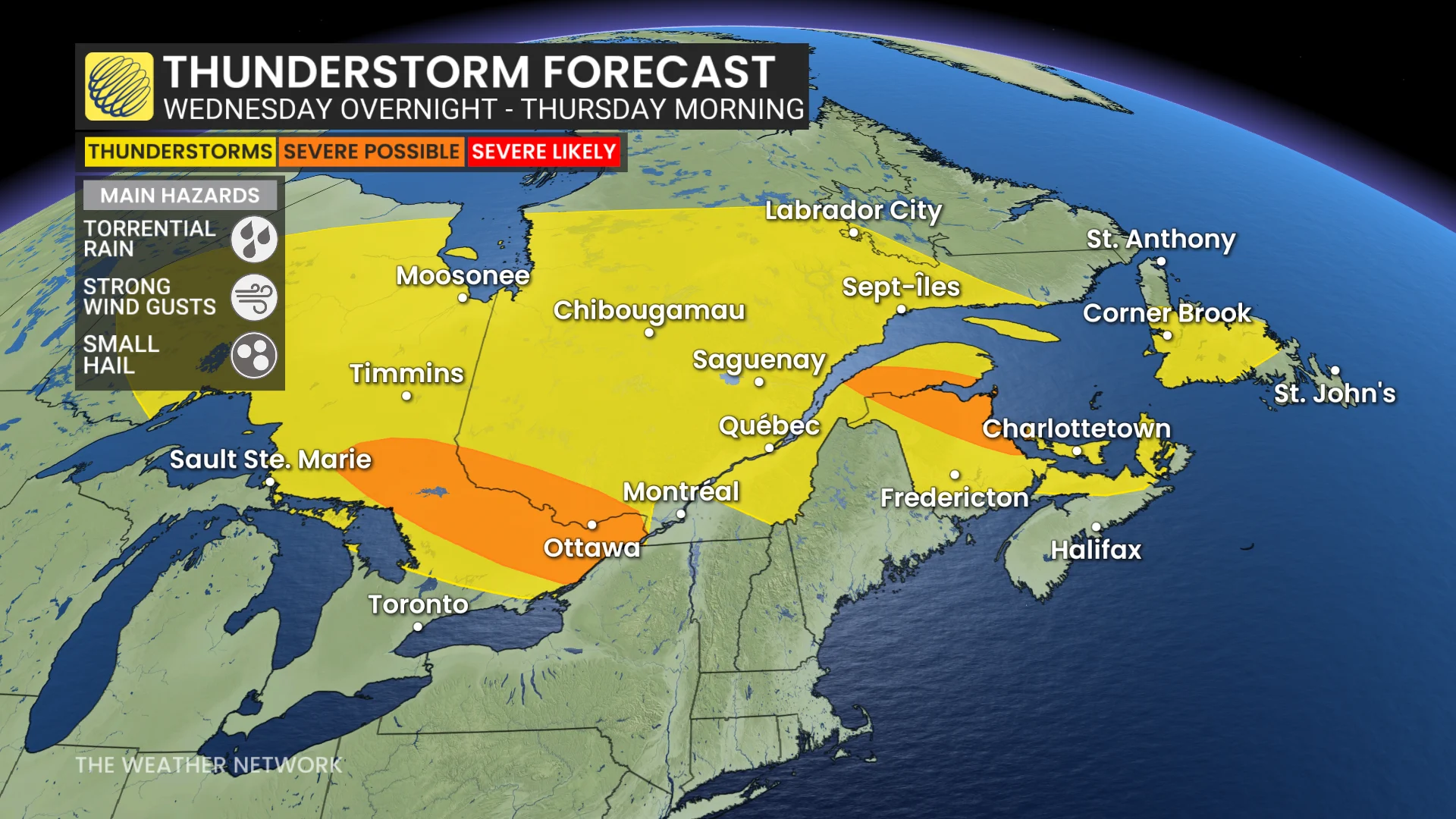
Some models indicate that an organized cluster of thunderstorms will develop, posing a risk for damaging wind gusts. High moisture will also allow for torrential rainfall.
There is a non-zero potential for rotation within this cluster of storms, especially in eastern Ontario. Nocturnal severe storms are particularly dangerous.
WATCH: How to stay safe as Toronto swelters in first major heat wave of the season
Thursday threat builds again over Ontario, Quebec
Daytime heating combined with an approaching cold front will trigger a risk for severe thunderstorms throughout the afternoon and evening hours on Thursday.
Most of the afternoon in the Greater Toronto Area should remain sunny with heat and humidity posing the greatest problem. That said, we’ll see the storm risk build along the 401 corridor from southwestern Ontario north through Montreal and up toward Quebec City.
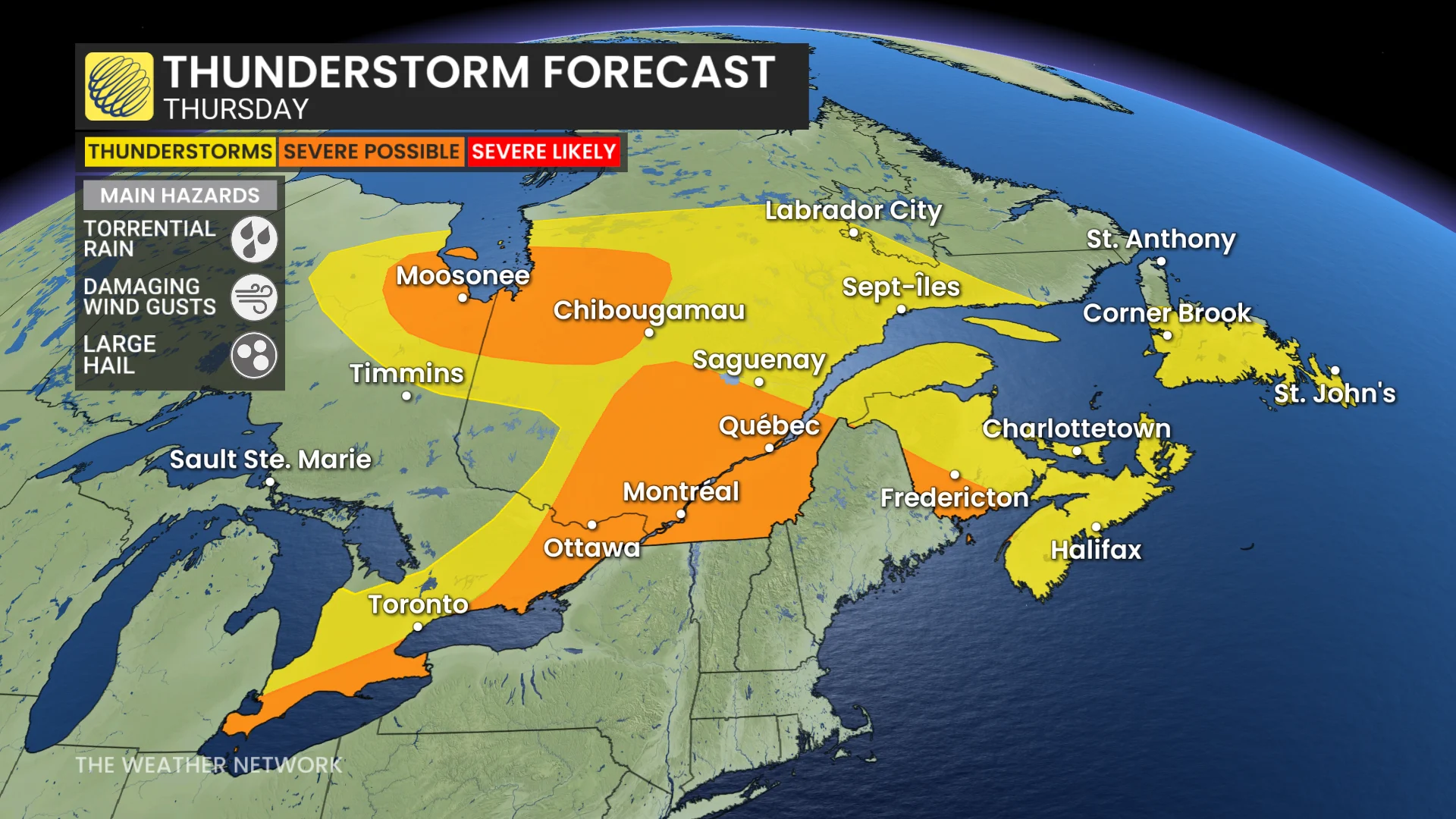
Torrential rainfall will be the primary threat with the high humidity in place. Storms could drop 30-50 mm of rain in a short period of time, which may lead to ponding or flash flooding.
The strongest storms could produce damaging wind gusts of 100 km/h, which may cause tree damage and power outages.
Some storms could also produce hailstones 2-4 cm in diameter across the Ottawa Valley and into the Eastern Townships. A non-zero threat for rotation also exists in the Eastern Townships.
There’s considerable uncertainty in the exact location of Thursday’s thunderstorm development with high heat in place and small-scale features acting to trigger the unsettled conditions.