LIVE: Severe storms firing up, tornado and very large hail risk grows
All the ingredients are coming together for another volatile day of severe thunderstorms over parts of the Prairies on Sunday, including a renewed threat for tornadoes and damaging hail
A tornado watch is in effect across portions of southern Saskatchewan and Manitoba amid a high-impact severe storm risk on Sunday afternoon. A tornado watch means that conditions are favourable for the development of tornadoes.
Any severe storms that develop may also be capable of producing very large hail, heavy rain, and strong wind gusts, Environment and Climate Change Canada (ECCC) added in its watch.
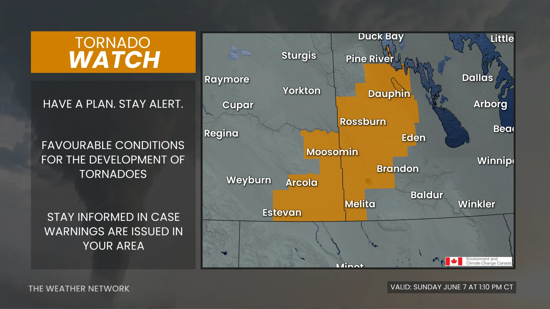
Pay close attention to the latest alerts in case the tornado watch is upgraded to a tornado warning in your area. Have a plan in place to seek safe shelter in case severe weather threatens your home, your office, or while you’re driving.
The original article with the full forecast for the Prairies continues below.
After a stormy Saturday that saw tornado warnings issued across parts of Saskatchewan and Manitoba, a potentially more impactful event is taking shape for similar regions on Sunday.
There is a threat of a few tornadoes and destructive hail. Take some time to ensure you have emergency supplies and a plan in place in case severe weather threatens your location.
RELATED: Tornado warning safety: Here’s what you should do
Severe weather threat builds again Sunday
The main event arrives during the day Sunday, when we’ll see ample instability, strong, upper-level winds, rich moisture, and a trigger to spawn storms all line up through the afternoon and evening hours.
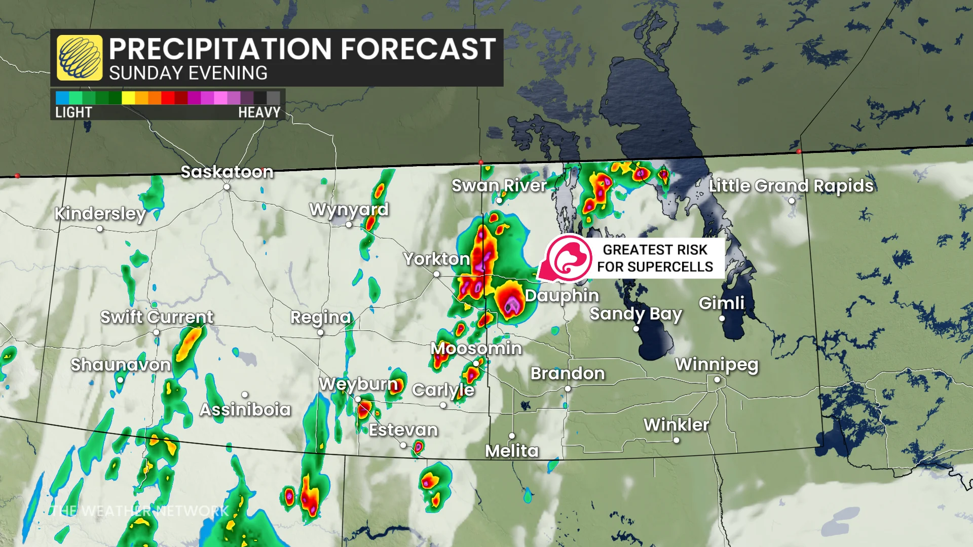
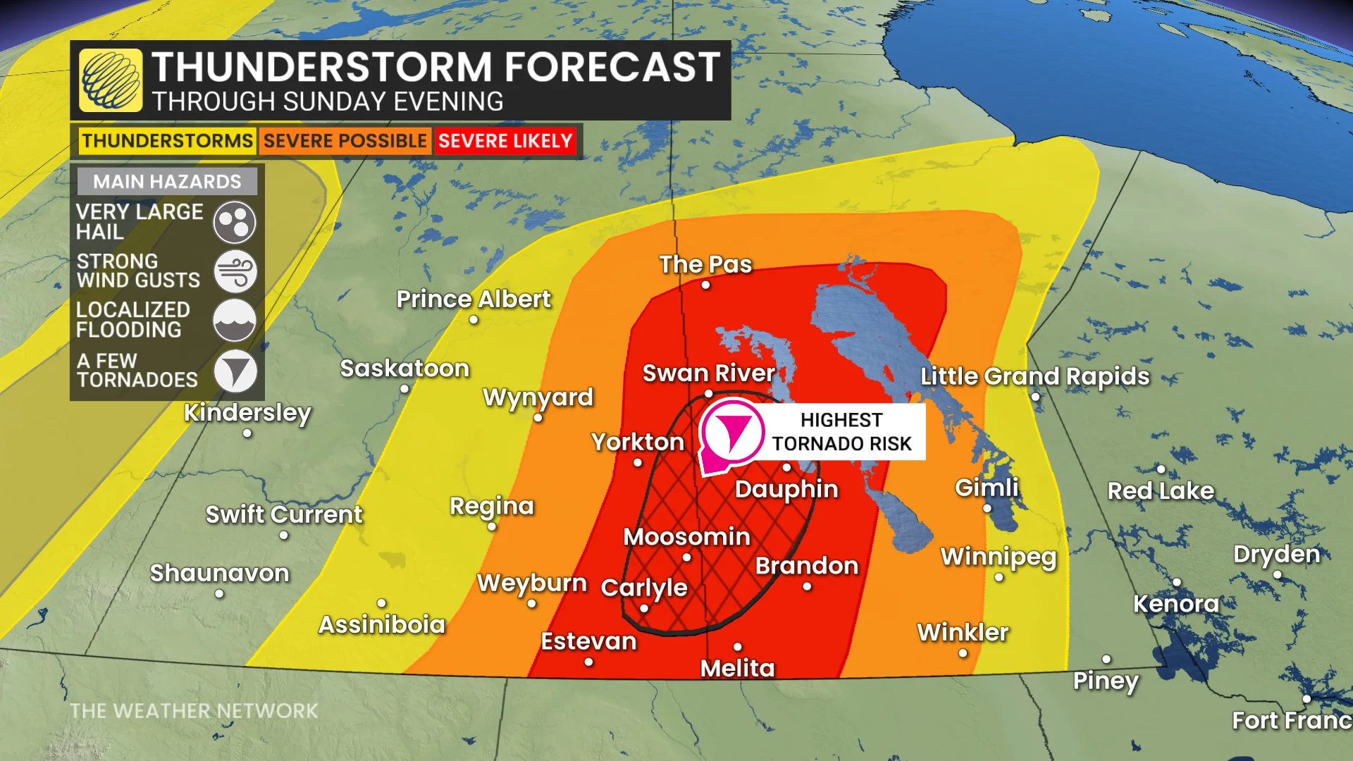
As a result, severe thunderstorms are likely across southern portions of Saskatchewan and Manitoba. This will be a more widespread risk than we saw on Saturday.
Sunday’s strongest storms will be capable of producing very large hail, damaging winds, and a few tornadoes. Some of the hail could approach the size of baseballs.
Localized flooding is also possible where thunderstorms repeatedly move over the same areas.
Through Sunday overnight and the pre-dawn hours of Monday, thunderstorms are likely to become linear as they slowly track eastward.
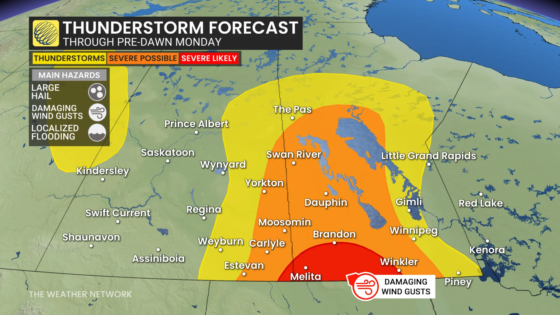
The threat into the nighttime hours should transition to mostly damaging wind gusts as the storms congeal into a line. The greatest potential for damaging winds will exist across southern Manitoba toward the international border, including Brandon, Melita, and Winkler.
Large hail and localized flooding are also possible.
WATCH: Spectacular supercell steals the show on the Prairies
Severe weather safety is paramount
Pay close attention to rapidly changing weather conditions in your area through the day Sunday. For tips on what to do in case a tornado warning is issued, click here.

Scout out a safe place to take shelter in your home well before storms approach your location. The safest place is an interior room on the lowest level of the building. The goal is to put as many walls as possible between you and flying debris.
If you’re in a vehicle and a tornado warning is issued, pull over at the nearest sturdy shelter. Never try to outrun a tornado.
Residents in impacted areas are urged to keep cell phones charged ahead of the storm in case of any power disruptions or outages to receive weather alerts (click here to see how to turn on alert notifications from The Weather Network app).
Stay with The Weather Network for all the latest on conditions across the Prairies.