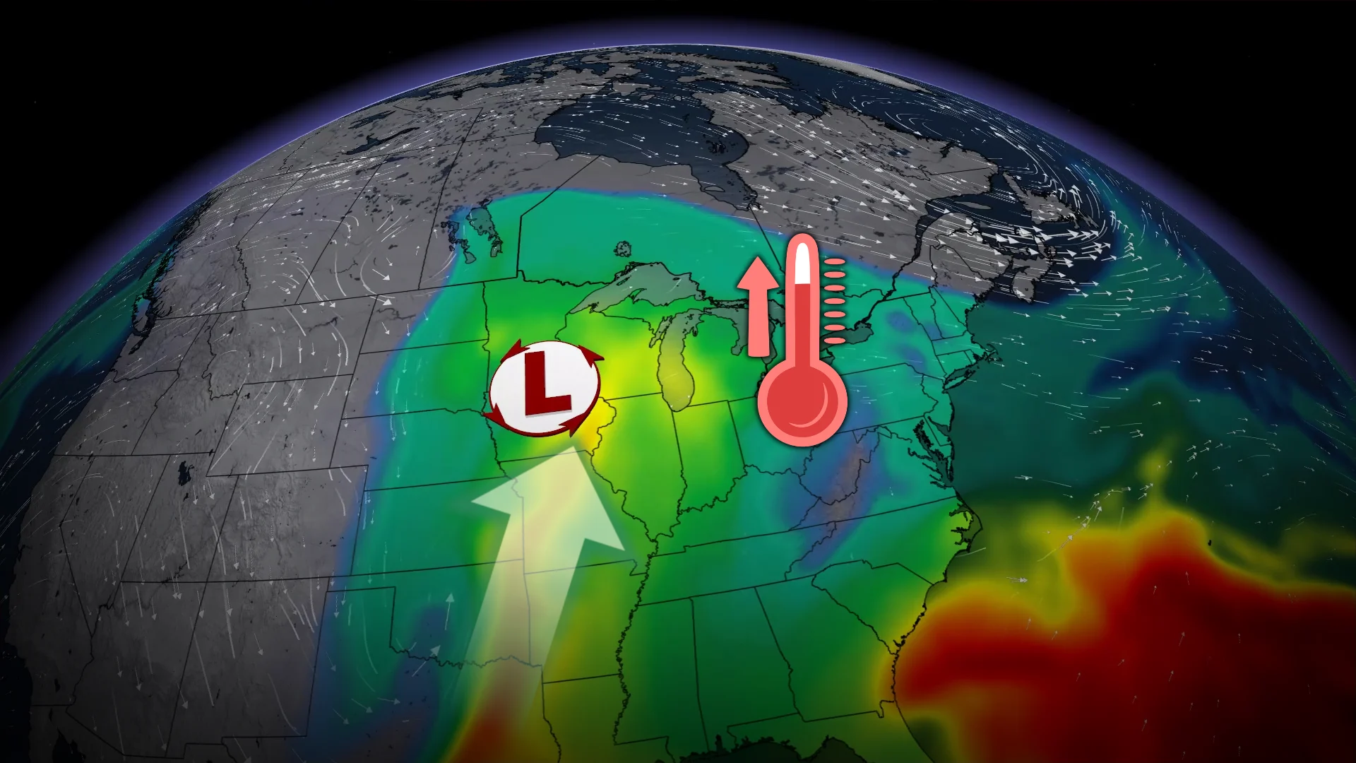
Hawaiian moisture will travel 7,000 km to Ontario next week

A potent atmospheric river will wash into North America over the weekend, sending deep moisture streaming toward Ontario next week
El Niño will flex its influence in the days ahead as a potent atmospheric river aims for the U.S. desert Southwest.
This surge of moisture will continue heading north and stream toward Ontario by next week, fuelling heavy rainfall across parts of the province.
DON’T MISS: What’s a Pineapple Express? Diving into this robust atmospheric river
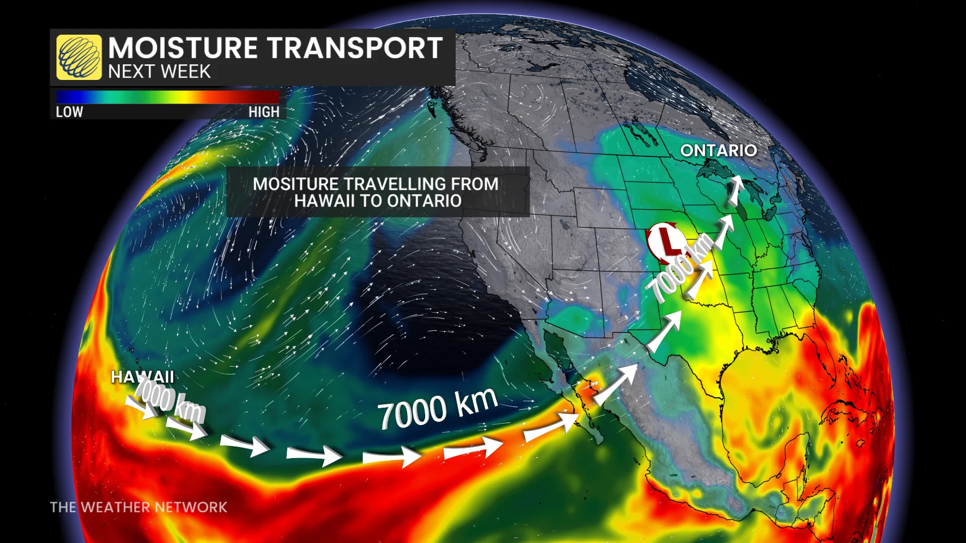
An approaching atmospheric river will rank as a strong AR4 to an AR5 as it approaches the Baja Peninsula and surges across the southwestern United States this weekend.
Multiple rounds of severe storms have affected the U.S. Southwest this month. Officials confirmed at least five tornadoes in Arizona and New Mexico last week, alongside numerous reports of hailstones the size of golf balls or larger. Organized severe weather outbreaks are unusual for the region.
Waves of heavy rainfall also helped raise Utah’s Lake Powell, a critical source of hydroelectric power, more than 4.3 metres from a historic low in mid-September. The lake’s pool elevation remains more than 30 metres below normal for the end of October.
Moisture moving over the Rockies will feed into a Colorado low that’s expected to develop and track toward Ontario through early next week. This will be Ontario’s first Colorado low of the season.
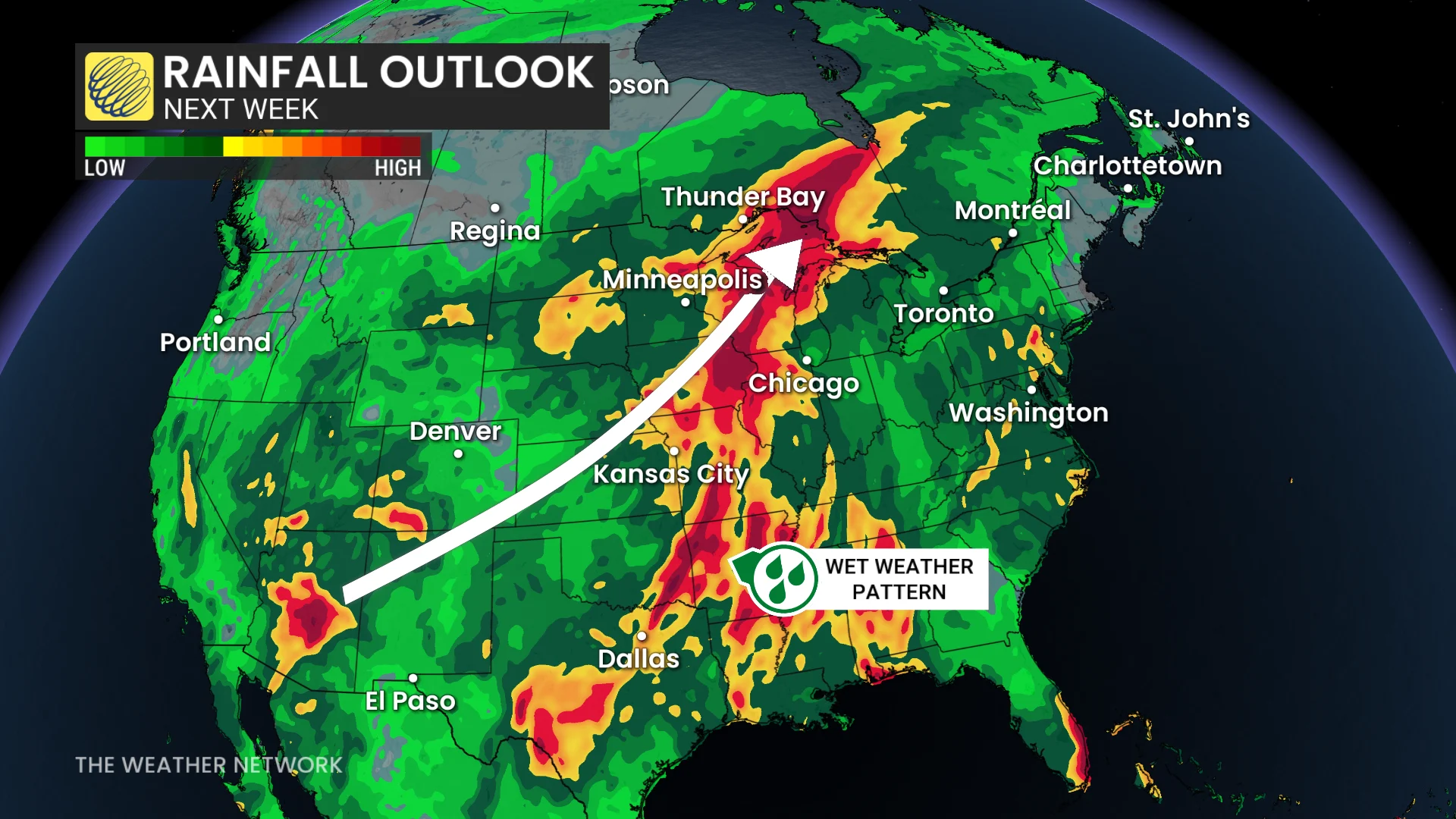
The system and its deep reserve of atmospheric moisture will fuel heavy rainfall across parts of Ontario. Computer guidance currently shows 50-75+ mm of rain in northwestern and northeastern Ontario.
Folks across southern Ontario will see an additional round of above-seasonal temperatures as the low-pressure system tracks into the province.
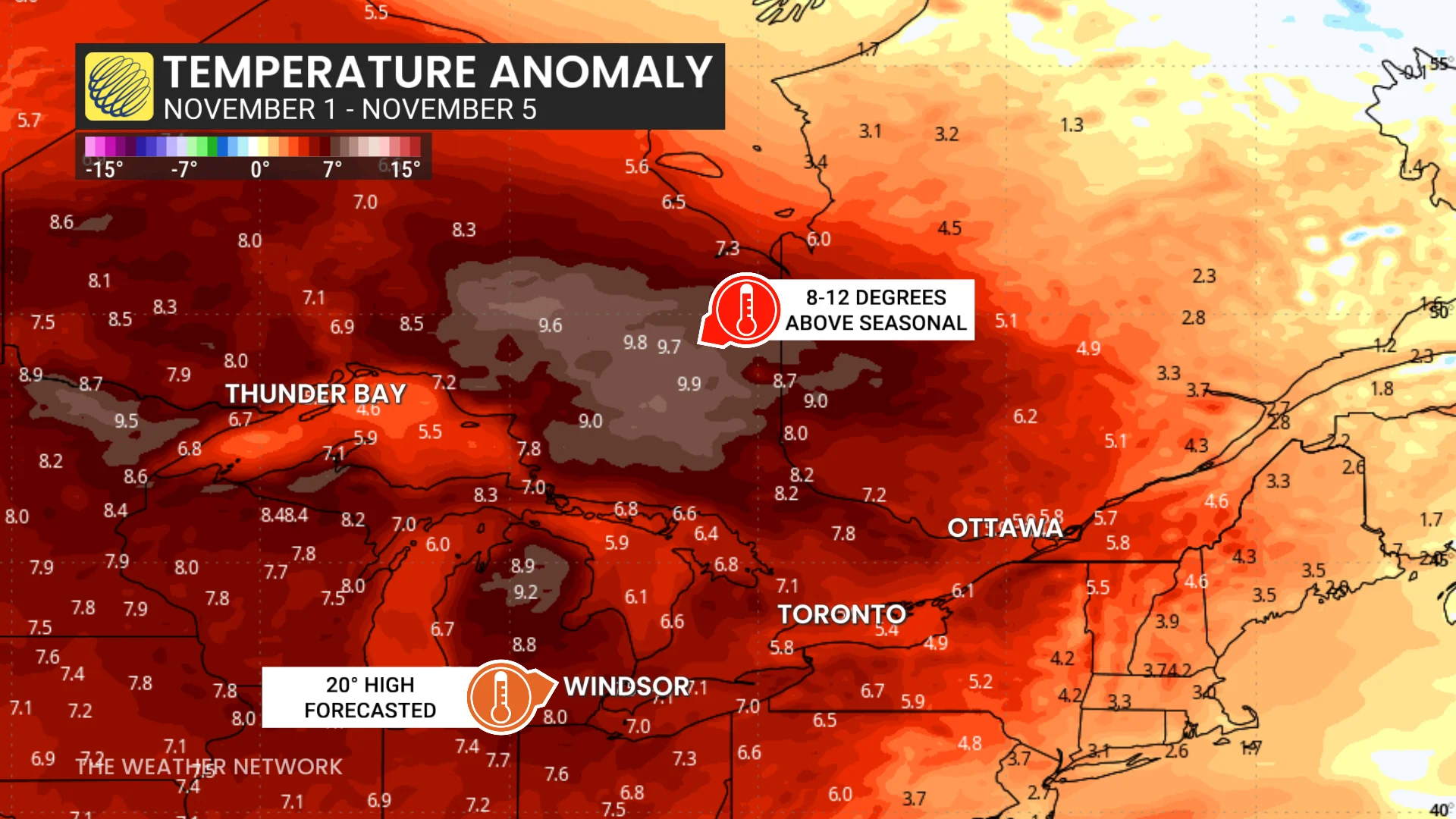
Readings will range 8-12 degrees above seasonal for part of next week. Windsor is expected to string together several consecutive 20-degree days.
But some uncertainty remains around the track of the system. If the low-pressure system tracks farther east, we would see a risk for heavy rain push closer to southern Ontario. Forecasters will continue to monitor the track of the storm and its potential impacts through the weekend.
Stay with The Weather Network for all the latest on conditions across Ontario.