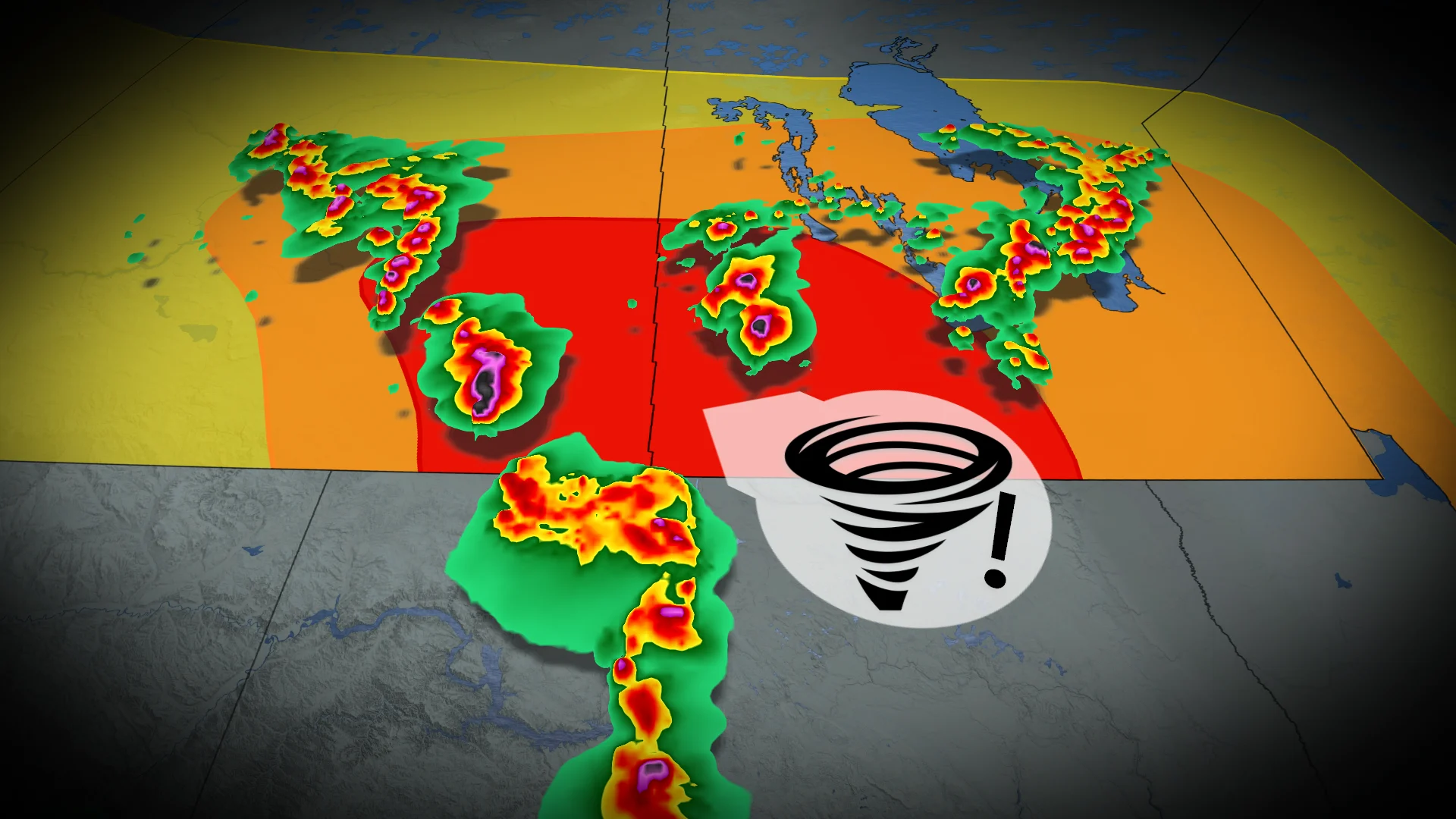
Hail and tornado risk return to Saskatchewan and Manitoba
More severe weather targets the eastern Prairies this week
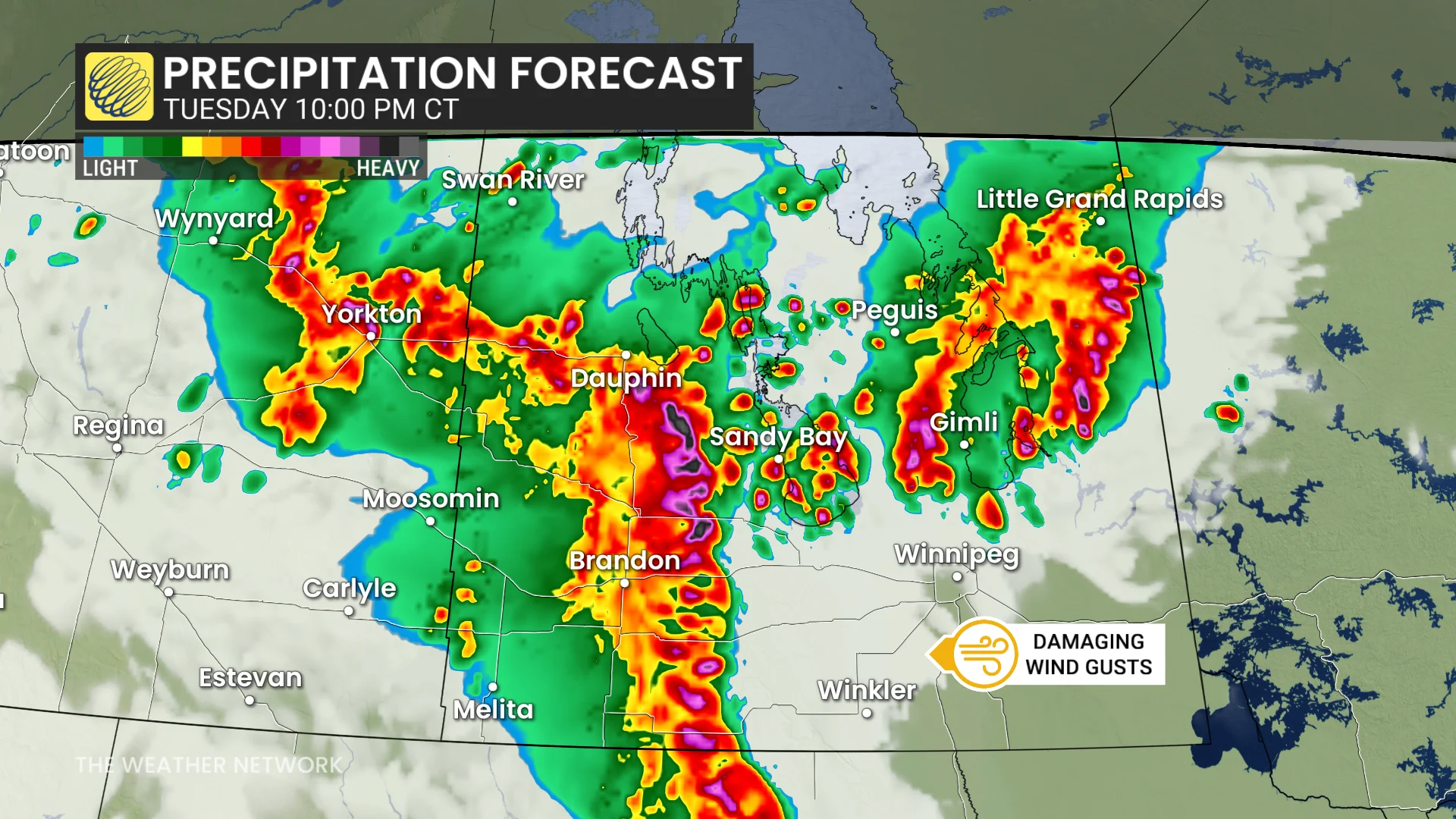
Severe weather is set to return to southern Saskatchewan and Manitoba on Tuesday after an active weekend across the Prairies. Key atmospheric conditions are aligning to support the development of severe thunderstorms in the region.
RELATED: Tornado warning safety: Here’s what you should do
Severe weather threat returns to the Prairies Tuesday
A negatively tilted trough over the Rockies, along with a strong jet stream extending into Manitoba, will enhance severe weather potential.
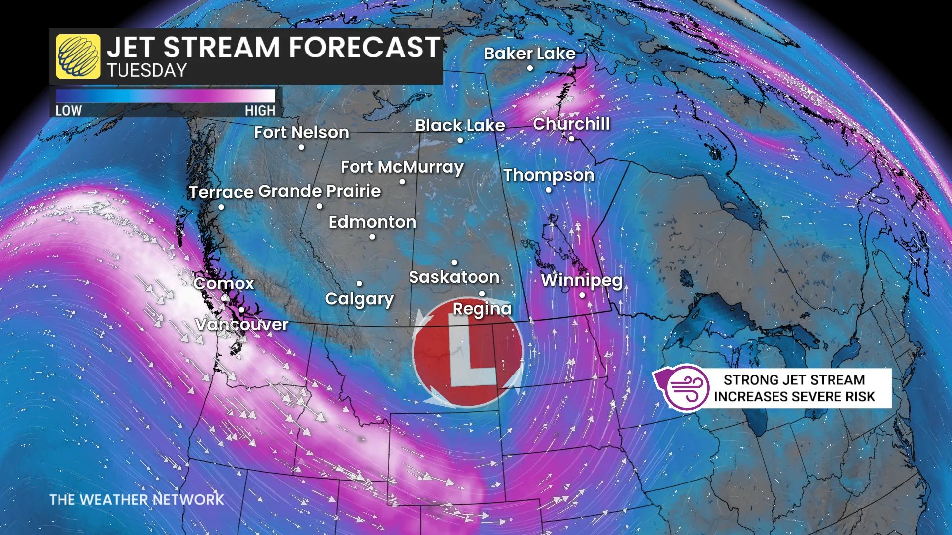
A surface low is expected to develop east of the Rockies in Montana and track northeast, acting as the main trigger for explosive storm development.
Conditions will feature high instability with ample CAPE, moisture, and steep lapse rates, creating an environment primed for severe thunderstorms.
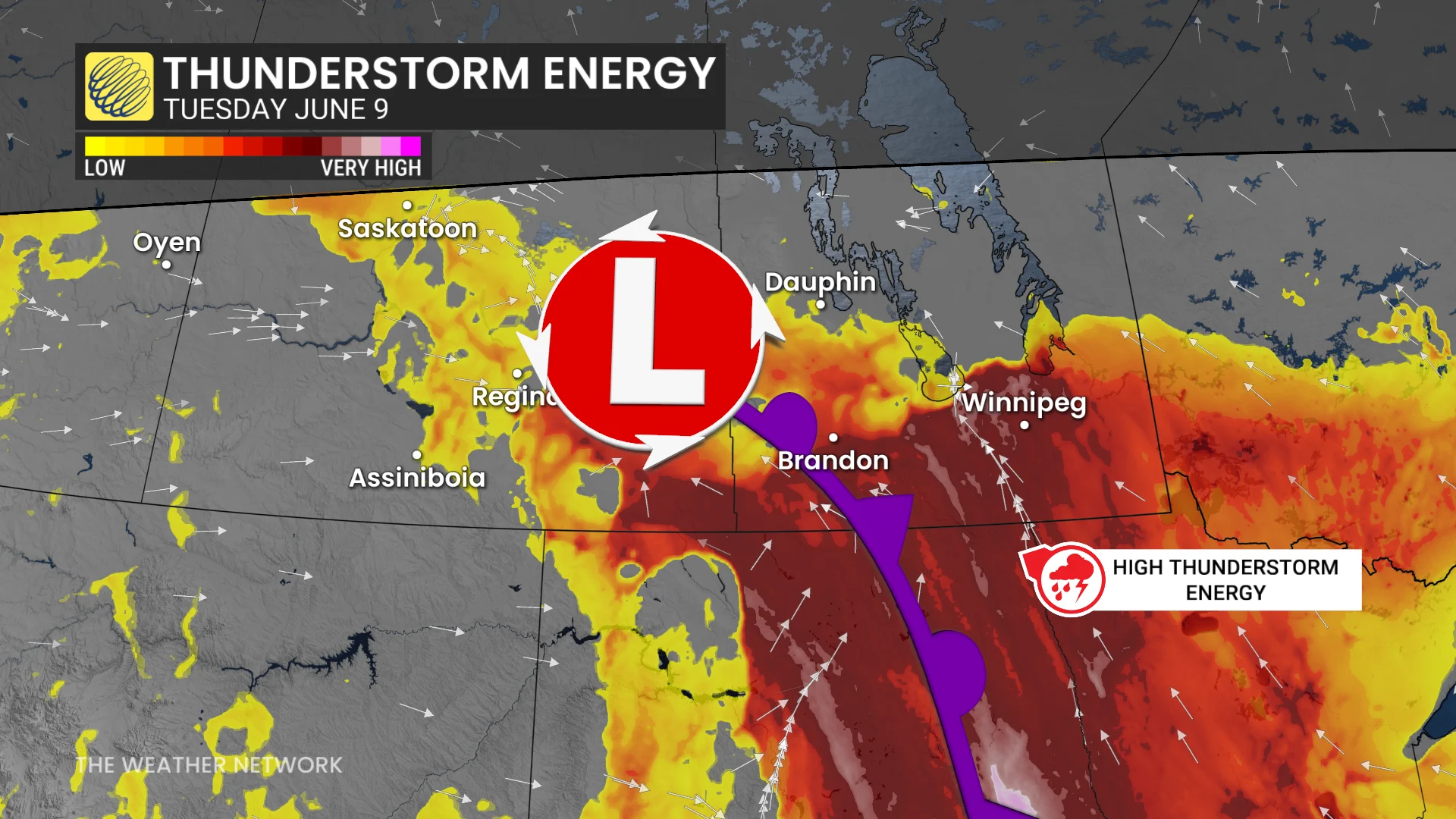
By late Tuesday afternoon and evening, high-based supercells are forecast to develop over the southern Saskatchewan-Manitoba border, moving eastward.
These cells bring a significant risk for large to possibly very large hail. By evening, strengthening low-level wind shear may increase the potential for tornado development.
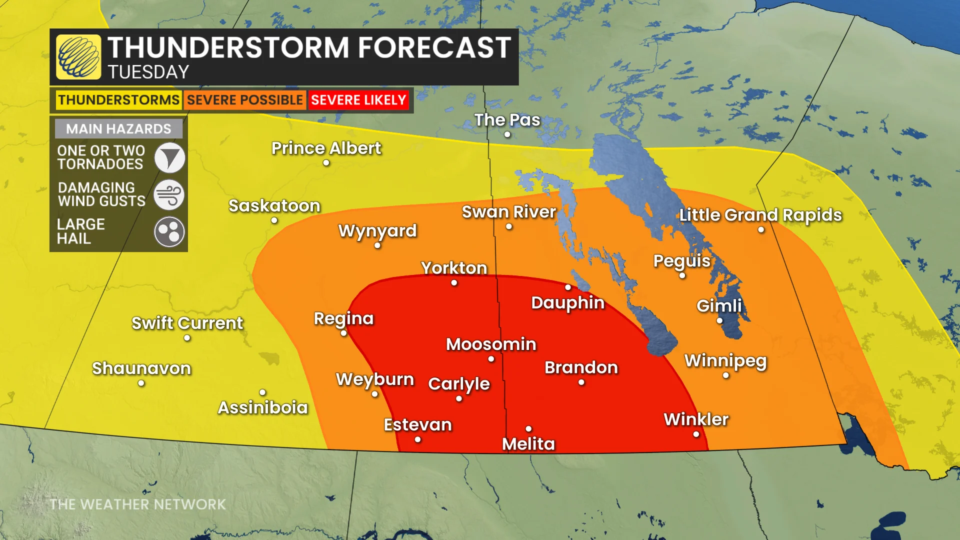
Later overnight, storms could consolidate into a mesoscale convective system (MCS), capable of producing damaging winds as it moves through areas such as Brandon and Winnipeg.
Confidence in large hail potential remains high, while the tornado threat is moderately certain, with storm locations subject to further refinement.
Residents should monitor evolving forecasts and local alerts closely.
WATCH: Spectacular supercell steals the show on the Prairies
Severe weather safety is paramount
Pay close attention to rapidly changing weather conditions in your area through the day Tuesday. For tips on what to do in case a tornado warning is issued, click here.

Scout out a safe place to take shelter in your home well before storms approach your location. The safest place is an interior room on the lowest level of the building. The goal is to put as many walls as possible between you and flying debris.
If you’re in a vehicle and a tornado warning is issued, pull over at the nearest sturdy shelter. Never try to outrun a tornado.
Residents in impacted areas are urged to keep cell phones charged ahead of the storm in case of any power disruptions or outages to receive weather alerts (click here to see how to turn on alert notifications from The Weather Network app).
Stay with The Weather Network for all the latest on conditions across the Prairies.