Flooding, large hail and wind concerns with southern Ontario severe storm risk

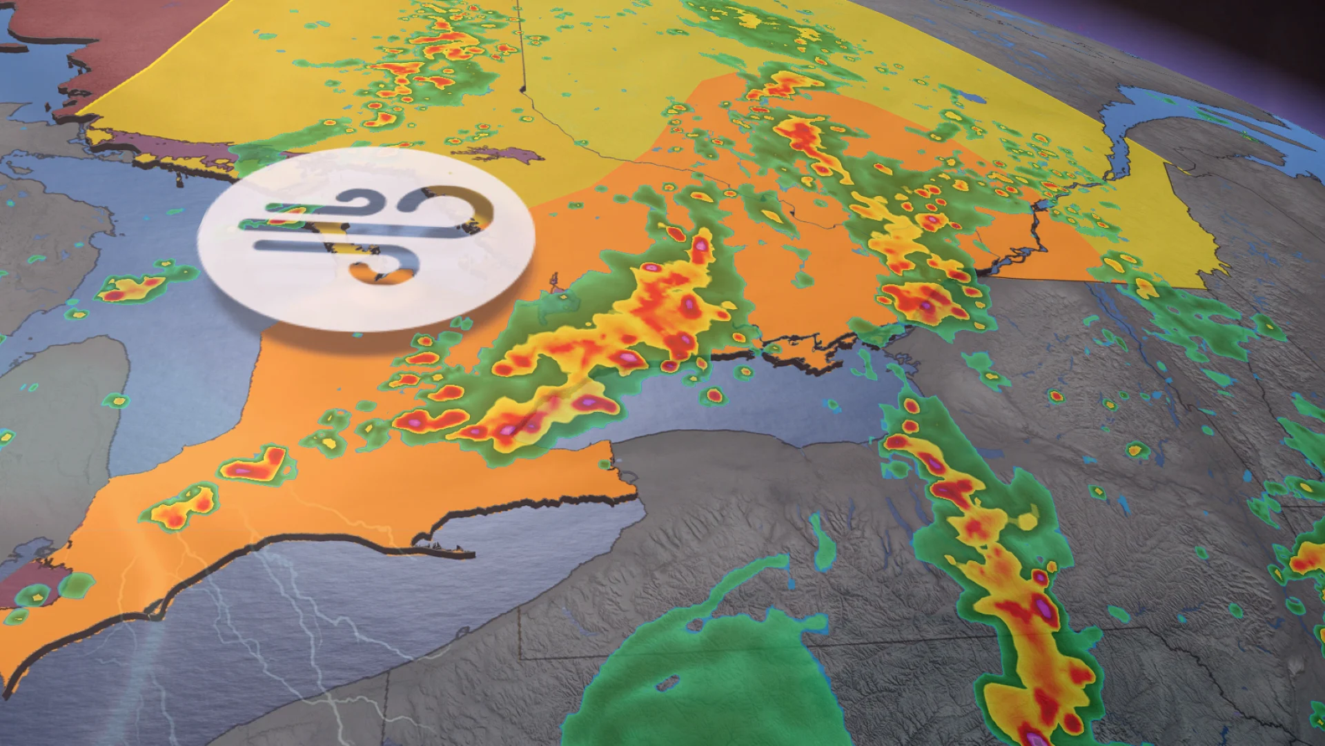
On Tuesday, the thunderstorm risk returns to the lower Great Lakes with multiple rounds expected in southern Ontario. There will be a widespread risk of severe storms, potentially bringing hail, damaging wind gusts and localized flooding as the primary hazards
A low-pressure system that tracked across the Prairies over the weekend will continue its eastward journey on Tuesday, bringing storms to Ontario.
The storm threat will shift south on Tuesday, with multiple rounds. The main hazards in severe storms will be large hail, damaging wind gusts, and heavy downpours--elevating the localized flooding risk. There's also the potential for a tornado or two to develop, but the higher chance will remain stateside.
SEE ALSO: Tornado causes 'significant damage' to parts of west-central Alberta county
Please keep up with the latest watches and warnings in your area. Take immediate action if a severe thunderstorm or tornado warning is issued for your location.
Widespread storm risk Tuesday, risk of isolated tornado
Tuesday will features multiple rounds of thunderstorms across Ontario, with initial, warm-front storms developing early Tuesday morning.
The morning commute in southwestern Ontario and the Greater Toronto Arwa (GTA) is likely to be slowed down by rain and storms.
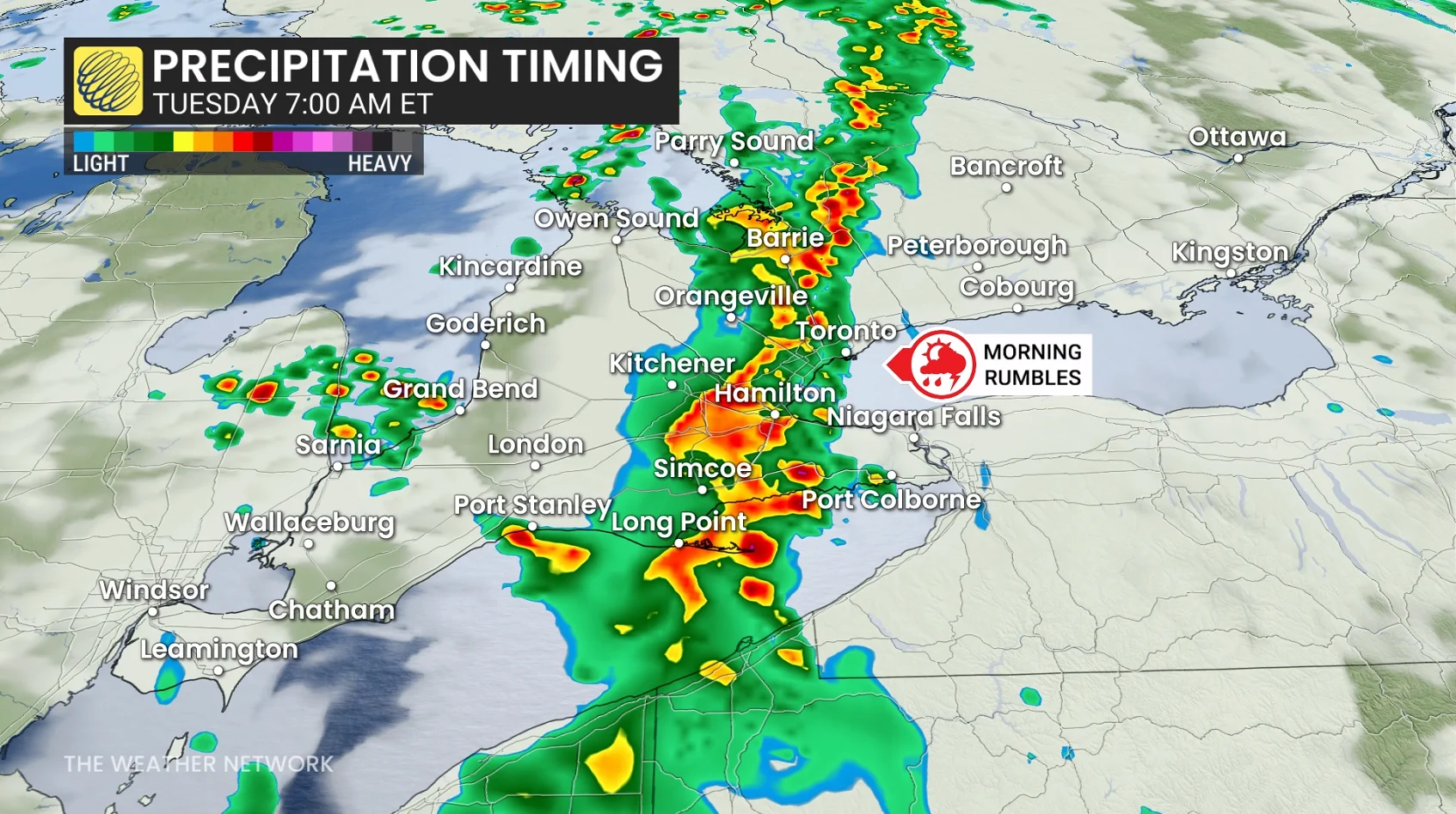
An unorganized mess of warm-front storms are expected in eastern Ontario, while cold-front storms are forecast in southwestern sections.
The higher wind and isolated tornado risk will be near and south of the 401 corridor, with heavy rain and hail threatening the entire region.
DON'T MISS: Showering during a thunderstorm: Risky business or just a myth?
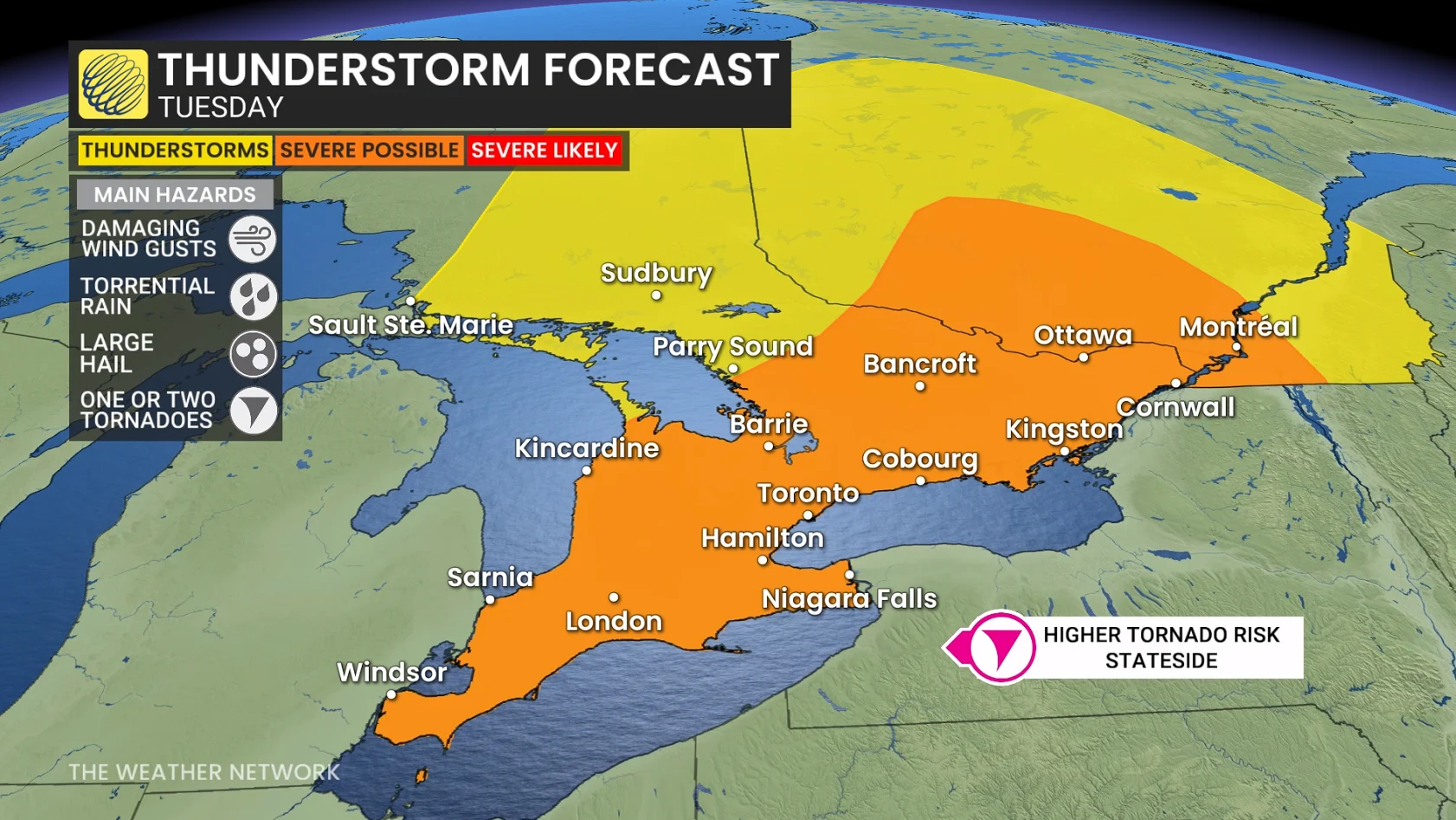
Tuesday afternoon, in the warm sector of the low, instability builds to moderate-to-high levels, initiating multiple lines of thunderstorms across southern Ontario ahead of the trailing cold front.
In the Kingston-Brockville-Cornwall corridor, storms could potentially be a bit stronger due to better dynamics Tuesday afternoon.
The highest tornado risk will likely exist stateside, so heavy rain, localized flooding and damaging winds remain the primary threats in Ontario on Tuesday.
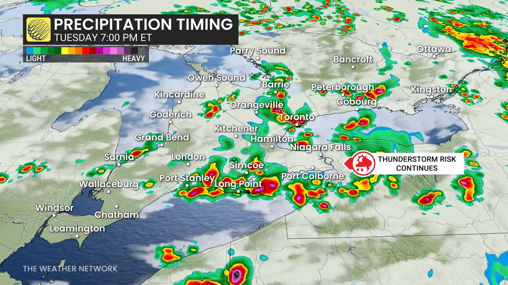
There's an unusual amount of moisture in the atmosphere, so flooding is a moderate concern. Locally, up to 40-60+ mm of rainfall is possible for some in the orange area.
Isolated power outages are possible with wind gusts surpassing 90 km/h in the strongest thunderstorms.
Confidence is high for multiple storm clusters over the next couple of days, but lower regarding their severity.
Stay with The Weather Network for the latest on your weather across Ontario.