Glancing blow from Pacific storm may impact weekend travel in B.C.

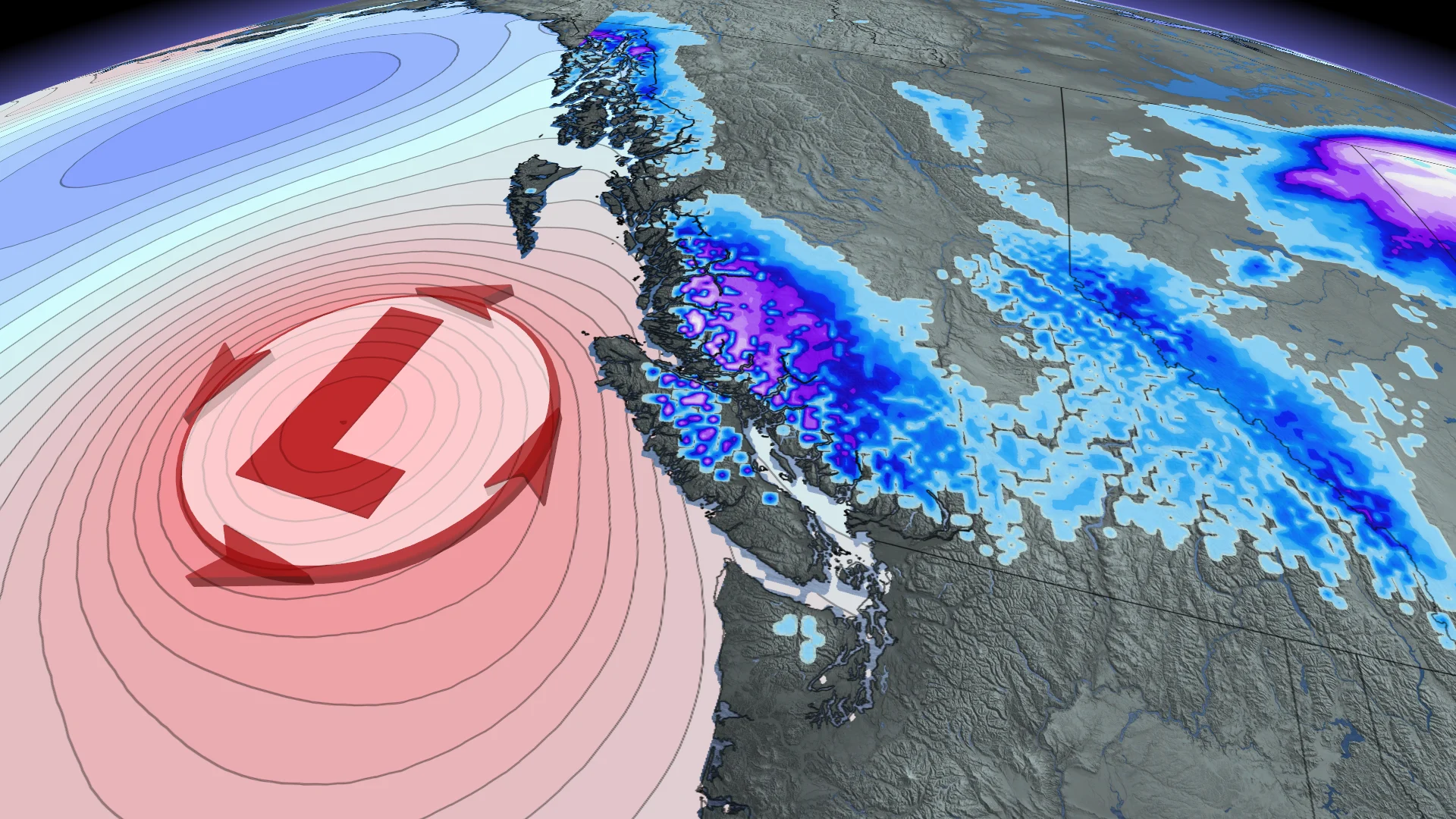
A Pacific low brewing off the British Columbia coast will bring a glancing blow of rain and snow to parts of the province over the weekend, impacting travel on some highways
After a bout of notable warmth and dryness across British Columbia earlier in October, it's now the start of fall storm season for the coastal province. The season will kick off this weekend with a Pacific low brewing off the coast, although it isn't forecast to move much over the weekend.
SEE ALSO: Exploring Hornby Island: Inside the "Seaweed School" adventure
Luckily, the storm will stay far enough offshore to only give the province a glancing blow in terms of impactful weather.
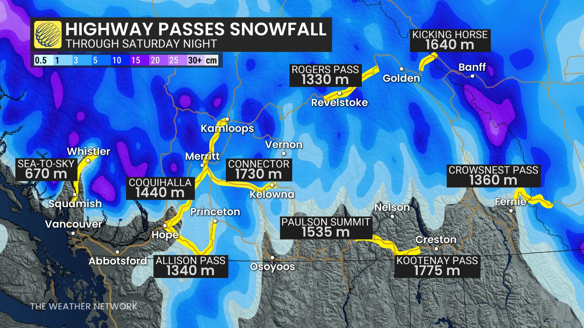
Atmospheric moisture will move in over the South Coast through Saturday and collide with a cold airmass currently sitting over the province. This will result in a quick decrease in freezing levels and a round of alpine snow along some mountain highway passes.
As freezing levels fall below 1,000 metres by Saturday evening, parts of the Coquihalla and Allison Passes, as well as the Connector to Kelowna, could see 5-10 cm of snow.
DON'T MISS: So long, summer: A final checklist for properly closing your cottage
B.C.'s winter tire requirement for mountain passes came into effect on Oct. 1; travel may still be impacted from the Lower Mainland through the Interior late Saturday.
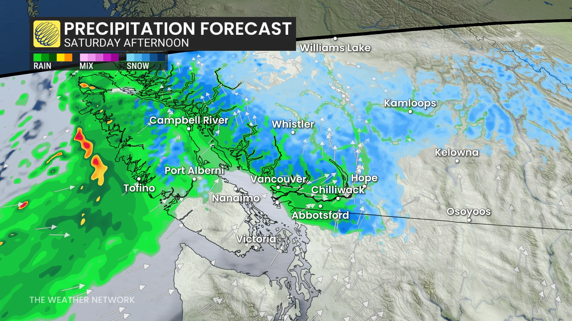
Along the Lower Mainland, we'll see the precipitation fall mainly as rain, although it won't be any significant amount—only 5-10 mm.
Since the low is forecast to stay offshore, wind likely won't be a concern either.
Stay with The Weather Network for more information and updates on your weather across B.C.