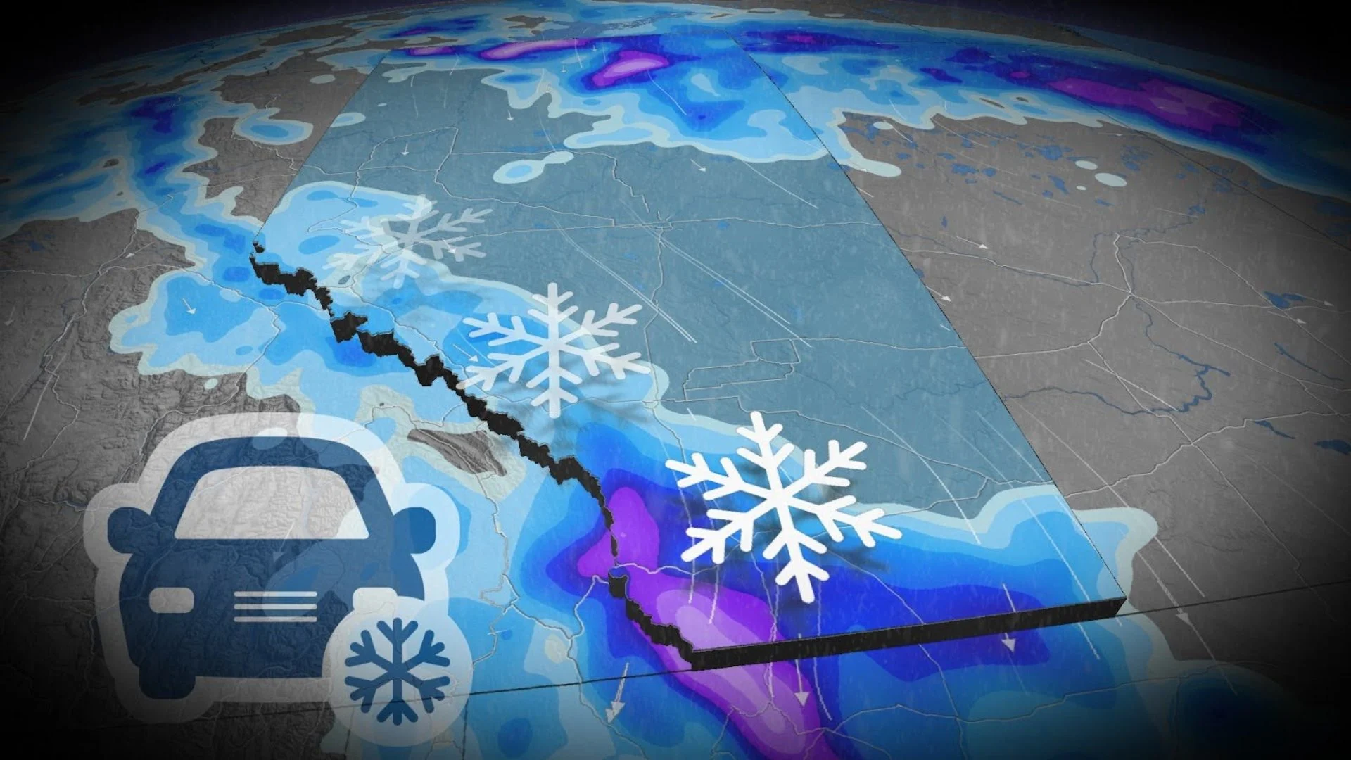
Disappearing warmth in Alberta replaced by 10-20 cm of snow for some
Alberta's 20-degree temperatures will soon be gone as cold air funnels south, bringing the threat for snow into portions of the province on Wednesday
Spring’s volatility will continue across Alberta over the next few days.
After starting the week with warm and double-digit temperatures across the south, the chance for snow chances returns as early as Wednesday.
RELATED: Canada snags its first tornado of the year and the credit goes to...
This may not be the last of April's snow chances, either. While there's still some uncertainty at this time, another band of snow could develop south of Edmonton on Thursday.
Snow threat returns to southern Alberta by Wednesday
By Wednesday morning, we'll see a return of below-average temperatures as a cold front sends temperatures closer to the freezing mark, bringing snow back to the southern foothills.
There's also the chance for snowfall near southern Calgary Wednesday morning, extending south into Claresholm, Pincher Creek, and Lethbridge.
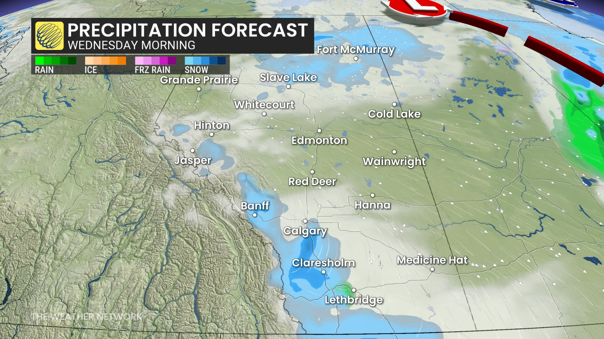
The snow will likely melt on contact, but with about 3 cm possible for areas in the southwest.
Across the higher elevations of the Rockies, between 10-20 cm of snow is forecast.
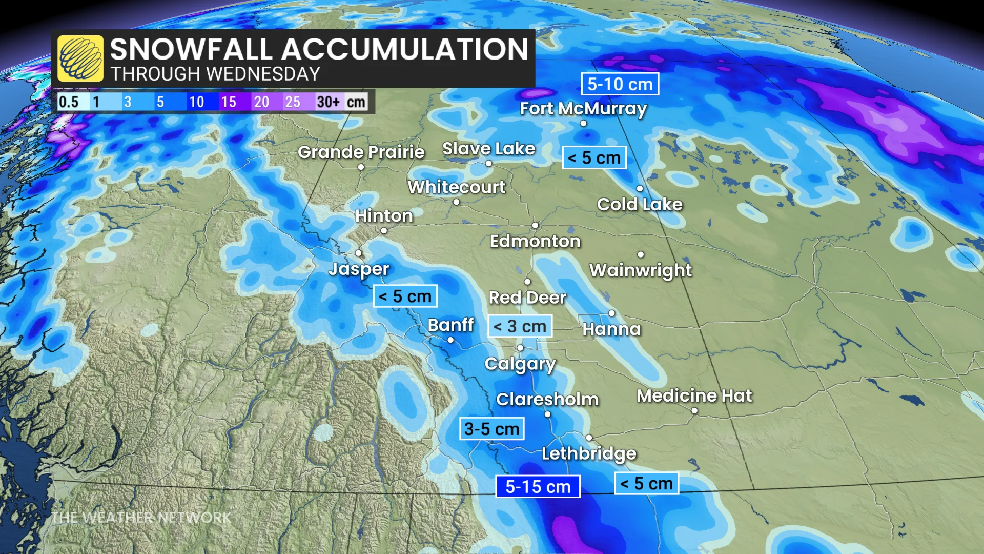
While the snow will clear out by the evening hours on Wednesday, that might not be the last of the April snow that falls. Some snow bands may develop on Thursday around Calgary, but there's still a lot of uncertainty at this time.
DON'T MISS: Get to know the hidden gems across Canada
Snowfall is not uncommon in Alberta for March and April. March is the snowiest month on average with 23.8 cm that falls, and April follows closely behind with 22.9 cm.
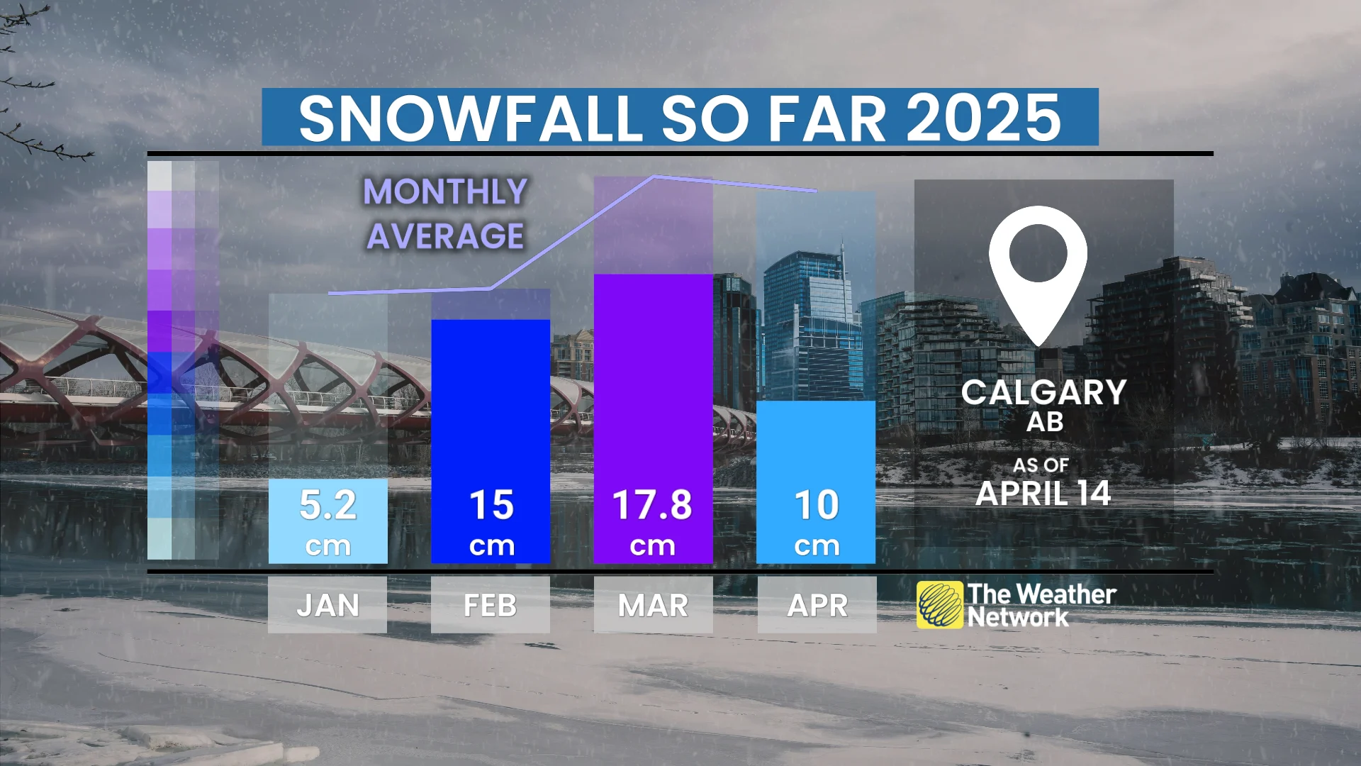
So far, 2025 has has seen below normal snowfall for the spring season.
Be sure to check back for the latest weather updates across Alberta