
Get ready for rough winds, heavy rain to hammer B.C. into Saturday
A potent storm pushing into the West Coast will bring blustery conditions, heavy rain, and copious alpine snows through the weekend
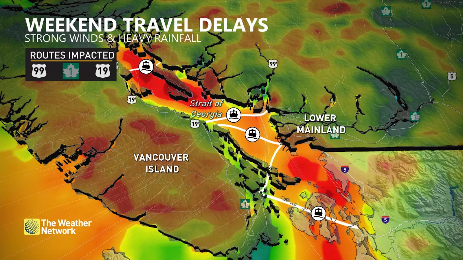
It’s going to be a rough 36 hours across parts of British Columbia expecting high winds, heavy rain, and deep alpine snows from a duo of Pacific systems pushing ashore this weekend.
Power outages are possible from the gusty winds, which may also bring travel delays and ferry cancellations throughout the region.
Conditions will deteriorate across Vancouver Island and the Lower Mainland overnight Friday into early Saturday. Intense precipitation rates are possible, and drivers are urged to plan ahead for rapidly changing conditions.
DON'T MISS: These winter driving hacks can save you some trouble (and time)
Through Saturday
Rainfall rates will approach 10 mm per hour across western Vancouver Island as heavy precipitation flows into the region. Conditions will begin to ease here by early Saturday as the front moves onto the Lower Mainland.

A dip in freezing levels below 1200 metres will coincide with the arrival of heavy precipitation along the South Coast, bringing the opportunity for significant snowfall along the coastal mountains.
Folks throughout the coastal alpine regions could see more than 50 cm of snow through Saturday, which will serve as a tremendous boon for ski resorts and winter sports fans looking to get out this weekend.
However, the glut of snow will make for difficult travel along the highway passes. Pack extra supplies and prepare for slow going if you have to travel through the region.
RELATED: Why B.C.'s Coquihalla Highway is a danger in the winter
Elevations near 1000 metres may experience periods of mixing between rain and snow as heavy precipitation rates pull down cooler air from above.
WATCH: Tricky travel this weekend for much of B.C.'s South Coast
Folks below 1000 metres will see heavy rain and gusty winds for the duration of this event.
Wind gusts of 60-70+ km/h, with even higher gusts over the Straits, will lead to the risk for power outages, travel delays, and ferry cancellations.

Winds will spread Friday evening from Campbell River southeast near the San Juan Islands by Saturday morning.
Forecasters expect more than 100 mm of rain for Tofino, with 20-60 mm expected across the Lower Mainland during this event.

The intensity of the system will diminish through Saturday, but another storm arriving soon after on Sunday will mark the return of active weather.
Unsettled weather will continue into the middle of next week, but the storm track will eventually start to shift south later in the week, taking the most active weather into California and Oregon. A somewhat drier pattern is expected during the second half of November.
Stay tuned to The Weather Network for the latest on conditions across B.C.