Excessive rainfall and funnel cloud chance comes with Prairies storm risk

Another day, another risk of thunderstorms for many on the Prairies, which could see funnel clouds develop Sunday. The long stretch of storm potential will also extend into this week, with the severe chance shifting into Manitoba on Monday
The Prairies' latest run of stormy weather will continue into Father’s Day on Sunday as a risk pops in Alberta and Saskatchewan through the afternoon hours.
Central Alberta will also be on the hook for substantial rainfall this week, which could lead to localized flooding in spots. But the rain is a welcome sight, both for agricultural areas and for regions hit hard by a historic start to this year’s wildfire season.
DON’T MISS: Global pattern upheaval triggers come-and-go summer for Canada
A strong trough dipping over Western Canada is responsible for the ongoing series of severe thunderstorms we’ve seen over the past couple of days.

The heat of the day on Sunday will elevate the storm threat, pushing it a bit farther east as a centre of low pressure begins tracking toward Saskatchewan.
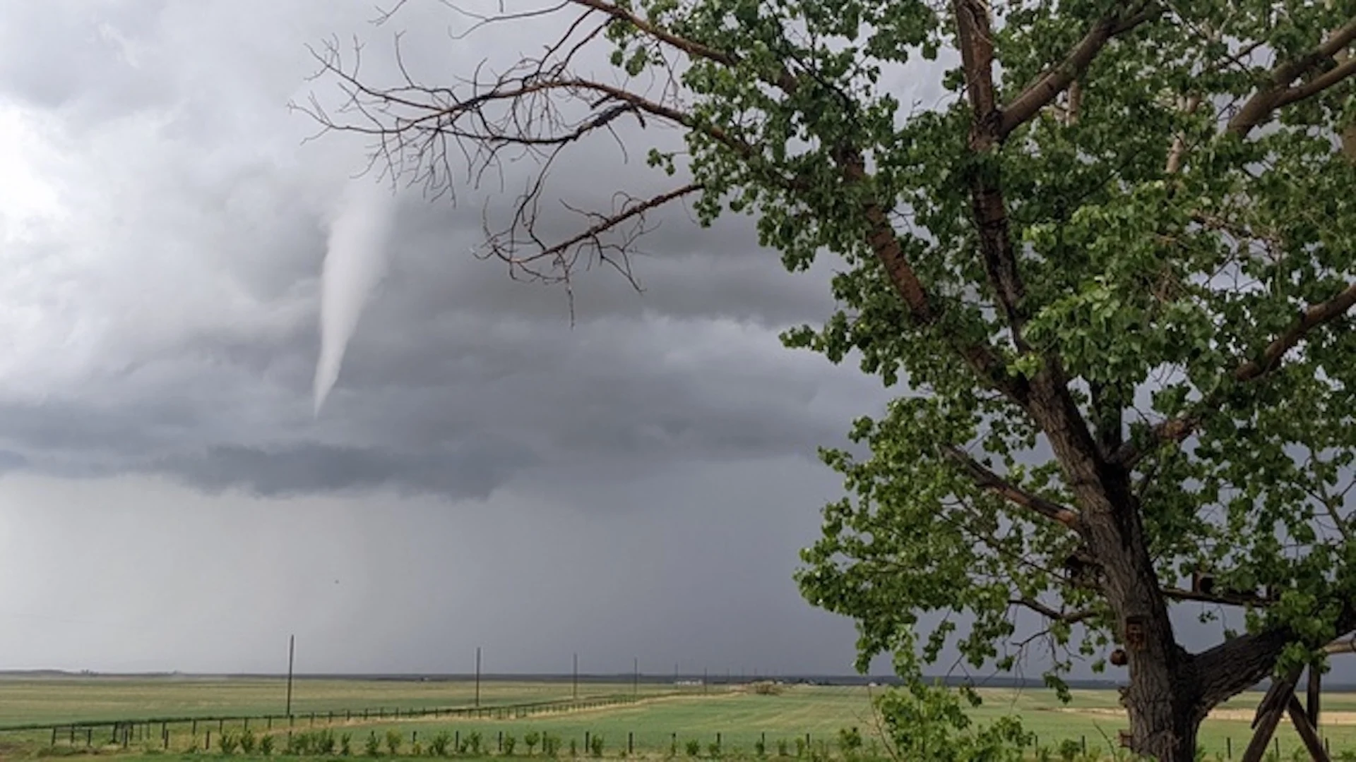
Forecasters expect a risk for widespread thunderstorms across most of the Prairies during the day Sunday, with the strongest storms carrying the risk for heavy rainfall and small hail. Dynamics near the centre of the low will be favourable for the development of funnel clouds across portions of southeastern Alberta.
After Wednesday's 10 landspout tornadoes, people should be prepared to take shelter if funnel clouds are spotted.
We’ll see that low scoot east by the beginning of the work week, bringing a risk for storms to the northern half of Saskatchewan and much of Manitoba.

There should be enough lift and instability over Manitoba to push some storms to severe limits, with the strongest among them packing heavy rainfall, large hail, and strong wind gusts.
MUST SEE: Curiosity rover sends back a marvelous 'postcard' view of Mars
While folks on the eastern Prairies contend with thunderstorms, a heavy and steady rain will blanket parts of Alberta behind that low-pressure system. Rainfall warnings are in place for portions of the province.
This could be a far-reaching expanse of heavy rainfall, with totals easily exceeding 50-100 mm for central parts of the province. Edmonton has more than 100 mm of rain in the forecast through the first half of this week.

Hinton, Whitecourt, and Grande Cache could see rainfall totals reach hit 150 mm in spots by the time it tapers off Wednesday.
Avoid driving through water on roads. Even shallow, fast-moving water across a road can sweep a vehicle or a person away. Don't approach washouts near rivers, creeks and culverts.
Heavy and persistent rains falling over burn scars will lead to increased runoff and a risk for localized flooding. Stay aware of the potential for rising water in vulnerable areas, and continue to monitor local weather alerts in the days ahead.
Check back frequently for the latest updates on conditions across the Prairies.
Thumbnail courtesy of Ela Thakore, taken in Champion, Alta.