From drought to deluge, B.C. pattern change brings unique hazards

After an extended drought in B.C., there is promising potential for an active October finish in the province
It will be 106 days since the drought began. But after 3.5 months, the ridge of high pressure flattens and folds, allowing a deep, upper trough to move over British Columbia.
The polar jet stream, largely absent from the South Coast and targeting the Alaska Panhandle instead, will careen out of the northwest by Friday. Consider this like the runway strip for low-pressure systems as they develop across the eastern Pacific. This is promising to be an active October finish.
Flood hazards
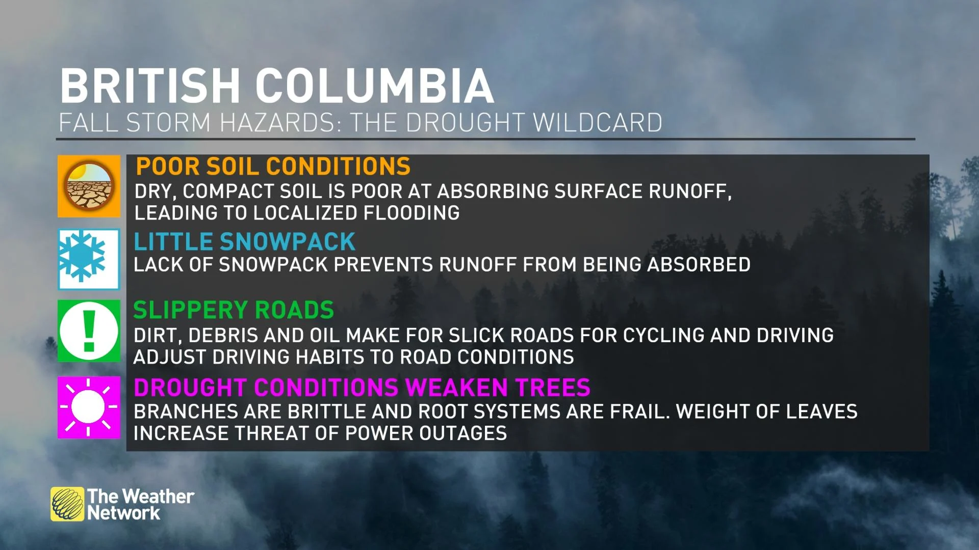
The soils are rock hard and are a far cry from the ideally moist dirt that allows ample runoff to be absorbed, heightening the risk of some localized pooling and ponding around low-lying areas.
Conditions will become locally blustery along the coast on Friday. That means the deciduous tree will shed leaves, which love to coalesce around storm drains, potentially clogging them.
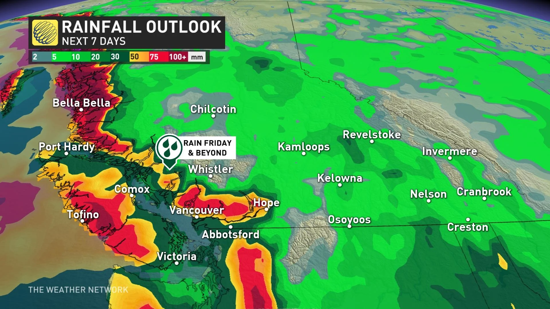
Let’s put it this way. It’s borderline drought-busting rainfall amounts on western Vancouver Island and the mountainous terrain on the mainland. But, those who reside on the Gulf Islands or eastern Vancouver Island might be disappointed in the rainfall amounts this upcoming weekend.
Wind hazards
Speaking of trees, they're stressed. Have you seen Stanley Park lately?
The drought, paired with looper moth devastation, has turned the park auburn and not the typical vibrant green. It means the root systems are frail, branches are brittle and less prone to flexing, adding to the potential for power outages this fall season.
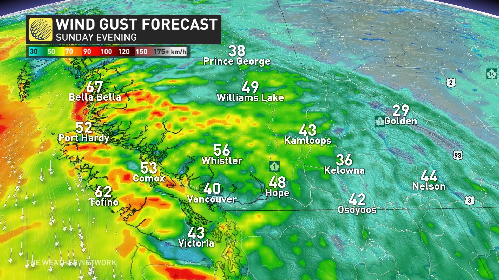
We’re watching early next week for the potential of a windstorm, but confidence remains very low.
We have higher confidence a stronger low will cross northern Vancouver Island later on Sunday, potentially causing wind gusts up to 90 km/h across the region.
Driving and biking hazards
Over one hundred days without substantial rain means a fair amount of oil, dirt and debris coating the roadways across the province. Adjust driving conditions accordingly, and pay extra attention at the onset of the precipitation -- that's when it will be most slippery.
Do you remember the last time you drove in a downpour? We’ll have to adjust our driving habits and refamiliarize ourselves with driving in the rain.
The good
It's not all bad news.
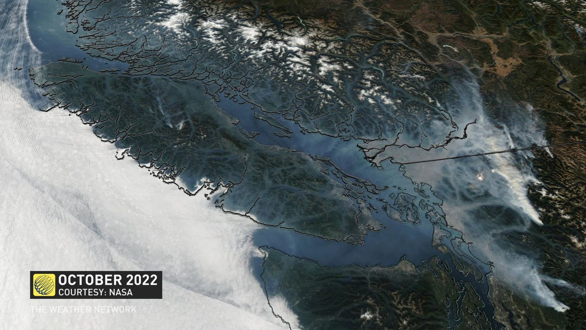
The air quality will steadily improve this week as an onshore flow flushes out the fine smoke particles. At one point on Tuesday, air quality soared to nearly 300 on the air quality health index, blocking the sun across the Lower Mainland.
Wildfire activity will become more easily managed, but it might be months before the final hot spots are extinguished. Over 20,000 hectares have burned in the Coastal Fire Centre region, the most since 2018.
Reservoirs for drinking water will get a sorely needed top-up, and the streams and tributaries for salmon will get an uptick in flow rates.
Reservoirs around the province have been dropping upwards of 10 centimetres a day, including the Upper Campbell Lake watershed -- located in central Vancouver Island. The lake has recorded a four-metre drop since peaking early in mid-July.
WATCH: Startling scene shows piles of dead salmon as B.C. rivers dry up
Stay tuned to The Weather Network for the latest forecast across B.C.
Thumbnail contains images from Getty. Drought picture: Getty Images. Credit: FotoDuets. Creative #: 979951132. Dry grass, drought. Rain: Getty Images: Credit: Marcin Kilarski Creative #: 1011442792.


