
From 30 degrees to frosty, a big change sweeps Eastern Canada
A significant temperature swing is in progress across the eastern half of the country to end the week
Many communities across Eastern Canada notched their warmest day of the year this week as a summer-like pattern built across the region.
This unseasonable warmth wasn’t long for the world as a strong cold front sends temperatures crashing down into the single digits.
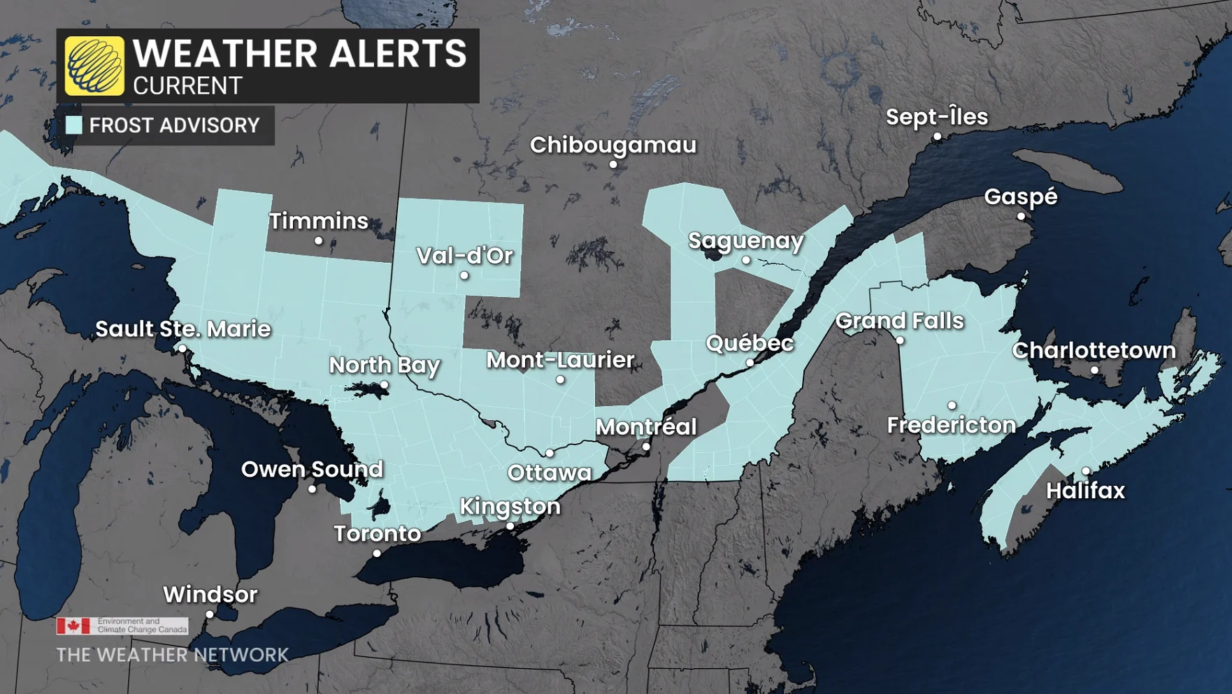
Widespread frost advisories are in effect heading into Thursday night.
DON'T MISS: The best tips to protect your plants from late-season frost
A hot pattern falls victim to a strong cold front
Southwesterly winds teamed up with an upper-level ridge to pump warm, humid air into Eastern Canada through the first half of the week.
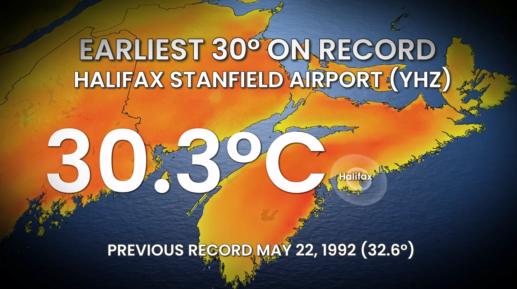
Halifax Stanfield Airport reached 30.3°C on Wednesday afternoon, making this the earliest 30-degree reading ever observed at the location. The previous record was a 32.6°C day back on May 22, 1992. Numerous other daily high temperature records fell across the region.
A fresher airmass has settled into the region to end the week, bringing less-humid conditions and near-seasonal temperatures. Some areas are running 2-5 degrees below seasonal for the next couple of days.
Not everyone will feel this relative chill, with dry conditions and plenty of sunshine keeping things feeling pleasant under the warm sunshine. Some areas will remain around seasonal with daytime highs in the middle to upper teens, with portions of southern Quebec cracking 20 degrees.
There’s always a catch to comfort in the springtime. Clear skies during the overnight hours will send temperatures tumbling into the single digits, prompting forecasters to issue widespread frost advisories from northern Ontario through Atlantic Canada.

We’re just past the average date of the last frost for much of the Maritimes, though these are just averages and some years will feature late frosts.