
Fresh burst of spring snow looms in Ontario amid incoming chilly air
Ontario will get another stark reminder that April is known for its varying conditions, with a shot of cool air filtering in after Saturday's rainfall––allowing snow to make an appearance for early next week
April is famous for its back-and-forth conditions, and Ontario is in the midst of another example of its changeable reputation.
The provinces experienced the weather of multiple seasons in one day recently, showing that Ontarians need to be prepared for more changeable conditions this month.
DON’T MISS: From snow to storms, Ontario endured three seasons in one day
The weekend will start off soggy and likely to end dry, but noticeably cooler. That will only be followed by a fresh round of snow and considerably cooler air to start next week.

Plan ahead for potential travel disruptions on Monday.
Rain returns to Ontario this weekend
An exceptionally soggy pattern south of the border will begin to spill moisture into southern Ontario this weekend.
Rain began Saturday morning from Windsor into the Greater Toronto Area, and will continue through most of the day.
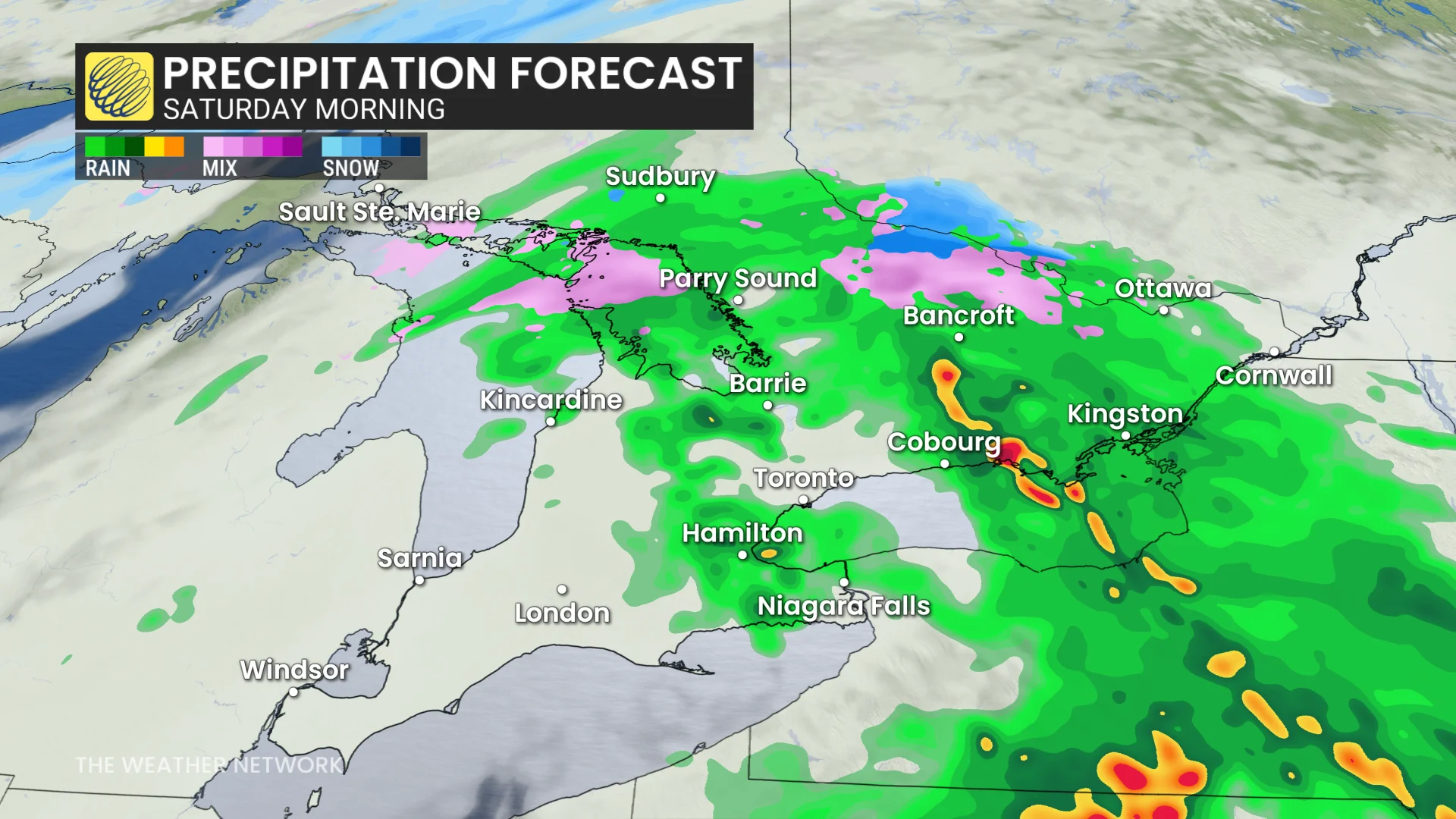
Expect rainfall totals on the order of 10-20 mm around the GTA, with 20-30 mm of rain on tap for communities along the Lake Erie shores toward the Niagara Peninsula.
Sunday’s storm track has shifted south, which could help leave us mostly dry through the day—but with falling temperatures.
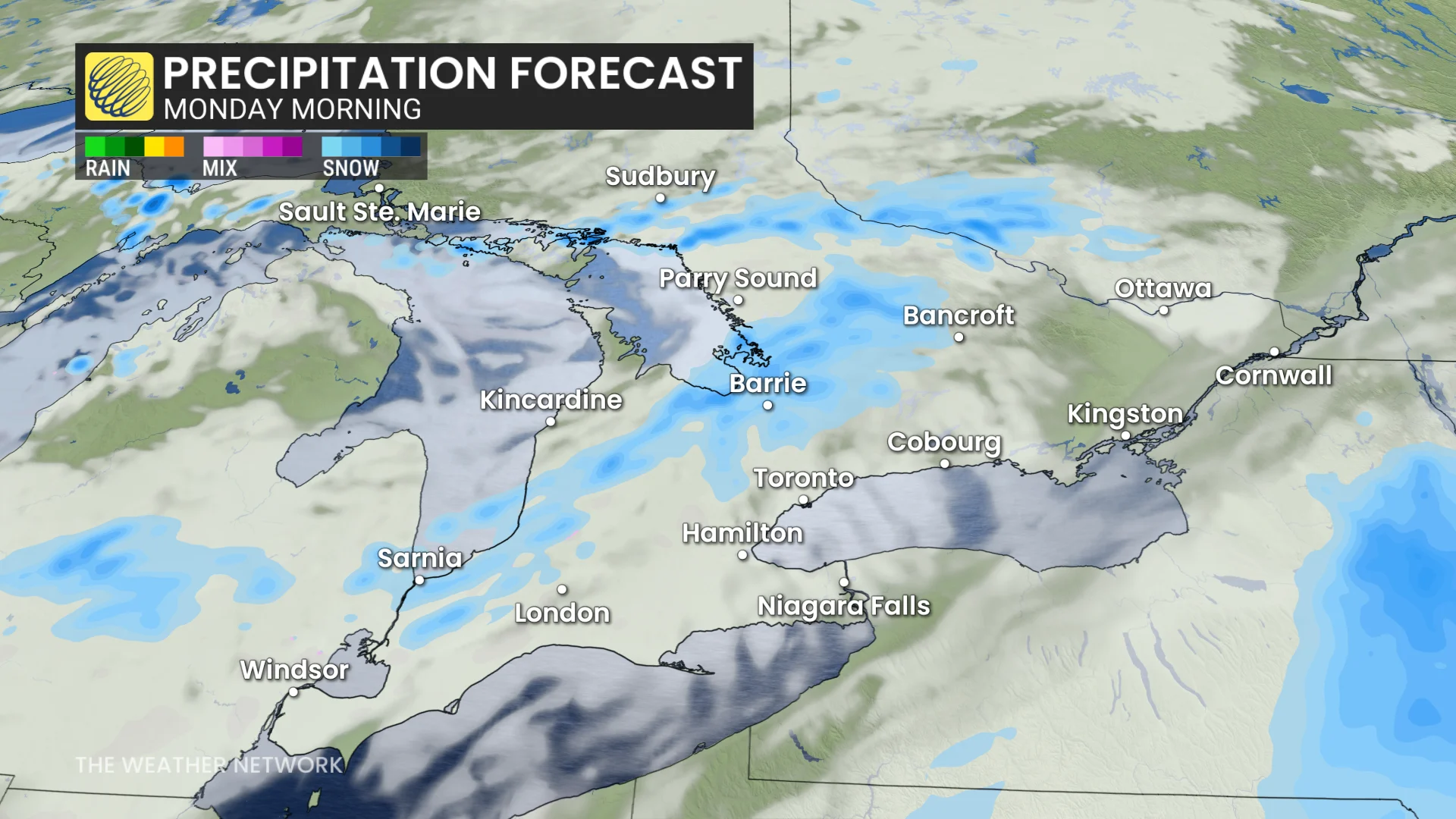
Arctic air brings snow risk Monday
A slug of Arctic air sinking south will infiltrate Ontario to start the new work week, sticking around Monday and Tuesday.
Temperatures will fall well below seasonal for the beginning of April. Tuesday will see a daytime high of about -3°C in Toronto with a feels-like value coming in closer to -10.
A second system pushing into this cold air will allow widespread snow to develop by the late afternoon or evening hours on Monday.
MUST SEE: Experts predict an above-average 2025 Atlantic hurricane season

WATCH: Rural Ontario suffering for days without power have unique challenges
There’s still some uncertainty surrounding exact snowfall totals with this next system. That said, this will be a widespread snowfall with accumulations expected for all of southern Ontario. Plan ahead for travel disruptions during your evening commute on Monday.
Cold winds wrapping around behind the departing storm will whip up bands of lake-effect snow for Tuesday, bringing additional accumulations to communities in the snowbelt regions.
This upcoming system is a reminder that, while unwelcome, April snows are normal in Ontario. Toronto averages about 5 cm of snow in a typical April, while the month usually brings around 11 cm of accumulation to Ottawa.
Temperatures will be well below seasonal for a couple days next week, potentially remaining below 0°C on Tuesday––more typical of February.
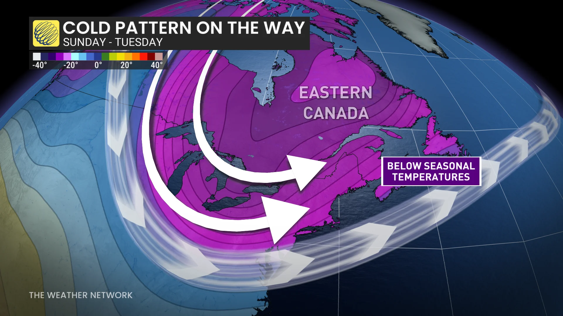
Temperatures will trend closer to seasonal late week, but another system is possible late week and into the weekend. No sustained warm weather is in sight.
Stay with The Weather Network for all the latest on conditions across Ontario.