
Schools close as icy storm hits the Maritimes, flood risk grows into Tuesday
Freezing rain will make for slick roads and sidewalks across much of Atlantic Canada through Tuesday. Heavy rain and flood risk follows
After hitting Ontario as a major ice storm this weekend, a sprawling system pushing east will send a diverse mix of conditions spilling over the Atlantic provinces to begin this new workweek.
Freezing rain warnings were issued across New Brunswick and western Prince Edward Island early Monday for several hours of icing that could lead to slippery roads and sidewalks. The deteriorating conditions prompted all public schools in New Brunswick to close.
Heavy rain will follow the wintry precipitation, posing a flood risk for portions of Nova Scotia. Rainfall warnings are in effect.
DON’T MISS: Does poking holes in the snow make it melt faster? We investigate
Icy conditions spread into Newfoundland Monday
Precipitation pushed into the cold air parked over the Maritimes on Sunday night, setting the stage for snow, ice pellets, and freezing rain throughout the region.
The most widespread risk for freezing rain covers New Brunswick and western Prince Edward Island, where 5-10 mm of ice accretion is forecast before transitioning to straight rain Monday. This includes Fredericton, Moncton, and Charlottetown.

The wintry mix will arrive across western and central Newfoundland by Monday afternoon and evening, bringing snow, ice pellets, and freezing rain to the region before precipitation transitions to plain rain by early Tuesday.
Heavy rain arrives Tuesday
A boundary sitting over the Maritimes will serve as the focus for heavy rain heading into Tuesday as ample moisture slides into the region from the south.
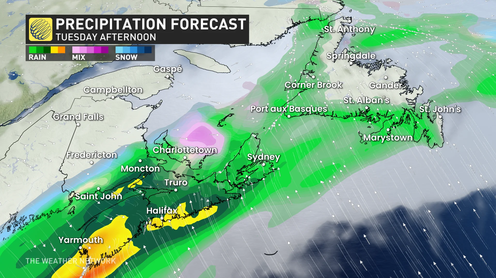
Heavy rain is expected throughout the day across southern sections of New Brunswick and Nova Scotia, including Halifax.
Some areas could see between 30-60 mm of rain from this soaker before it tapers off later in the day Tuesday.
"Heavy downpours can cause flash floods and water pooling on roads. Localized flooding in low-lying areas is possible," says Environment and Climate Change Canada (ECCC) in the rainfall warning.

This rain will also head to Newfoundland through the day Tuesday, dropping 30-60 mm for southern parts of Newfoundland of the island, as well. Lesser amounts are forecast along the Trans-Canada Highway from St. John’s to Stephenville.
As the storm heads out to sea, much colder weather will spread across the region during Tuesday and continue through Wednesday. Temperatures will rebound ahead of the next storm system, which will track across the region late week.
An active pattern is forecast during early April, with changeable temperatures tipping to the cool side of seasonal.
Stay with The Weather Network for the latest on conditions across Atlantic Canada.