Fall-like storm targets B.C. with gusty winds, excessive rains, alpine snow

A major pattern change will bring heavy rainfall, gusty winds and even alpine snow to parts of B.C. through the middle of the week.
Prepare for an extended spell of foul weather in parts of British Columbia to kick off September.
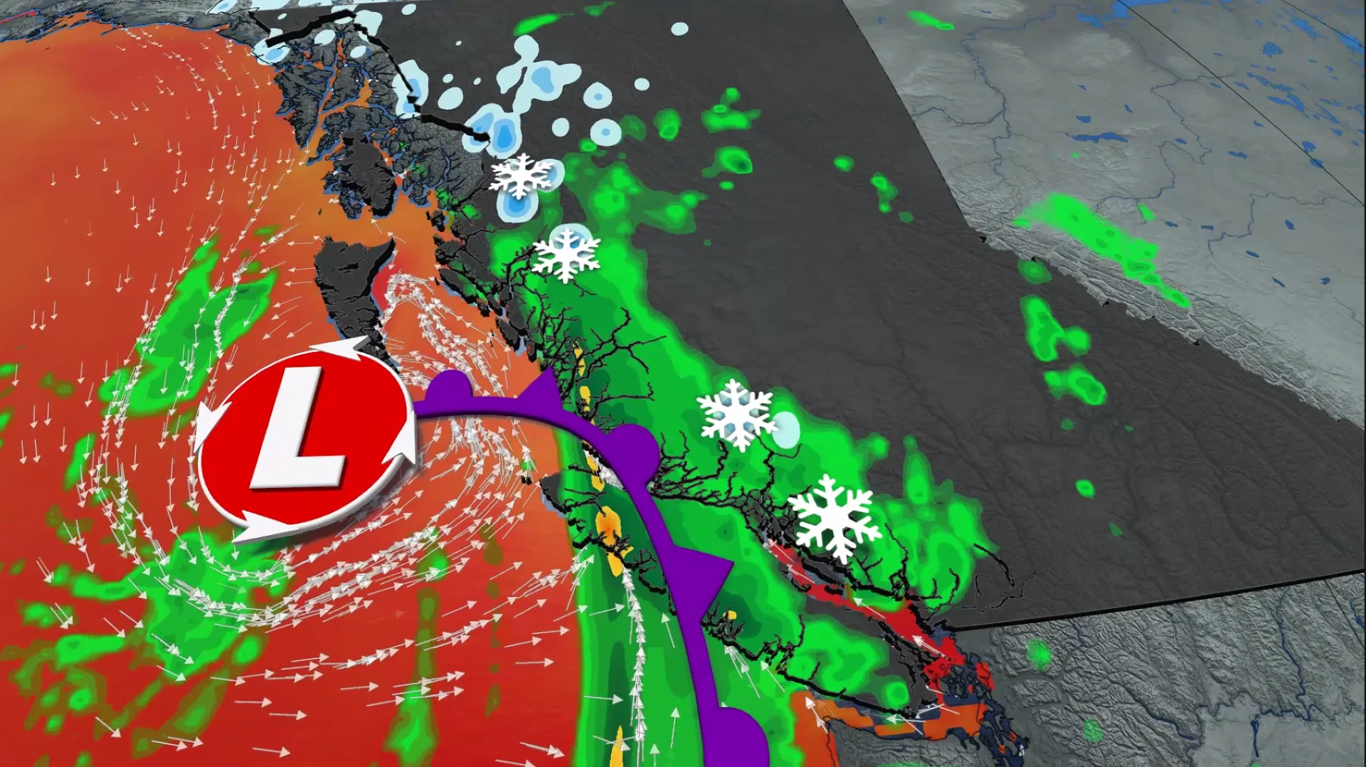
Meteorological fall isn't wasting any time along the West Coast as a formidable low-pressure system pushes into British Columbia.
DON’T MISS: Staying safe from flash floods, a serious and deadly hazard
A fall-like storm is bringing widespread rain to the South Coast and Vancouver Island, while strong wind gusts up to 75 km/h could cause ferry delays and power outages. Meanwhile, alpine snow is forecast for some of the high elevations.
Potent storm hits B.C. coast this week
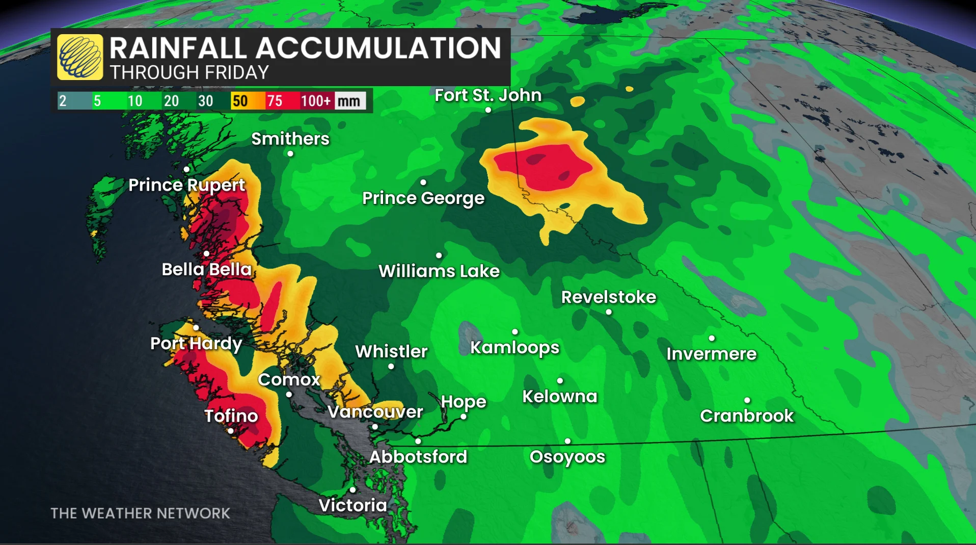
Heavy rains were built up through Tuesday along the North Coast as plumes of moisture streamed ashore. Localized totals up to 200 mm are forecast for the mountains of the North Coast.
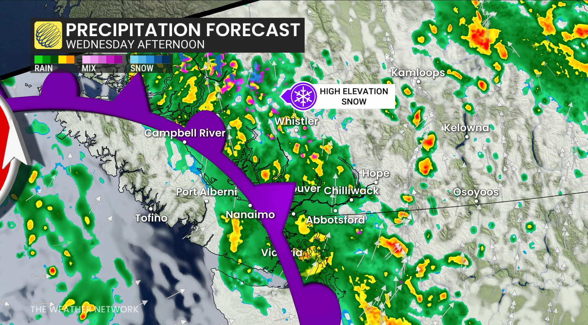
By Tuesday night, the cold front will slide south toward the northwestern tip of Vancouver Island, increasing both rainfall rates and winds across the region. This front will slide across the South Coast on Wednesday, with gusty southeasterly winds pushing up the Straits and shorelines.
Wind gusts stronger than 70 km/h are possible for exposed coastal areas, with locally higher gusts possible. These winds should ease overnight Wednesday.
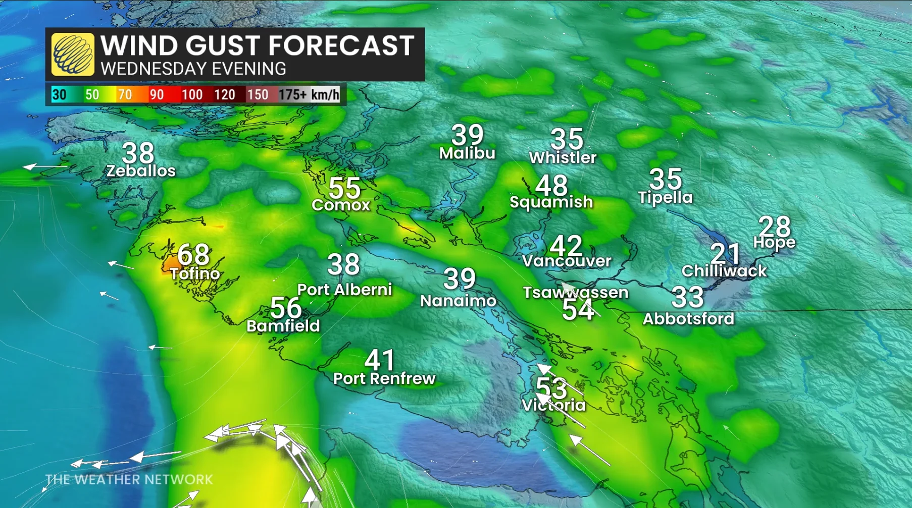
It’s important to note that early fall storms can cause a disproportionate number of power outages due to foliage and stresses due to the ongoing drought. Travellers should be prepared for potential ferry delays, especially on smaller routes farther up the Strait of Georgia on Wednesday.
Rainfall totals will vary widely throughout southern B.C., with more than 100 mm forecast for Tofino while less than 10 mm is expected for most of Greater Victoria.
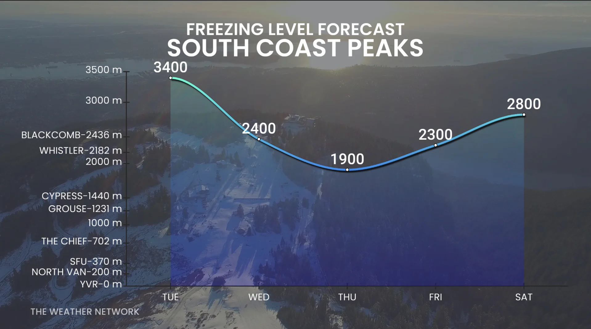
As the low pressure reaches the Lower Mainland on Wednesday, the offshore flow will bring cooler temperature and lower freezing levels.
Freezing levels are expected to fall below 2000 metres, meaning some high-elevation snow is expected. The North Shore Mountains may see some snow Wednesday at the peaks. Drivers should expected difficult driving at times.
Areas that experience heavy rainfall may experience dangerous driving conditions as the rainfall reduces visibility and runoff pools on roadways.
This system doesn’t mean that autumn weather is here to stay. Ridging in the northeastern Pacific may put a pause on the active weather and bring much drier conditions to the B.C. coast during the second week of September.
Stay with The Weather Network for all the latest on conditions across B.C.