Frozen ground heightens risk of localized flooding in B.C. South Coast

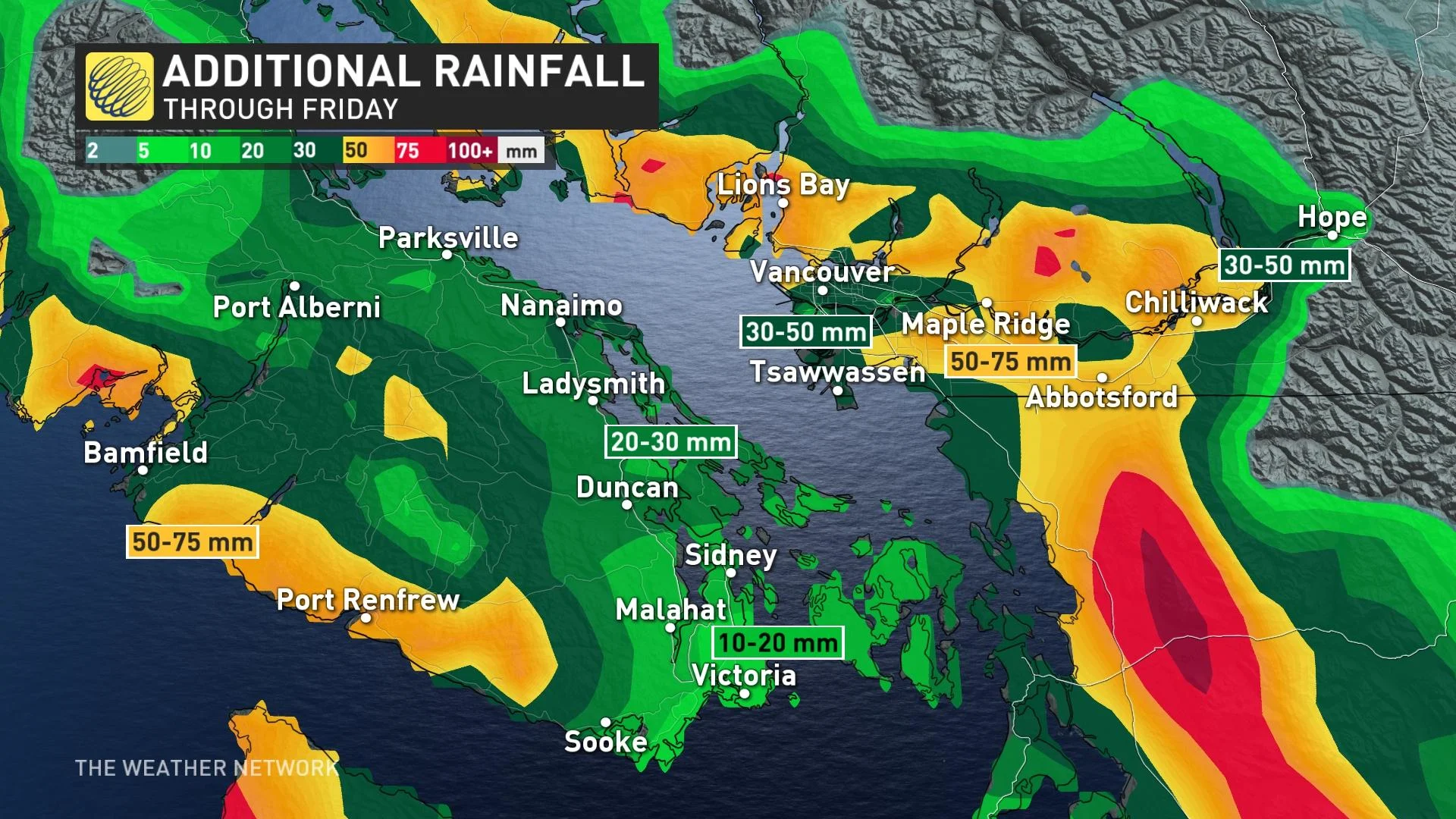
Another round of rain that could bring up to 60 mm is expected later on in the week.
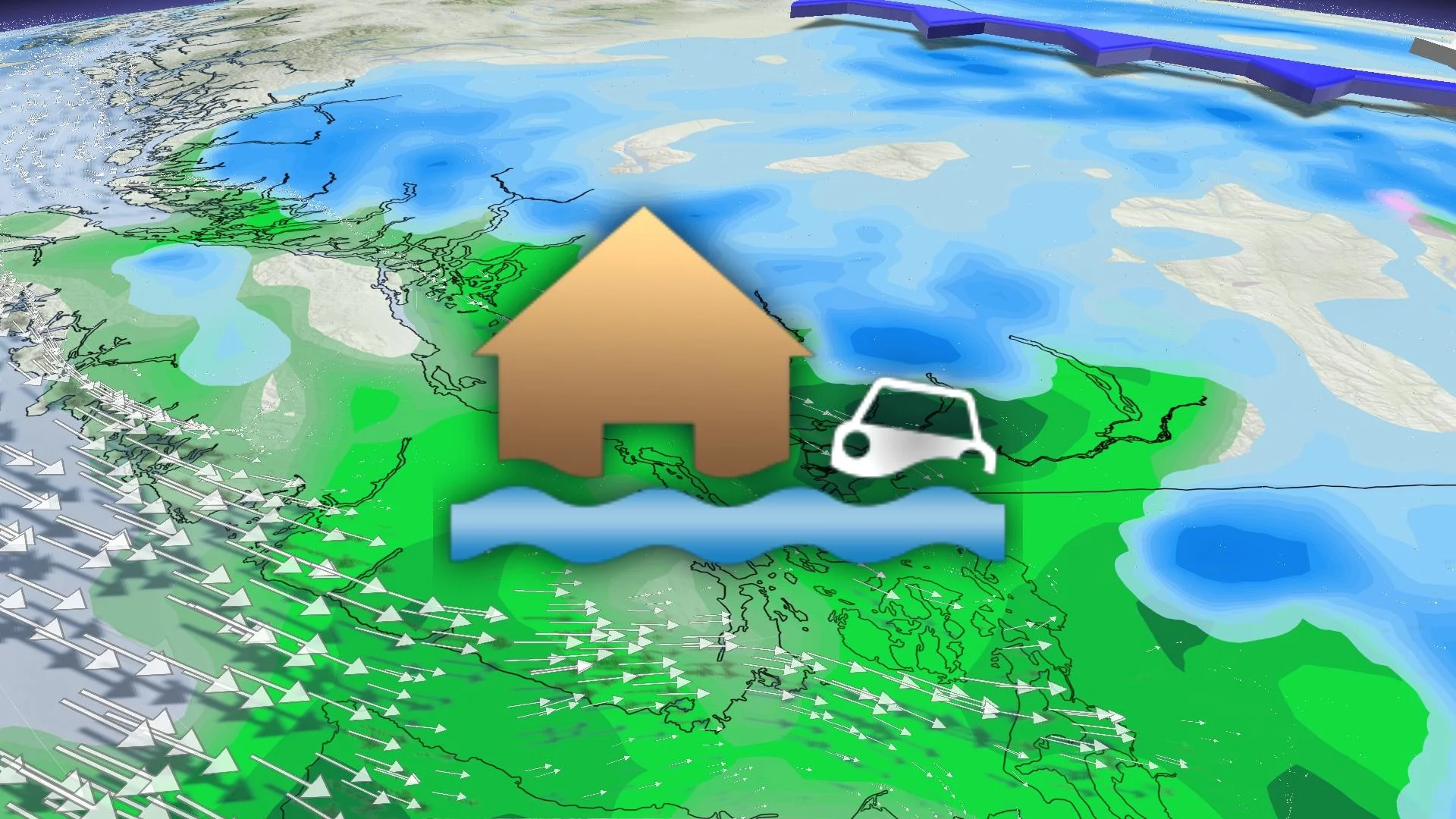
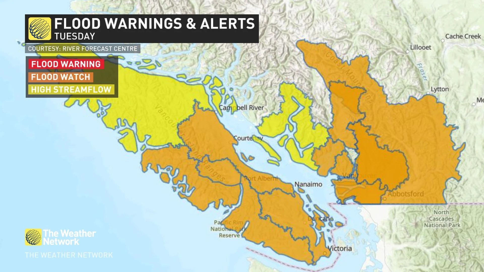
Flood watches are in effect for much of southwestern British Columbia after two successive systems brought heavy rain to the region. The frozen ground is largely unable to absorb the excessive precipitation, which is raising the risk of localized flooding.
On Saturday afternoon, the River Forecast Centre issued flood watches for Howe Sound, North Shore, Metro Vancouver, and the Fraser Valley. A high streamflow advisory is in effect for the South Coast including the Sunshine Coast and surrounding tributaries.
“If visibility is reduced while driving, turn on your lights and maintain a safe following distance. Avoid driving through water on roads. Even shallow, fast-moving water across a road can sweep a vehicle or a person away. Don't approach washouts near rivers, creeks and culverts. Keep children and pets away from creeks and riverbanks,” Environment and Climate Change Canada (ECCC) stated in their rainfall warning for Vancouver.
Wednesday will give the rivers a brief chance to catch up to the runoff ahead of the next system’s arrival on Thursday.
DON'T MISS: Why some people feel the cold more than others: Here's the science behind that
Another 40-60 mm of rainfall is expected for the Lower Mainland, however, freezing levels dropping below 1000 metres will slow the alpine melt and hold the incoming moisture in the snowpack.
Snow lovers will have to appreciate this week’s snow because a more southern storm track looks to target northern California to start 2023, which will cause B.C. to enter another drier-than-normal pattern.
WATCH: Keep these tips in mind so your Christmas tree doesn’t become a fire hazard
Stay tuned to The Weather Network for the latest on conditions across British Columbia.


