Localized flood threat as 20-40+ mm of rain falls in southern Ontario
Southern Ontario faces multiple rounds of heavy rainfall and embedded thunderstorms over frozen ground, increasing the flood risk. Stay alert for rising water levels in affected areas.
Heavy rain and early morning thunderstorms likely woke much of southern Ontario on Wednesday.
Additional rain and storms are expected through the afternoon, bringing 20-40 mm of precipitation, with higher local amounts in thunderstorms. Some thunderstorms may produce gusty winds, as well. With saturated ground conditions, the rainfall increases the risk of localized flooding in affected areas.

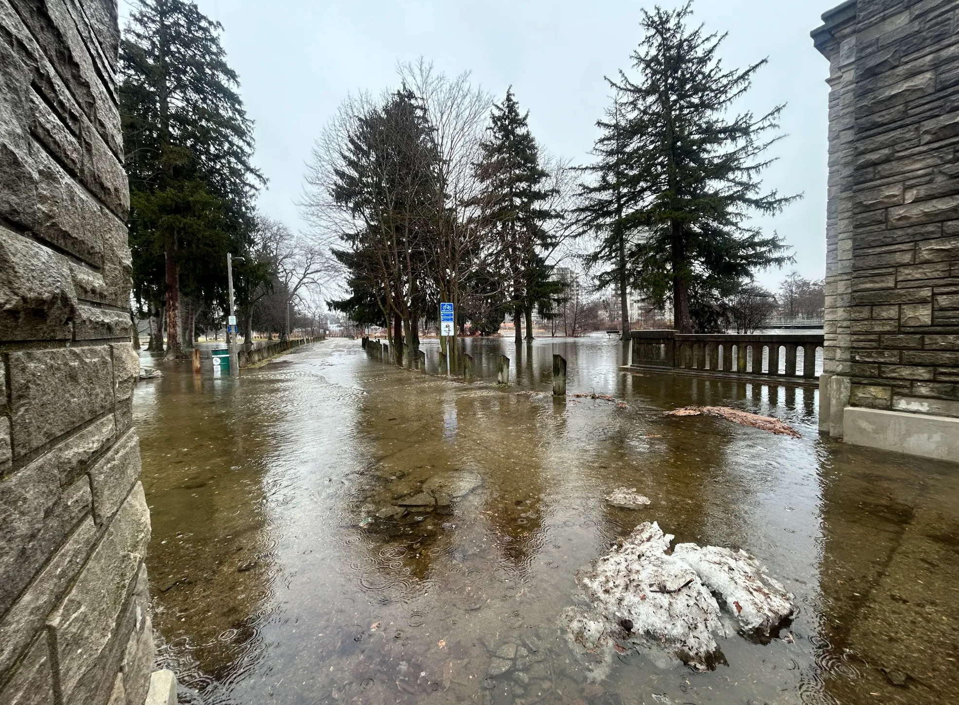
Localized flooding in Riverside, Ont. March 11, 2026. (Mark Robinson/The Weather Network)
SEE ALSO: Ice storm to hit parts of Ontario with up to 24 hours of freezing rain
Meanwhile, a strong clipper from the Prairies will bring blustery winds and widespread snow back to the Great Lakes region by Friday. Southern and eastern Ontario can expect 5-15 cm of snow, with a few centimetres likely for Toronto and communities along Lake Ontario. More on all the active weather ahead, below.
Thunderstorms bring heavy rain and elevated flood risk
Thunderstorms swept through southern Ontario early Wednesday, delivering torrential rain and frequent lightning. The line of storms also produced at least one tornado in the U.S., crossing from Illinois into Indiana.
A break in the activity is likely before more rain and thunderstorms return around midday and into the afternoon.

Temperatures will hold in the mid to upper teens for one last day before colder air arrives overnight.
With frozen, saturated ground and melting snow elevating water levels, the risk of localized flooding is increased. Caution is advised on the roads as heavy rain could disrupt commutes.

The Ontario Provincial Police said local areas of flooding have been reported around the Greater Toronto and Hamilton Area due to recent rain. They're warning drivers that flooded areas and puddles may disguise potholes and to use extreme caution and care in wet conditions.
Rainfall totals are expected to range between 20-40 mm, with higher amounts possible near the Lake Ontario and Lake Erie shorelines and in areas affected by thunderstorms.

Water pooling in Toronto, Ont. March 11, 2026. (Victoria Fenn Alvarado/The Weather Network)
SEE ALSO: Another Canadian March ice storm looms. Will it also be historic?
Wintry end to the week with the return of snow
Lake-effect snow flurries are expected Thursday, with falling temperatures and northwest winds.
A powerful clipper system from the Prairies will cross the Great Lakes on Friday, bringing blustery winds and widespread snow.

A wintry mix or rain showers are possible in extreme southwestern Ontario.
Snowfall totals of 5-15 cm are forecast for southern and eastern Ontario, with a few centimetres likely for Toronto and areas along Lake Ontario.

Another winter storm is set to arrive Sunday into Monday, bringing a mix of precipitation types.
Temperatures will rebound late next week and weekend, however, an active pattern with changeable temperatures is expected to continue through late March.
WATCH: Existing high water could rise even more as rain hammers southwestern Ontario
Stay with The Weather Network for more information and updates on your weather across Ontario.