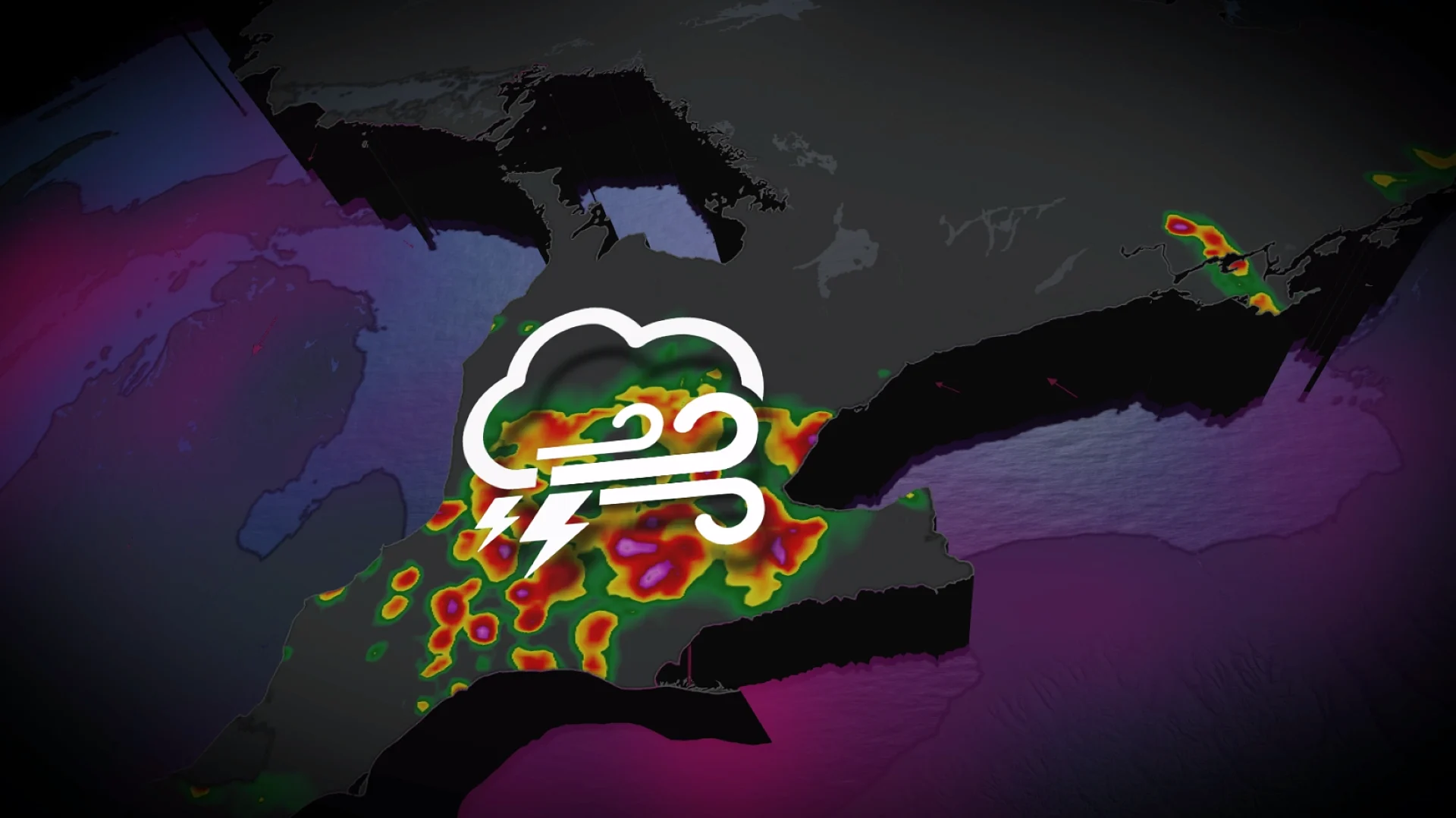
Flood potential in southern Ontario with multi-day thunderstorm risk

Multiple days of storm risk across southern Ontario begins Sunday and will continue through Tuesday. The biggest hazard will be the risk of localized flooding from heavy downpours
With August around the corner, the final days of July in southern Ontario will be met with multiple days of thunderstorm risk.
With plenty of moisture to work with in the atmosphere, heavy rainfall will be the biggest concern with thunderstorm development through Tuesday, raising the chance of localized flooding as totals get hefty in some areas.
SEE ALSO: Tornado causes 'significant damage' to parts of west-central Alberta county
Please keep up with the latest watches and warnings in your area. Take immediate action if a severe thunderstorm or tornado warning is issued for your location.
Multi-day storm, flood threat in southern Ontario
On Sunday, a risk of isolated thunderstorms will pop up in southern Ontario ahead of a cold front sweeping through.
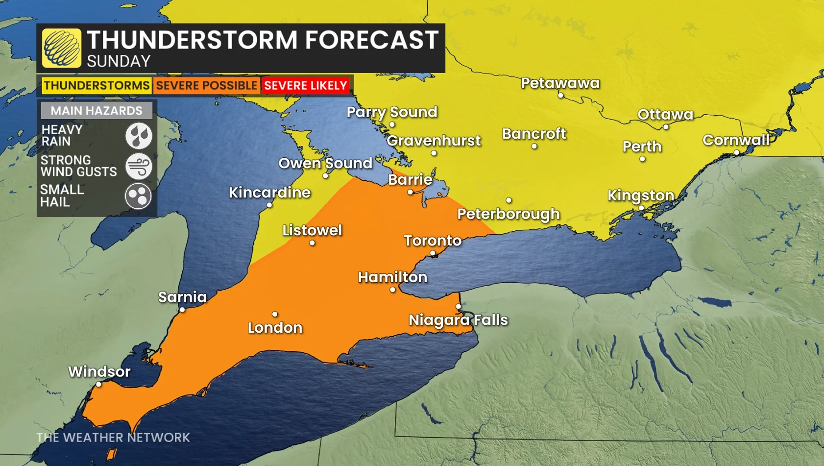
The threat will primarily impact from the Greater Toronto Area (GTA) to southwestern Ontario, extending north to Georgian Bay. Lake breezes could help trigger storm development.
DON'T MISS: Showering during a thunderstorm: Risky business or just a myth?
Monday and Tuesday will be on the warm side of seasonal, and humid, too, with periods of rain and thunderstorms likely. Rain totals should be substantial parts of southern Ontario with a threat for locally heavy rain and flooding.
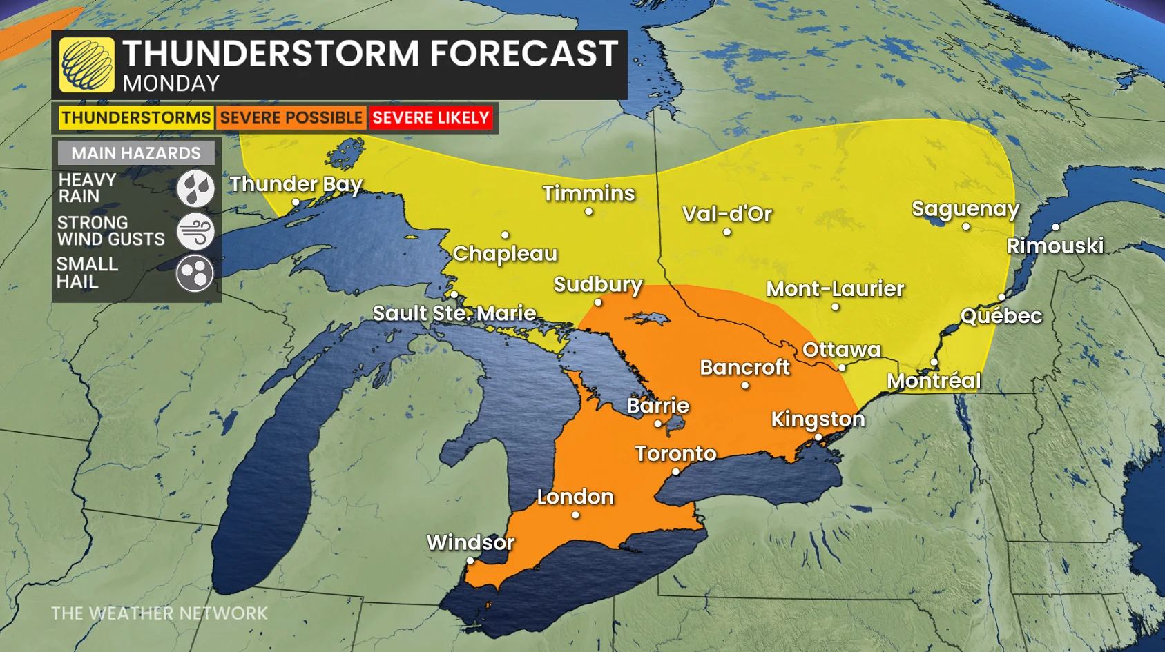
A higher threat of severe storms will arise on Monday as parameters intensify. A warm front moves through the region, triggering storms.
Multiple rounds of storms are anticipated, beginning with morning showers. The storm threat continues into Monday evening across the region, ahead of the cold front's arrival.
The impacts include heavy downpours and localized flooding, resulting in poor driving conditions. There will also be a nocturnal storm threat.
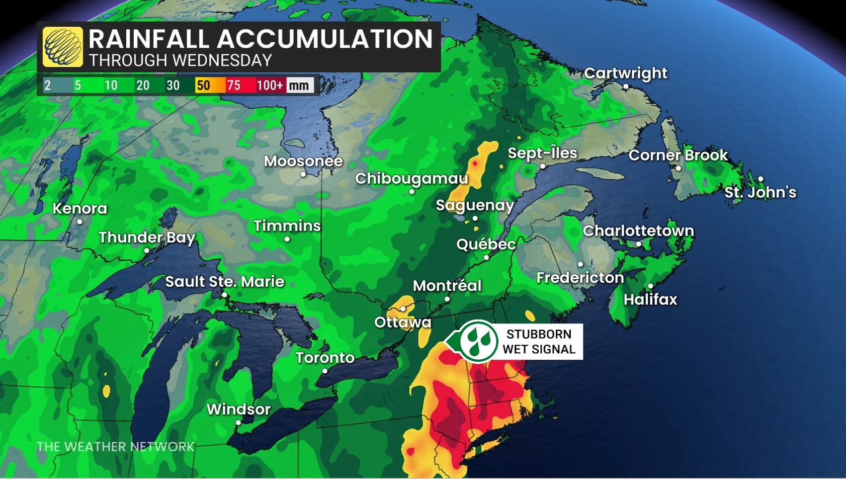
Rainfall amounts will be highly variable with thunderstorm activity, but some regions could exceed 50 mm of rainfall including extreme southwestern Ontario and south of Georgian Bay.
Looking ahead to the Civic Holiday long weekend, temperatures are expected to be near seasonal or a few degrees cooler than seasonal, with a threat for a couple rounds of showers and thunderstorms.
Similar conditions are expected well into the first week of August. However, a period of warmer weather is possible heading into the second week of August. Overall, August is expected to be near seasonal but changeable at times.
Stay with The Weather Network for the latest on your weather across Ontario.