Messy winter storm raises flood, power cut risk in Atlantic Canada
A series of systems will pull in significant subtropical moisture, bringing heavy rainfall and powerful wind gusts that could exceed 100 km/h, with Newfoundland experiencing the strongest impacts
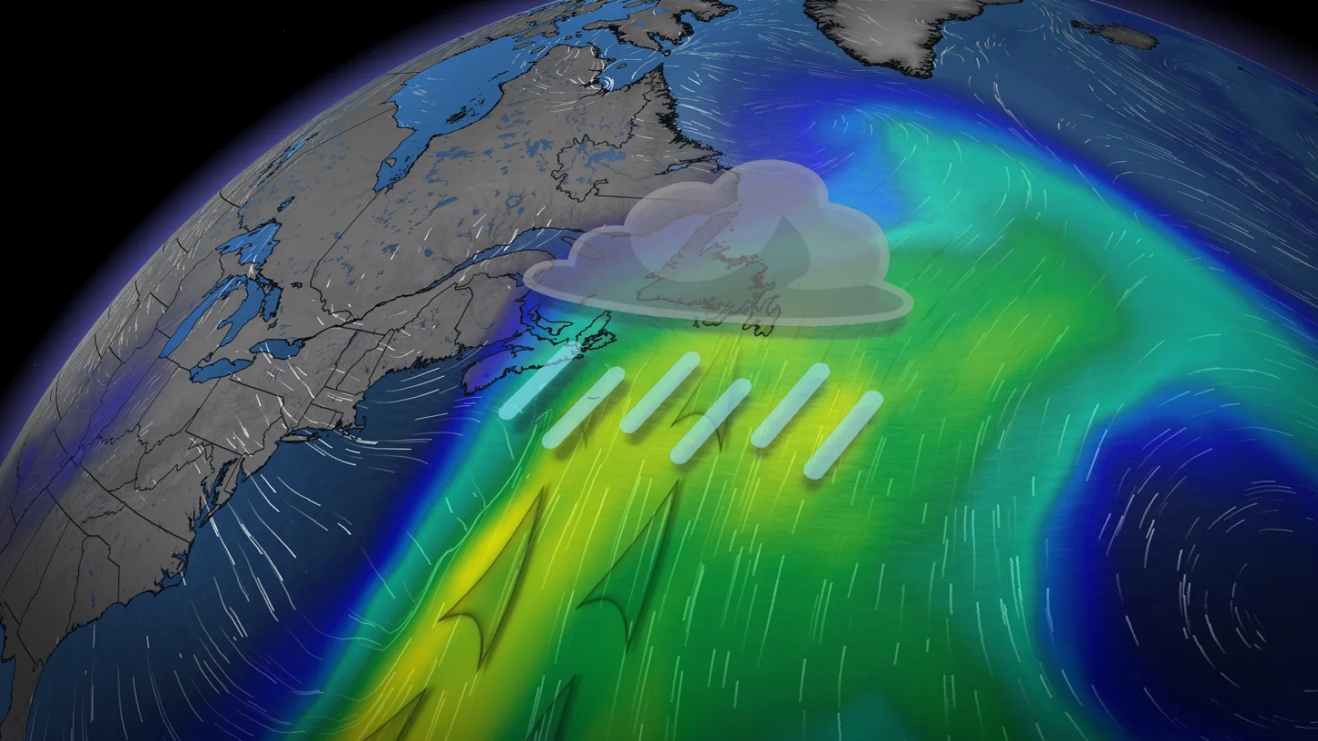
Substantial moisture from the subtropics will fuel multiple Atlantic Canada systems this week, with the first arriving Thursday and the second on Friday.
Expect wet, snowy and windy conditions, with the threat of power outages while extensive snowmelt could lead to localized flooding in some areas. Yellow-level rainfall and snowfall warnings are in place, along with special weather statements.
DON'T MISS: The ‘surprise’ hurricane that formed in the middle of January
Looking ahead, a series of storms is expected to continue into next week, with colder temperatures forecast, especially across the Maritimes. This shift increases the potential for impactful winter storms in the region. You'll want to stay updated and check back for forecast details as conditions develop.
Localized flood threat with heavy rain and snowmelt
Widespread steady rain will move through the Maritimes Thursday morning into the afternoon before clearing by early evening. Northern New Brunswick, including areas such as Edmundston and Campbellton, is forecast to see up to 10-20 cm of snow, while most other areas will remain mild enough for rainfall.

Rain will also reach Newfoundland by Thursday afternoon, continuing through the day. Rainfall from this system will be less intense for Newfoundland compared to the next round. A brief overnight break is expected before heavier rain arrives again by daybreak Friday.
The heaviest rainfall will impact Newfoundland and possibly eastern Nova Scotia.

Overall, Nova Scotia and P.E.I. are forecast to receive 10-20 mm, while central and western Nova Scotia should be in the 20-30 mm range. Coastal Nova Scotia, east of Halifax and Cape Breton, should see 30-50 mm while the southern coast of Newfoundland, including much of the Avalon Peninsula, could be in the 50-75 mm range.

Areas north of Corner Brook and into the Great Northern Peninsula could see a period of freezing rain Friday.
Power outage potential with another round of strong winds
Wind gusts for Thursday will range from 30-50 km/h in the Maritimes and 40-80 km/h in Newfoundland. Friday looks windier, particularly for eastern Newfoundland, where gusts could exceed 110 km/h by the afternoon and evening. Elsewhere, wind gusts will increase to 50-80 km/h on Friday.
Localized flooding is possible due to rain and snowmelt, along with the risk of power outages in areas like the Avalon Peninsula.

A series of storms is expected to continue into next week, with temperatures trending colder, particularly in the Maritimes. This shift increases the potential for a few high-impact winter storms in the region.
WATCH: Strong wind blow through Newfoundland, knocking out power to thousands
Be sure to check back for the latest weather updates across Atlantic Canada.