Fleeting warmth in Alberta to give way to cooldown, winds, even snow
Wednesday will be the final day of warmth in Alberta before single-digit highs, blustery winds and snow make a return in the wake of a pattern change this week
Enjoy the warmth while you can, Alberta, as the end of the week will come as a noticeable shock to the system with the arrival of much cooler temperatures.
In fact, some areas of the province could see snow return, alongside single-digit, daytime highs and gusty winds, in time for the long weekend.
DON'T MISS: Summer Sneak Peek: El Niño may split Canada’s summer in two
But, before then, Wednesday will still offer mild temperatures for Albertans. However, there comes the threat of rain and thunderstorms with daytime instability rising.
Weather Highlights:
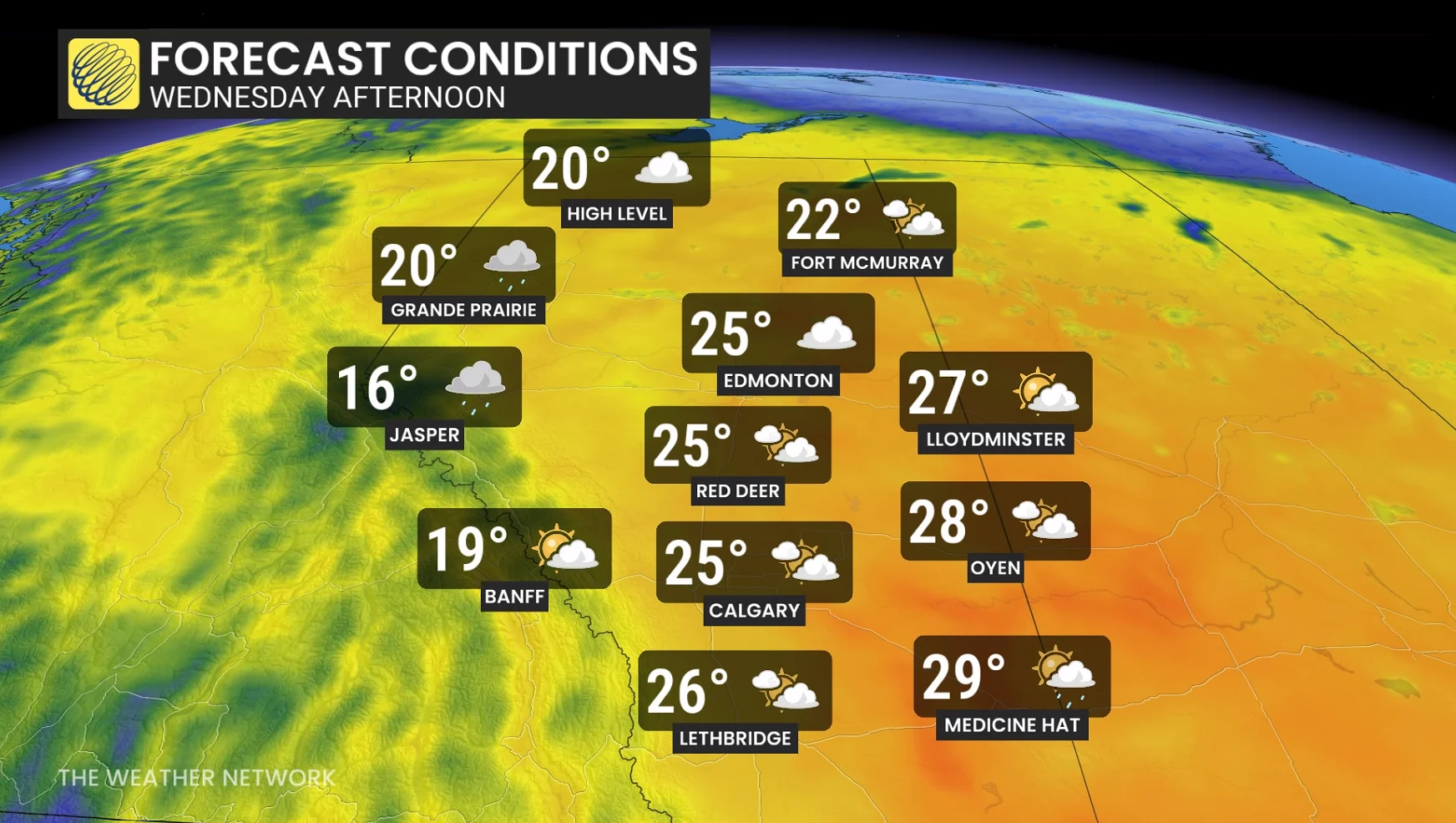
Warm temperatures to continue through Wednesday before falling
Chance of thunderstorms along the foothills, extreme southern Alberta Wednesday
Cooldown arrives Thursday and Friday, with gusty winds, single-digit highs, and possible snow on Friday and the weekend
Wednesday will be final day of warmth, risk of thunderstorms
Temperatures will remain in the mid- to upper 20s through Wednesday before temperatures begin to fall.
SEE ALSO: Canada's May long weekend hopes hang on looming pattern change
Locked in warm temperatures and a southerly flow will help to bring in moisture, which will boost daytime instability in the atmosphere.
As a result, there is the chance for a few thunderstorms to develop along the foothills and extreme southern Alberta on Wednesday afternoon and evening.
Widespread rain is forecast to develop late Wednesday, along with strong winds as the low strengthens, and will continue into Thursday.
Concerns will be heightened in northern parts of the province where river levels are running high.
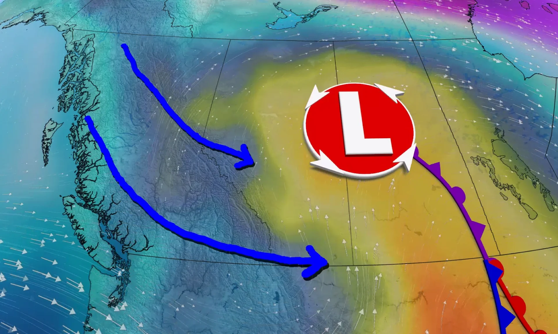
Midweek pattern change
A trough in the jet stream over the Pacific Ocean will make its way east through the week, working to develop a surface low-pressure system over Alberta Wednesday. That will bring an end to the warm temperatures and usher in the return of widespread, wet weather and falling temperatures.
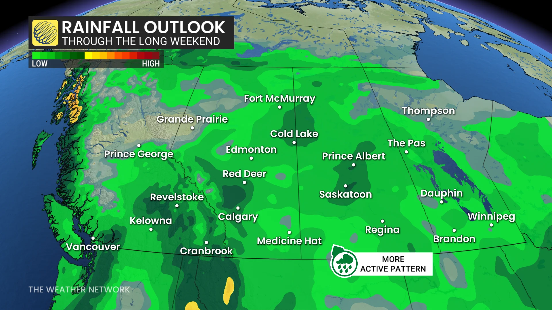
Wednesday night into Thursday and Friday will bring the most rain, with less than 10 mm generally expected for western regions of the province.
Eastern and northern sections could receive locally 30+ mm. Embedded thunderstorms Thursday are also possible.
On Thursday and Friday temperatures are forecast in the mid-teens, closer to seasonal, before even chillier air settles in for the long weekend with single-digit, daytime highs possible.
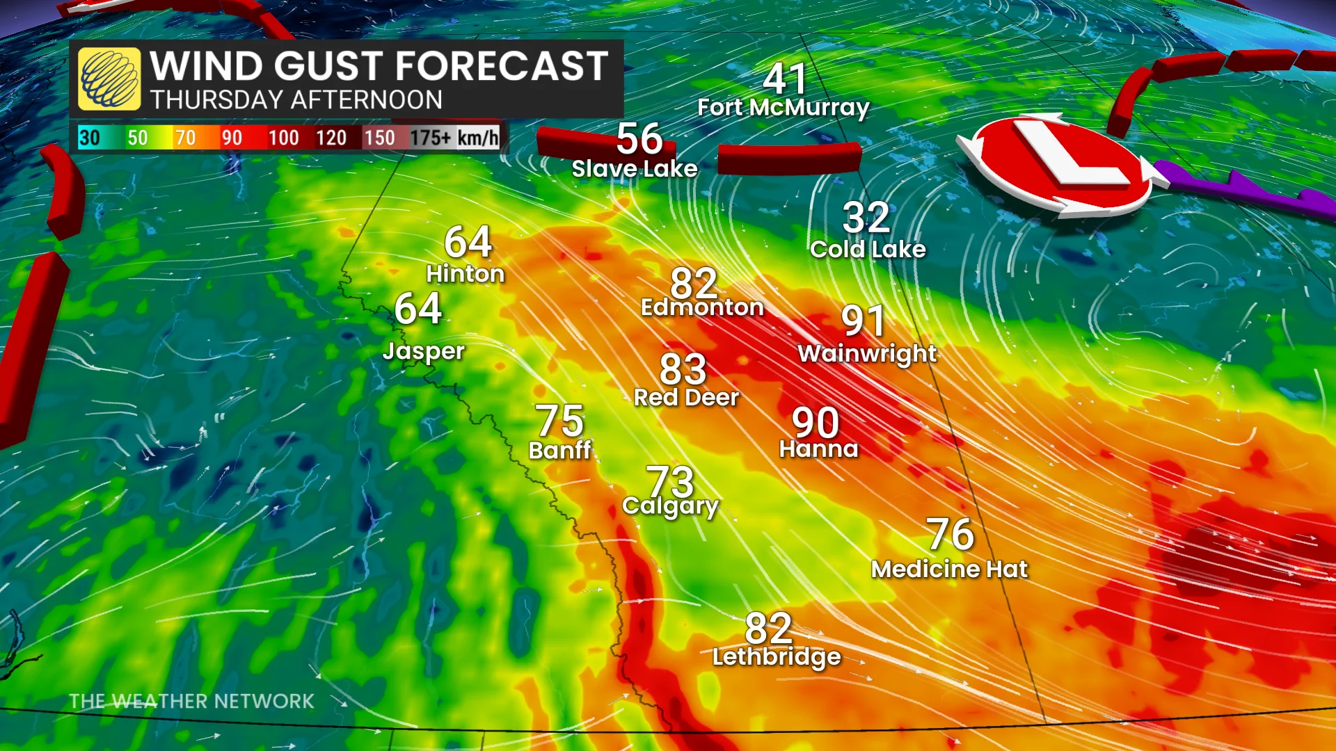
Thursday afternoon will see winds ramp up significantly in Alberta, with 70-90 km/h gusts possible.
Snow possible on Friday as province sees significant temperature drop
Temperatures on Friday, Saturday and Sunday are forecast to trend cooler than normal, with the chance for temperatures to be as much as 5 to 10 degrees below seasonal for mid-May.
Single-digit, daytime highs are possible for Calgary and surrounding regions on Saturday.
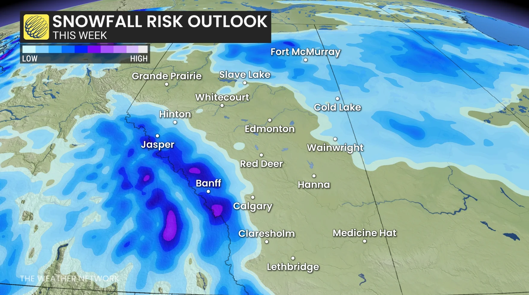
As cold air sinks south, rain will likely transition to snow across northern parts of the province Friday.
Snow will also be possible through the Rockies, and along the foothills, through the weekend as freezing levels drop to 1600 metres or lower at times.
Stay tuned to The Weather Network as we continue to update the forecast for Alberta.